Edited ann saunders (20 risultati)

Mercers' Company 1596-1959
Doolittle, I.G. [ With an Introduction by Peter Nailor; Edited by Ann Saunders ]
- Rilegato
- Prima edizione
Da: Works on Paper, DeKalb, IL, U.S.A.Works on Paper
Contatta il venditoreVenditore con 5 stelleCondizione: Usato - Molto buono
EUR 28,84
EUR 5,70 spedizioneSpedito in U.S.A.Quantità: 1 disponibili
Hardcover. Condizione: Very Good. Condizione sovraccoperta: Very Good. 1st Edition. A very good copy of the presumed first hard cover edition (no explicit edition or printing statement) in a like (not clipped) dust-jacket. The text is wholly unmarked, pristine, and the binding and jacket are bright and fresh in appearance. A sha…rp copy. [Please note: Due to the size and weight of the volume extra shipping may be required depending on the destination and speed of delivery requested. Quotations gladly provided.].

OLD ST PAULâS : THE SOCIETY OF ANTIQUARIESâ DIPTYCH, 1616
Tudor-Craig, Pamela, & Whittick, Christopher. (Hunting, Penelope & Saunders, Ann. edited. )
Lingua: Inglese
Editore: London Topographical Society / the Society of Antiquaries of London, 2004
- Brossura
Da: Paul Meekins Military & History Books, Stratford upon Avon, Regno UnitoPaul Meekins Military & History Books
Contatta il venditoreVenditore con 5 stelleCondizione: Usato - Molto buono
EUR 5,98
EUR 30,18 spedizioneSpedito da Regno Unito a U.S.A.Quantità: 1 disponibili
Paperback. Condizione: Very Good. Publication No.163 of the London Topographical Society. Paperback; very good in card covers.; Illustrated.; 67 pages.

- Rilegato
Da: Paul Meekins Military & History Books, Stratford upon Avon, Regno UnitoPaul Meekins Military & History Books
Contatta il venditoreVenditore con 5 stelleCondizione: Usato - Molto buono
EUR 5,98
EUR 30,18 spedizioneSpedito da Regno Unito a U.S.A.Quantità: 1 disponibili
Hardcover. Condizione: Very Good. Publication No.176 of the London Topographical Society. Hardback; ink ownership name to endpaper, otherwise very good in brown cloth boards.; Articles include: Henry VII's Almshouse at Westminster; Inigo Jones's Ceiling Designs and London Artisans in the 1630s; James VI and I's (Unfortunate) Cer…emonial Entry into the City of London, 1604. Illustrations & maps.; 218 pages.

- Rilegato
Da: Paul Meekins Military & History Books, Stratford upon Avon, Regno UnitoPaul Meekins Military & History Books
Contatta il venditoreVenditore con 5 stelleCondizione: Usato - Molto buono
EUR 5,98
EUR 30,18 spedizioneSpedito da Regno Unito a U.S.A.Quantità: 1 disponibili
Hardcover. Condizione: Very Good. Publication No.165 of the London Topographical Society. Hardback; ink ownership name to endpaper, otherwise very good in brown cloth boards.; Articles include: Medallic Panoramas of London 1633-1795; A Survey of Marylebone in 1738; A German Intelligence Map of London, 1944. Illustrations & maps.…; 236 pages.

- Rilegato
- Prima edizione
Da: Wildside Books, Eastbourne, Regno UnitoWildside Books
Contatta il venditoreVenditore con 5 stelleMembro dell’associazione: PBFA
Condizione: Usato - Ottimo
EUR 23,92
EUR 13,93 spedizioneSpedito da Regno Unito a U.S.A.Quantità: 1 disponibili
Hardcover. Condizione: Fine. Condizione sovraccoperta: Near Fine. 1st Edition. 4to, i-xvi, 444 pp, 14 colour plates, 167 black and white figures. An excellent copy. A heavy item extra charges will be required to send an overseas order.

Editore: London Topographical Society., London., 2015
- Rilegato
Da: Sapience Bookstore, Hexham, Regno UnitoSapience Bookstore
Contatta il venditoreVenditore con 3 stelleCondizione: Usato - Ottimo
EUR 9,57
EUR 20,32 spedizioneSpedito da Regno Unito a U.S.A.Quantità: 1 disponibili
Hard. Condizione: Fine. Fine. Fully illustrated from colour photographs and in b/w etc. (illustratore).

Editore: London Topographical Society, London, 2015
- Rilegato
Da: St Marys Books And Prints, Stamford, Regno UnitoSt Marys Books And Prints
Contatta il venditoreVenditore con 4 stelleCondizione: Usato
EUR 9,57
EUR 23,97 spedizioneSpedito da Regno Unito a U.S.A.Quantità: 1 disponibili
Hard Back. Vol XXXI Cloth covered boards in very good condition Contents clean with several photographs throughout Edges clean Binding tight Overall very good pp218. book.
 Altre immagini
- Rilegato
- Prima edizione
Da: Roger Godden, Sheerness, KENT, Regno UnitoRoger Godden
Contatta il venditoreVenditore con 5 stelleCondizione: Usato - Come nuovo
EUR 33,48
EUR 19,16 spedizioneSpedito da Regno Unito a U.S.A.Quantità: 1 disponibili
Hardcover. Condizione: As New. Condizione sovraccoperta: Near Fine. 1st Edition. 444pp. 11.25 x 9 inches approx. Hardcover illustrated in b&w/colour. Heavy book, overseas extra postage over default would be required. As New/Near Fine.
The Singularities of London, 1578: Biblioteca Apostolica Vaticana MS Reg. Lat. 672 (London Topographical Society Publication)
L. Grenade ; edited by Derek Keene and Ian W. Archer ; with the assistance of Emma Pauncefort and Ann Saunders
- Rilegato
- Prima edizione
Da: Joseph Burridge Books, Dagenham, Regno UnitoJoseph Burridge Books
Contatta il venditoreVenditore con 5 stelleCondizione: Nuovo
EUR 35,87
EUR 31,35 spedizioneSpedito da Regno Unito a U.S.A.Quantità: 2 disponibili
Hardcover. Condizione: New. Condizione sovraccoperta: New. 1st Edition. viii, 288 pages : illustrations (some colour), facsimiles, maps ; 26 cm. This lively, original and informative account of London, originally written in French and completed in 1578, occupies an important place among 16th Century descriptions of the city. The… author s text often provides an original and informative view, and presents a good deal of historical, quasi-historical and mythical background. With a distinctly Protestant outlook, he characterises London as a city of peace, good order, good government and charitable institutions. He has much to say about laws and regulations and takes a special interest in London s legal structure.

- Rilegato
Da: Paul Meekins Military & History Books, Stratford upon Avon, Regno UnitoPaul Meekins Military & History Books
Contatta il venditoreVenditore con 5 stelleCondizione: Usato - Molto buono
EUR 47,83
EUR 30,18 spedizioneSpedito da Regno Unito a U.S.A.Quantità: 1 disponibili
Hardcover. Condizione: Very Good. Condizione sovraccoperta: Very Good. Publication No.166 of the London Topographical Society. Hardback; very good in lightly creased dustjacket.; Bacon's Large Scale Atlas of London and Suburbs (Revised Edition) published circa 1912. Colour reproduction of the maps at almost full size. Includes s…pecial maps of London, maps of the Home Counties; a large-scale plan of Central London, and Index to Streets.; 169 pages.
Somerset House: The Palace of England's Queens 1551-1692 (Publication S.)
Simon Thurley ; with contributions by Patricia Croot and Claire Gapper ; edited by Ann Saunders and Roger Cline
- Rilegato
- Prima edizione
Da: Joseph Burridge Books, Dagenham, Regno UnitoJoseph Burridge Books
Contatta il venditoreVenditore con 5 stelleCondizione: Nuovo
EUR 47,83
EUR 31,35 spedizioneSpedito da Regno Unito a U.S.A.Quantità: 1 disponibili
Hardcover. Condizione: New. Condizione sovraccoperta: New. 1st Edition. viii, 144 pages : illustrations (some colour), plans, portraits ; 31 cm. Contents: Edward Seymour, patron of architecture -- The Stand before Somerset Place -- The Duke of Somerset's Somerset Place -- Elizabethan interlude -- Denmark House: palace of the fir…st Stuart queen -- Henrietta Maria: Denmark House, France and catholicism -- Commonwealth interlude 1642-60 -- The Stuart dower house -- Decline -- Fragments of decorative plasterwork excavated at Somerset House / by Claire Gapper.
The A to Z of Charles II's London 1682 : London & .c. actually survey'd
William Morgan ; introductory notes by Peter Barber and Ralph Hyde ; index compiled by Robert Thompson ; edited by Ann Saunders
- Rilegato
- Prima edizione
Da: Joseph Burridge Books, Dagenham, Regno UnitoJoseph Burridge Books
Contatta il venditoreVenditore con 5 stelleCondizione: Nuovo
EUR 59,79
EUR 31,35 spedizioneSpedito da Regno Unito a U.S.A.Quantità: 1 disponibili
Hardcover. Condizione: New. Condizione sovraccoperta: New. 1st Edition. vi, 152 pages : illustrations, maps, plans ; 31 cm. At first sight, it seems scarcely possible that London & .c Actually Survey'd, and A large and Accurate Map of the City of London that preceded it by six yeas having been completed in December 1676, could h…ave been the work of the same team of people. The map of the City seems the very model of merchant sobriety and scientific clarity, combining understated elegance with an almost total lack of decoration. London & .c Actually Survey'd dazzles with its flamboyant use of text as well as image which in places threaten to overwhelm the map. The difference between the two maps can only fully be understood in the context of the very different political situations prevailing at the times of their publications--Peter Barker.

Editore: Published by London Topographical Society, 3 Medway Gate, London First Edition . 2015., 2015
- Rilegato
- Prima edizione
Da: Little Stour Books PBFA Member, Canterbury, Regno UnitoLittle Stour Books PBFA Member
Contatta il venditoreVenditore con 5 stelleMembro dell’associazione: PBFA
Condizione: Usato - Ottimo
EUR 20,93
EUR 34,83 spedizioneSpedito da Regno Unito a U.S.A.Quantità: 1 disponibili
Condizione: Fine. First edition hard back binding in publisher's original biscuit cloth covers, black title lettering to the spine. Quarto 10'' x 7¼''. Contains 6-[iv], 218 printed pages of text with colour street plans, archive monochrome illustrations and photographs throughout. In Fine condition, no dust wrapper as issued, un…used new book. Member of the P.B.F.A. ISBN 9780902087637 LONDON (Londinium).

- Rilegato
- Prima edizione
Da: Joseph Burridge Books, Dagenham, Regno UnitoJoseph Burridge Books
Contatta il venditoreVenditore con 5 stelleCondizione: Nuovo
EUR 71,75
EUR 31,35 spedizioneSpedito da Regno Unito a U.S.A.Quantità: 1 disponibili
Hardcover. Condizione: New. 1st Edition. 367 pages : 22 cm. Contains papers on: The Beginnings of an Early Victorian Suburb (Sir John Summerson) St John's Wood: the Eyre Estate before 1830 (Malcolm Brown) Mountjoy's Inn, Fenchurch Street (Caroline Dalton) A Glimpse of the Earliest Map-View of London? (Peter Barber) Ralph Treswel…l's Association with St Bartholomew's Hospital (Judith Etherton) Frederick Crace's Plans, Elevations and Sections of the Churches of London (Paul Jeffery) Church of St Michael Cornhill (K.E. Campbell) Hartshorn Lane and Angel Court, c.1614c.1720 (Ann Cowper-Coles) Charles Dingley and his Limehouse Sawmill (John H. Appleby) Angel Court and its Development to 1985 (D.E. Wickham) Building Development in Mile End Old Town, 16601820 (Isobel Watson) The Secret Map of the County of London, 1926 (Christopher Board) Forbes House, Halkin Street (Ann Saunders) The Role of a Topographical Society (Simon Morris).
- Rilegato
- Prima edizione
Da: Joseph Burridge Books, Dagenham, Regno UnitoJoseph Burridge Books
Contatta il venditoreVenditore con 5 stelleCondizione: Nuovo
EUR 71,75
EUR 31,35 spedizioneSpedito da Regno Unito a U.S.A.Quantità: 1 disponibili
Hardcover. Condizione: New. 1st Edition. 157 pages : 22 cm. Contains papers on: St Paul's and its Architecture (Kerry Downes) Before and after Drury House: Development of a Suburban Town House 12501800 (Patricia Croot) The First Printed 'Directory' of British Politicians (Clyve Jones) Oxford Street Two Hundred Years Ago: the Por…tland Estate Block Plans c.18051870 (Richard Bowden) Amateurs, Antiquaries and Tradesmen: a Context for Photographic History in London (Ian Leith) The Photographic Studios of Regent Street 18501875 (David Webb) London Diarists (Heather Creaton) Maps, Prints, Presses and the Merchant Taylors in the Seventeenth Century (Laurence Worms) Hyde Park Corner: Breaking a Nineteenth-Century Bottleneck (M.H. Port) St Paul's in Wartime (Noel Mander and Ann Saunders) Felix Barker: an obituary (Denise Silvester-Carr).
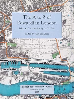
The A to Z of Edwardian London: Facsimile of Bacon's Large Scale Atlas of London and Suburbs (revised Edition) Published Approx 1912 (Publication S. 166)
George W. Bacon ; with an introduction by M.H. Port ; edited by Ann Saunders.
- Rilegato
Da: Joseph Burridge Books, Dagenham, Regno UnitoJoseph Burridge Books
Contatta il venditoreVenditore con 5 stelleCondizione: Nuovo
EUR 95,66
EUR 31,35 spedizioneSpedito da Regno Unito a U.S.A.Quantità: 1 disponibili
Hardcover. Condizione: New. Condizione sovraccoperta: New. 1 atlas (169 pages) : maps ; 35 cm. Between the 1888 and the c.1912 editions of George Washington Bacon s New Large-Scale Ordnance Atlas of London & Suburbs , the population of Greater London grew by more than 28% and the area loosely termed London expanded similarly. Re…quiring 34 sheets at 4 inches to the mile, the later edition, now reproduced here almost to full size and in colour, enables the reader to distinguish tram from omnibus routes and to easily pick out the topographical features. Other maps, showing utilities and administrative areas, help define the structures of the world s then largest city.

Editore: London Topographical Society, GB, 2011
- Brossura
- Prima edizione
Da: Richard Sylvanus Williams (Est 1976), WINTERTON, Regno UnitoRichard Sylvanus Williams (Est 1976)
Contatta il venditoreVenditore con 5 stelleCondizione: Usato
EUR 30,67
EUR 37,15 spedizioneSpedito da Regno Unito a U.S.A.Quantità: 1 disponibili
Paperback. Condizione: nrFine. 1st Edition. Enclosure at back. Book is in nearly fine condition with only slightest signs of wear and/or age.
 Altre immagini
- Rilegato
Da: HALCYON BOOKS, LONDON, Regno UnitoHALCYON BOOKS
Contatta il venditoreVenditore con 5 stelleCondizione: Usato - Molto buono
EUR 166,82
EUR 20,90 spedizioneSpedito da Regno Unito a U.S.A.Quantità: 1 disponibili
Hardcover. Condizione: Very Good. Condizione sovraccoperta: Very Good. A clean, tight copy. ALL ITEMS ARE DISPATCHED FROM THE UK WITHIN 48 HOURS ( BOOKS ORDERED OVER THE WEEKEND DISPATCHED ON MONDAY) ALL OVERSEAS ORDERS SENT BY TRACKABLE AIR MAIL. IF YOU ARE LOCATED OUTSIDE THE UK PLEASE ASK US FOR A POSTAGE QUOTE FOR MULTI VOLU…ME SETS BEFORE ORDERING. None (illustratore).
Handlist of the Hampstead Garden Suburb archive : a user's guide
compiled by Emma Bashforth, Daniel Beagles and Sally Robbins ; edited by Henry S. Cobb and Ann Saunders
Editore: London : HGS Archive Trust in association with London Metropolitan Archives, 2001
- Brossura
- Prima edizione
Da: Joseph Burridge Books, Dagenham, Regno UnitoJoseph Burridge Books
Contatta il venditoreVenditore con 5 stelleCondizione: Usato - Molto buono
EUR 47,83
EUR 26,70 spedizioneSpedito da Regno Unito a U.S.A.Quantità: 1 disponibili
Soft cover. Condizione: Very Good. 1st Edition. 162 pages : illustrations ; 29 cm. contains several items of ephemera loosely inserted.
 Altre immagini
Editore: London Topographical Society, London, 2005
- Rilegato
Da: Rooke Books PBFA, Bath, Regno UnitoRooke Books PBFA
Contatta il venditoreVenditore con 5 stelleMembro dell’associazione: PBFA
Condizione: Usato - Ottimo
EUR 1135,99
EUR 23,21 spedizioneSpedito da Regno Unito a U.S.A.Quantità: 1 disponibili
Cloth. Condizione: Fine. Condizione sovraccoperta: Near Fine. A scarce volume of printed maps, showing the bomb damage of the Second World War in London. With 147 colour maps. Includes an introduction by Robin Woolven. Robin Woolven joined the airforce at the age of seventeen, taking on the role of Air Signaller and then Navigat…or. In 1942 he was the navigation leader of the 249 Squadron. Later on he joined the 617 Squadron, flying Vulcan Mk2 bombers. This volume uses relevant sheets of Ordnance Survey Maps, coloured to show the various damages suffered by some London and its landmarks. A fascinating work that shows how London has been shaped by the war and the restoration afterwards. Very scarce. In a cloth binding in the original unclipped dustwrapper. Externally, in excellent condition. Dustwrapper very smart with just some light edgewear. Internally, firmly bound with bright and clean pages. Fine. None (illustratore). book.


