Introductory notes ralph hyde (5 risultati)

Lingua: Inglese
Editore: Harry Margary Lympne Castle Kent in association with the Guildhall Library London, 1987
- Rilegato
Da: Handsworth Books PBFA, Woodford Green, Regno UnitoHandsworth Books PBFA
Contatta il venditoreVenditore con 5 stelleMembro dell’associazione: PBFA
Condizione: Usato - Buono
EUR 24,05
EUR 17,45 spedizioneSpedito da Regno Unito a U.S.A.Quantità: 1 disponibili
Hardcover. Condizione: Good. Condizione sovraccoperta: Fair. 31cm x 22cm, xiv, 116pp, maps. Hardback/Red Cloth (Good), Dust Jacket (some wear & soiling, protected by self adhesive clear plastic - some wear, some soiling).
 Altre immagini
- Rilegato
- Prima edizione
Da: Raymond Tait, Beccles, SUFFO, Regno UnitoRaymond Tait
Contatta il venditoreVenditore con 5 stelleCondizione: Usato - Molto buono
EUR 54,11
EUR 25,22 spedizioneSpedito da Regno Unito a U.S.A.Quantità: 1 disponibili
Original Cloth. Condizione: Very Good. Condizione sovraccoperta: Very Good. 1st Edition. Red boards have very slight edge wear. The pages are clean and unmarked. Jacket has some small patches of surface damage near the bottom of the rear panel where a label has been removed, a tiny nick to the top edge of the rear panel, two sma…ll dents to the front panel and light creasing to the edges. First printing. Rocque, John (illustratore).
Lingua: Inglese
Editore: HARRY MARGARY, LYMPNE, LONDON, 1981
- Rilegato
- Prima edizione
Da: Richard Booth's Bookshop, Hereford, Regno UnitoRichard Booth's Bookshop
Contatta il venditoreVenditore con 4 stelleCondizione: Usato - Ottimo
EUR 48,10
EUR 37,36 spedizioneSpedito da Regno Unito a U.S.A.Quantità: 1 disponibili
HardBack. Condizione: Fine. Condizione sovraccoperta: Fine. First edition. HARRY MARGARY, LYMPNE CASTLE KENT in association with Guildhall Library, London. 1981 A fine copy in red cloth boards, lavishly illustrated with numerous b/w facsimile copies of street maps and documents reproduced on fine quality paper, has a fine dust j…acket in a clear protective wrapper.
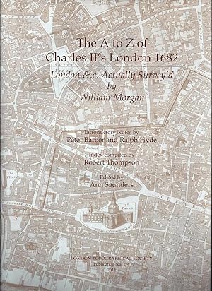
The A to Z of Charles II's London 1682 : London & .c. actually survey'd
William Morgan ; introductory notes by Peter Barber and Ralph Hyde ; index compiled by Robert Thompson ; edited by Ann Saunders
- Rilegato
- Prima edizione
Da: Joseph Burridge Books, Dagenham, Regno UnitoJoseph Burridge Books
Contatta il venditoreVenditore con 5 stelleCondizione: Nuovo
EUR 60,13
EUR 31,52 spedizioneSpedito da Regno Unito a U.S.A.Quantità: 1 disponibili
Hardcover. Condizione: New. Condizione sovraccoperta: New. 1st Edition. vi, 152 pages : illustrations, maps, plans ; 31 cm. At first sight, it seems scarcely possible that London & .c Actually Survey'd, and A large and Accurate Map of the City of London that preceded it by six yeas having been completed in December 1676, could h…ave been the work of the same team of people. The map of the City seems the very model of merchant sobriety and scientific clarity, combining understated elegance with an almost total lack of decoration. London & .c Actually Survey'd dazzles with its flamboyant use of text as well as image which in places threaten to overwhelm the map. The difference between the two maps can only fully be understood in the context of the very different political situations prevailing at the times of their publications--Peter Barker.
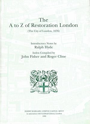
A. to Z. of Restoration London: City of London, 1676
William Morgan ; introductory notes by Ralph Hyde ; index compiled by John Fisher and Roger Cline
- Rilegato
Da: Joseph Burridge Books, Dagenham, Regno UnitoJoseph Burridge Books
Contatta il venditoreVenditore con 5 stelleCondizione: Nuovo
EUR 72,15
EUR 31,52 spedizioneSpedito da Regno Unito a U.S.A.Quantità: 1 disponibili
Hardcover. Condizione: New. xii, 93 pages : maps ; 31 cm. The atlas section consists of the 20 map sheets from John Ogilby and Williams Morgan s large-scale survey of the 1676 City of London, published 10 years after the Great Fire and shows the City as newly rebuilt. The index section includes almost 2000 items and is based on…Ogilby and Morgan s Explanation of 1677 but it has been considerably improved.


