
John speed taylor (14 risultati)

Lingua: Inglese
Editore: Penguin, London, 1951
- Rilegato
Da: Terra Firma Books, San Diego, CA, U.S.A.Terra Firma Books
Contatta il venditoreVenditore con 5 stelleCondizione: Usato - Molto buono
EUR 7,21
EUR 5,25 spedizioneSpedito in U.S.A.Quantità: 1 disponibili
Aggiungi al carrelloHardcover. Condizione: Very Good. Condizione sovraccoperta: Very Good. 40 maps in full color + 32 page explanation.

Lingua: Inglese
Editore: King Penguin Books, London, 1951
- Rilegato
Da: AJ Scruffles, Leigh On Sea, ESSEX, Regno UnitoAJ Scruffles
Contatta il venditoreVenditore con 5 stelleCondizione: Usato - Buono
EUR 7,24
EUR 21,10 spedizioneSpedito da Regno Unito a U.S.A.Quantità: 1 disponibili
Aggiungi al carrelloHardcover. Condizione: Good. With 40 colour plates from John Speed's Pocket Atlas of 1627, with an introduction by Taylor. Toning to covers, small tear to rear hinge. Mark to spine. Contents clean, binding tight. Good+.
 Altre immagini
Lingua: Inglese
Editore: PENGUIN BOOKS / A King Penguin Book, HARMONDSWORTH, 1951
- Rilegato
- Prima edizione
Da: booksonlinebrighton, Brighton, Regno Unitobooksonlinebrighton
Contatta il venditoreVenditore con 5 stelleCondizione: Usato - Molto buono
EUR 9,66
EUR 25,79 spedizioneSpedito da Regno Unito a U.S.A.Quantità: 1 disponibili
Aggiungi al carrelloHard Back. Condizione: Very Good. Condizione sovraccoperta: Very Good. 1st Edition. Illustrated paper covered boards repeating the design of the dust jacket, 180 x 125 mm approx.32pp of text + 40 colour plates.First Edition 1st printing 1951 of No 61 in the King Penguin Series. Please see our images of the actual book offered fo…r sale for further details and condition. Very Good/ Very Good (Book - negligible shelf wear or soiling, previous owner name in ink to free front end paper. Dust jacket- mild shelf rubbing with tiny chip to top front panel 7 x 1 mm in depth approx, no notable soiling and non price clipped - cover 3/6. No other notable defects to book or jacket). Please request via "ask bookseller a question/contact bookseller" after placing order if you would like a removable proprietary protective sleeve be fitted prior to posting at no extra cost. JOHN SPEED (illustratore).
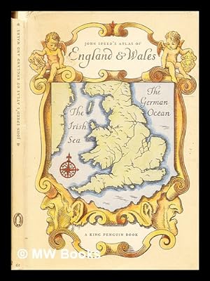
An atlas of Tudor England and Wales : forty plates from John Speed's pocket atlas of 1627 / described by E.G.R. Taylor
Speed, John (1552-1629). Taylor, E. G. R. (Eva Germaine Rimington)
Editore: London: Penguin Books, 1951
- Rilegato
Da: MW Books, New York, NY, U.S.A.MW Books
Contatta il venditoreVenditore con 5 stelleCondizione: Usato
EUR 24,50
Spedizione gratuitaSpedito in U.S.A.Quantità: 1 disponibili
Aggiungi al carrelloReprint. Near fine cloth copy in a near-fine, very slightly edge-nicked and dust-dulled dust-wrapper. Remains particularly well-preserved overall; tight, bright, clean and strong. Physical description; 32 pages : illustrations ; 19 cm. Subjects; Early maps ; Facsimiles. Historical geography ; Maps. Wales Maps ; Early works to 18…00. Great Britain History Elizabeth, 1558-1603 ; Maps. 3 Kg.
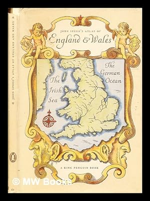
An atlas of Tudor England and Wales : forty plates from John Speed's pocket atlas of 1627 / described by E.G.R. Taylor
Speed, John (1552-1629). Taylor, E. G. R. (Eva Germaine Rimington)
Editore: London: Penguin Books, 1951
- Rilegato
Da: MW Books Ltd., Galway, IrlandaMW Books Ltd.
Contatta il venditoreVenditore con 5 stelleCondizione: Usato
EUR 14,95
EUR 13,95 spedizioneSpedito da Irlanda a U.S.A.Quantità: 1 disponibili
Aggiungi al carrelloReprint. Near fine cloth copy in a near-fine, very slightly edge-nicked and dust-dulled dust-wrapper. Remains particularly well-preserved overall; tight, bright, clean and strong. Physical description; 32 pages : illustrations ; 19 cm. Subjects; Early maps ; Facsimiles. Historical geography ; Maps. Wales Maps ; Early works to 18…00. Great Britain History Elizabeth, 1558-1603 ; Maps. 1 Kg.
Editore: 1st edit., King Penguin, 1951. Very good copy in d.w. (small tears), 1951
- Rilegato
Da: R.G. Watkins Books and Prints, Ilminster, SOMER, Regno UnitoR.G. Watkins Books and Prints
Contatta il venditoreVenditore con 4 stelleCondizione: Usato
EUR 6,04
EUR 32,82 spedizioneSpedito da Regno Unito a U.S.A.Quantità: 1 disponibili
Aggiungi al carrello40 colour maps; 32pp; sellotape marks on endpapers. orig. boards.
Lingua: Inglese
Editore: King Penguin, HARMONDSWORTH, 1951
- Rilegato
- Prima edizione
Da: Amazing Book Company, Liphook, Regno UnitoAmazing Book Company
Contatta il venditoreVenditore con 5 stelleCondizione: Usato - Ottimo
EUR 24,15
EUR 35,69 spedizioneSpedito da Regno Unito a U.S.A.Quantità: 1 disponibili
Aggiungi al carrelloHardback. Condizione: Fine. Condizione sovraccoperta: Very Good Plus. First Edition. This copy is in fine, unmarked condition bound in illustrated paper covered boards with black titling to the spine. This copy is bright, tight, white and square. The unclipped dustwrapper is sunned to the spine but still in very good plus condit…ion. International postal rates are calculated on a book weighing 1 Kilo, in cases where the book weighs more than 1 Kilo increased postal rates will be quoted, where the book weighs less then postage will be reduced accordingly. Illustrated with 40 colour plates from John Speed's Pocket Atlas of 1627. 32 pages (text), 40 pages of Plates. Ref KKK 1. John Speed (illustratore).
Editore: Penguin Books - London, 1951
- Rilegato
- Prima edizione
Da: Barberry Lane Booksellers, Bar Harbor, ME, U.S.A.Barberry Lane Booksellers
Contatta il venditoreVenditore con 4 stelleCondizione: Usato - Quasi ottimo
EUR 35,20
EUR 6,57 spedizioneSpedito in U.S.A.Quantità: 1 disponibili
Aggiungi al carrelloHardcover. Condizione: Near Fine. Condizione sovraccoperta: Very Good. 1st Edition. Printed illustrated boards in Near Fine condition with sharp corners and no markings or flaws inside or out. Matching Dust Jacket has had some archival tape repair but shows very minimal scuffing or shelfwear - bright colors, sharp edges. Very Go…od+ and unclipped with original price sticker of .95 cents. This is No. 61 in the King Penguin series - beautifully produced with 40 full color plates - exact reproductions of the original maps produced by Speed in the original pocket atlas of 1627.
Editore: Penguin Books Ltd, London, 1953
- Rilegato
Da: Karol Krysik Books ABAC/ILAB, IOBA, PBFA, Toronto, ON, CanadaKarol Krysik Books ABAC/ILAB, IOBA, PBFA
Contatta il venditoreVenditore con 5 stelleCondizione: Usato - Molto buono
EUR 28,83
EUR 15,77 spedizioneSpedito da Canada a U.S.A.Quantità: 1 disponibili
Aggiungi al carrelloHardcover. Condizione: Very Good. Condizione sovraccoperta: Good. 2nd Edition. 12mo - over 6? - 7?" tall. Pictorial paper boards in matching dust jacket. King Penguin # 61. Very good plus condition, color maps, a few tiny tears in jacket, light foxing on reverse of jacket. 40 pp. Speed, John (illustratore).
Editore: Penquin,, London,, 1953
- Rilegato
Da: Harry E Bagley Books, Fredericton, NB, CanadaHarry E Bagley Books
Contatta il venditoreVenditore con 4 stelleCondizione: Usato - Molto buono
EUR 22,56
EUR 26,29 spedizioneSpedito da Canada a U.S.A.Quantità: 1 disponibili
Aggiungi al carrelloHardcover. Condizione: Very Good. Condizione sovraccoperta: Very Good. Originally published: 1951. 31 p., 40 p. of plates : col. maps ; d.j. is NOT price-clipped, Introduced and Described by E.G.R. Taylor, King Penquin No. 61,small ink number on upper edge of front panel of d.j. minor wear at d.j. corners, end papers toned. Size…: 12 mo., (19 cm). Book.

Editore: King Penguin Books, 1951
- Rilegato
Da: HALCYON BOOKS, LONDON, Regno UnitoHALCYON BOOKS
Contatta il venditoreVenditore con 5 stelleCondizione: Usato - Molto buono
EUR 29,58
EUR 21,10 spedizioneSpedito da Regno Unito a U.S.A.Quantità: 1 disponibili
Aggiungi al carrelloHardcover. Condizione: Very Good. Condizione sovraccoperta: Very Good. Pages clean and bright, no markings, light wear to edges. Dust Jacket unclipped. Includes removeable plastic cover. Complete with 40 plates. We are closed 14th-23rd July items ordered after 9:00am on the 13th July will be shipped on 25th July, shipping times…have been updated. ALL ITEMS ARE DISPATCHED FROM THE UK, ALL OVERSEAS ORDERS SENT BY TRACKABLE AIR MAIL. IF YOU ARE LOCATED OUTSIDE THE UK PLEASE ASK US FOR A POSTAGE QUOTE FOR MULTI VOLUME SETS BEFORE ORDERING.
 Altre immagini
Editore: King Penguin Books, 1951
- Rilegato
Da: HALCYON BOOKS, LONDON, Regno UnitoHALCYON BOOKS
Contatta il venditoreVenditore con 5 stelleCondizione: Usato - Molto buono
EUR 32,00
EUR 21,10 spedizioneSpedito da Regno Unito a U.S.A.Quantità: 1 disponibili
Aggiungi al carrelloHardcover. Condizione: Very Good. Condizione sovraccoperta: Very Good. Pages clean and bright, no markings. Complete with numerous illustrations. Dust jacket price clipped with light edgewear. We are closed 14th-23rd July items ordered after 9:00am on the 13th July will be shipped on 25th July, shipping times have been updated.…ALL ITEMS ARE DISPATCHED FROM THE UK, ALL OVERSEAS ORDERS SENT BY TRACKABLE AIR MAIL. IF YOU ARE LOCATED OUTSIDE THE UK PLEASE ASK US FOR A POSTAGE QUOTE FOR MULTI VOLUME SETS BEFORE ORDERING.
Editore: Penguin, 1951
Da: The Guru Bookshop, Hereford, Regno UnitoThe Guru Bookshop
Contatta il venditoreVenditore con 5 stelleCondizione: Usato - Buono
EUR 12,07
EUR 28,13 spedizioneSpedito da Regno Unito a U.S.A.Quantità: 1 disponibili
Aggiungi al carrelloUnknown Binding. Condizione: Good. spine cover has splits and missing part of top area reast of book in good condition with tight binding.
 Altre immagini
Editore: Penguin Books., London, 1951
Da: Marrins Bookshop, Folkestone, KENT, Regno UnitoMarrins Bookshop
Contatta il venditoreVenditore con 4 stelleCondizione: Usato
EUR 18,11
EUR 29,71 spedizioneSpedito da Regno Unito a U.S.A.Quantità: 1 disponibili
Aggiungi al carrelloSmall 8vo. 7.5 x 5 inches. 31 + [1] pp. In pictorial stiff card boards, in matching unclipped dust wrapper which has minor edge wear. Small dent at tail of spine and a little foxing largely confined to edges; otherwise a very good copy. Illustrated by 40 pages of coloured map plates. Decorated by title page vignette. King Pengui…n edition of the the county maps of England (and one of The Kingdom of England and one of Wales and Monmouthshire). From the 1627 pocket edition of England, Wales, Scotland and Ireland, described and abridged, by the cartographer and historian, John Speed (1552?-1629). Edited by Eva Germaine Rimington Taylor (1879-1966), geographer and historian of science, who was professor of geography at the University of London, 1930-44. KING PENGUIN ATLAS ATLAS 17TH CENTURY ILLUSTRATED KING PENGUIN.


