Johnston col j (14 risultati)

Lingua: Inglese
Editore: Blue & Grey Press, Secaucus, NY
- Rilegato
Da: Maxwell's House of Books, La Mesa, CA, U.S.A.Maxwell's House of Books
Contatta il venditoreVenditore con 2 stelleCondizione: Usato - Quasi ottimo
EUR 18,10
EUR 4,09 spedizioneSpedito in U.S.A.Quantità: 1 disponibili
Hardcover. Condizione: Near Fine. Condizione sovraccoperta: Good Plus. Clean, crisp hardcover in near fine condition; faint shelf wear. Good plus DJ in mylar cover; mild edge wear.
[Kentucky; Missouri] in Confederate military history. A library of Confederate States History . . . edited by Gen. Clement A. Evans of Georgia. Vol. VIII.
[CIVIL WAR -- CONFEDERACY]. [JOHNSTON, Col. J. Stoddard & MOORE, Col. John C.].
Editore: Thomas Yoseloff, [1962]., New York: 1962
- Rilegato
Da: Zephyr Used & Rare Books, Vancouver, WA, U.S.A.Zephyr Used & Rare Books
Contatta il venditoreVenditore con 5 stelleCondizione: Usato
EUR 18,10
EUR 7,03 spedizioneSpedito in U.S.A.Quantità: 1 disponibili
Two works in one vol. Thick 8vo. 257, [1]; 225, [1] pp. Illusts., maps. Blue cloth, blk & silver lettnrg, NF. Reprint edition of this volume in the Confederate Military history series.
Kentucky and Missouri [Confederate Military History, Volume IX, edited by Gen. Clement A. Evans]
Johnston, Col. J. Stoddard; Col. John C. Moore; Clement A. Evans (series editor)
Editore: The Blue & Grey Press, Secaucus, New Jersey 1971
- Rilegato
Da: About Books, Henderson, NV, U.S.A.About Books
Contatta il venditoreVenditore con 5 stelleCondizione: Usato
EUR 22,58
EUR 6,11 spedizioneSpedito in U.S.A.Quantità: 1 disponibili
Hardcover. Condizione: Very Good+ condition. Very Good (small chips) Jacket. Reprint of the 1899 original. Secaucus, New Jersey: The Blue & Grey Press, 1971. Clean, square, tight, unmarked copy. No owner's name or bookplate. No underlining. No highlighting. No margin notes. Bound in the original gray boards, with black lettering… on the spine. Pages are toned as usual, but are clean, crisp, and apparently never read. Two volumes, bound as one. Kentucky by Col. J. Stoddard Johnston. Missouri by Col. John C. Moore. Illustrated with over 30 portraits. Written under the supervision of Gen. Clement A. Evans of Georgia, the bulk of this volume consists of a history of Kentucky and Missouri involvement in the Confederate war effort, followed by a biographical register of important officers attached to those states. Dust Jacket is not price-clipped (10.00). Eicher 690: "The description of organizations, battles, movements, campaigns, and strategy throughout the narrative is generally good. [and despite some errors of fact] continues to offer a large amount of useful information for researchers investigating the military history of the Confederacy." . Reprint of the 1899 original. Hard Cover. Very Good+ condition./Very Good (small chips) Jacket. 8vo. 257pp. + 225pp.

Editore: China Book, Thousand Oaks, CA 1990
- Rilegato
- Firmato
Da: Easton's Books, Inc., Mount Vernon, WA, U.S.A.Easton's Books, Inc.
Contatta il venditoreVenditore con 5 stelleCondizione: Usato - Molto buono
EUR 36,16
EUR 5,26 spedizioneSpedito in U.S.A.Quantità: 1 disponibili
Hardcover. Condizione: VG+. Hardback in Very Good+ condition without dust jacket. . Oblong 8vo 8" to 9" tall. 123 pages. Signed by author Willard A. Johnston on title page. . * Quick Shipping * All Books Mailed in Boxes * Free Tracking Provided *.

Vector Mechanics for Engineers : Statics and Dynamics
Beer, Ferdinand P.; Johnston, E. Russell, Jr.; Mazurek, David F.; Cornwell, Phillip J.; Self, Brian P. (COL)
- Rilegato
Da: GreatBookPrices, Columbia, MD, U.S.A.GreatBookPrices
Contatta il venditoreVenditore con 5 stelleCondizione: Usato - Buono
EUR 143,50
EUR 2,32 spedizioneSpedito in U.S.A.Quantità: 4 disponibili
Condizione: good. May show signs of wear, highlighting, writing, and previous use. This item may be a former library book with typical markings. No guarantee on products that contain supplements Your satisfaction is 100% guaranteed. Twenty-five year bookseller with shipments to over fifty million happy customers.

Vector Mechanics for Engineers : Statics and Dynamics
Beer, Ferdinand P.; Johnston, E. Russell, Jr.; Mazurek, David F.; Cornwell, Phillip J.; Self, Brian P. (COL)
- Rilegato
Da: GreatBookPricesUK, Woodford Green, Regno UnitoGreatBookPricesUK
Contatta il venditoreVenditore con 5 stelleCondizione: Usato - Buono
EUR 143,98
EUR 17,40 spedizioneSpedito da Regno Unito a U.S.A.Quantità: 4 disponibili
Condizione: good. May show signs of wear, highlighting, writing, and previous use. This item may be a former library book with typical markings. No guarantee on products that contain supplements Your satisfaction is 100% guaranteed. Twenty-five year bookseller with shipments to over fifty million happy customers.
Notes of a Military Reconnaissance, from Fort Leavenworth, in Missouri, to San Diego, in California, Including Parts of the Arkansas, Del Norte, and Gila Rivers 13th Congress, 1st Session. Ex. Doc. No. 41. [Includes Reports of Lieut. J. W. Abert, Lieut. Col. P. St. George Cooke, Journal of Capt. A. R. Johnson. ]
Emory, Lieut. Col. W. H. ; Lieut. J. W. Abert; Philip St. George Cooke; Joseph Eggleston Johnston
Editore: Wendell and Van Benthuysen, Printers, Washington, D. C. 1848
- Rilegato
Da: G. F. Wilkinson Books, member IOBA, GRASS VALLEY, CA, U.S.A.G. F. Wilkinson Books, member IOBA
Contatta il venditoreVenditore con 4 stelleMembro dell’associazione: IOBA
Condizione: Usato - Mediocre
EUR 407,30
EUR 3,51 spedizioneSpedito in U.S.A.Quantità: 1 disponibili
Hardcover. Condizione: Poor. Joint split with spine laid down, chipped at edges; rubbing to edges and bumped corners; front endpaper torn; owner signature second endpaper, two bookplates, one for Frederick Wm. Zimmerman, one for Alfred I. Exberg. Hinge starting lower 2 inches at title page, but cord binding holding firm. First f…olding map of New Mexico with tape repairs to back; degrees of foxing in general to text pages and plates from mild to moderate, occasionaly heavy, yet many pages and plates remain relatively clean. ; Original brown cloth, and paper spine label; 4 sketches; 26 plates; 10 of 12 botanical plates called for, also lacking 2 botanical plates called for in appendix. Abert's report with 23 of 24 plates, lacking Pueblo de Santa Ana; 2 folding maps. Conforms to Wagner-Camp 148: 5. ; 8vo 8" - 9" tall; 614 pages.
Editore: Union Office, Washington 1850
- Rilegato
- Prima edizione
Da: Robert G. Smith Jr., Denver, CO, U.S.A.Robert G. Smith Jr.
Contatta il venditoreVenditore con 4 stelleCondizione: Usato - Discreto
EUR 438,98
EUR 5,27 spedizioneSpedito in U.S.A.Quantità: 1 disponibili
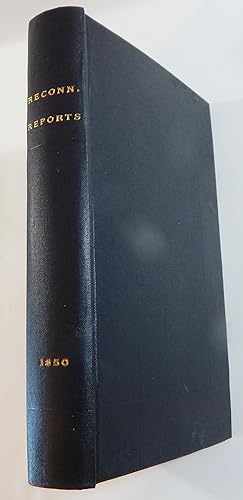
Hardcover. Condizione: Fair. 1st Edition. Hardcover. 31st Congress, 1st Session, Senate Ex. Doc. 64. In later quarter maroon leather and dark marbled boards, rebacked with gilt lettered spine laid down. 250 pp., 72 plates (numbered through 75, plates 2, 21, and 39 never issued), with about half in full or partial color and 3 fol…ding, and 2 folding maps. Lithography by P. S. Duval, Philadelphia. *** Condition: Complete with all plates and maps. Ex-library (John Crerar) with some exterior exterior wear but good overall. Bookplate on front pastedown, perforated stamp on title page, a few other minor library markings and ink stamps on the back of all plates. Text is lightly foxed, as are some of the plates. The long folding "Inscription Rock" plate has separated along several vertical folds and is complete except for some chipping to the top edge. The maps are fragile and have also split along the vertical folds leaving each map in several large pieces, plus some smaller edge pieces. There appears to be little or no loss of paper along the fold lines although some chipping into the top neatline occurs in one of the maps. Both should be backed for display or use. The maps are presently stored loose in a plastic pouch. *** The plates depict topographic views of New Mexico scenery, full page portraits of important Indian tribal members, ancient ruins, pottery shards, pueblo ground plans, petrified wood, and markings on Inscription Rock. Taft notes that "these colored plates must be among the earliest in government reports reproduced from multiple impressions".
Editore: Union Office, Washington 1850
- Rilegato
- Prima edizione
Da: Robert G. Smith Jr., Denver, CO, U.S.A.Robert G. Smith Jr.
Contatta il venditoreVenditore con 4 stelleCondizione: Usato - Discreto
EUR 438,98
EUR 5,27 spedizioneSpedito in U.S.A.Quantità: 1 disponibili
Hardcover. Condizione: Fair. 1st Edition. Hardcover. 31st Congress, 1st Session, Senate Ex. Doc. 64. In original brown cloth with gilt lettered spine. Octavo, 250 pp., 72 plates (numbered through 75, plates 2, 21, and 39 never issued), with about half in full or partial color and 3 folding, and 2 folding maps. Lithography by P.…S. Duval, Philadelphia. *** Condition: Complete with all plates and maps. Light exterior shelf wear but backstrip is being held on by thin, clear tape which gives the spine a glossy look. Binding intact but rear hinge is weak with the rear endpaper almost completely detached. Text and plates show varying amounts browning and foxing. The right and left edges of both maps (including neatlines) have been strengthened with thin strips of masking tape which has yellowed with age. Each map also has a short tear or two that enters the map area which have been repaired with the same tape. Map condition is otherwise very good. Good reference copy. *** The plates depict topographic views of New Mexico scenery, full page portraits of important Indian tribal members, ancient ruins, pottery shards, pueblo ground plans, petrified wood, and markings on Inscription Rock. Taft notes that "these colored plates must be among the earliest in government reports reproduced from multiple impressions".
Notes of a Military Reconnaissance, from Fort Leavenworth, in Missouri, to San Diego, in California, Including Parts of the Arkansas, Del Norte, and Gila Rivers 13th Congress, 1st Session. Ex. Doc. No. 41. [Includes Reports of Lieut. J. W. Abert, Lieut. Col. P. St. George Cooke, Journal of Capt. A. R. Johnson. ]
Emory, William Hemsley aka Emory, William H., Lieut. Col. (1811-1887) & Lieut. J. W. Abert & Philip St. George Cooke & Joseph Eggleston Johnston
Editore: WashDC: Wendell and Van Benthuysen, Printers 1848
- Rilegato
- Prima edizione
Da: Ethnographics, Georgetown, TX, U.S.A.Ethnographics
Contatta il venditoreVenditore con 3 stelleCondizione: Usato - Molto buono
EUR 452,55
EUR 2,64 spedizioneSpedito in U.S.A.Quantità: 1 disponibili
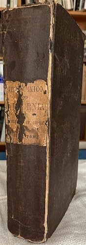
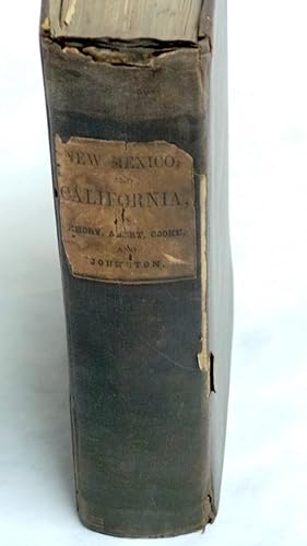
Hardcover. Condizione: Very Good. No Jacket. 1st Edition. 1stedn; THIRTIETH CONGRESS, FIRST SESSION - EX. DOC. NO. 41; lg8vo blue cloth bds, gilt spine titles; rebacked with orig ptdwraps preserved, pp433ff has nibbling and water staining to extreme bottom page corners but not affecting text, ow VG/ndj: 11+614pp, many tables, bw… plates and intext illus; First edition, House of Representatives issues of the report, containing the reports of Lieutenant Abert, Colonel Cooke, and Captain Johnson as well as that of Emory; the Senate issue only contained the Emory report; with [this copy only contains 1 of 2 folding maps, The large foldout map of the Territory of New Mexico is MISSING but the large foldout sketch of the march and wagon road of Lt. Colonel Cooke is PRESENT and attached toward the rear of the book. At the start of the Mexican War, Emory was selected to join General Stephen Watts Kearny and the Army of the West (1846) to take New Mexico and California. Along the way he kept a detailed journal of the march down the Rio Grande and across to the Gila River, and down it to its mouth on the Colorado River, then to the Pacific Coast. It became an important guide book for the road to Southern California. This report described terrain and rivers, cities and forts and made observations about Native Americans, Mexicans, primarily in future New Mexico Territory, Arizona Territory and Southern California. It was and is considered one of the important chronicles and descriptions of the historic Southwest, particularly noted for its maps. [wikipedia];Zamorano Eighty 33: "Emory's report contains numerous folding maps of the areas described, and 64 lithograph plates of views and of botanical and natural history subjects. It is source material for the Southwest and the Mexican border. A library of Western Americana is incomplete without it." Howes E145: "That the House edition has priority is indicated by the fact that many copies were seemingly issued before the large map was available.". Thirtieth Congress - Senate Executive No. 7, 30th Congress First Session. (Cowan page 195; (Cowan p.195; Graff 1249; Howes E145; Wagner-Camp 148:2; Zamorano Eighty 33) First edition. In 1844, Emory served in an expedition that produced a new map of Texan claims westward to the Rio Grande. He came to public attention as the author of the Notes of a Military Reconnaissance from Fort Leavenworth in Missouri to San Diego, California, published by the Thirtieth United States Congress in 1848. This report described terrain and rivers, cities and forts and made observations about Indians, Mexicans, primarily in New Mexico Territory, Arizona Territory and Southern California. It was and is considered one of the important chronicles and descriptions of the historic Southwest, particularly noted for its maps. Emory was a reliable and conscientious cartographer. There is a story of testament as to Emory s dedication to accuracy that says John Bartlett his supervisor in the Corps of Topographical Engineers made him sign off on a misplaced boundary marker, creating a sweet revenge for Emory who replaced him as Head of the International Boundary Commission in 1855. So accurate were his maps that when topographical engineers were surveying possible routes for the transcontinental railroad the most Southern route did not need to be surveyed thanks to the outstanding work by William H. Emory.
 Altre immagini
NOTES OF A MILITARY RECONNOISSANCE, from FORT LEAVENWORTH, IN MISSOURI, TO SAN DIEGO, IN CALIFORNIA
Lieut. Col. W.H. Emory; Lieut. J.W. Abert; Col. P. St. George Cooke; Captain A.R. Johnston
Editore: Wendell and Van Benthuysen, Printers, Washington 1848
- Rilegato
- Prima edizione
Da: Frey Fine Books, Rougemont, NC, U.S.A.Frey Fine Books
Contatta il venditoreVenditore con 5 stelleCondizione: Usato - Molto buono
EUR 2262,76
EUR 6,11 spedizioneSpedito in U.S.A.Quantità: 1 disponibili
Cloth. Condizione: Very Good +. 1st edition. 1st edition. A Very Good + copy. 8vo., 614 pp., illustrated with 64 engraved plates and Two large folding maps attached: "Map of Territory of New Mexico" by Kearney's Report ("under instruction from Emory") 1846-47 and "Sketch of part of the march & wagon road of Lt. Colonel Cooke fro…m Santa Fe to the Pacific Ocean 1846-47"by Cooke's Report. Laid in, is a very large (7 foot long) map, titled: "Military Reconnaissance of the Arkansas, Rio Del Norte and Rio Gila. by W. H. Emory". Bound in the original brown cloth with paper title label on the spine. A very clean copy, with plates vibrant, with rich blacks and no spotting or soiling. Maps are also very clean, with very little (if any) breaks along the folds. Lower front tip bumped. Some browning to the paste downs. A Superior copy. Howes E-145. Thirtieth Congress- First Session. Ex. Doc. No. 41. Includes the reports of J.W. Abert and Philip St. George Cooke. Together they summarize the activity of the U.S. Army to the west of Santa Fe after the capture of New Mexico by the Army of the West. This work is considered one of the important chronicles and descriptions of the historic Southwest.
 Altre immagini
Editore: Printed at the Union Office, Washington 1850
- Rilegato
- Prima edizione
Da: Thorn Books, ABAA, Tucson, AZ, U.S.A.Thorn Books, ABAA
Contatta il venditoreVenditore con 5 stelleCondizione: Usato - Buono
EUR 1301,09
Spedizione gratuitaSpedito in U.S.A.Quantità: 1 disponibili
Hardcover. Condizione: Good. First edition. 8vo. Complete with all plates as issued (i.e., without plates numbered 2, 21,39). Later black cloth, gilt spine title. Plates foxed; the large map has old repairs on the reverse at the folds and with some fold separation (no loss). Howes J-178. .
 Altre immagini
Editore: Washington: Printed at The Union Office, 1850., None 1850
- Rilegato
- Prima edizione
Da: BUCKINGHAM BOOKS, ABAA, ILAB, IOBA, GREENCASTLE, PA, U.S.A.BUCKINGHAM BOOKS, ABAA, ILAB, IOBA
Contatta il venditoreVenditore con 5 stelleCondizione: Usato
EUR 1810,21
EUR 13,62 spedizioneSpedito in U.S.A.Quantità: 1 disponibili
[TEXAS] [NEW MEXICO]. First edition. 8vo. 31st Congress, 1st Session, Senate Executive Document No. 64. Pebbled faux leather, titles stamped in gold gilt on the spine, raised bands, 250 pp., 72 plates (25 in color) with plates 2, 21, & 39 not issued as stated by Howes J164, illustrated, plates, maps. The two large folding maps a…re present. Map #1 is entitled, Reconnaissances of Routes from San Antonio de Bexar to El Paso del Norte. Map #2 is entitled, Map of the Route Pursued in 1849 by the U.S. Troops under the Command of Bvt. Lieut. Col. Jno. M. Washington, Governor of New Mexico, in an Expedition against the Navajos Indians. The maps illustrate the tracks of the expeditions that opened up West Texas to American settlement. An important report for its role in the opening of travel and settlement in West Texas and New Mexico. The many handsome plates are related to Simpson's surveys of New Mexico. Howes J 164 says "Contains among other reports, R. B. Marcy's (on his route from Ft. Smith to Santa Fe) and J. H. Simpson's (on his Navajo country expedition)." Basic Texas Books 111 says "This is a valuable compendium of government explorations that led to the opening of West Texas to travel and settlement." A clean, square copy in near fine condition in a handsome modern binding.
 Altre immagini
Notes of a Military Reconnoissance, from Fort Leavenworth, in Missouri, to San Diego, in California, Including Part of the Arkansas, Del Norte, and Gila Rivers; AND, Report of Lieut. J. W. Abert; AND, Cook's March from Santa Fe; AND, Journal of Johnston
Lieut. Col. W.H. Emory; AND, Lieut. J.W. Abert; AND, Col. P. St. George Cooke; AND, Captain A.R. Johnston
Editore: Wendell and Van Benthuysen., Washington 1848
- Rilegato
- Prima edizione
Da: Ziern-Hanon Galleries, Frontenac, MO, U.S.A.Ziern-Hanon Galleries
Contatta il venditoreVenditore con 1 stelleCondizione: Usato - Buono
EUR 1036,35
EUR 4,83 spedizioneSpedito in U.S.A.Quantità: 1 disponibili
Full Cloth. Condizione: Good. First Edition. FIRST EDITION. House of Representatives Edition which proceeds the Senate edition. Title page mistakenly lists Emory as "Lieut. Col.". Original dark brown cloth with paper label title "New Mexico, and California, by Emory, Abert, Cooke, and Johnston". Contains some scuffs and nicks. R…ight spine edge is loose. Pages are age-toned and stiff with a few foxed. Includes wonderful pen and ink drawings in fine condition. Two fold out maps and three maps of battles in California with the Mexicans. Large fold-out map with 5" tear from inner margin affecting the map, "The Territory of New Mexico, 1846-47"; 67 plates. Page 454 misprinted as 754. 614pp. Overall GOOD minus condition. Extreemely scarce first edition. Damp staining to bottom corner throughout. Previous owner's notes on first page from 1929. Includes the reports of J.W. Abert and Philip St. George Cooke. Together they summarize the activity of the U.S. Army to the west of Santa Fe after the capture of New Mexico by the Army of the West. The first folding map is Philip St. George Cooke's "Sketch of Part of the march & Wagon road of Lt. Colonel Cooke, from Santa Fe to the Pacific Ocean, 1846-7." This shows the route of the Mormon Battalion from Santa Fe to the Gila River. The other, "Map of the Territory of New Mexico," was compiled by Lieutenants Abert and Peck after the conquest of New Mexico. Both are important contributions to western cartography. Abert's report includes material on the Indians of New Mexico and their languages. The Abert report also includes all of his views of New Mexico, the best group of early New Mexico views published. Wagner-Camp is in error in its collation of this edition, mistakenly calling for only forty plates, plus those of the Abert report. William Hemsley Emory (September 7, 1811 -- December 1, 1887) was an United States Army officer and surveyor of Texas. Emory was born in Queen Anne's County, Maryland, on his family's "Poplar Grove" estate. He attended the United States Military Academy at West Point, New York, and graduated in 1831. Assigned as a second lieutenant, he served in the Corps of Engineers until he resigned from the service in 1836 to pursue civil engineering, but he returned to the service in 1838.During that same year, he married a great-grandaughter of Benjamin Franklin, Matilda Wilkins Bache of Philadelphia. The couple would have three children. During his second stint in the army, he was successively promoted from lieutenant to captain and finally to major. He specialized in mapping the United States border, including the Texas-Mexico border, the United States-Canadian border(18441866) and the Gadsen Purchase (1854 -- 1857). In 1844, Emory served in an expedition that produced a new map of Texan claims westward to the Rio Grande River. He came to public attention as the author of the Notes of a Military Reconnaissance from Fort Leavenworth in Missouri to San Diego, California, published by the Thirtieth United States Congress in 1848. This report described terrain and rivers, cities and forts and made observations about Indians, Mexicans, primarily in New Mexico Territory, Arizona Territory and Southern California. It was and is considered one of the important chronicles and descriptions of the historic Southwest, particularly noted for its maps. Emory was a reliable and conscientous cartographer. Size: 8vo - over 7¾" - 9¾" tall. Hardcover.


