Importo totale (1 articolo articoli):
Destinazione ordine:

josefino comiso (39 risultati)
Vai alla pagina principale dei risultati di ricerca
Filtri di ricerca
Tipo di articolo
- Tutti i tipi di prodotto
- Libri (39)
- Riviste e Giornali (Nessun altro risultato corrispondente a questo perfezionamento)
- Fumetti (Nessun altro risultato corrispondente a questo perfezionamento)
- Spartiti (Nessun altro risultato corrispondente a questo perfezionamento)
- Arte, Stampe e Poster (Nessun altro risultato corrispondente a questo perfezionamento)
- Fotografie (Nessun altro risultato corrispondente a questo perfezionamento)
- Mappe (Nessun altro risultato corrispondente a questo perfezionamento)
- Manoscritti e Collezionismo cartaceo (Nessun altro risultato corrispondente a questo perfezionamento)
Condizioni Maggiori informazioni
- Nuovo (25)
- Come nuovo, Ottimo o Quasi ottimo (8)
- Molto buono o Buono (2)
- Discreto o Mediocre (Nessun altro risultato corrispondente a questo perfezionamento)
- Come descritto (4)
Legatura
Ulteriori caratteristiche
- Prima ed. (6)
- Copia autograf. (2)
- Sovracoperta (Nessun altro risultato corrispondente a questo perfezionamento)
- Con foto (18)
- Non Print on Demand (21)
Lingua (2)
Spedizione gratuita
Paese del venditore
Valutazione venditore
-

The Spatial Coherence of Interannual Temperature Variations in the Antarctic Peninsula
Da: GreatBookPrices, Columbia, MD, U.S.A.
Valutazione del venditore 5 su 5 stelle

EUR 14,72
Spedizione EUR 2,29
Spedito in U.S.A.Quantit�: Pi� di 20 disponibili
Aggiungi al carrelloCondizione: New.
-

Impact Studies of a 2 C Global Warming on the Arctic Sea Ice Cover
Da: GreatBookPrices, Columbia, MD, U.S.A.
Valutazione del venditore 5 su 5 stelle
EUR 14,72
Spedizione EUR 2,29
Spedito in U.S.A.Quantit�: Pi� di 20 disponibili
Aggiungi al carrelloCondizione: New.
-

The Spatial Coherence of Interannual Temperature Variations in the Antarctic Peninsula
Da: GreatBookPrices, Columbia, MD, U.S.A.
Valutazione del venditore 5 su 5 stelle
EUR 15,34
Spedizione EUR 2,29
Spedito in U.S.A.Quantit�: Pi� di 20 disponibili
Aggiungi al carrelloCondizione: As New. Unread book in perfect condition.
-

Impact Studies of a 2 C Global Warming on the Arctic Sea Ice Cover
Da: GreatBookPrices, Columbia, MD, U.S.A.
Valutazione del venditore 5 su 5 stelle
EUR 15,70
Spedizione EUR 2,29
Spedito in U.S.A.Quantit�: Pi� di 20 disponibili
Aggiungi al carrelloCondizione: As New. Unread book in perfect condition.
-

Arctic and Antarctic Sea Ice 1978 - 1987 Satellite Passive-Microwave Observations and Analysis
Editore: NASA, Washington D. C., 1992
Da: Chequamegon Books, Washburn, WI, U.S.A.
Valutazione del venditore 5 su 5 stelle
Hardcover. Condizione: Near Fine with no dust jacket. 290 pages. NASA SP - 511/ shipping will be extra for this large and heavy book, please inquire.; 12 1/4 x 12 1/4".
-

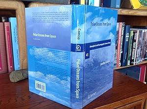
Polar Oceans from Space (Atmospheric and Oceanographic Sciences Library)
Libro 8 di 23: Atmospheric and Oceanographic Sciences LibraryDa: Reader's Corner, Inc., Raleigh, NC, U.S.A.
Valutazione del venditore 5 su 5 stelle
Prima edizione Copia autografata
Hardcover. Condizione: As New. Condizione sovraccoperta: No DJ. First Edition. This is a fine, as new, hardcover first edition copy, no DJ, blue spine. Inscribed by the author on the half title page. Inscribed by Author(s).
-

The Spatial Coherence of Interannual Temperature Variations in the Antarctic Peninsula
Da: GreatBookPricesUK, Woodford Green, Regno Unito
Valutazione del venditore 5 su 5 stelle
EUR 20,25
Spedizione EUR 17,39
Spedito da Regno Unito a U.S.A.Quantit�: Pi� di 20 disponibili
Aggiungi al carrelloCondizione: As New. Unread book in perfect condition.
-

Impact Studies of a 2 C Global Warming on the Arctic Sea Ice Cover
Da: GreatBookPricesUK, Woodford Green, Regno Unito
Valutazione del venditore 5 su 5 stelle
EUR 20,48
Spedizione EUR 17,39
Spedito da Regno Unito a U.S.A.Quantit�: Pi� di 20 disponibili
Aggiungi al carrelloCondizione: As New. Unread book in perfect condition.
-
EUR 10,00
Spedizione EUR 15,20
Spedito da Francia a U.S.A.Quantit�: 1 disponibili
Aggiungi al carrelloNASA, Washington, DC - 1983, 23,50x29,50 cm, cartonn�, XIV + 206 pages Tr�s bon �tat - Pour les envois hors de France, la tafication �livre & brochure� pour les frais de port a disparue.Les frais de port annonc�s correspondent � une moyenne. Ils seront calcul�s au plus juste en fonction du poids de votre article.
-
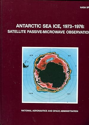
ANTARCTIC SEA ICE, 1973-1976: Satellite Passive-Microwave Observations
Editore: NASA, 1983
Da: Veronica's Books, Gig Harbor, WA, U.S.A.
Valutazione del venditore 5 su 5 stelle
Pictorial Cover. Condizione: Near Fine. NASA SP-459. Size: 4to - over 9�" - 12" tall. Book.
-

Impact Studies of a 2 C Global Warming on the Arctic Sea Ice Cover
Da: GreatBookPricesUK, Woodford Green, Regno Unito
Valutazione del venditore 5 su 5 stelle
EUR 24,97
Spedizione EUR 17,39
Spedito da Regno Unito a U.S.A.Quantit�: Pi� di 20 disponibili
Aggiungi al carrelloCondizione: New.
-

The Spatial Coherence of Interannual Temperature Variations in the Antarctic Peninsula
Da: GreatBookPricesUK, Woodford Green, Regno Unito
Valutazione del venditore 5 su 5 stelle
EUR 25,68
Spedizione EUR 17,39
Spedito da Regno Unito a U.S.A.Quantit�: Pi� di 20 disponibili
Aggiungi al carrelloCondizione: New.
-
NASA SP-489: ARCTIC SEA ICE, 1973-1976: Satellite Passive-Microwave Observations.
Editore: Washington, DC: NASA, 1987., 1987
Da: OLD WORKING BOOKS & Bindery (Est. 1994), West Brookfield, MA, U.S.A.
Membro dell'associazione: SNEAB
Valutazione del venditore 5 su 5 stelle
Prima edizione
Illustrated by Color and b/w photos of, and line-drawn maps. First edition. Gloss pictorial boards. 4to. pp. xvi, 296. Index. Near Fine/No jacket, as issued/Ex-Lib. Technical markings: bookplate, rear envelope, white spine label. Atlas of Satellite photos of freezing and thawing of sea ice, implications on weather and Geology and Space Technology (Same format as NASA SP-459 ANTARCTIC Sea Ice, 1983).
-
NASA SP-459: ANTARCTIC SEA ICE, 1973-1976: Satellite Passive-Microwave Observations.
Editore: Washington, DC: NASA, 1983., 1983
Da: OLD WORKING BOOKS & Bindery (Est. 1994), West Brookfield, MA, U.S.A.
Membro dell'associazione: SNEAB
Valutazione del venditore 5 su 5 stelle
Prima edizione
Illustrated by Color and b/w. First edition. Gloss pictorial boards. 4to. pp. xii, 206. Index. Near Fine/No jacket, as issued/Ex-Lib. Technical marking: remnant of rear envelope, white spine label. Atlas of Satellite photos of freezing and thawing of sea ice, implications on weather and Geology and Space Technology (Same format as NASA SP-489, Arctic Sea Ice, 1987).
-
SSM/I Sea Ice Concentrations Using the Bootstrap Algorithm
Editore: NASA, Greenbelt, Maryland, U.S.A, 1995
Da: Peter Rhodes, Southampton, Regno Unito
Valutazione del venditore 4 su 5 stelle

Prima edizione
EUR 11,94
Spedizione EUR 41,40
Spedito da Regno Unito a U.S.A.Quantit�: 1 disponibili
Aggiungi al carrelloPaperback. Condizione: Good +. Paperback Edition. 280 x 220mm. pp. 49. English text. Original NASA publication entitled 'SSM/I Sea Ice Concentrations Using the Bootstrap Algorithm' issued in December 1995. NASA reference publication 1380. Black and white illustrations. Bound in original light brown card covers. Library marks to front cover and some bumping to corners and edges. Binding strong. No underlining. Ex-Library.
-
EUR 95,05
Spedizione EUR 105,00
Spedito da Germania a U.S.A.Quantit�: 1 disponibili
Aggiungi al carrelloCondizione: Sehr gut. Zustand: Sehr gut | Seiten: 507 | Sprache: Englisch | Produktart: B�cher | The book presents a wealth of material about the polar oceans, more specifically the ice-covered areas and peripheral seas. It provides a detailed history of the changing climate of the polar oceans as observed by satellite sensors in the last three decades. The satellite research data show spatial distributions of surface temperature, sea ice, albedo, chlorophyll concentration, clouds, ocean color and sea level pressure.The book discusses remote sensing techniques and algorithms used to transform digital data to geophysical parameters, to process and analyze the data, the limitations of these data and the enormous potential in the use of this data. The main goal of the book is the presentation of results from studies of the time evolution of polar surfaces as observed by satellite sensors and their relevance to the study of cryospheric and ocean processes and climate change. The book contains about 150 satellite images of surface parameters which reveal that from month to month and from one year to another the Earth is changing.Although the historical record of about three decades of continuous satellite observation is relatively short, these measurements have provided useful insights into the current state of the polar environment and have served as a powerful tool for studying the processes that govern the Earth's climate system. The advent of even more sophisticated technology, including international ventures like the Global Earth Observation System of all Systems (GEOSS), will speed the progress. The advances in understanding of the Earth's climate engine, including the crucial role played by the polar oceans, have been tremendous, and people look forward to being able to forecast effectively the state of the planet in the immediate and foreseeable future.
-

Polar Oceans from Space (Atmospheric and Oceanographic Sciences Library (41))
Libro 8 di 23: Atmospheric and Oceanographic Sciences LibraryDa: Books Puddle, New York, NY, U.S.A.
Valutazione del venditore 4 su 5 stelle
Condizione: New. pp. 521.
-
Polar Oceans from Space
Libro 8 di 23: Atmospheric and Oceanographic Sciences LibraryDa: Books Puddle, New York, NY, U.S.A.
Valutazione del venditore 4 su 5 stelle
Condizione: New. PP. x + 430.
-

Polar Oceans from Space
Libro 8 di 23: Atmospheric and Oceanographic Sciences LibraryLingua: Inglese
Editore: Springer New York, Springer New York, 2016
ISBN 10: 1493938878 ISBN 13: 9781493938872
EUR 168,73
Spedizione EUR 64,40
Spedito da Germania a U.S.A.Quantit�: 1 disponibili
Aggiungi al carrelloTaschenbuch. Condizione: Neu. Druck auf Anfrage Neuware - Printed after ordering - Only a few centuries ago, we knew very little about our planet Earth. The Earth was considered flat by many although it was postulated by a few like Aristotle that it is spherical based on observations that included the study of lunar eclipses. Much later, Christopher Columbus successfully sailed to the West to discover the New World and Ferdinand Magellan's ship circumnavigated the globe to prove once and for all that the Earth is indeed a sphere. Worldwide navigation and explorations that followed made it clear that the Earth is huge and rather impossible to study solely by foot or by water. The advent of air travel made it a lot easier to do exploratory studies and enabled the mapping of the boundaries of continents and the oceans. But aircraft coverage was limited and it was not until the satellite era that full c- erage of the Earth's surface became available. Many of the early satellites were research satellites and that meant in part the development of engineering measurement systems with no definite applications in mind. The Nimbus-5 Electrically Scanning Microwave Radiometer (ESMR) was a classic case in point. The sensor was built with the idea that it may be useful for meteorological research and especially rainfall studies over the oceans, but success in this area of study was very limited.
-

Impact Studies of a 2 C Global Warming on the Arctic Sea Ice Cover
Da: Majestic Books, Hounslow, Regno Unito
Valutazione del venditore 4 su 5 stelle
EUR 20,32
Spedizione EUR 7,53
Spedito da Regno Unito a U.S.A.Quantit�: 4 disponibili
Aggiungi al carrelloCondizione: New. Print on Demand pp. 24.
-

The Spatial Coherence of Interannual Temperature Variations in the Antarctic Peninsula
Da: Majestic Books, Hounslow, Regno Unito
Valutazione del venditore 4 su 5 stelle
EUR 20,99
Spedizione EUR 7,53
Spedito da Regno Unito a U.S.A.Quantit�: 4 disponibili
Aggiungi al carrelloCondizione: New. Print on Demand pp. 22.
-
Impact Studies of a 2 C Global Warming on the Arctic Sea Ice Cover
Da: Books Puddle, New York, NY, U.S.A.
Valutazione del venditore 4 su 5 stelle
Condizione: New. Print on Demand pp. 24.
-
The Spatial Coherence of Interannual Temperature Variations in the Antarctic Peninsula
Da: Books Puddle, New York, NY, U.S.A.
Valutazione del venditore 4 su 5 stelle
Condizione: New. Print on Demand pp. 22.
-
Impact Studies of a 2 C Global Warming on the Arctic Sea Ice Cover
Da: Biblios, Frankfurt am main, HESSE, Germania
Valutazione del venditore 4 su 5 stelle
EUR 20,91
Spedizione EUR 9,95
Spedito da Germania a U.S.A.Quantit�: 4 disponibili
Aggiungi al carrelloCondizione: New. PRINT ON DEMAND pp. 24.
-
The Spatial Coherence of Interannual Temperature Variations in the Antarctic Peninsula
Da: Biblios, Frankfurt am main, HESSE, Germania
Valutazione del venditore 4 su 5 stelle
EUR 21,58
Spedizione EUR 9,95
Spedito da Germania a U.S.A.Quantit�: 4 disponibili
Aggiungi al carrelloCondizione: New. PRINT ON DEMAND pp. 22.
-
Arctic Sea Ice, 1973-1976: Satellite Passive-Microwave Observations. NASA SP-489
Editore: NASA, Washington, DC, 1987
Da: Ground Zero Books, Ltd., Silver Spring, MD, U.S.A.
Valutazione del venditore 5 su 5 stelle
Prima edizione
Condizione: very good. First Edition. 30 cm, 296, illus., maps (some color), bibliography, index. Study of climate changes observed in Arctic region by monitoring sea ice from near-Earth orbit. Sea ice plays a key role in the climate of the earth; this work summarizes Arctic observations made by the electrically scanning radiometer aboard the Nimbus 5 satellite.
-
Polar Oceans from Space
Editore: Springer, New York, 2010
Da: D.G.Wills Books, La Jolla, CA, U.S.A.
Valutazione del venditore 5 su 5 stelle
Prima edizione Copia autografata
Cloth. Condizione: Near Fine. No Jacket. First Edition. Inscribed on Half-Title page: "To Robin, With Compliments of Josefino Comiso.". Inscribed from Author.
-
Impact Studies of a 2 C Global Warming on the Arctic Sea Ice Cover
Da: THE SAINT BOOKSTORE, Southport, Regno Unito
Valutazione del venditore 5 su 5 stelle
EUR 97,53
Spedizione EUR 13,55
Spedito da Regno Unito a U.S.A.Quantit�: Pi� di 20 disponibili
Aggiungi al carrelloPaperback / softback. Condizione: New. This item is printed on demand. New copy - Usually dispatched within 5-9 working days.
-
Polar Oceans from Space (eng)
Libro 8 di 23: Atmospheric and Oceanographic Sciences LibraryDa: Brook Bookstore On Demand, Napoli, NA, Italia
Valutazione del venditore 3 su 5 stelle

EUR 126,26
Spedizione EUR 11,00
Spedito da Italia a U.S.A.Quantit�: Pi� di 20 disponibili
Aggiungi al carrelloCondizione: new. Questo � un articolo print on demand.
-

Polar Oceans from Space
Libro 8 di 23: Atmospheric and Oceanographic Sciences LibraryLingua: Inglese
Editore: Springer New York Aug 2016, 2016
ISBN 10: 1493938878 ISBN 13: 9781493938872
Da: BuchWeltWeit Ludwig Meier e.K., Bergisch Gladbach, Germania
Valutazione del venditore 5 su 5 stelle
EUR 160,49
Spedizione EUR 23,00
Spedito da Germania a U.S.A.Quantit�: 2 disponibili
Aggiungi al carrelloTaschenbuch. Condizione: Neu. This item is printed on demand - it takes 3-4 days longer - Neuware -Only a few centuries ago, we knew very little about our planet Earth. The Earth was considered flat by many although it was postulated by a few like Aristotle that it is spherical based on observations that included the study of lunar eclipses. Much later, Christopher Columbus successfully sailed to the West to discover the New World and Ferdinand Magellan's ship circumnavigated the globe to prove once and for all that the Earth is indeed a sphere. Worldwide navigation and explorations that followed made it clear that the Earth is huge and rather impossible to study solely by foot or by water. The advent of air travel made it a lot easier to do exploratory studies and enabled the mapping of the boundaries of continents and the oceans. But aircraft coverage was limited and it was not until the satellite era that full c- erage of the Earth's surface became available. Many of the early satellites were research satellites and that meant in part the development of engineering measurement systems with no definite applications in mind. The Nimbus-5 Electrically Scanning Microwave Radiometer (ESMR) was a classic case in point. The sensor was built with the idea that it may be useful for meteorological research and especially rainfall studies over the oceans, but success in this area of study was very limited. 524 pp. Englisch.