

Importo totale (1 articolo articoli):
Destinazione ordine:

kapp capt (11 risultati)
Vai alla pagina principale dei risultati di ricerca
Filtri di ricerca
Tipo di articolo
- Tutti i tipi di prodotto
- Libri (11)
- Riviste e Giornali (Nessun altro risultato corrispondente a questo perfezionamento)
- Fumetti (Nessun altro risultato corrispondente a questo perfezionamento)
- Spartiti (Nessun altro risultato corrispondente a questo perfezionamento)
- Arte, Stampe e Poster (Nessun altro risultato corrispondente a questo perfezionamento)
- Fotografie (Nessun altro risultato corrispondente a questo perfezionamento)
- Mappe (Nessun altro risultato corrispondente a questo perfezionamento)
- Manoscritti e Collezionismo cartaceo (Nessun altro risultato corrispondente a questo perfezionamento)
Condizioni Maggiori informazioni
- Nuovo (Nessun altro risultato corrispondente a questo perfezionamento)
- Come nuovo, Ottimo o Quasi ottimo (2)
- Molto buono o Buono (7)
- Discreto o Mediocre (Nessun altro risultato corrispondente a questo perfezionamento)
- Come descritto (2)
Legatura
- Tutte
- Rilegato (Nessun altro risultato corrispondente a questo perfezionamento)
- Brossura (9)
Ulteriori caratteristiche
- Prima ed. (3)
- Copia autograf. (Nessun altro risultato corrispondente a questo perfezionamento)
- Sovracoperta (Nessun altro risultato corrispondente a questo perfezionamento)
- Con foto (4)
- Non Print on Demand (11)
Lingua (3)
Spedizione gratuita
Paese del venditore
Valutazione venditore
-
Mola Art: From the San Blas Islands
Lingua: Inglese
Editore: K.S Kapp Publications, North Bend, OH., 1972
Da: Sheapast Art and Books, Sherman Oaks, CA, U.S.A.
Valutazione del venditore 5 su 5 stelle

Mola Art: From the San Blas Islands Capt, Kit S. Kapp, softcover , illustrated Published by K.S. Kapp Publications, North Bend, OH, 1972. The decorative arts , fabrics, customs , traditions of the Kuna peoples of Panama "name inside, some wear".
-
Mola Art from the San Blas Islands
Lingua: Inglese
Editore: K.S. Kapp Publications, North Bend, OH, 1982
Da: Books by White/Walnut Valley Books, Winfield, KS, U.S.A.
Valutazione del venditore 5 su 5 stelle
Prima edizione
Soft cover. Condizione: As New. No Jacket. 1st Edition. K.S. Kapp Publications, North Bend, OH. 1982. Softcover/Trade Wraps. Stated 5th Printing. Book is tight, square, and unmarked. Book Condition: As New. No DJ. Pictorial card stock wraps. Wraps are not bent or folded; spine is not creased or split; Text is secure in binding. 48 pp 8vo. The Kuna people are and Indian tribe that live on the San Blas Islands of Panama in Central America. The women create the Mola blouses which are several layers of rectangular cotton cloth, stitched together, on which designs have been carefully cut out to expose the underlying colors. This book is a source for information about the Kuna people and their art. The book is filled with stories of Mr. Kapp's expeditions to the islands and descriptions of the molas he found and photographed for this book. A clean very presentable copy.
-

Mola Art From the San Blas Islands
Editore: K. S. Kapp Publications
Da: ThriftBooks-Atlanta, AUSTELL, GA, U.S.A.
Valutazione del venditore 5 su 5 stelle
Paperback. Condizione: Good. No Jacket. Pages can have notes/highlighting. Spine may show signs of wear. ~ ThriftBooks: Read More, Spend Less.
-
Mola Art; from the San Blas Islands
Editore: self published, 1972
Da: Lowry's Books, Three Rivers, MI, U.S.A.
Valutazione del venditore 4 su 5 stelle

Soft cover. Condizione: Good. No Jacket. various (illustratore). This thin book has some light rubbing of the covers, no creasing of the covers or spine. Interior text has slightly darkened with age, clean and tight in binding. Numerous black and white illustrations throughout.
-
The Early Maps of Colombia up to 1825. No. 77.
Editore: North Bend, Ohio: K. S. Kapp Publications, ., 1971
Da: Lighthouse Books, ABAA, Dade City, FL, U.S.A.
Membro dell'associazione: ABAA FABA ILAB
Valutazione del venditore 4 su 5 stelle
Octavo, softbound (stiff red map illus. upper cover with white spine and lower cover), 32 pp + x plates. Fine. From Author's Preface: This bibliography is intended to list as completely as possible the earliest printed maps of Colombia to 1860. The author is both a collector and a student of antiquarian maps of the Americas. He has been engaged in cartographic and exploratory studies in the Republic of Colombia during the past ten years and has therefore taken keen interest in searching for original material of the area in both Europe and America. The research undertaken for the project dealing with a country which abounds in romantic history and tales of the odl Spanish Main has proved to be a source of much enjoyment. All maps, except those marked N.E.B.A. (not examined by the author), have been personally inspected. The institutions that have specimens of the maps are noted. Measurements are in centimentres (cm) being the width by heighth of the printed surface excluding the blank margins. Dates in brackets [] mean approximate or questionable dates. Care has been taken to include such incidentals as plate, page or volume numbers, which are often the only clude to identify the exact edition. South American History, Latin America, Colombia, South America, Maps, Reference. tslic.
-
Mola Art; From the San Blas Islands
Editore: K.S. Kapp Publications
Da: Wonder Book, Frederick, MD, U.S.A.
Membro dell'associazione: ABAA ILAB
Valutazione del venditore 5 su 5 stelle
Condizione: Very Good. Very Good condition. (anthropology, san blas islands, art) A copy that may have a few cosmetic defects. May also contain light spine creasing or a few markings such as an owner's name, short gifter's inscription or light stamp.
-
Central America Early Maps up to 1860.
Editore: North Bend, Ohio: K. S. Kapp Publications, ()., 1974
Da: Lighthouse Books, ABAA, Dade City, FL, U.S.A.
Membro dell'associazione: ABAA FABA ILAB
Valutazione del venditore 4 su 5 stelle
Octavo, paperbound (tan, map illus. wrappers), 64 pp + xviii Plates. Fine. From Author's Preface: A spirited curiosity and a fascination for Central America has inspired the author to conduct research and travel into remote parts of this land, to explore the coast and direct hydrographic surveys in the Bay Islands and off the Mosquito coast. This bibliography is intended to list, as completely as possible, the printed general maps of Central America, including detailed plans of Costa Rica, Nicaragua, Honduras, Salvador, Guatemala, British Honduras and Yucatan. Geographically, Central America extends from the isthmus of Darien, where it connects with South America, to an undefined line somewhere between the Tropic of Cancer and the present United States -- Mexico border. Maps featuring Panama are described in a previous publication "The Early Maps of Panama up to 1865," while Mexico and specific plans of its provinces will be presented in a forthcoming work by the author. . The listing of maps from other bibliographies, catalogues and reference works cannot be a desirable substitute for personal examination of original publications. Therefore, all maps listed in this text, except those marked with an asterick, have been personally inspected. Institutions that have specimens of the maps listed are noted. Measurements are given in centimetres, being the width by height of the printed surface excluding blank margins. South American History, Latin America, Central America, South America, Maps, Reference. unxsl.
-
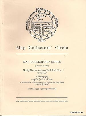
Map Collectors' Series (Eighth Volume), No 63 County Atlases of the British Isles 1579-1850 A Bibliography compiled by R. A Skelton in collaboration with members of the staff of the Map Room, British Museum. Part 5 (1579-1703 : appendixes)
Editore: Map Collectors' Circle, London, 1970
Da: Kuenzig Books ( ABAA / ILAB ), Topsfield, MA, U.S.A.
Membro dell'associazione: ABAA ESA ILAB IOBA SNEAB
Valutazione del venditore 5 su 5 stelle
Prima edizione
Wraps. Condizione: Good. First Edition. First Edition. [4], 209-250 pages. Buff printed wrappers. 7 1/4 x 9 3/4 inches. Wrappers with minor soiling. A well used copy. Map Collectors' Series (Eighth Volume), No 63 County Atlases of the British Isles 1579-1850 A Bibliography compiled by R. A Skelton in collaboration with members of the staff of the Map Room, British Museum. Part 5 (1579-1703 : appendixes). Wraps. No 63 in a series. A scholarly series related to cartography (maps). "The Map Collectors' Circle was founded in London in April 1963 by Ronald Vere Tooley with a stated aim of "stimulating interest in and publish material on early printed maps, atlases, cartographers, etc." Between 1963 and 1975, it set about fulfilling its second mandate with a series of 110 monographs related to the field of historical cartography which remain of interest to cartographers for their breadth. An index to the series has been created by the Bodleian Library Map Section." (wiki).
-
Central America: Early Maps Up to 1860
Editore: K. S. Kapp Publications, North Bend, Ohio, 1974
Da: Wheeler's Bookshop, Midhurst, West Sussex, Regno Unito
Valutazione del venditore 5 su 5 stelle
Prima edizione
EUR 23,82
Spedizione EUR 21,74
Spedito da Regno Unito a U.S.A.Quantità: 1 disponibili
Aggiungi al carrelloSoftcover. Condizione: Near Fine. First Edition. 4to. Pictorial wraps. 64 pp. text plus28 plates of maps. A great collection, nicely printed. Near as-new. NEAR FINE.
-
Mola Art - From the San Blas Islands
Lingua: Tedesco
Editore: K.S. Kapp Publications
Da: Antiquariat Armebooks, Frankfurt am Main, Germania
Valutazione del venditore 5 su 5 stelle
EUR 22,19
Spedizione EUR 20,00
Spedito da Germania a U.S.A.Quantità: 1 disponibili
Aggiungi al carrelloTaschenbuch. Condizione: Befriedigend. 48 Seiten; K. S. Kapp - 1. Auf. 1972 : Capt. Kit S. Kapp - tb #. K. 15x23 cm. JY-NJJB-KZ3Q Sprache: Deutsch Gewicht in Gramm: 500.
-

Mola Art from the San Blas Islands
Da: Vasco & Co / Emilia da Paz, Brussels, Belgio
Valutazione del venditore 5 su 5 stelle
EUR 45,00
Spedizione EUR 42,00
Spedito da Belgio a U.S.A.Quantità: 1 disponibili
Aggiungi al carrelloSoft cover. Condizione: Good. 1972 , 48 pp By Capt. Kit S. Kapp Photos in it Soft Cover.


