
Importo totale (1 articolo articoli):
Destinazione ordine:

kendall carter (131 risultati)
Vai alla pagina principale dei risultati di ricerca
Filtri di ricerca
Tipo di articolo
- Tutti i tipi di prodotto
- Libri (131)
- Riviste e Giornali (Nessun altro risultato corrispondente a questo perfezionamento)
- Fumetti (Nessun altro risultato corrispondente a questo perfezionamento)
- Spartiti (Nessun altro risultato corrispondente a questo perfezionamento)
- Arte, Stampe e Poster (Nessun altro risultato corrispondente a questo perfezionamento)
- Fotografie (Nessun altro risultato corrispondente a questo perfezionamento)
- Mappe (Nessun altro risultato corrispondente a questo perfezionamento)
- Manoscritti e Collezionismo cartaceo (Nessun altro risultato corrispondente a questo perfezionamento)
Condizioni Maggiori informazioni
- Nuovo (106)
- Come nuovo, Ottimo o Quasi ottimo (18)
- Molto buono o Buono (5)
- Discreto o Mediocre (Nessun altro risultato corrispondente a questo perfezionamento)
- Come descritto (2)
Legatura
Ulteriori caratteristiche
- Prima ed. (1)
- Copia autograf. (Nessun altro risultato corrispondente a questo perfezionamento)
- Sovracoperta (1)
- Con foto (38)
- Non Print on Demand (108)
Lingua (2)
Spedizione gratuita
Paese del venditore
Valutazione venditore
-

Prayer and Meditation Through the Holy Spirit
Da: -OnTimeBooks-, Phoenix, AZ, U.S.A.
Valutazione del venditore 5 su 5 stelle

Condizione: very_good. Gently read. May have name of previous ownership, or ex-library edition. Binding tight; spine straight and smooth, with no creasing; covers clean and crisp. Minimal signs of handling or shelving. 100% GUARANTEE! Shipped with delivery confirmation, if you're not satisfied with purchase please return item! Ships USPS Media Mail.
-

Prayer and Meditation Through the Holy Spirit
Da: GreatBookPrices, Columbia, MD, U.S.A.
Valutazione del venditore 5 su 5 stelle
EUR 13,84
Spedizione EUR 2,32
Spedito in U.S.A.Quantit�: Pi� di 20 disponibili
Aggiungi al carrelloCondizione: New.
-

Prayer and Meditation Through the Holy Spirit (Paperback or Softback)
Da: BargainBookStores, Grand Rapids, MI, U.S.A.
Valutazione del venditore 5 su 5 stelle
Paperback or Softback. Condizione: New. Prayer and Meditation Through the Holy Spirit. Book.
-

Prayer and Meditation Through the Holy Spirit
Da: GreatBookPrices, Columbia, MD, U.S.A.
Valutazione del venditore 5 su 5 stelle
EUR 14,82
Spedizione EUR 2,32
Spedito in U.S.A.Quantit�: Pi� di 20 disponibili
Aggiungi al carrelloCondizione: As New. Unread book in perfect condition.
-

The Power of Preaching
Lingua: Inglese
Editore: Emerald House Group, Incorporated, 2025
ISBN 10: 1649606354 ISBN 13: 9781649606358
Da: California Books, Miami, FL, U.S.A.
Valutazione del venditore 4 su 5 stelle

EUR 20,81
Spedizione gratuita
Spedito in U.S.A.Quantit�: Pi� di 20 disponibili
Aggiungi al carrelloCondizione: New.
-

Prayer and Meditation Through the Holy Spirit
Da: GreatBookPrices, Columbia, MD, U.S.A.
Valutazione del venditore 5 su 5 stelle
EUR 21,92
Spedizione EUR 2,32
Spedito in U.S.A.Quantit�: Pi� di 20 disponibili
Aggiungi al carrelloCondizione: As New. Unread book in perfect condition.
-
The Power of Preaching
Da: PBShop.store UK, Fairford, GLOS, Regno Unito
Valutazione del venditore 5 su 5 stelle
EUR 20,72
Spedizione EUR 3,86
Spedito da Regno Unito a U.S.A.Quantit�: Pi� di 20 disponibili
Aggiungi al carrelloPAP. Condizione: New. New Book. Shipped from UK. Established seller since 2000.
-

A SUPPRESSED CRITIQUE OF WISE'S SWINBURNE TRANSACTIONS ADDENDUM TO AN ENQUIRY.
Editore: Humanities Research Center
Da: Wonder Book, Frederick, MD, U.S.A.
Membro dell'associazione: ABAA ILAB
Valutazione del venditore 5 su 5 stelle
Condizione: Very Good. Very Good condition. In protective mylar cover. (Forgery of Manuscripts, Bibliophile Society) A copy that may have a few cosmetic defects. May also contain light spine creasing or a few markings such as an owner's name, short gifter's inscription or light stamp.
-

EUR 27,22
Spedizione gratuita
Spedito in U.S.A.Quantit�: Pi� di 20 disponibili
Aggiungi al carrelloCondizione: As New. Unread copy in mint condition.
-
EUR 27,32
Spedizione gratuita
Spedito in U.S.A.Quantit�: Pi� di 20 disponibili
Aggiungi al carrelloCondizione: New. Brand New.
-

Prayer and Meditation Through the Holy Spirit
Da: GreatBookPrices, Columbia, MD, U.S.A.
Valutazione del venditore 5 su 5 stelle
EUR 25,40
Spedizione EUR 2,32
Spedito in U.S.A.Quantit�: Pi� di 20 disponibili
Aggiungi al carrelloCondizione: New.
-

Reeds Astro Navigation Tables 2025
Lingua: Inglese
Editore: Bloomsbury Publishing PLC, GB, 2024
ISBN 10: 1399416707 ISBN 13: 9781399416702
Paperback. Condizione: New. This is the established book of annual astro-navigation tables compiled specifically for the needs of boaters.This superbly compact almanac and sight reduction tables contains information the ocean-going sailor needs in order to navigate by the sun, moon, stars and planets, using tables devised by practical ocean navigators. This book, together with a sextant, will help sailors to navigate confidently and safely when out of the sight of land.The book continues to feature the well-received additions of the past few years, including forms to help determine True Altitude (for the sun, stars and planets), Calculated Altitude (using the versine formula) and Azimuth (using the ABC Tables), as well as a pro forma for calculating Intercept. These tables, along with clear and easy to use star ID charts, mean you can resolve any calculation you're ever going to need. There is also an introductory section on practising ashore, with helpful worked examples as an aide memoire. With 8 extra pages and an improved layout, there is plenty of space for making notes and calculations.While they should not be relied upon as anyone's sole means of navigation, being so easy to use, Reeds tables encourage active navigation and a better understanding by sailors of where they have been and where to go next - rewarding in itself and essential in the event of GPS failure.
-

Reeds Astro Navigation Tables 2024
Lingua: Inglese
Editore: Bloomsbury Publishing PLC, GB, 2023
ISBN 10: 1399407708 ISBN 13: 9781399407700
Paperback. Condizione: New. Reeds Astro Navigation Tables is the established book of annual astro-navigation tables compiled specifically for the needs of boaters.This superbly compact almanac and sight reduction tables contains all the information the ocean-going sailor needs in order to navigate by the sun, moon, stars and planets, using tables devised by practical ocean navigators. This book, together with a sextant, will enable sailors to navigate confidently and safely when out of the sight of land.The book continues to feature the well-received additions of the past few years, including forms to help determine True Altitude (for the sun, stars and planets), Calculated Altitude (using the versine formula) and Azimuth (using the ABC Tables), as well as a pro forma for calculating Intercept. These tables, along with clear and easy to use star ID charts, mean you can resolve any calculation you're ever going to need. There is also an introductory section on practising ashore, with helpful worked examples as an aide memoire. With 8 extra pages and an improved layout, there is plenty of space for making notes and calculations.Being so easy to use, Reeds tables encourage active navigation and a better understanding by sailors of where they have been and where to go next - rewarding in itself and essential in the event of GPS failure.
-

The Power of Preaching
Lingua: Inglese
Editore: Emerald House Group, Incorporated, 2025
ISBN 10: 164960761X ISBN 13: 9781649607614
Da: California Books, Miami, FL, U.S.A.
Valutazione del venditore 4 su 5 stelle
EUR 29,86
Spedizione gratuita
Spedito in U.S.A.Quantit�: Pi� di 20 disponibili
Aggiungi al carrelloCondizione: New.
-

EUR 31,48
Spedizione gratuita
Spedito in U.S.A.Quantit�: Pi� di 20 disponibili
Aggiungi al carrelloCondizione: As New. Unread copy in mint condition.
-
EUR 31,58
Spedizione gratuita
Spedito in U.S.A.Quantit�: Pi� di 20 disponibili
Aggiungi al carrelloCondizione: New. Brand New.
-

Prayer and Meditation Through the Holy Spirit
Da: Ria Christie Collections, Uxbridge, Regno Unito
Valutazione del venditore 5 su 5 stelle
EUR 18,01
Spedizione EUR 14,05
Spedito da Regno Unito a U.S.A.Quantit�: Pi� di 20 disponibili
Aggiungi al carrelloCondizione: New. In.
-

Reeds Astro Navigation Tables 2026
Da: PBShop.store US, Wood Dale, IL, U.S.A.
Valutazione del venditore 5 su 5 stelle
PAP. Condizione: New. New Book. Shipped from UK. Established seller since 2000.
-
The Power of Preaching
Lingua: Inglese
Editore: Emerald House Group, Incorporated, 2025
ISBN 10: 1649606354 ISBN 13: 9781649606358
Da: Ria Christie Collections, Uxbridge, Regno Unito
Valutazione del venditore 5 su 5 stelle
EUR 19,08
Spedizione EUR 14,05
Spedito da Regno Unito a U.S.A.Quantit�: Pi� di 20 disponibili
Aggiungi al carrelloCondizione: New. In.
-
Prayer and Meditation Through the Holy Spirit
Da: Chiron Media, Wallingford, Regno Unito
Valutazione del venditore 5 su 5 stelle
EUR 14,80
Spedizione EUR 18,17
Spedito da Regno Unito a U.S.A.Quantit�: 10 disponibili
Aggiungi al carrelloPF. Condizione: New.
-
![Immagine dell'editore per The Tale of a Devil Dog: [The Illustrated Edition] venduto da Revaluation Books](https://pictures.abebooks.com/isbn/9781977051028-it-300.jpg)
The Tale of a Devil Dog: [The Illustrated Edition]
Da: Revaluation Books, Exeter, Regno Unito
Valutazione del venditore 5 su 5 stelle
EUR 22,28
Spedizione EUR 11,73
Spedito da Regno Unito a U.S.A.Quantit�: 1 disponibili
Aggiungi al carrelloPaperback. Condizione: Brand New. 75 pages. 9.00x6.00x0.19 inches. In Stock.
-
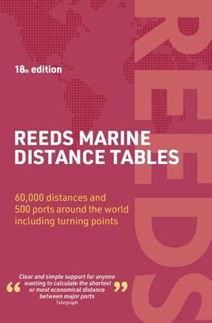
Reeds Marine Distance Tables 18th Edition
Da: GreatBookPrices, Columbia, MD, U.S.A.
Valutazione del venditore 5 su 5 stelle
Condizione: New.
-

Reeds Marine Distance Tables 18th edition
Lingua: Inglese
Editore: Bloomsbury Publishing PLC, GB, 2024
ISBN 10: 1399412418 ISBN 13: 9781399412414
Paperback. Condizione: New. Reeds Marine Distance Tables are the perfect ready-reckoner for captains, navigators and owners of merchant and cruise ships large and small wanting a quick and accurate distance reference between all the regularly used commercial ports around the world. They are also of increasing value to the superyacht fleet.The book is divided into key 'market areas', and includes a pull-out map for area identification and easy see-at-a-glance port reference. Traffic Separation Schemes are calculated into the tables whilst the distance to any port not included can easily be determined by making an approximation from the next closest port. Useful tables of major 'turning points' around the world (such as Cape Finisterre, Cape Horn and the Dover Straits), Transatlantic distances, world time zones, and time and speed conversion tables are also included.As well as incorporating general updates and improvements, this edition has been expanded to include more Indian Ocean ports, routes reflecting the increasing role of China in international shipping, as well as inter-distance tables for the Adriatic and Aegean. Freighter movements, cargo tonnage and cruise ship destinations have all been factored into considering details on the top ten busiest ports worldwide.Reeds Marine Distance Tables are an invaluable reference for ship owners, operators, brokers, navigators and superyacht skippers. Using this one reference, anyone can calculate the shortest or most economical distances between all the major ports in the world.
-

Prayer and Meditation Through the Holy Spirit
Da: GreatBookPricesUK, Woodford Green, Regno Unito
Valutazione del venditore 5 su 5 stelle
EUR 17,79
Spedizione EUR 17,59
Spedito da Regno Unito a U.S.A.Quantit�: Pi� di 20 disponibili
Aggiungi al carrelloCondizione: New.
-
Reeds Astro Navigation Tables 2026
Lingua: Inglese
Editore: Bloomsbury Academic & Professional, 2025
ISBN 10: 1399425315 ISBN 13: 9781399425315
Da: Better World Books Ltd, Dunfermline, Regno Unito
Valutazione del venditore 5 su 5 stelle
EUR 30,25
Spedizione EUR 5,86
Spedito da Regno Unito a U.S.A.Quantit�: 1 disponibili
Aggiungi al carrelloCondizione: Good. Former library copy. Pages intact with minimal writing/highlighting. The binding may be loose and creased. Dust jackets/supplements are not included. Includes library markings. Stock photo provided. Product includes identifying sticker. Better World Books: Buy Books. Do Good.
-

Reeds Marine Distance Tables 19th edition
Da: PBShop.store US, Wood Dale, IL, U.S.A.
Valutazione del venditore 5 su 5 stelle
PAP. Condizione: New. New Book. Shipped from UK. Established seller since 2000.
-

Reeds Astro Navigation Tables 2026
Lingua: Inglese
Editore: Bloomsbury Publishing PLC, GB, 2025
ISBN 10: 1399425315 ISBN 13: 9781399425315
Da: Rarewaves.com USA, London, LONDO, Regno Unito
Valutazione del venditore 5 su 5 stelle
EUR 36,85
Spedizione gratuita
Spedito da Regno Unito a U.S.A.Quantit�: 5 disponibili
Aggiungi al carrelloPaperback. Condizione: New. The established book of annual astro-navigation tables compiled specifically for the needs of boaters.This superbly compact almanac and sight reduction tables contains information the ocean-going sailor needs in order to navigate by the sun, moon, stars and planets, using tables devised by practical ocean navigators. This book, together with a sextant, will help sailors to navigate confidently and safely when out of the sight of land.This 2026 edition is completely up to date and continues to feature the well-received additions of the past few years, including forms to help determine True Altitude (for the sun, stars and planets), Calculated Altitude (using the versine formula) and Azimuth (using the ABC Tables), as well as a pro forma for calculating Intercept. These tables, along with clear and easy to use star ID charts, mean you can resolve any calculation you're ever going to need. There is also an introductory section on practising ashore, with helpful worked examples as an aide memoire, and plenty of space for making notes and calculations.While they should not be relied upon as anyone's sole means of navigation, being so easy to use, Reeds tables encourage active navigation and a better understanding by sailors of where they have been and where to go next - rewarding in itself and essential in the event of GPS failure.
-
The Power of Preaching
Da: PBShop.store UK, Fairford, GLOS, Regno Unito
Valutazione del venditore 5 su 5 stelle
EUR 31,77
Spedizione EUR 4,88
Spedito da Regno Unito a U.S.A.Quantit�: Pi� di 20 disponibili
Aggiungi al carrelloHRD. Condizione: New. New Book. Shipped from UK. Established seller since 2000.
-

Reeds Marine Distance Tables 18th Edition
Da: GreatBookPrices, Columbia, MD, U.S.A.
Valutazione del venditore 5 su 5 stelle
Condizione: As New. Unread book in perfect condition.
-

EUR 26,68
Spedizione EUR 10,00
Spedito da Germania a U.S.A.Quantit�: 1 disponibili
Aggiungi al carrelloCondizione: very good. Gut/Very good: Buch bzw. Schutzumschlag mit wenigen Gebrauchsspuren an Einband, Schutzumschlag oder Seiten. / Describes a book or dust jacket that does show some signs of wear on either the binding, dust jacket or pages.
