Importo totale (1 articolo articoli):
Destinazione ordine:

lake beers (9 risultati)
Vai alla pagina principale dei risultati di ricerca
Filtri di ricerca
Tipo di articolo
- Tutti i tipi di prodotto
- Libri (8)
- Riviste e Giornali (Nessun altro risultato corrispondente a questo perfezionamento)
- Fumetti (Nessun altro risultato corrispondente a questo perfezionamento)
- Spartiti (Nessun altro risultato corrispondente a questo perfezionamento)
- Arte, Stampe e Poster (Nessun altro risultato corrispondente a questo perfezionamento)
- Fotografie (Nessun altro risultato corrispondente a questo perfezionamento)
- Mappe (1)
- Manoscritti e Collezionismo cartaceo (Nessun altro risultato corrispondente a questo perfezionamento)
Condizioni Maggiori informazioni
- Nuovo (Nessun altro risultato corrispondente a questo perfezionamento)
- Come nuovo, Ottimo o Quasi ottimo (1)
- Molto buono o Buono (1)
- Discreto o Mediocre (1)
- Come descritto (6)
Legatura
- Tutte
- Rilegato (Nessun altro risultato corrispondente a questo perfezionamento)
- Brossura (Nessun altro risultato corrispondente a questo perfezionamento)
Ulteriori caratteristiche
- Prima ed. (3)
- Copia autograf. (Nessun altro risultato corrispondente a questo perfezionamento)
- Sovracoperta (Nessun altro risultato corrispondente a questo perfezionamento)
- Con foto (8)
- Non Print on Demand (9)
Lingua (2)
Prezzo
- Qualsiasi prezzo
- Inferiore a EUR 20 (Nessun altro risultato corrispondente a questo perfezionamento)
- EUR 20 a EUR 45 (Nessun altro risultato corrispondente a questo perfezionamento)
- Superiore a EUR 45
Spedizione gratuita
- Spedizione gratuita in U.S.A. (Nessun altro risultato corrispondente a questo perfezionamento)
Paese del venditore
Valutazione venditore
-
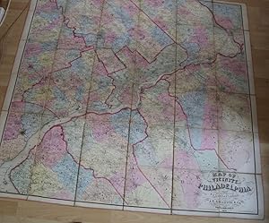
MAP OF THE VICINITY OF PHILADELPHIA From Actual Surveys By D.J. Lake and S.N.Beers
Lingua: Inglese
Editore: J.E. Gillette & Co., Philadelphia, 1861
Da: THOMAS RARE BOOKS, Yaxley, SUFFOLK, Regno Unito
Valutazione del venditore 4 su 5 stelle

Prima edizione
EUR 3.275,09
Spedizione EUR 17,34
Spedito da Regno Unito a U.S.A.Quantità: 1 disponibili
Aggiungi al carrelloprinted Map. Condizione: Fine. 1st Edition. A very rare large folding map of Philadelphia divided into 36 sections [each 22x23 cms] and laid on a single linen sheet, 132x 138cms [52x54 inches]. Hand coloured. Enclosed with marbled paper covers. Only one copy traced. [City of Philadelphia Parks and Recreation Historic Archives]. No copy traced at auction. PLEASE EMAIL FOR PHOTOS.
-

Axles and axle-boxes. being patent number 3652 published 18 September 1876
Editore: London Eyre and Spottiswood HMSO printed c, 1876
Prima edizione
EUR 119,09
Spedizione EUR 4,74
Spedito da Regno Unito a U.S.A.Quantità: 1 disponibili
Aggiungi al carrellono binding. Condizione: good. First Edition. Original Printed patent disbound About 27cm by 18cm some wear and tear due to the disbinding.
-

Map of the Vicinity of Philadelphia (2)
Editore: Philadelphia, Philadelphia, 1860
Da: High Ridge Books, Inc. - ABAA, South Deerfield, MA, U.S.A.
Membro dell'associazione: ABAA ESA ILAB SNEAB
Valutazione del venditore 5 su 5 stelle

Wall map in poor condition with extensive fraying and some loss at top. Original linen and rods, some short tears mended, mild fraying at edges. Age toned. 23 inset plans of cities and towns, mostly in Montgomery County, including a large plan of Philadelphia. Shows parts of Gloucester, Camden and Burlington Counties New Jersey and the northernmost three towns in Delaware. Full color by town. Shows all of Montgomery and Delaware Counties and large parts of Chester and Bucks Counties in Pennsylvania.
-

Map of the Vicinity of Philadelphia (3)
Editore: Philadelphia, Philadelphia, 1860
Da: High Ridge Books, Inc. - ABAA, South Deerfield, MA, U.S.A.
Membro dell'associazione: ABAA ESA ILAB SNEAB
Valutazione del venditore 5 su 5 stelle
Wall map in fair to good condition. The largest issue is a piece of the surface missing in the title block, with the loss of the last three letters of the word "Philadelphia" in the title. General wear and tear with very minor chipping to surface and edges. The worst of the wear is confined to the top 4-6 inches of the map. The remainder of the map is very good. Original linen and rods. 23 inset plans of cities and towns, mostly in Montgomery County, including a large plan of Philadelphia. Shows parts of Gloucester, Camden and Burlington Counties New Jersey and the northernmost three towns in Delaware. Full color by town. Shows all of Montgomery and Delaware Counties and large parts of Chester and Bucks Counties in Pennsylvania.
-
Map of the Vicinity of Philadelphia and Trenton. (Original Color Map)
Editore: Philadelphia: C.K. Stone and A. Pomeroy, 1860
Da: Sequitur Books, Boonsboro, MD, U.S.A.
Membro dell'associazione: IOBA
Valutazione del venditore 5 su 5 stelle
Mappa Prima edizione
Maps. Condizione: Fair. First Edition. 65 x 63 inches. Hand colored and lacquered. Only top wooden roller present. Mounted on original linen. Some creasing, chipping, soiling, tears. Includes numerous directories and inset maps mostly of Montgomery County, including: Philadelphia, Wilmington, Kennett Square, West Chester, etc. Shows Gloucester, parts of Camden, Mercer and Burlington County, NJ; 9 towns in Delaware; and the northernmost three towns in Maryland. Scale approximately 1:63,360. 1 inch equals one mile. Ristow, page 397.
-

Map of Columbia Co., New York
Editore: Philadelphia, Philadelphia, 1858
Da: High Ridge Books, Inc. - ABAA, South Deerfield, MA, U.S.A.
Membro dell'associazione: ABAA ESA ILAB SNEAB
Valutazione del venditore 5 su 5 stelle
Large wall map in fair to good condition, scattered light chipping and soiling, torn at bottom left corner with slight loss to view. 22 inset maps of towns and villages and 9 inset views of buildings. Columbia County is south of Albany between the Hudson River and Massachusetts. Not in Phillips.
-

Map of the Vicinity of Philadelphia and Wilmington
Editore: Philadelphia, Philadelphia, 1860
Da: High Ridge Books, Inc. - ABAA, South Deerfield, MA, U.S.A.
Membro dell'associazione: ABAA ESA ILAB SNEAB
Valutazione del venditore 5 su 5 stelle
Wall map in very good to fine condition with minor abrasion damage at the top and several short tears mended. Original varnish, bright and fresh. Full color by town. Original linen and rods, some short tears mended, mild fraying at edges. Age toned. 29 inset plans of cities and towns, including a large plan of Philadelphia. Shows all of Gloucester County and parts of Camden, Mercer and Burlington Counties New Jersey, 9 towns in Delaware and the northernmost three towns in Maryland. The insets include plans of Elkton and Chesapeake City Maryland. Shows all of Montgomery, Delaware and Chester Counties and part of Bucks County in Pennsylvania. This is an expanded version of a state of the Lake & Beers map which shows basically the same area but with less territory in Chester County and Delaware and does not extend south to Maryland.
-
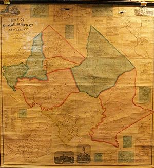
Map of Cumberland County, New Jersey
Editore: Philadelphia, Philadelphia, 1862
Da: High Ridge Books, Inc. - ABAA, South Deerfield, MA, U.S.A.
Membro dell'associazione: ABAA ESA ILAB SNEAB
Valutazione del venditore 5 su 5 stelle
Wall map in very good condition to fine condition. There are small holes, with some loss, in the inset plans of Vineland and Roadstown at the top of the map. Aside from those blemishes, the map is in fine condition. Original linen backing. Full color by town. Land owners identified. 18 inset maps of towns, 4 views of buildings. The first detailed map of this rural southwestern New Jersey county, Phillips p. 256.
-

Map of the Vicinity of Philadelphia
Editore: Philadelphia, Philadelphia, 1860
Da: High Ridge Books, Inc. - ABAA, South Deerfield, MA, U.S.A.
Membro dell'associazione: ABAA ESA ILAB SNEAB
Valutazione del venditore 5 su 5 stelle
Wall map in good to very good condition. Original linen and rods, some short tears mended, mild fraying at edges. Age toned. 23 inset plans of cities and towns, mostly in Montgomery County, including a large plan of Philadelphia. Shows parts of Gloucester, Camden and Burlington Counties New Jersey and the northernmost three towns in Delaware. Shows all of Montgomery County and large parts of Chester and Bucks Counties in Pennsylvania. Full color by town.