Leslie kettlewell (23 risultati)

- Brossura
Da: Top Notch Books, Tolar, U.S.A.Top Notch Books
Contatta il venditoreVenditore con 5 stelleCondizione: Usato - Molto buono
EUR 7,15
EUR 4,99 spedizioneSpedito in U.S.A.Quantità: 1 disponibili
Soft Cover. Condizione: Very Good. Wraps have only light wear, spine is unbent. Pages are clean with no markings in text. Size: 8vo - 7¾" - 9¾" Tall.
- Brossura
Da: Booksavers of Virginia, Harrisonburg, U.S.A.Booksavers of Virginia
Contatta il venditoreVenditore con 5 stelleCondizione: Usato - Discreto
EUR 10,28
EUR 4,33 spedizioneSpedito in U.S.A.Quantità: 1 disponibili
Spiral-bound. Condizione: Acceptable. Binding tight, pages unmarked. Spiral bound. Some pages and cover have slight wrinkling. Front cover is creased. Your purchase benefits the world-wide relief efforts of Mennonite Central Committee.
- Brossura
Da: ThriftBooks-Atlanta, AUSTELL, U.S.A.ThriftBooks-Atlanta
Contatta il venditoreVenditore con 5 stelleCondizione: Usato - Discreto
EUR 20,88
Spedizione gratuitaSpedito in U.S.A.Quantità: 1 disponibili
Paperback. Condizione: Fair. No Jacket. Readable copy. Pages may have considerable notes/highlighting. ~ ThriftBooks: Read More, Spend Less.

Editore: International Marine 1997
- Brossura
Da: Library House Internet Sales, Grand Rapids, U.S.A.Library House Internet Sales
Contatta il venditoreVenditore con 4 stelleCondizione: Usato - Buono
EUR 9,83
EUR 6,06 spedizioneSpedito in U.S.A.Quantità: 1 disponibili
Aggiungi al carrelloSoftcover. Condizione: Good. No Jacket. Piece(s) of the spine missing. Due to age and/or environmental conditions, the pages of this book have darkened. Please note the image in this listing is a stock photo and may not match the covers of the actual item. Book.
- Brossura
Da: Nelsons Books, Chazy, U.S.A.Nelsons Books
Contatta il venditoreVenditore con 4 stelleCondizione: Usato - Molto buono
EUR 28,59
EUR 5,80 spedizioneSpedito in U.S.A.Quantità: 1 disponibili
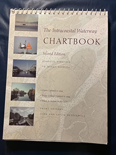
Spiralbound. Condizione: Very good. 3rd ed. Trade paperback (US). Glued binding. 267 p. Norfolk, Virginia, to Miami, Florida. Audience: General/trade. book is very good plus, some light edge wear. no markings.
- Brossura
Da: Patrico Books, Apollo Beach, U.S.A.Patrico Books
Contatta il venditoreVenditore con 5 stelleCondizione: Usato - Molto buono
EUR 35,73
EUR 3,46 spedizioneSpedito in U.S.A.Quantità: 1 disponibili
spiral_bound. Condizione: Very Good. Ships Out Tomorrow.

- Brossura
Da: GreatBookPrices, Columbia, U.S.A.GreatBookPrices
Contatta il venditoreVenditore con 5 stelleCondizione: Usato - Come nuovo
EUR 58,87
EUR 2,29 spedizioneSpedito in U.S.A.Quantità: 2 disponibili
Condizione: As New. Unread book in perfect condition.

- Brossura
Da: GreatBookPrices, Columbia, U.S.A.GreatBookPrices
Contatta il venditoreVenditore con 5 stelleCondizione: Nuovo
EUR 60,11
EUR 2,29 spedizioneSpedito in U.S.A.Quantità: 2 disponibili
Condizione: New.
- Brossura
Da: Lakeside Books, Benton Harbor, U.S.A.Lakeside Books
Contatta il venditoreVenditore con 5 stelleCondizione: Nuovo
EUR 58,92
EUR 3,46 spedizioneSpedito in U.S.A.Quantità: 1 disponibili
Condizione: New. Brand New! Not Overstocks or Low Quality Book Club Editions! Direct From the Publisher! We're not a giant, faceless warehouse organization! We're a small town bookstore that loves books and loves it's customers! Buy from Lakeside Books.

Lingua: Inglese
Editore: International Marine Publishing Co, Rockport, ME 2012
- Brossura
Da: Grand Eagle Retail, Bensenville, U.S.A.Grand Eagle Retail
Contatta il venditoreVenditore con 5 stelleCondizione: Nuovo
EUR 66,55
Spedizione gratuitaSpedito in U.S.A.Quantità: 1 disponibili
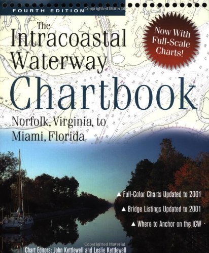
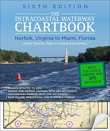
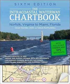
Spiral. Condizione: new. Spiral. $500 WORTH OF GOVERNMENT CHART AND COAST PILOT COVERAGE--MARKED WITH WAYPOINTS, BRIDGES, AND THE ROUTE!The Intracoastal Waterway Chartbook is a complete set of navigation charts for the 1,090-mile Intracoastal Waterway from Norfolk to Miami, as well as charts for all major Atlantic inlets. The ch…artbook also includes a complete listing of waterway bridge and lock characteristics; anchorage listings; mileage charts; charts for a picturesque alternate route; andnew to thiseditionmarina listingsall in a compact, easy-to-use format. The preferred route is marked in magenta on the charts to guide you all the way down (or up) the entire length of the Intracoastal Waterway. Safe anchorage locations are also shown to keep you and your vessel safe--and rested--as you cruise. Waypoints are also given for critical locations along the entire route, allowingyou to pre-plot your course in your GPS. Use this all-in-one chartbook alone or as a backup to your electronic navigation.Statute miles are noted in fi ve-mile increments in the chart margins, along with bridge, lock, marina, and anchorage locations. A handy place-name index makes it even easier to go right to the chart showing your destination."All the charts you need for the 1,000-mile 'Ditch'cruise for a fraction of the price." -- Cruising World"An outstanding example of economical, complete,no-nonsense chart compilation." -- Practical Sailor"An excellent compendium." -- The Capital (Annapolis, MD)"Your destination can be followed page by page in the proper order." -- Trailer Boats Presents a complete set of navigation that charts for the 1,090-mile Intracoastal Waterway from Norfolk to Miami, as well as charts for all major Atlantic inlets. This book includes a complete listing of waterway bridge and lock characteristics; anchorage listings; mileage charts; and charts for a picturesque alternate route. Shipping may be from multiple locations in the US or from the UK, depending on stock availability.
- Brossura
Da: James Lasseter, Jr, Brooksville, U.S.A.James Lasseter, Jr
Contatta il venditoreVenditore con 5 stelleCondizione: Usato - Molto buono
EUR 62,53
EUR 6,90 spedizioneSpedito in U.S.A.Quantità: 1 disponibili
Soft cover. Condizione: Very Good. Condizione sovraccoperta: None (as issued). A 265 page book "The Intracoastal Waterway Chartbook" is a complete set of Navigation Charts for the 1,090 mile Waterway from Norfolk to Miami. It also includes charts for the major inlets between the Waterway and the Atlantic Ocean. It would have cos…t more than $350.00 in 1995 dollars to purchase the same coverage in government charts and publications. A previous owner has highlighted many bridges in yellow; statute miles in blue; green markers in green, red markers in red and anchorage in orange. Some text is highlighted in light yellow. The work is held together by 21 wire binders at the page tops. Apparently the last name of the prior owner was Kokomo and this is etched (but does not go through to the other side) at the upper right hand corner of the front cover. You must hold it to light at the correct angle to see the name. The back cover has an area in the middle where a sticker of some sort has apparently been removed. Condition is better than it sounds. All in all, this is a highly useful copy; available for immediate shipment, carefully packed in a sturdy box! bx109.

- Brossura
Da: Rarewaves USA, OSWEGO, U.S.A.Rarewaves USA
Contatta il venditoreVenditore con 5 stelleCondizione: Nuovo
EUR 71,04
Spedizione gratuitaSpedito in U.S.A.Quantità: Più di 20 disponibili
Spiral Bound. Condizione: New. $500 WORTH OF GOVERNMENT CHART AND COAST PILOT COVERAGE--MARKED WITH WAYPOINTS, BRIDGES, AND THE ROUTE!The Intracoastal Waterway Chartbook is a complete set of navigation charts for the 1,090-mile Intracoastal Waterway from Norfolk to Miami, as well as charts for all major Atlantic inlets. The char…tbook also includes a complete listing of waterway bridge and lock characteristics; anchorage listings; mileage charts; charts for a picturesque alternate route; and-new to thisedition-marina listings-all in a compact, easy-to-use format. The preferred route is marked in magenta on the charts to guide you all the way down (or up) the entire length of the Intracoastal Waterway. Safe anchorage locations are also shown to keep you and your vessel safe--and rested--as you cruise. Waypoints are also given for critical locations along the entire route, allowingyou to pre-plot your course in your GPS. Use this all-in-one chartbook alone or as a backup to your electronic navigation.Statute miles are noted in fi ve-mile increments in the chart margins, along with bridge, lock, marina, and anchorage locations. A handy place-name index makes it even easier to go right to the chart showing your destination."All the charts you need for the 1,000-mile 'Ditch'cruise for a fraction of the price." -- Cruising World"An outstanding example of economical, complete,no-nonsense chart compilation." -- Practical Sailor"An excellent compendium." -- The Capital (Annapolis, MD)"Your destination can be followed page by page in the proper order." -- Trailer Boats.
- Brossura
Da: GreatBookPricesUK, Woodford Green, Regno UnitoGreatBookPricesUK
Contatta il venditoreVenditore con 5 stelleCondizione: Usato - Come nuovo
EUR 60,20
EUR 17,35 spedizioneSpedito da Regno Unito a U.S.A.Quantità: Più di 20 disponibili
Condizione: As New. Unread book in perfect condition.

- Brossura
Da: Rarewaves.com USA, London, Regno UnitoRarewaves.com USA
Contatta il venditoreVenditore con 5 stelleCondizione: Nuovo
EUR 79,19
Spedizione gratuitaSpedito da Regno Unito a U.S.A.Quantità: Più di 20 disponibili
Spiral Bound. Condizione: New. $500 WORTH OF GOVERNMENT CHART AND COAST PILOT COVERAGE--MARKED WITH WAYPOINTS, BRIDGES, AND THE ROUTE!The Intracoastal Waterway Chartbook is a complete set of navigation charts for the 1,090-mile Intracoastal Waterway from Norfolk to Miami, as well as charts for all major Atlantic inlets. The char…tbook also includes a complete listing of waterway bridge and lock characteristics; anchorage listings; mileage charts; charts for a picturesque alternate route; and-new to thisedition-marina listings-all in a compact, easy-to-use format. The preferred route is marked in magenta on the charts to guide you all the way down (or up) the entire length of the Intracoastal Waterway. Safe anchorage locations are also shown to keep you and your vessel safe--and rested--as you cruise. Waypoints are also given for critical locations along the entire route, allowingyou to pre-plot your course in your GPS. Use this all-in-one chartbook alone or as a backup to your electronic navigation.Statute miles are noted in fi ve-mile increments in the chart margins, along with bridge, lock, marina, and anchorage locations. A handy place-name index makes it even easier to go right to the chart showing your destination."All the charts you need for the 1,000-mile 'Ditch'cruise for a fraction of the price." -- Cruising World"An outstanding example of economical, complete,no-nonsense chart compilation." -- Practical Sailor"An excellent compendium." -- The Capital (Annapolis, MD)"Your destination can be followed page by page in the proper order." -- Trailer Boats.
- Brossura
Da: Kennys Bookshop and Art Galleries Ltd., Galway, IrlandaKennys Bookshop and Art Galleries Ltd.
Contatta il venditoreVenditore con 5 stelleCondizione: Nuovo
EUR 74,66
EUR 10,50 spedizioneSpedito da Irlanda a U.S.A.Quantità: Più di 20 disponibili
Condizione: New. Presents a complete set of navigation that charts for the 1,090-mile Intracoastal Waterway from Norfolk to Miami, as well as charts for all major Atlantic inlets. This book includes a complete listing of waterway bridge and lock characteristics; anchorage listings; mileage charts; and charts for a picturesque al…ternate route. Num Pages: 304 pages, Illustrations, map. BIC Classification: 1KBBF; TRLN; WSSN. Category: (G) General (US: Trade). Dimension: 233 x 302 x 15. Weight in Grams: 844. . 2012. 6th Edition. . . . .
- Brossura
Da: GreatBookPricesUK, Woodford Green, Regno UnitoGreatBookPricesUK
Contatta il venditoreVenditore con 5 stelleCondizione: Nuovo
EUR 72,81
EUR 17,35 spedizioneSpedito da Regno Unito a U.S.A.Quantità: Più di 20 disponibili
Condizione: New.
- Brossura
Da: Revaluation Books, Exeter, Regno UnitoRevaluation Books
Contatta il venditoreVenditore con 5 stelleCondizione: Nuovo
EUR 86,87
EUR 14,46 spedizioneSpedito da Regno Unito a U.S.A.Quantità: 2 disponibili
Spiral-bound. Condizione: Brand New. 6th edition. 304 pages. 11.70x8.50x1.20 inches. In Stock.
- Brossura
Da: Kennys Bookstore, Olney, U.S.A.Kennys Bookstore
Contatta il venditoreVenditore con 5 stelleCondizione: Nuovo
EUR 93,53
EUR 9,11 spedizioneSpedito in U.S.A.Quantità: Più di 20 disponibili
Condizione: New. Presents a complete set of navigation that charts for the 1,090-mile Intracoastal Waterway from Norfolk to Miami, as well as charts for all major Atlantic inlets. This book includes a complete listing of waterway bridge and lock characteristics; anchorage listings; mileage charts; and charts for a picturesque al…ternate route. Num Pages: 304 pages, Illustrations, map. BIC Classification: 1KBBF; TRLN; WSSN. Category: (G) General (US: Trade). Dimension: 233 x 302 x 15. Weight in Grams: 844. . 2012. 6th Edition. . . . . Books ship from the US and Ireland.

- Brossura
Da: Rarewaves USA United, OSWEGO, U.S.A.Rarewaves USA United
Contatta il venditoreVenditore con 5 stelleCondizione: Nuovo
EUR 72,82
EUR 43,37 spedizioneSpedito in U.S.A.Quantità: Più di 20 disponibili
Spiral Bound. Condizione: New. $500 WORTH OF GOVERNMENT CHART AND COAST PILOT COVERAGE--MARKED WITH WAYPOINTS, BRIDGES, AND THE ROUTE!The Intracoastal Waterway Chartbook is a complete set of navigation charts for the 1,090-mile Intracoastal Waterway from Norfolk to Miami, as well as charts for all major Atlantic inlets. The char…tbook also includes a complete listing of waterway bridge and lock characteristics; anchorage listings; mileage charts; charts for a picturesque alternate route; and-new to thisedition-marina listings-all in a compact, easy-to-use format. The preferred route is marked in magenta on the charts to guide you all the way down (or up) the entire length of the Intracoastal Waterway. Safe anchorage locations are also shown to keep you and your vessel safe--and rested--as you cruise. Waypoints are also given for critical locations along the entire route, allowingyou to pre-plot your course in your GPS. Use this all-in-one chartbook alone or as a backup to your electronic navigation.Statute miles are noted in fi ve-mile increments in the chart margins, along with bridge, lock, marina, and anchorage locations. A handy place-name index makes it even easier to go right to the chart showing your destination."All the charts you need for the 1,000-mile 'Ditch'cruise for a fraction of the price." -- Cruising World"An outstanding example of economical, complete,no-nonsense chart compilation." -- Practical Sailor"An excellent compendium." -- The Capital (Annapolis, MD)"Your destination can be followed page by page in the proper order." -- Trailer Boats.

- Brossura
Da: moluna, Greven, Germaniamoluna
Contatta il venditoreVenditore con 5 stelleCondizione: Nuovo
EUR 66,25
EUR 48,99 spedizioneSpedito da Germania a U.S.A.Quantità: 2 disponibili
Kartoniert / Broschiert. Condizione: New. Presents a complete set of navigation that charts for the 1,090-mile Intracoastal Waterway from Norfolk to Miami, as well as charts for all major Atlantic inlets. This book includes a complete listing of waterway bridge and lock characteristics anchorage l.
Lingua: Inglese
Editore: International Marine Publishing Co, Rockport, ME 2012
- Brossura
Da: AussieBookSeller, Truganina, AustraliaAussieBookSeller
Contatta il venditoreVenditore con 5 stelleCondizione: Nuovo
EUR 114,10
EUR 32,09 spedizioneSpedito da Australia a U.S.A.Quantità: 1 disponibili
Spiral. Condizione: new. Spiral. $500 WORTH OF GOVERNMENT CHART AND COAST PILOT COVERAGE--MARKED WITH WAYPOINTS, BRIDGES, AND THE ROUTE!The Intracoastal Waterway Chartbook is a complete set of navigation charts for the 1,090-mile Intracoastal Waterway from Norfolk to Miami, as well as charts for all major Atlantic inlets. The ch…artbook also includes a complete listing of waterway bridge and lock characteristics; anchorage listings; mileage charts; charts for a picturesque alternate route; andnew to thiseditionmarina listingsall in a compact, easy-to-use format. The preferred route is marked in magenta on the charts to guide you all the way down (or up) the entire length of the Intracoastal Waterway. Safe anchorage locations are also shown to keep you and your vessel safe--and rested--as you cruise. Waypoints are also given for critical locations along the entire route, allowingyou to pre-plot your course in your GPS. Use this all-in-one chartbook alone or as a backup to your electronic navigation.Statute miles are noted in fi ve-mile increments in the chart margins, along with bridge, lock, marina, and anchorage locations. A handy place-name index makes it even easier to go right to the chart showing your destination."All the charts you need for the 1,000-mile 'Ditch'cruise for a fraction of the price." -- Cruising World"An outstanding example of economical, complete,no-nonsense chart compilation." -- Practical Sailor"An excellent compendium." -- The Capital (Annapolis, MD)"Your destination can be followed page by page in the proper order." -- Trailer Boats Presents a complete set of navigation that charts for the 1,090-mile Intracoastal Waterway from Norfolk to Miami, as well as charts for all major Atlantic inlets. This book includes a complete listing of waterway bridge and lock characteristics; anchorage listings; mileage charts; and charts for a picturesque alternate route. Shipping may be from our Sydney, NSW warehouse or from our UK or US warehouse, depending on stock availability.

- Brossura
Da: Rarewaves.com UK, London, Regno UnitoRarewaves.com UK
Contatta il venditoreVenditore con 5 stelleCondizione: Nuovo
EUR 73,64
EUR 75,18 spedizioneSpedito da Regno Unito a U.S.A.Quantità: Più di 20 disponibili
Spiral Bound. Condizione: New. $500 WORTH OF GOVERNMENT CHART AND COAST PILOT COVERAGE--MARKED WITH WAYPOINTS, BRIDGES, AND THE ROUTE!The Intracoastal Waterway Chartbook is a complete set of navigation charts for the 1,090-mile Intracoastal Waterway from Norfolk to Miami, as well as charts for all major Atlantic inlets. The char…tbook also includes a complete listing of waterway bridge and lock characteristics; anchorage listings; mileage charts; charts for a picturesque alternate route; and-new to thisedition-marina listings-all in a compact, easy-to-use format. The preferred route is marked in magenta on the charts to guide you all the way down (or up) the entire length of the Intracoastal Waterway. Safe anchorage locations are also shown to keep you and your vessel safe--and rested--as you cruise. Waypoints are also given for critical locations along the entire route, allowingyou to pre-plot your course in your GPS. Use this all-in-one chartbook alone or as a backup to your electronic navigation.Statute miles are noted in fi ve-mile increments in the chart margins, along with bridge, lock, marina, and anchorage locations. A handy place-name index makes it even easier to go right to the chart showing your destination."All the charts you need for the 1,000-mile 'Ditch'cruise for a fraction of the price." -- Cruising World"An outstanding example of economical, complete,no-nonsense chart compilation." -- Practical Sailor"An excellent compendium." -- The Capital (Annapolis, MD)"Your destination can be followed page by page in the proper order." -- Trailer Boats.

- Brossura
- Prima edizione
Da: George Kent, Bookseller, Silverhill, U.S.A.George Kent, Bookseller
Contatta il venditoreVenditore con 5 stelleCondizione: Usato - Molto buono
EUR 263,56
EUR 6,38 spedizioneSpedito in U.S.A.Quantità: 1 disponibili
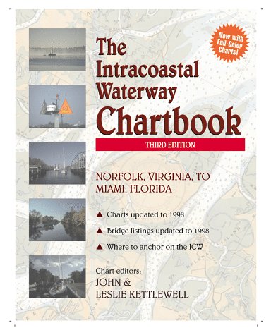
Soft cover. Condizione: Very Good. No Jacket. 1st Edition. This spiral bound soft cover first edition of 262 pages is tight, bright, and clean, free of names and markings. There is a bit of a crinkle at the bottom corner, front to back, that does not affect the printed page or illustrations.


