Ministry map (27 risultati)

- Brossura
Da: ThriftBooks-Dallas, Dallas, TX, U.S.A.ThriftBooks-Dallas
Contatta il venditoreVenditore con 5 stelleCondizione: Usato - Come nuovo
EUR 6,94
Spedizione gratuitaSpedito in U.S.A.Quantità: 1 disponibili
Paperback. Condizione: As New. No Jacket. Pages are clean and are not marred by notes or folds of any kind. ~ ThriftBooks: Read More, Spend Less.

- Brossura
Da: -OnTimeBooks-, Phoenix, AZ, U.S.A.-OnTimeBooks-
Contatta il venditoreVenditore con 5 stelleCondizione: Usato - Molto buono
EUR 6,96
Spedizione gratuitaSpedito in U.S.A.Quantità: 1 disponibili
Condizione: very_good. Gently read. May have name of previous ownership, or ex-library edition. Binding tight; spine straight and smooth, with no creasing; covers clean and crisp. Minimal signs of handling or shelving. 100% GUARANTEE! Shipped with delivery confirmation, if you're not satisfied with purchase please return item! S…hips USPS Media Mail.
- Brossura
Da: Better World Books, Mishawaka, IN, U.S.A.Better World Books
Contatta il venditoreVenditore con 5 stelleCondizione: Usato - Molto buono
EUR 7,05
Spedizione gratuitaSpedito in U.S.A.Quantità: 1 disponibili
Condizione: Very Good. Former library copy. Pages intact with possible writing/highlighting. Binding strong with minor wear. Dust jackets/supplements may not be included. Includes library markings. Stock photo provided. Product includes identifying sticker. Better World Books: Buy Books. Do Good.
- Brossura
Da: HPB-Emerald, Dallas, TX, U.S.A.HPB-Emerald
Contatta il venditoreVenditore con 5 stelleCondizione: Usato - Molto buono
EUR 4,68
EUR 3,28 spedizioneSpedito in U.S.A.Quantità: 1 disponibili
Paperback. Condizione: Very Good. Connecting readers with great books since 1972! Used books may not include companion materials, and may have some shelf wear or limited writing. We ship orders daily and Customer Service is our top priority.

- Brossura
Da: tLighthouse Books, Onekama, MI, U.S.A.tLighthouse Books
Contatta il venditoreVenditore con 5 stelleCondizione: Usato - Buono
EUR 6,95
EUR 6,98 spedizioneSpedito in U.S.A.Quantità: 1 disponibili
Condizione: good. Good condition. A copy that has been read but remains in clean condition. All pages are intact and the cover is intact. The spine and cover may show signs of wear. Pages can include limited notes and highlighting, and the copy can include "From the library of" labels or previous owner inscriptions. 100% GUARANT…EE! Shipped with delivery confirmation. If you're not satisfied with purchase please just return it.

- Brossura
Da: GreatBookPrices, Columbia, MD, U.S.A.GreatBookPrices
Contatta il venditoreVenditore con 5 stelleCondizione: Nuovo
EUR 12,14
EUR 2,31 spedizioneSpedito in U.S.A.Quantità: Più di 20 disponibili
Condizione: New.

- Brossura
Da: GreatBookPrices, Columbia, MD, U.S.A.GreatBookPrices
Contatta il venditoreVenditore con 5 stelleCondizione: Usato - Come nuovo
EUR 13,67
EUR 2,31 spedizioneSpedito in U.S.A.Quantità: Più di 20 disponibili
Condizione: As New. Unread book in perfect condition.

Editore: Department of Tourism, New Delhi India, 1962
- Brossura
- Prima edizione
Da: Vashon Island Books, Vashon, WA, U.S.A.Vashon Island Books
Contatta il venditoreVenditore con 5 stelleCondizione: Usato - Molto buono
EUR 8,96
EUR 4,81 spedizioneSpedito in U.S.A.Quantità: 1 disponibili
Paperback. Condizione: Very Good-. First Thus. In color pictorial wraps, light rubbing and wear, 12mo, 108pp. Size: 12mo - over 6¾" - 7¾" tall. b/w Illustration and Fold Out Map (illustratore). Book.
Editore: Ministry Of Information & Broadcasting 1958, Ju_e, New Delhi, India, 1958
- Brossura
Da: WONDERFUL BOOKS BY MAIL, CHICO-CA, CA, U.S.A.WONDERFUL BOOKS BY MAIL
Contatta il venditoreVenditore con 5 stelleCondizione: Usato - Molto buono
EUR 13,51
EUR 3,28 spedizioneSpedito in U.S.A.Quantità: 1 disponibili
Paperback. Condizione: Very Good. Revised Edition. VERY GOOD Condition CLEAN, SOLID, BRIGHT.; Black titles on PINK SQUARE spine BOOK.WRAPAROUND COVER ART SHOWS color paintings of many scens based on Photos in text showing sotted deer, astronomy site; holy temples, waterfal, imposing buildings. ; 112Pg pages; Informative text.cha…rming little travel item.Part of a series of pamplets "PRINTED AT SREE SARASWATY PRESS, CALCUTTA. Illustrated by Photos. Ilustrations,fold out map (illustratore).
Editore: Department of Tourism
- Brossura
Da: Terrace Horticultural Books, St. Paul, MN, U.S.A.Terrace Horticultural Books
Contatta il venditoreVenditore con 4 stelleCondizione: Usato - Molto buono
EUR 10,81
EUR 6,11 spedizioneSpedito in U.S.A.Quantità: 1 disponibili
Soft cover. Condizione: Very Good. Copyright Date: 1965 16mo, , PP.84, The State Or Morelos South Of Mexico City, Very Good, Owners Name At Cover. B & W And Color Photos, Text Figures, Folding Map (illustratore).
- Brossura
Da: Revaluation Books, Exeter, Regno UnitoRevaluation Books
Contatta il venditoreVenditore con 5 stelleCondizione: Nuovo
EUR 16,45
EUR 11,67 spedizioneSpedito da Regno Unito a U.S.A.Quantità: 2 disponibili
Paperback. Condizione: Brand New. 184 pages. 8.50x5.50x0.42 inches. In Stock.
- Brossura
Da: Ria Christie Collections, Uxbridge, Regno UnitoRia Christie Collections
Contatta il venditoreVenditore con 5 stelleCondizione: Nuovo
EUR 21,15
EUR 13,98 spedizioneSpedito da Regno Unito a U.S.A.Quantità: Più di 20 disponibili
Condizione: New. In.
- Brossura
Da: Chiron Media, Wallingford, Regno UnitoChiron Media
Contatta il venditoreVenditore con 5 stelleCondizione: Nuovo
EUR 17,77
EUR 18,08 spedizioneSpedito da Regno Unito a U.S.A.Quantità: 10 disponibili
Paperback. Condizione: New.

- Brossura
Da: GreatBookPricesUK, Woodford Green, Regno UnitoGreatBookPricesUK
Contatta il venditoreVenditore con 5 stelleCondizione: Nuovo
EUR 20,05
EUR 17,51 spedizioneSpedito da Regno Unito a U.S.A.Quantità: Più di 20 disponibili
Condizione: New.
Editore: Ministry of Mines and Energy, Brazil., 1978
- Brossura
Da: Eryops Books, Stephenville, TX, U.S.A.Eryops Books
Contatta il venditoreVenditore con 5 stelleCondizione: Usato - Molto buono
EUR 19,77
EUR 5,25 spedizioneSpedito in U.S.A.Quantità: 1 disponibili
Soft cover. Condizione: Very Good. Softcovers explanation and two large folded maps in light cardboard slipcase; ex-corporate library; several small light spots on outside of slipcase; o/w book and maps are in very good condition. Book.
Lingua: Inglese
Editore: Federal Ministry of Home Affairs, Salisbury, 1961
- Brossura
Da: J J Basset Books, bassettbooks, bookfarm.co.uk, Peter Tavy, Regno UnitoJ J Basset Books, bassettbooks, bookfarm.co.uk
Contatta il venditoreVenditore con 3 stelleCondizione: Usato
EUR 18,03
EUR 23,34 spedizioneSpedito da Regno Unito a U.S.A.Quantità: 1 disponibili
Colour Paper. Condizione: NEAR FINE (ABOVE AVERAGE). No Jacket. This is a First Edition. Not Signed or Inscribed.please e-mail for further details. Size: 16mo - over 5¾" - 6¾". Illustrated with a Map (illustratore).

- Brossura
Da: GreatBookPricesUK, Woodford Green, Regno UnitoGreatBookPricesUK
Contatta il venditoreVenditore con 5 stelleCondizione: Usato - Come nuovo
EUR 49,88
EUR 17,51 spedizioneSpedito da Regno Unito a U.S.A.Quantità: Più di 20 disponibili
Condizione: As New. Unread book in perfect condition.
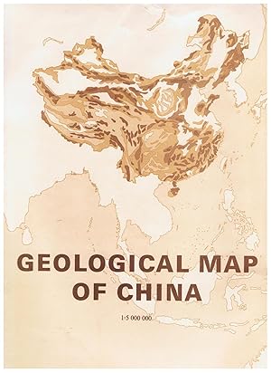
Geological Map of China (1: 5,000,000)
Commission for Geological Map of China(1: 5, 000,000); Ministry of Geology and Mineral Resources
- Brossura
Da: Tinakori Books, Lower Hutt, Nuova ZelandaTinakori Books
Contatta il venditoreVenditore con 5 stelleCondizione: Usato - Molto buono
EUR 67,53
EUR 28,85 spedizioneSpedito da Nuova Zelanda a U.S.A.Quantità: 1 disponibili
Soft cover. Condizione: Very Good. Two large folding coloured maps in envelope plus softcover book "Explanatory Notes" 82 pages. Map and book are contained in a plastic envelope.
- Brossura
- Print on Demand
Da: PBShop.store US, Wood Dale, IL, U.S.A.PBShop.store US
Contatta il venditoreVenditore con 5 stelleCondizione: Nuovo
EUR 23,83
Spedizione gratuitaSpedito in U.S.A.Quantità: Più di 20 disponibili
PAP. Condizione: New. New Book. Shipped from UK. THIS BOOK IS PRINTED ON DEMAND. Established seller since 2000.
- Brossura
- Print on Demand
Da: PBShop.store UK, Fairford, GLOS, Regno UnitoPBShop.store UK
Contatta il venditoreVenditore con 5 stelleCondizione: Nuovo
EUR 22,83
EUR 4,86 spedizioneSpedito da Regno Unito a U.S.A.Quantità: Più di 20 disponibili
PAP. Condizione: New. New Book. Delivered from our UK warehouse in 4 to 14 business days. THIS BOOK IS PRINTED ON DEMAND. Established seller since 2000.

Editore: Information Service of India (1957), New Delhi, 1957
- Brossura
Da: Expatriate Bookshop of Denmark, Svendborg, DanimarcaExpatriate Bookshop of Denmark
Contatta il venditoreVenditore con 5 stelleCondizione: Usato
EUR 31,51
EUR 59,00 spedizioneSpedito da Danimarca a U.S.A.Quantità: 1 disponibili
orig. wrappers. 21x14cm, 86 pages. Contents: Introduction; Pakistan's Case; Geography, Ethnology & History of Kashmir; Partition and the Indian States; Kashmir in the United Nations; Direct Negotiations; Pakistan and the Military Pacts; Kashmir and its People; Conclusion; Appendices. Spine chipped. Rear cover stained. Some rubbi…ng. Good. Folding map (illustratore).
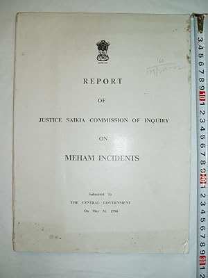
Report of Justice Saikia Commission of Inquiry on Meham Incidents Submitted to the Central Government on May 31, 1994
India, Ministry of Home Affairs, Justice Saikia Commission of Inquiry
Editore: [Govt. of India Press] (1994), [New Delhi], 1994
- Brossura
Da: Expatriate Bookshop of Denmark, Svendborg, DanimarcaExpatriate Bookshop of Denmark
Contatta il venditoreVenditore con 5 stelleCondizione: Usato
EUR 62,13
EUR 59,00 spedizioneSpedito da Danimarca a U.S.A.Quantità: 1 disponibili
orig. wrappers. x,144,(7) pp, 29x21cm, Published in an edition of 1200 copies. Some small spots to cover. A chip from cover corner. Investigation into the murder of Amir Singh during 1990 election campaign in Haryana. Contents: Appointment & Proceedings of the Commission; Investigation; Exposition of the Terms of Reference; Argu…ments of Learned Counsel; Findings on Circumstances; Findings on Other Circumstances; Findings on Circumstances Resulting in the Death of Amir Singh; Findings on Facts Relating to Violent Incidents in Village Madina; Role of Police Authorities in the Violent Incidents; Answers & Observations; Annexures. Some rubbing. Small tears to spine. Good. 6pp photoplates, 1 map (illustratore).

- Mappa
Da: Geographicus Rare Antique Maps, Brooklyn, NY, U.S.A.Geographicus Rare Antique Maps
Contatta il venditoreVenditore con 4 stelleCondizione: Usato
EUR 302,54
EUR 14,86 spedizioneSpedito in U.S.A.Quantità: 1 disponibili
Very good. Exhibits wear along original fold lines and slight loss at fold intersections. Verso repairs to fold separations and at fold intersections. Text and printed photographs on verso. Size 19.25 x 38.5 Inches. This is a 1966 Turkish Ministry of Tourism and Information bilingual English and Turkish panorama tourist map of T…urkey. The country's mountainous terrain takes center stage, allowing the viewer a brief but comprehensive view of Turkey's topography. Three different types of red lines illustrate three different road grades, from hard-surfaced roads to 'loose surfaced roads of low standards,' which snake their way from one end of the country to the other and. The black lines represent railroads. A table on the lower right presents Turkish traffic signs to foreign visitors. A chart on the lower left details distances between Turkish cities, while a series of tables along the right border provide average temperatures and humidity levels for eight Turkish cities. Publication History and Census This map was created by APA OFSET of Istanbul for the Turkish Ministry of Tourism and Information in 1966. Two examples are cataloged in OCLC and are part of the institutional collections at the University of Pennsylvania in Philadelphia and Queen's University in Kingston, Ontario. References: OCLC 767736011.

Cach Mang Thang Tam. / August Revolution.
1975 Vietnamese Ministry of Education Wall Map of Vietnam during the August Revolution
- Mappa
Da: Geographicus Rare Antique Maps, Brooklyn, NY, U.S.A.Geographicus Rare Antique Maps
Contatta il venditoreVenditore con 4 stelleCondizione: Usato
EUR 756,35
EUR 14,86 spedizioneSpedito in U.S.A.Quantità: 1 disponibili
Average. Backed on archival tissue for stability. Large area of infill at top center. Old poorly executed repairs and been replaced with archival repairs, but some damage is impossible to undo. Exhibits soiling throughout. Size 48 x 31.5 Inches. Published near the end of the American Vietnam War, this 1975 Vietnamese Ministry of… Education wall map of Vietnam depicts the 1945 August Revolution, an armed revolt against the Japanese occupation and French colonial rule. Small illustrations of the Vietnamese Communist flag (now the national flag of Vietnam) mark cities where insurrections occurred, with dates in red. The dark red in extreme northern Vietnam highlights the region controlled by the Central Committee of the Communist Party, while the orange areas mark 'Chi?n Khu' (war zones). The August Revolution The August Revolution, also known as the August General Uprising, began in mid-August 1945, and within two weeks the Vi?t Minh controlled all of Vietnam. This fortuitous position evolved after the Japanese coup d'état in March 1945 that overthrew the puppet French government. The coup exacerbated an already devastating famine, which allowed the Vi?t Minh the opportunity to organize their 'People's Revolutionary Committees'. When the Japanese surrendered in August 1945, these committees were poised to seize power and did so without hesitation. Two weeks later, on September 2, 1945, Ho Chi Minh declared Vietnamese independence from France, which would lead to the French Indochina War (1946 -1954) and subsequently the American Vietnam War (1855 - 1975). Publication History and Census This map was created and printed by the Second Publishing House of Survey of Geodesy and Map and published by the Vietnamese Ministry of Education in 1975. This is the only known example.

- Mappa
Da: Geographicus Rare Antique Maps, Brooklyn, NY, U.S.A.Geographicus Rare Antique Maps
Contatta il venditoreVenditore con 4 stelleCondizione: Usato
EUR 756,35
EUR 14,86 spedizioneSpedito in U.S.A.Quantità: 1 disponibili
Very good. Blank on verso. Size 9.5 x 13 Inches. This is a c. 1830 French map of Guantánamo Bay, Cuba, published by the French Ministry of the Navy. Depth soundings are noted in Guantánamo Bay as well as in the nearly Guantánamo River, suggesting that the river was then navigable. Inland topography details the nearby landscape,…but there is notably no trace of human habitation anywhere on the map. A pastedown at bottom center advertises Chez Chaumas-Gayet, a book, map, and chart seller in Bordeaux, France, active in the early to mid-19th century. The French in Guantánamo Between 1810 - 1830, the bay would have been of interest to the French, many of whom landed in Guantánamo after fleeing the revolutionary wars in Haiti (1791 - 1804) and the subsequent destabilization. French expatriates were involved in renovating and laying out the nearby city of Guantánamo, just 15 miles to the north. With a rich plantation culture, excellent harbor, and weak central government in Havana, Guantánamo may have seemed like a second chance for the French, who despite setbacks in Haiti, were once again waxing historical. Gitmo, Then and Now Although Guantánamo, or Gitmo, is today synonymous with the War on Terror, detainees, a U.S. Naval Base, and American imperialism, this was not always the case. Guantánamo is a major port in the southeastern part of Cuba, unique for being surrounded by high mountains that somewhat separate it from the surrounding territory. It was first visited by Columbus in 1494, who named it Puerto Grande. Afterwards, it became one of the most important ports in Southern Cuba, notable for being fully sheltered from dangerous Caribbean storms. It was briefly sized by the British in 1741 during the War of Jenkins Ear (1739 - 1748) who renamed it Cumberland Bay. When this map was made, in the early 1800s, the bay was an important anchorage. The new name lasted no longer than the British occupation. After the United States seized control of Cuba during the Spanish American War (1898), Cuba President Tomás Estrada Palma, offered the U.S. a perpetual lease on the Bay. The subsequent 1903 Cuban-American Treaty of Relations held, among other things, that the United States, for the purposes of operating 'coaling and naval stations', has 'complete jurisdiction and control' of the Guantánamo Bay. Today the Bay hosts an important U.S. Naval base and prison, Gitmo, as it is known colloquially. Cuba had accepted only one lease payment from the U.S. in over 100 years of occupation, citing the illegality of U.S. claims. While Cuba does not recognize U.S. claims on the bay, it is de facto fully under U.S. military control. During the War on Terror (2001 - ????), the Guantánamo Bay naval base was developed as a dentation center for political prisoners and, despite international protest, remains so to this day. Publication History and Census This map was published by the French Ministry of the Navy c. 1820 - 1830. An example is cataloged in OCLC as part of the collection at the British Library. References: OCLC 557623587.
 Altre immagini
Carte du District Postal de Ki-Hei. / Postal Map of Ki-Hei District.
1923 Chinese Ministry of Finance Postal Wall Map of Manchuria, China
- Mappa
Da: Geographicus Rare Antique Maps, Brooklyn, NY, U.S.A.Geographicus Rare Antique Maps
Contatta il venditoreVenditore con 4 stelleCondizione: Usato
EUR 1916,10
EUR 14,86 spedizioneSpedito in U.S.A.Quantità: 1 disponibili
Very good. Laid down on old linen in 12 sections by publisher. Old linen stable. Size 42 x 57.25 Inches. This is an impressive 1923 official tri-lingual (Chinese, French, English) postal wall map of Jihei, at the time known as Ki-Hei, northern Manchuria. The work is a comprehensive postal administration tool, and with it, a post…master could reasonably manage postal distribution throughout the massive province. A Closer Look Coverage is centered on the district capital of Harbin. The map is bordered on the north and east by Siberia and the Heilong River (Amur River), and on the south by Mongolia, Fengtien, and Korea. The impressively detailed chart notes postal roads, river crossings, and mileage between post locations. Post Offices appear throughout and are subdivided by size, with seven designations between the single District Head Office (Harbin) and numerous Rural Stations. A key at bottom center breaks down these and other distinctions not used on this map, such as 'Postal Connexion by Boat' suggesting that this coding system was used on other postal maps of the period. Chinese Post Prior to the Japanese invasion of Manchuria in 1931, during the Mínguó or Republic of China Era (1912 - 1949), Manchuria was divided into two large postal districts. The northern district, Jihei or Ki-Hei, centered on Harbin (???) and covered most of modern-day Manchuria to its borders with Siberia, Korea, and Mongolia. The smaller but more populous southern district, Fengtien, consisted of the Liaodong Peninsula, including Russian-administered Port Arthur (??; Dalian), Moukden (??; Shenyang), and Newchwang (??; Yingkou). Railroad Routes The map notes the Trans-Siberian railway passing north of the border from Chita to Vladivostok. It also notes the Tras-Manchurian Railway to Harbin and the South Manchuria Railway from Harbin to Lüshunkou (????). Minor manuscript annotation highlights the line from Kirin (??; Jilin) to Omu and Tunhwa (Tonghua; ???). Publication History and Census This map was printed in Beijing by the printing bureau of the Ministry of Finance (???) for the Chinese Postal Service in 1923, during the Republic of China. This map was first issued in 1920. The present example has minor updates to 1923. We note examples of the map in its 1927 edition at Yale University and at the British Library, St. Pancras. There is only one recorded holding of this 1923 edition, which is at the University of Kansas. References: OCLC 896882279, 755101998.

- Brossura
- Print on Demand
Da: moluna, Greven, Germaniamoluna
Contatta il venditoreVenditore con 5 stelleCondizione: Nuovo
EUR 20,60
EUR 48,99 spedizioneSpedito da Germania a U.S.A.Quantità: Più di 20 disponibili
Condizione: New. Dieser Artikel ist ein Print on Demand Artikel und wird nach Ihrer Bestellung fuer Sie gedruckt. KlappentextThe majority of Amish and conservative Mennonites are certain concerning church and lifestyle practices, but are content to avoid diving into most deep, biblical topics. That lack made compiling this book…a bit of a challenge..


