
Importo totale (1 articolo articoli):
Destinazione ordine:

nat geo maps (Oltre 2.100 risultati)
Vai alla pagina principale dei risultati di ricerca
Filtri di ricerca
Tipo di articolo
- Tutti i tipi di prodotto
- Libri (2.099)
- Riviste e Giornali (Nessun altro risultato corrispondente a questo perfezionamento)
- Fumetti (Nessun altro risultato corrispondente a questo perfezionamento)
- Spartiti (Nessun altro risultato corrispondente a questo perfezionamento)
- Arte, Stampe e Poster (Nessun altro risultato corrispondente a questo perfezionamento)
- Fotografie (Nessun altro risultato corrispondente a questo perfezionamento)
- Mappe (24)
- Manoscritti e Collezionismo cartaceo (Nessun altro risultato corrispondente a questo perfezionamento)
Condizioni Maggiori informazioni
- Nuovo (2.099)
- Come nuovo, Ottimo o Quasi ottimo (Nessun altro risultato corrispondente a questo perfezionamento)
- Molto buono o Buono (23)
- Discreto o Mediocre (Nessun altro risultato corrispondente a questo perfezionamento)
- Come descritto (1)
Legatura
- Tutte
- Rilegato (Nessun altro risultato corrispondente a questo perfezionamento)
- Brossura (14)
Ulteriori caratteristiche
- Prima ed. (Nessun altro risultato corrispondente a questo perfezionamento)
- Copia autograf. (Nessun altro risultato corrispondente a questo perfezionamento)
- Sovracoperta (Nessun altro risultato corrispondente a questo perfezionamento)
- Con foto (1.037)
- Non Print on Demand (2.123)
Lingua (2)
Spedizione gratuita
Paese del venditore
Valutazione venditore
-
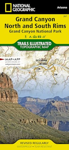
Grand Canyon, North and South Rims Map : Trails Illustrated Maps
Da: Better World Books, Mishawaka, IN, U.S.A.
Valutazione del venditore 5 su 5 stelle

Condizione: Good. Pages intact with minimal writing/highlighting. The binding may be loose and creased. Dust jackets/supplements are not included. Stock photo provided. Product includes identifying sticker. Better World Books: Buy Books. Do Good.
-

Orlando Map
Lingua: Inglese
Editore: National Geographic Maps, US, 2012
ISBN 10: 159775076X ISBN 13: 9781597750769
Map. Condizione: New. . Waterproof . Tear-Resistant . Travel MapNational Geographic's City Destination map of Orlando is both a comprehensive map and travel guide for the city for business and leisure travelers alike. The city is presented using various maps with different levels of detail. A road map of the entire state of Florida shows the city's position in the center of the state and a regional map shows the roads leading in a out of the city. A city map of the Orlando area shows the city and its suburbs and inset maps of the Walt Disney Resort, International Drive and Downtown provide unparalleled detail of these popular areas. Pinpointed on the maps are hundreds of hotels, theaters, churches, parks, train stations, churches, notable buildings and points of interest.Each inset map is accompanied by an easy to use index of cities and towns, roads, hotels, attractions, golf courses, parks and other points of interest, which will aid in planning your route and arriving at your destination. A diagram of Orlando Airport will allow you to navigate this travel hub quickly and efficiently. Background information about the city, an overview of the public transit system and descriptions of top attractions in and around the city are also provided. Every Destination Map is printed on durable synthetic paper, making them waterproof, tear-resistant and tough - capable of withstanding the rigors of any kind of travel.
-

Toronto Map
Lingua: Inglese
Editore: National Geographic Maps, US, 2018
ISBN 10: 1566957982 ISBN 13: 9781566957984
Map. Condizione: New. 2018th ed. . Waterproof . Tear-Resistant . Travel MapNational Geographic's City Destination map of Toronto was designed for business and leisure travelers alike. Canada's capital city is covered with unparalleled detail in a unique package that combines a easy to read street map and travel guide. A regional map and an inset map of the city center, along with information about the city and its points of interest are featured on the front side of the map. A user friendly index of streets, hotels, public buildings, points of interest, metro stations, parks and beaches will help you find your destination quickly. While an overview of the transit system, a comprehensive metro map and map of Toronto Pearson International Airport will aid in your navigation around the city. A detailed street map of the city is shown on the reverse side, including the Toronto Islands. as well as an inset map of the Eastern Beaches. Points of interest, theaters, monuments, hotels, churches, parks, visitor information centers, notable buildings, underground walkways and pedestrian areas are clearly marked and easy to find with the multi-language legend. Many popular attractions are depicted in 3D, including the CN Tower, Ontario Parliament Buildings and Eaton Center. The location of train and metro stations, ferry routes and parking areas will further assist your exploration of the city. Every Destination Map is printed on durable synthetic paper, making them waterproof, tear-resistant and tough - capable of withstanding the rigors of any kind of travel.
-

Southern California Map
Lingua: Inglese
Editore: National Geographic Maps, US, 2012
ISBN 10: 1597750158 ISBN 13: 9781597750158
Map. Condizione: New. 2024th ed. . Waterproof . Tear-Resistant . Travel MapNational Geographic's Southern California Guide Map provides travelers with the perfect combination of detail and perspective in a highly functional travel tool. Both comprehensive map and mini-guidebook, this map provides information on many points of interest, the cities of Los Angeles and San Diego, and Sequoia and Kings Canyon national parks. Road network designations are clear and distances in miles on major highways are shown. Cities and towns are easy to find with the map's helpful index and hundreds of attractions are noted.Inset maps of the Los Angeles area, San Diego, Oxnard-Ventura, Bakersfield, Santa Barbara, the Monterrey Bay area, and Palm Springs provide greater detail of these key areas of the region. The California 1 South scenic drive from Monterrey to Morro Bay is highlighted with its own map as well. A handy chart of park service sites and climate information are also included.Every State Guide Map is printed on durable synthetic paper, making them waterproof, tear-resistant and tough - capable of withstanding the rigors of any kind of travel.
-

Las Vegas Map
Lingua: Inglese
Editore: National Geographic Maps, US, 2012
ISBN 10: 1597751928 ISBN 13: 9781597751926
Map. Condizione: New. . Waterproof . Tear-Resistant . Travel MapHome to some of the world's best known mega casinos-hotels, Las Vegas is internationally recognized by its unique cityscape along The Strip. Whether traveling to 'Sin City' for business or pleasure, National Geographic's City Destination map of Las Vegas will be an invaluable travel companion, serving both as a comprehensive street map and well-researched travel guide. The map's front side features a regional map and inset maps of the downtown area and Grand Canyon, Bryce Canyon and Zion National Parks. An overview of the transit system along with a diagram of McCarran International Airport will help you get acclimated to the city. Information is also provided about popular attraction in and around the city. The main road map is on the reverse side, detailed with hundreds of points of interest, hotels, notable buildings, parks and theaters, as well as police stations, hospitals and post offices. Many top attractions are displayed in 3D, including the Stratosphere Tower, the Bellagio and MGM Grand. A user friendly index of streets and points of interest, will help you find your destination and plan your route quickly and efficiently. Every Destination Map is printed on durable synthetic paper, making them waterproof, tear-resistant and tough - capable of withstanding the rigors of any kind of travel.
-

U.S. Scenic Drives Map
Lingua: Inglese
Editore: National Geographic Maps, US, 2012
ISBN 10: 1597750263 ISBN 13: 9781597750264
Map. Condizione: New. 2025th ed. . Waterproof . Tear-Resistant . Travel MapDesigned for those who enjoy viewing the country on 2 or 4 wheels, National Geographic's Scenic Drives USA Guide Map covers 20 of the most beautiful scenic drives from coast to coast. Plan your trip using the national road map with clear designations for toll and toll-free roads, interstate highways, state routes and other primary highways along with pinpointed locations of the scenic drives and national parks. Each scenic drive has its own inset map showing the route from beginning to end, as well as points of interest along the way; road notes describing the drive; and a chart showing the estimated driving time and distance. Also included are the address, phone number and website for each state's tourism office.Every State Guide Map is printed on durable synthetic paper, making them waterproof, tear-resistant and tough - capable of withstanding the rigors of any kind of travel.
-

Buenos Aires Map
Lingua: Inglese
Editore: National Geographic Maps, US, 2018
ISBN 10: 1566957729 ISBN 13: 9781566957724
Map. Condizione: New. 2026th ed. . Waterproof . Tear-Resistant . Travel MapNational Geographic's City Destination map of Buenos Aires combines a city map and travel guide, making it the ultimate traveling companion to Argentina's capital city. Featured on the front side are a regional map and inset map of Isla Martin Garcia. Maps of Ezeiza Airport and the subway (subte) along with an overview of the public transit system will help you travel around the city efficiently. Find your destination and plan your route using the user friendly index of streets, hotels, parks, metro stations, points of interest and public buildings. Information about the most popular points of interest in and around the city is also provided.The main street map of the city is on the reverse side. In addition to road network designations for through routes, main and secondary roads, and one ways streets, the map also pinpoints hundreds of points of interest, public transit stations, monuments, theaters, places of worship, hotels, notable buildings and parks, along with a multi-language legend. Inset maps show the Belgrano and La Boca neighborhoods. Every Destination Map is printed on durable synthetic paper, making them waterproof, tear-resistant and tough - capable of withstanding the rigors of any kind of travel.
-

Paris Map
Lingua: Inglese
Editore: National Geographic Maps, US, 2018
ISBN 10: 1566957958 ISBN 13: 9781566957953
Map. Condizione: New. . Waterproof . Tear-Resistant . Travel MapNational Geographic's City Destination map of Paris is a complete travel guide to this top tourist destination, with valuable information not found in traditional maps. The front side presents an easy-to-read map of the city with its road network and features 3D depictions of many top attractions, like Arc de Triomphe, Eiffel Tower and The Louvre. Hundreds of points of interest are displayed with the aid of a multi-language legend, including metro and train stations, hotels, parks, hospitals, police stations, places of worship, theaters and pedestrian areas.The reverse side has a regional map and descriptions of the city, many popular attractions and the transit system. A user-friendly index of streets, metro stations, hotels and points of interest along with a metro map and diagrams of Charles de Gaulle and Orly Airports will help you arrive at your destination quickly. With all of this specialized content, this map is the perfect companion to National Geographic's Paris Traveler Guide. Every City Destination Map is printed on durable synthetic paper, making them waterproof, tear-resistant and tough - capable of withstanding the rigors of any kind of travel.
-

Sydney Map
Lingua: Inglese
Editore: National Geographic Maps, US, 2012
ISBN 10: 1597754021 ISBN 13: 9781597754026
Map. Condizione: New. . Waterproof . Tear-Resistant . Travel MapExplore the vibrant urban life, culture, and natural beauty of Sydney with National Geographic's City Destination map. A detailed street map and inset of Sydney Harbour is featured on the front side of this comprehensive map. Transportation decisions in and around the city are made easier with the inclusion of ferry stops and CityRail, light rail, monorail, and Sydney Explorer stations. Hundreds of points of interest, places of worship, parks, notable buildings, pedestrian areas, hotels, theaters, and more are noted. The reverse side of the map has both a regional map and a diagram of the Sydney Airport. Unlike many city maps, this one also acts as a travel guide with information about points of interest, sites to visit around Sydney, and the many public transportation options. The CityRail map will prove particularly helpful to visitors wishing to travel to most attractions in the city as well as surrounding suburbs.Every Destination Map is printed on durable synthetic paper, making them waterproof, tear-resistant and tough - capable of withstanding the rigors of any kind of travel.
-

Madrid Map
Lingua: Inglese
Editore: National Geographic Maps, US, 2010
ISBN 10: 1597754153 ISBN 13: 9781597754156
Map. Condizione: New. 2024th ed. . Waterproof . Tear-Resistant . Travel MapNational Geographic's City Destination map of Madrid is both a comprehensive map and travel guide. Known for its nightlife and arts, the city has many attractions to explore virtually around the clock. A detailed street map of the city is featured on the front side of the map. Points of interest, hotels, places of worship, notable buildings, theaters, parks, information centers, and more are easy to find with the multi-language legend. National and regional railway stations as well as Metro stations and other transportation aids will prove invaluable in traversing the city.Further detail of Central Madrid is included on the reverse side along with information on points of interest and a regional map. A diagram of Barajas Airport and a map of Metro stations will help you navigate these travel hubs quickly and efficiently.Every Destination Map is printed on durable synthetic paper, making them waterproof, tear-resistant and tough - capable of withstanding the rigors of any kind of travel.
-

Munich Map
Lingua: Inglese
Editore: National Geographic Maps, US, 2012
ISBN 10: 1597753114 ISBN 13: 9781597753111
Da: Rarewaves.com USA, London, LONDO, Regno Unito
Valutazione del venditore 5 su 5 stelle
EUR 11,06
Spedizione gratuita
Spedito da Regno Unito a U.S.A.Quantit�: 1 disponibili
Aggiungi al carrelloMap. Condizione: New. . Waterproof . Tear-Resistant . Travel MapNational Geographic's City Destination map of Munich is an invaluable tool for exploring the capital of Bavaria. The comprehensive street map on the front side provides exceptional detail of the city. Points of interest, hotels, places of worship, notable buildings, theaters, parks, information centers, and more are easy to find with the multi-language legend. Transportation aids such as subway and regional railway stations and parking areas are shown as well.Information on various points of interest are included on the reverse side, along with maps of the region and the extravagant palace of Schloss Nymphenburg. The Romantic Road and Bavarian Alps map provides detail of the Romantic, Alpine, Castle and Thuringia, and Alpine-Baltic roads. Handy diagrams of Munich (Franz Josef Strauss) International Airport and the U-Bahn (subway) and S-Bahn (suburban trains) transit systems will help you navigate the city quickly and efficiently.Every Destination Map is printed on durable synthetic paper, making them waterproof, tear-resistant and tough - capable of withstanding the rigors of any kind of travel.
-

Galapagos Map
Lingua: Inglese
Editore: National Geographic Maps, US, 2018
ISBN 10: 1566957877 ISBN 13: 9781566957878
Map. Condizione: New. . Waterproof . Tear-Resistant . Travel MapResting on the Nazca tectonic plate in the eastern Pacific Ocean approximately 600 miles west of Ecuador, the actively volcanic Gal�pagos Islands were discovered in 1535 by the bishop of Panama, Tom�s de Berlanga, when his ship drifted off course. In 1835, naturalist Charles Darwin, aboard the H.M.S Beagle, arrived in the Gal�pagos and spent 5 weeks collecting geological and biological specimens from several islands, noting his surprise at the variety of birds, tortoises, iguanas and other creatures-all without fear of humans. Darwin's short visit inspired, in part, his 1859 theory of evolution by natural selection and led to the declaration of Gal�pagos as a national park 100 years later in 1959. Gal�pagos was declared the first UNESCO World Heritage site in 1978.Now, National Geographic has created a map of this island chain that is so remote that many of the species who live here can be found nowhere else on earth. The front of the map includes an overview of the entire island chain to help with context since the islands are spread over a large swath of ocean. On the back of the map, each major island has a description including the endemic species (animals or plants living only on the Gal�pagos), facts about the human history of each island, and other facts that are important to travelers.Every Adventure Map is printed on durable synthetic paper, making them waterproof, tear-resistant and tough - capable of withstanding the rigors of international travel.
-

Texas Map
Lingua: Inglese
Editore: National Geographic Maps, US, 2017
ISBN 10: 156695729X ISBN 13: 9781566957298
Map. Condizione: New. 2026th ed. . Waterproof . Tear-Resistant . Travel MapExpertly researched and loaded with helpful information, National Geographic's Texas Guide Map is a must-have for travelers exploring 'The Lone Star State.' In addition to a state map, inset maps provide detail on the Texas Panhandle and the cities of Dallas, Fort Worth, Houston, Amarillo, Abilene, Lubbock, Waco, Laredo, Beaumont, El Paso, Odessa-Midland, McAllen, Corpus Christi, San Antonio, and Austin. Cities and towns are easy to find with the map's helpful index and hundreds of attractions are noted. Road network designations are clear and distances in miles on major highways are shown.Additional information and maps feature the recreation activities available in Big Bend National Park and the attractions along the Hill Country scenic drive. The Alamo, the Space Center Houston, the San Antonio Riverwalk, and Guadalupe Mountains National Park are just some of the many points of interest that are highlighted. A handy chart of park service sites and climate information are also included.Every State Guide Map is printed on durable synthetic paper, making them waterproof, tear-resistant and tough - capable of withstanding the rigors of any kind of travel.
-

Southeastern USA Map
Lingua: Inglese
Editore: National Geographic Maps, US, 2018
ISBN 10: 1566957966 ISBN 13: 9781566957960
Map. Condizione: New. 2026th ed. . Waterproof . Tear-Resistant . Travel MapCovering the country from Philadelphia to the Florida Keys and west to the Mississippi River, National Geographic's Southeastern USA Guide Map is designed to meet the needs of all travelers to this part of the country. The main map displays a comprehensive interstate highway network, complete with mileage markers and designations for toll and free access roads, as well as smaller state highways and county roads. Points of interest, national parks and forests, airports and state capitals are pinpointed. An index of cities and towns will help you quickly locate your destination. More than 20 metropolitan areas can be found on inset maps, providing extra detail of each area's road network and points of interest. Inset maps are also provided for the Everglades, Shenandoah and Great Smoky Mountains National Parks. Traveling information is given about the Deep South, Coastal South, southern Appalachian Mountain and Chesapeake Bay areas, Florida and many national parks.Every State Guide Map is printed on durable synthetic paper, making them waterproof, tear-resistant and tough - capable of withstanding the rigors of any kind of travel.
-

Florence Map
Lingua: Inglese
Editore: National Geographic Maps, US, 2017
ISBN 10: 1566957311 ISBN 13: 9781566957311
Map. Condizione: New. 2026th ed. . Waterproof . Tear-Resistant . Travel MapLet National Geographic's City Destination map of Florence guide you as you explore this historic city that was the birthplace of the Renaissance and is still considered a world center for fashion, art and culture. Featured on the map's front side is a clearly marked road network complete with designations for through routes, main and secondary roads, one way streets and pedestrian zones. Along with a multi-language legend, hundreds of points of interest are pinpointed, including notable buildings, places of worship, hotels, theaters, parking areas, rail stations, parks, police stations and hospitals. Many of the city's top attractions are displayed with 3D images, including Santa Maria del Fiore, Palazzo Vecchio and Ponte Vecchio.The reverse side has a regional map, showing the city's location on the heart of Tuscany. An insert map of Centro Storico provides extra detail of the remarkable city center. A user-friendly index of streets, hotels and points of interest, will ensure you find your destination quickly. A travel guide gives background information about the city, its most popular destinations and an overview of the public transit system, including a diagram of Amerigo Vespucci airport. With such an abundance of specialized content that is not available in traditional maps, this destination map is the perfect complement to National Geographic's Florence and Tuscany Traveler Guide.Every Destination Map is printed on durable synthetic paper, making them waterproof, tear-resistant and tough - capable of withstanding the rigors of any kind of travel.
-

Los Angeles Map
Lingua: Inglese
Editore: National Geographic Maps, US, 2012
ISBN 10: 1597750921 ISBN 13: 9781597750929
Map. Condizione: New. . Waterproof . Tear-Resistant . Travel MapBusiness and leisure travelers alike will find National Geographic's City Destination map of Los Angeles is an invaluable tool for exploring this diverse global city. A unique combination of city map and travel guide, this is the ultimate travel companion.The front side includes inset maps of Westside, Long Beach and Anaheim along with a regional map and diagrams of Los Angeles (LAX) and John Wayne Airports. Provided also are general information about the city and surrounding areas, descriptions of popular points of interest and an overview of public transit system. The reverse side features the main map of the entire city from the Santa Monica Mountains to Chino Hills along with an inset map of the downtown area. The easy to read street map shows road designations for freeways, toll roads, main streets, secondary roads and one way streets. Pinpointed are hundreds of points of interest, including subway and train stations, hotels, theaters, churches, notable buildings and parks. A user friendly index of cities and towns, neighborhoods, roads and streets, hotels and points of interest will help you find your destination and plan your route quickly and efficiently.Every Destination Map is printed on durable synthetic paper, making them waterproof, tear-resistant and tough - capable of withstanding the rigors of any kind of travel.
-

Prague Map
Lingua: Inglese
Editore: National Geographic Maps, US, 2018
ISBN 10: 1566957842 ISBN 13: 9781566957847
Map. Condizione: New. 2026th ed. . Waterproof . Tear-Resistant . Travel MapWell know for its rich history and historic city center, Prague is one of the most visited cities in all of Europe. Expertly researched, National Geographic's City Destination map of Prague is a unique combination of an easy-to-read road map with a travel guide. The front side covers the five quarters of the city center with unparalleled detail. Road designations are shown and hundreds of points of interest are pinpointed, including subway, train and tram stations, theaters, hotels, places of worship, notable buildings and parks. Many of the city's top attractions are depicted in 3D, including the Prague Castle, Charles Bridge and National Museum.The reverse side has a regional map as well as inset maps of the Castle District and Charles Bridge. Finding your destination couldn't be simpler, with streets names, parks, hotels, metro stations and points of interest listed in a convenient index. A comprehensive map of the city's three metro lines will aid in your navigation around the city, as will a diagram of Prague airport and an overview of the city's public transportation. Also included is essential information about the city and descriptions of many of the most popular attractions. Such an abundance of specialized information make this map the perfect complement to National Geographic's Prague Traveler Guide.Every Destination Map is printed on durable synthetic paper, making them waterproof, tear-resistant and tough - capable of withstanding the rigors of any kind of travel.
-

Mogollon Rim, Munds Mountain Map
Lingua: Inglese
Editore: National Geographic Maps, US, 2012
ISBN 10: 1566955149 ISBN 13: 9781566955140
Da: Rarewaves.com USA, London, LONDO, Regno Unito
Valutazione del venditore 5 su 5 stelle
EUR 12,37
Spedizione gratuita
Spedito da Regno Unito a U.S.A.Quantit�: 1 disponibili
Aggiungi al carrelloMap. Condizione: New. 2020th ed. . Waterproof . Tear-Resistant . Topographic MapOutdoor enthusiasts seeking recreational opportunities in central Arizona, will find National Geographic's Trails Illustrated map of Mogollon Rim and Munds Mountain an essential travel companion. Expertly researched and created in cooperation with the U.S. Forest Service and others, the map covers parts of the Tonto, Coconino and Apache-Sitgreaves National Forests and provides unmatched detail of the region, including popular places of interest, such as Munds Mountain, Wet Beaver, West Clear Creek, Fossil Springs and Mazatzal Wilderness Areas, Verde Wild and Scenic River, Montezuma Castle National Monument, Red Rock Scenic Byway and Mogollon Plateau.Get off the beaten path and back on again by following the map to clearly marked trailheads and trails, labeled according to their designated usage. The Highline, General Crook and Arizona Trails are all highlighted. Your navigation of the area will be aided by the map's contour lines, elevations, labeled peaks and summits, water features, numbered Forest Service roads and selected waypoints. Recreation features pinpointed on the map include: campgrounds, swimming areas, boat launch and river access points, interpretive trails and scenic viewpoints. The map also provides background information of the area including the wilderness areas, safety tips and essential contact information.Every Trails Illustrated map is printed on 'Backcountry Tough' waterproof, tear-resistant paper. A full UTM grid is printed on the map to aid with GPS navigation.Other features found on this map include: Coconino National Forest, Fossil Springs Wilderness, Horse Mesa, Mazatzal Wilderness, Munds Mountain Wilderness, Pine Mountain Wilderness, Prescott National Forest, Sedona, Sitgreaves National Forest, Tonto National Forest, West Clear Creek Wilderness.
-

New York City Map
Lingua: Inglese
Editore: National Geographic Maps, US, 2012
ISBN 10: 1597750697 ISBN 13: 9781597750691
Map. Condizione: New. . Waterproof . Tear-Resistant . Travel MapBusiness and leisure travelers alike will marvel at National Geographic's City Destination map of New York City. Expertly researched, it contains a comprehensive road map and an informative travel guide, making it the ideal travel companion as well as the perfect complement to National Geographic's New York Traveler Guide. The easy-to-read street map covers Manhattan from Uptown to the Financial District and includes the many bridges and tunnels that cross the Hudson and East Rivers. Pinpointed are hundreds of points of interest, including hotels, theaters, notable buildings, churches, synagogues, parks, police stations, hospitals and subway stations with 3D depictions for many top attractions, like the Empire State Building and Metropolitan Museum of Art .Insert maps of Midtown and Lower Manhattan provide extra detail of these heavily traveled areas. An additional regional insert map shows all five boroughs of New York City and parts of New Jersey. A complete subway map, diagrams of LaGuardia, JFK and Newark Airports, ferry routes and a user friendly index streets, tunnels and bridges; neighborhoods, districts and boroughs; parks; theaters; and other points of interest, will help you plan your route and find your destination quickly. Descriptions of the city, popular attractions and the transit system provide valuable information for visitors.Every Destination Map is printed on durable synthetic paper, making them waterproof, tear-resistant and tough - capable of withstanding the rigors of any kind of travel.
-

Rome Map
Lingua: Inglese
Editore: National Geographic Maps, US, 2018
ISBN 10: 1566957702 ISBN 13: 9781566957700
Map. Condizione: New. 2026th ed. . Waterproof . Tear-Resistant . Travel MapOne of the most visited places in the world for the past two millennia, Rome has been an important city for Western Civilization as well for Christianity. Let National Geographic's City Destination map of Rome, lead you on your exploration of this fascinating ancient destination. Combining an easy-to-read road map along with a travel guide, this expertly researched map is unparalleled in its accuracy and content making it the ideal travel companion as well as the perfect complement to National Geographic's Rome Traveler Guide. The front side has a regional map and descriptions of the city, many popular attractions and the transit system. A user-friendly index of streets, hotels and points of interest along with a metro (or Metropolitana) map and a diagram of Fiumicino Airport will help you arrive at your destination quickly. An inset map of Vatican City provides details of this very popular area. The road map on the reverse side labels main, secondary and one-way streets with a multi-language legend. In addition, hundreds are popular and lesser known points of interest are pinpointed, including metro stations, places of worship, theaters, hotels, hospitals, police stations and notable buildings.Every Destination Map is printed on durable synthetic paper, making them waterproof, tear-resistant and tough - capable of withstanding the rigors of any kind of travel.
-

Yellowstone National Park Map
Lingua: Inglese
Editore: National Geographic Maps, US, 2012
ISBN 10: 1566952956 ISBN 13: 9781566952958
Map. Condizione: New. 2022nd ed. . Waterproof . Tear-Resistant . Topographic MapNational Geographic's Trails Illustrated map of Yellowstone National Park is designed to meet the needs of outdoor enthusiasts by combining valuable information with unmatched detail of America's first national park. Expertly researched and created in partnership with local land management agencies, this map features key points of interest including Mammoth Hot Springs, Canyon Village, Yellowstone Lake, Yellowstone Falls, Grant Village, and Old Faithful geyser area.With over 1,000 miles of mapped trails, the Yellowstone National Park map can guide you off the beaten path and back again. The clearly marked trails include mileages between intersections. Trail summaries provide elevation, duration, and difficulty for a variety of suggested hikes. The map base includes contour lines and elevations for summits, passes and many lakes. The bathymetry of Yellowstone Lake is shown with both contours and hill shading. Some of the many recreation features include: campgrounds, trailheads, boat ramps, marinas, scenic overlooks and interpretive trails.Every Trails Illustrated map is printed on 'Backcountry Tough' waterproof, tear-resistant paper. A full UTM grid is printed on the map to aid with GPS navigation.Other features found on this map include: Absaroka-Beartooth Wilderness, Beartooth Mountains, Big Game Ridge, Buffalo Plateau, Colter Peak, Craig Pass, Crowfoot Ridge, Custer National Forest, Eagle Peak, Emigrant Peak, Gallatin National Forest, Grand Teton National Park, Granite Peak, Granite Range, Grouse Mountain, Heart Lake, Hurricane Mesa, Jedediah Smith Wilderness, John D. Rockefeller, Jr. Memorial Parkway, Lake Plateau, Lamar River, Lee Metcalf Wilderness, Lewis Lake, Lower Falls of the Yellowstone River, Mount Hancock, Mount Holmes, Mount Sheridan, Mount Wallace, Mount Washburn, North Absaroka Wilderness, Pilot Peak, Pitchstone Plateau, Ramshorn Peak, Red Mountains, Saddle Mountain, Shoshone Lake, Shoshone National Forest, Targhee National Forest, Teton National Forest, Teton Wilderness, Thorofare Plateau, Washakie Wilderness, Yellowstone Lake, Yellowstone National Park.
-

Canada West Map
Lingua: Inglese
Editore: National Geographic Maps, US, 2013
ISBN 10: 1566956358 ISBN 13: 9781566956352
Map. Condizione: New. . Waterproof . Tear-Resistant . Travel MapNational Geographic's Canada West Adventure Map provides global travelers with the perfect combination of detail and perspective in a highly functional travel tool. Cities and towns are clearly indicated and easy to find in the user-friendly index. A road network complete with distances and designations for roads, motorways, and expressways will help you find the route that's right for you. Secondary routes are also marked for those seeking to explore off the beaten path in and around Banff National Park, the Yukon Territories, Jasper National Park, Vancouver Island, and the rainforests of British Columbia. Hundreds of points of interest and diverse and unique destinations are highlighted including national parks, nature reserves, World Heritage sites, archeological sites, ski areas, hot springs, beaches, museums, and more. The north side of the print map shows Victoria Island, Nanavut, the Great Slave Lake, the Northwest Territories, Yukon Plateau, Great Bear Lake and Prince Albert Sound. The reverse side showcases the topographic features of Vancouver and Queen Charlotte Islands, the Coast Mountains, British Columbia, the Rocky Mountains, and Alberta. Search for whales off the coast of Vancouver, ski the trails of Whistler, paddle the epic South Nahanni River as it tumbles through the jagged Mackenzie Mountains and the Nahanni National Park Reserve, a World Heritage-listed site. Whatever your adventure, this map is the perfect companion to a guidebook, yet far easier to pack.Every Adventure Map is printed on durable synthetic paper, making them waterproof, tear-resistant and tough - capable of withstanding the rigors of international travel.
-

Iceland Map
Lingua: Inglese
Editore: National Geographic Maps, US, 2011
ISBN 10: 1566955343 ISBN 13: 9781566955348
Map. Condizione: New. . Waterproof . Tear-Resistant . Travel MapLet National Geographic's Iceland Adventure Map guide you as you discover the pristine nature and unique scenery on this Nordic island. The expertly researched map, with its accurate and detailed information, is designed to meet the needs of adventure travelers. In addition to a clearly marked road network, with distances and destinations of both major and main roads, the map also delivers an abundance of specialized content not found in traditional road maps. An index of cities and towns will help you arrive at your destination quickly. Recreational, ecological, cultural, and historic points of interest as well as secondary roads, remote tracks, secluded paths and ferry routes will aid in your exploration both on and off the beaten path. Among the pinpointed points of interest are hot springs, geysers, waterfalls, caves, museums, lighthouses, swimming pools, golf courses, campsites and scenic viewpoints. Also labeled are the UNESCO World Heritage Sites, Thingvellir National Park and the volcanic island of Surtsey. The shaded relief map details the entire island, contour lines are drawn, peaks and summits are labeled with elevations, forested areas are shaded, water features are shown and boundaries of National Parks and nature reserves are color-coded, making it the perfect companion to any guidebook. Every Adventure Map is printed on durable synthetic paper, making them waterproof, tear-resistant and tough - capable of withstanding the rigors of international travel.
-

Costa Rica Map
Lingua: Inglese
Editore: National Geographic Maps, US, 2012
ISBN 10: 1566953146 ISBN 13: 9781566953146
Map. Condizione: New. . Waterproof . Tear-Resistant . Travel MapCreated in cooperation with Instituto Geografico Nacional, National Geographic's Costa Rica Adventure Map is designed to meet the needs of all adventure travelers in this tropical tourist hotspot. Indexes of towns and protected areas, such as National Wildlife Refuges and Parks, wetlands, nature reserves and other natural attractions as well as pinpointed recreational, ecological, cultural, and historic destinations are combined with the clearly mapped road network of primary and secondary roads, to help you explore on and off the beaten path. Such specialized content, not available on traditional road maps, makes the map the perfect companion to National Geographic's Costa Rica Traveler Guide or any other guidebook.Coverage includes the country in its entirety along with many of its islands including an inset map of Cocos Island (Isla de Coco), the UNESCO World Heritage Site. An inset of capital San Jose, provides in-depth detail of the capital, including notable buildings, churches, embassies, parks and churches. Recreation and adventure activities marked along the country's shorelines including areas for surfing, diving and fishing as well as labeled natural features, such as freshwater and saltwater swamps, mangroves and reefs. Background information about the region, traveling regulations and a conservation overview will further enhance your trip preparation.Every Adventure Map is printed on durable synthetic paper, making them waterproof, tear-resistant and tough - capable of withstanding the rigors of international travel.
-

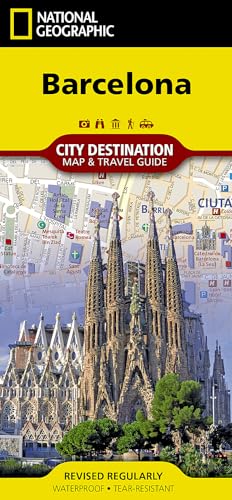
Barcelona Map
Lingua: Inglese
Editore: National Geographic Maps, US, 2012
ISBN 10: 1597754579 ISBN 13: 9781597754576
Map. Condizione: New. . Waterproof . Tear-Resistant . Travel MapNational Geographic's City Destination map of Barcelona combines a city map and travel guide, making it the ultimate traveling companion to this popular destination on Spain's Mediterranean coast. The easy-to-read road map covers the city from the Les Corts and Sants-Montjuic districts in the south and west to Sant Marti in the northeast. Included are hundreds of points of interest, such as metro and railway stations, places of worship, notable buildings, parks, police stations and hospitals, along with 3D depictions of many top attractions. The front side has a regional map and descriptions of the city, many popular points of interest and the transit system. A user-friendly index of streets, hotels, train stations and points of interest along with a diagram of Barcelona Airport and a comprehensive metro map will help you plan your route and arrive at your destination quickly. An inset map of Ciutat Vella district provides detail of this very popular area which is the oldest part of the city. With all of this specialized content, this map is the perfect complement to National Geographic's Barcelona Traveler Guide. Every Destination Map is printed on durable synthetic paper, making them waterproof, tear-resistant and tough - capable of withstanding the rigors of any kind of travel.
-
Barcelona Map (Folded)
Lingua: Inglese
Editore: National Geographic Maps, Evergreen, 2012
ISBN 10: 1597754579 ISBN 13: 9781597754576
Da: Grand Eagle Retail, Bensenville, IL, U.S.A.
Valutazione del venditore 5 su 5 stelle
Folded. Condizione: new. Folded. In addition to the easy-to-read map on the front, the back includes: Regional map - Inset map of Ciutat Vella - Points of interest - Airport diagram - Metro map - Information on transportation, tipping, museums, and more - Multi-language legend National Geographic's City Destination map of Barcelona combines a city map and travel guide, making it the ultimate traveling companion to this popular destination on Spain's Mediterranean coast. Shipping may be from multiple locations in the US or from the UK, depending on stock availability.
-

Colorado Trail North, Monarch to Denver Map
Lingua: Inglese
Editore: National Geographic Maps, US, 2017
ISBN 10: 1566956951 ISBN 13: 9781566956956
Map. Condizione: New. 2018th ed. . Waterproof . Tear-Resistant . Topographic MapThe Colorado Trail North Topographic Map Guide has been designed as the perfect traveling companion when navigating the north section of The Colorado Trail. In a state known for its trails, The Colorado Trail is Colorado's premier long distance trail. Conceived in 1973 and completed in 1987, the trail runs 486 miles between Denver and Durango, traversing some of the most spectacular scenery in the state. The Colorado Trail is often started at its north terminus in Waterton Canyon just outside of Denver. When traveling from north to south the trail follows the South Platte River and quickly climbs into the Lost Creek Wilderness. From here the trail crosses into Holy Cross Wilderness near Leadville. The trail then skirts the eastern slope of the Sawatch Range and passes beneath Mount Elbert, the highest mountain in Colorado. Next comes the Collegiate Peaks Wilderness with its multiple 14ers before finally joining with the Collegiate Loop near Monarch Pass. The Colorado Trail from Monarch to Durango is then picked up on the south Topographic Map Guide. Each page is centered on the trail and overlaps with adjacent pages so there is little chance of getting lost. Along the bottom of each page is a trail profile that shows the distance between passes, camping areas, and trail access points. The map and trail profile provide a step by step visual guide to hiking the trail, mile by rugged mile.Expertly researched and created in partnership with local land management agencies including The Colorado Trail Foundation, this map guide provides detailed topographic maps, interesting history, bike detour maps, and a resupply location chart shows distances, and services available at each resupply point.More convenient and easier to use than folded maps, but just as compact and lightweight, National Geographic's Topographic Map Guide booklets are printed on 'Backcountry Tough' waterproof, tear-resistant paper with stainless steel staples. A full UTM grid is printed on the map to aid with GPS navigation.
-

Wonderland Trail Map
Lingua: Inglese
Editore: National Geographic Maps, US, 2018
ISBN 10: 1566957508 ISBN 13: 9781566957502
EUR 13,36
Spedizione gratuita
Spedito in U.S.A.Quantit�: Pi� di 20 disponibili
Aggiungi al carrelloMap. Condizione: New. 2025th ed. . Waterproof . Tear-Resistant . Topographic MapThe Wonderland Trail encircles Mount Rainier and was completed in 1915 by volunteers and designated a National Recreation Trail in 1981. The Wonderland Trail is known for its undulating terrain with a striking cumulative 22,000 feet of elevation gains and losses. The Topographic Map Guide is arranged for clockwise travel around the Wonderland Trail starting at the Sunrise trailhead. Each map page has a detailed trail profile that shows the elevation changes you will encounter. Also, the Wonderland Trail is highlighted and centered on each page so you can easily track your progress. The Topographic Map Guide also includes information about Mt Rainier National Park as well as wilderness regulations and other important facts and tips to help make your journey on this amazing trail both successful and memorable.More convenient and easier to use than folded maps, but just as compact and lightweight, National Geographic's Topographic Map Guide booklets are printed on 'Backcountry Tough' waterproof, tear-resistant paper with stainless steel staples. A full UTM grid is printed on the map to aid with GPS navigation.
-

Saguaro National Park Map
Lingua: Inglese
Editore: National Geographic Maps, US, 2012
ISBN 10: 1566952409 ISBN 13: 9781566952408
Map. Condizione: New. 2025th Revised ed. . Waterproof . Tear-Resistant . Topographic MapNational Geographic's Trails Illustrated map of Saguaro National Park and surrounding areas to the east and west of Tucson, is the perfect map for hiking, biking, exploring, climbing, riding, camping, and sightseeing in this beautiful desert wilderness. Created in partnership with local land management agencies, this expertly researched map highlights key areas of interest including Tucson Mountain Park, Sweetwater Preserve, Robles Pass, Saguaro Wilderness, Tanque Verde Ridge, and Hope Camp, Yetman, and Petroglyphs trails. This map features detailed topography with shaded relief, elevations, and clearly defined, color-coded boundaries for parks, public lands, and wilderness areas. With miles of mapped trails including a portion of the Arizona Trail, this map can guide you off the beaten path and back again in some of the most iconic scenery in the desert southwest. The clearly marked trails include mileage between intersections and handy hiking and trailhead summaries will help you choose the path that's right for you. Recreation features are clearly marked, including campgrounds, interpretive trails, rifle and archery ranges, scenic drives, picnic areas, and points of interest.Every Trails Illustrated map is printed on 'Backcountry Tough' waterproof, tear-resistant paper. A full UTM grid is printed on the map to aid with GPS navigation.Other features found on this map include: Coronado National Forest, Rincon Mountain Wilderness, Rincon Mountains, Saguaro National Park, Spud Rock, Tucson Mountains.
-

Canada East Map
Lingua: Inglese
Editore: National Geographic Maps, US, 2013
ISBN 10: 1566956374 ISBN 13: 9781566956376
Map. Condizione: New. . Waterproof . Tear-Resistant . Travel MapExplore the rich cultural history and many recreation activities available in Canada's eastern territories with National Geographic's Canada East Adventure Map. Designed to meet the needs of adventure travelers with its detailed, accurate information, this map includes the location of cities and towns with a user-friendly index and a clearly marked road network complete with distances and designations for roads, motorways, and expressways. Secondary routes are also included for those seeking to explore the stark wilderness of Newfoundland, the fertile farms of Prince Edward Island, or Nova Scotia's hidden coves and beaches. This map contains hundreds of diverse and unique recreational, ecological, cultural, and historic destinations. Whether you seek the quaint harbor gem of Halifax, the majestic city life of Toronto, or the old world charm of Montreal and Quebec City, you'll find it a perfect companion to a guidebook.On the front side of the print map you'll find routes leading to the stunning Niagara Falls, Canada's largest city of Toronto, Algonquin Provincial Park (Canada's largest national park), and the northern regions of Ontario and the Labrador Peninsula. The far eastern provinces on the reverse side are playgrounds for active exploring and scenic beauty, including Quebec, New Brunswick, Prince Edward Island, Nova Scotia, Newfoundland, and the mighty St. Lawrence River.Every Adventure Map is printed on durable synthetic paper, making them waterproof, tear-resistant and tough - capable of withstanding the rigors of international travel.