Importo totale (1 articolo articoli):
Destinazione ordine:

new york state map (10 risultati)
Vai alla pagina principale dei risultati di ricerca
Filtri di ricerca
Tipo di articolo
- Tutti i tipi di prodotto
- Libri (5)
- Riviste e Giornali (Nessun altro risultato corrispondente a questo perfezionamento)
- Fumetti (Nessun altro risultato corrispondente a questo perfezionamento)
- Spartiti (Nessun altro risultato corrispondente a questo perfezionamento)
- Arte, Stampe e Poster (Nessun altro risultato corrispondente a questo perfezionamento)
- Fotografie (Nessun altro risultato corrispondente a questo perfezionamento)
- Mappe (5)
- Manoscritti e Collezionismo cartaceo (Nessun altro risultato corrispondente a questo perfezionamento)
Condizioni Maggiori informazioni
- Nuovo (2)
- Come nuovo, Ottimo o Quasi ottimo (Nessun altro risultato corrispondente a questo perfezionamento)
- Molto buono o Buono (Nessun altro risultato corrispondente a questo perfezionamento)
- Discreto o Mediocre (2)
- Come descritto (6)
Legatura
Ulteriori caratteristiche
- Prima ed. (Nessun altro risultato corrispondente a questo perfezionamento)
- Copia autograf. (Nessun altro risultato corrispondente a questo perfezionamento)
- Sovracoperta (Nessun altro risultato corrispondente a questo perfezionamento)
- Con foto (9)
- Non Print on Demand (8)
Lingua (2)
Prezzo
- Qualsiasi prezzo
- Inferiore a EUR 20 (Nessun altro risultato corrispondente a questo perfezionamento)
- EUR 20 a EUR 45
- Superiore a EUR 45
Spedizione gratuita
Paese del venditore
Valutazione venditore
-

The Official Maps of New York
Editore: Chester, Vermont. The National Survey Company. [1922], 1922
Da: J. Patrick McGahern Books Inc. (ABAC), Ottawa, ON, Canada
Membro dell'associazione: ABAC ILAB
Valutazione del venditore 4 su 5 stelle

EUR 28,80
Spedizione EUR 8,67
Spedito da Canada a U.S.A.Quantit�: 1 disponibili
Aggiungi al carrello8vo. 22cm, 80p., index to towns, brown aligator stiff cloth over card wraps, damp mark on both covers, (not internal), wear on the spine edges, very good sound copy (ho1.1). ~ From the early days of car touring. Containing 71 maps (by county including Long Island, New York City), featuring routes in colour: main routes, secondary auto routes, important & minor highways. L.V. Crocker, Topographer.
-
![Immagine del venditore per Inventory of aerial photography and other remotely sensed imagery of New York State, 1975. 1975 [LeatherBound] venduto da S N Books World](https://pictures.abebooks.com/inventory/md/md31650066519.jpg)
Inventory of aerial photography and other remotely sensed imagery of New York State, 1975. 1975 [LeatherBound]
Lingua: Inglese
Data di pubblicazione: 2025
EUR 26,78
Spedizione gratuita
Spedito da India a U.S.A.Quantit�: 18 disponibili
Aggiungi al carrelloLeatherBound. Condizione: New. BOOKS ARE EXEMPT FROM IMPORT DUTIES AND TARIFFS; NO EXTRA CHARGES APPLY. Leatherbound edition. Condition: New. Leather Binding on Spine and Corners with Golden leaf printing on spine. Bound in genuine leather with Satin ribbon page markers and Spine with raised gilt bands. Pages: 130. A perfect gift for your loved ones. Reprinted from 1975 edition. NO changes have been made to the original text. This is NOT a retyped or an ocr'd reprint. Illustrations, Index, if any, are included in black and white. Each page is checked manually before printing. As this print on demand book is reprinted from a very old book, there could be some missing or flawed pages, but we always try to make the book as complete as possible. Fold-outs, if any, are not part of the book. If the original book was published in multiple volumes then this reprint is of only one volume, not the whole set. IF YOU WISH TO ORDER PARTICULAR VOLUME OR ALL THE VOLUMES YOU CAN CONTACT US. Resized as per current standards. Sewing binding for longer life, where the book block is actually sewn (smythe sewn/section sewn) with thread before binding which results in a more durable type of binding. Language: English Pages: 130.
-
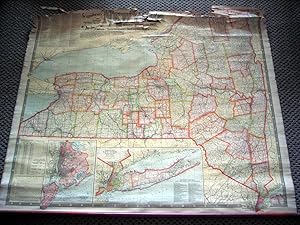
National Publishing Company's New Railroad, Post Office, Township, and County Map of New York with Distances Between Stations. Compiled From the Latest Government and State Surveys and Original Sources
Editore: National Publishing Company, [ca. 1905 ] Boston, 1905
Da: DR Fine Arts, New York, NY, U.S.A.
Valutazione del venditore 3 su 5 stelle

Cloth. Condizione: Fair. This is a very detailed, handsome and at the bottom are 2 large- scale map insets: "Map of New York City (Greater New York) and Vicinity" and "Southeastern Part of New York including all of the City of New York, and Long Island."; on a scale of one half mile to the inch; rolled map size: 39-1/4 x 44-1/4in, with printed color; Numerous tables and charts, including: "List of all Steam Railroads in New York State," "Steamship Lines from New York, Jersey City and Hoboken," "County and County Seats, from Census of 1900."; reference: not in Rumsey; the map has browning from the chemical coating; it is cloth-backed, rolled and with long wood at bottom but not at top; tiny tears to the edges; the top of the map is badly torn and needs repairs; but the map is clear except for the top, otherwise in FAIR COND.
-
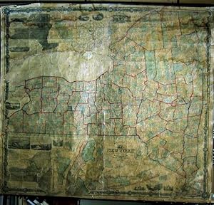
THE STATE OF NEW YORK from New and Original Surveys. 1860 (a very large wall Map)
Editore: Robert Pearsall Smith, Syracuse, 1860, 1860
Da: DR Fine Arts, New York, NY, U.S.A.
Valutazione del venditore 3 su 5 stelle
Soft cover. Condizione: Poor. With two insetted maps: "Geological and Land Patent Map of the State of New York" & "Meteorological Map of the State of New York."; with twelve insetted city plans: Buffalo, Troy, Utica, Syracuse, Albany, Oswego, Schenectady, Hudson, Auburn, Poughkeepsie, Rochester, New York City; also with twelve pictorial vignettes of New York State towns and scenery, and a decorative floral border: size: 6 x 5-1/2 feet OR 65 x 71 ins. (168 x 183 cm.) ; "The second edition of the best map of any American state published to its time. Ristow devotes an entire chapter to the construction of this map, and pronounced it of a "higher quality than the maps of other states published prior to the Civil War." From 1853, Robert Pearsall Smith contracted with a number of local surveyors to construct maps of New York counties. In 1855 he engaged John Homer French to compile a state map from the various county maps. Although the individual county maps were not all of uniform quality, they were far more comprehensive and uniform than the local surveys conducted for any other American state. French's general map of THE STATE OF NEW YORK, first published in 1859, supplanted Burr's ATLAS OF THE STATE OF NEW YORK (1829) as the definitive reference for the topography of the state. It remained so until two decades later, when the U.S. Geological Survey began publishing maps based on original triangulation. This second edition was published in 1860. Despite the quality of the map, the number of copies sold was insufficient to offset costs, and in 1865 Smith sold his publication rights to H.H. Lloyd, who brought out new editions. No edition in Rumsey. PHILLIPS, MAPS, p.513. RISTOW, AMERICAN MAPS & MAPMAKERS, pp.355-78". ; before being hung again it would need to be professionally repaired; the original clear coating has all yellowed; it is now backed with old linen but still holding map together; with original wooden rollers; the small tie cords at top are beginning to detach; there are cracks in image and stains thru out but all the map is attached; pulled at top wood edges but still attached; water stains mostly in the corners; again stating it would need to be professionaly repaired before hung; condition is poor but all present and being sold as is.
-

1828 The Tourists Map of the State of New York Compiled from the Latest Authorities
Da: New World Cartographic, Chicago, IL, U.S.A.
Membro dell'associazione: ABAA ILAB
Valutazione del venditore 4 su 5 stelle
Mappa
By: William WilliamsDate: 1828 (dated) Utica, NYDimensions: 20 x 28.5 inches (51 x 71.5 cm)A scarce and early-19th century travelers map of New York State made prior to the implementation of railroads when stage, canal, and steam-boats were the most efficient methods of travel.This map is an importantrelic of New York history, published just three years after the first boat made the trip from Lake Erie along the newly constructed Erie Canal to New York City in 1825. This connection, along with the natural waterway of the Ohio River would prove vital for the transportation of goods and raw materials to Chicago and the western frontier. At its peak in 1855 alone, some33,000 commercial shipmentsutilized the canal. This map features a large profile and description of the canal as well as a smaller profile of the Champlain Canal. The right hand portion of the map details distance and times of travel throughout the state via stage, canal, and steamship.The map was originally issued folded, now flattened and without its original covers. Counties are were carefully color-coded by hand with towns, cities, roads, canals, rivers, and streams shown in fine detail. Anmix of fonts make a lovely title cartouche that pays homage to early 19th Century Americana.Condition: This map is in A condition with some light paper toning along folds and where the piece was once adhered to cover boards. Some archival reinforcement work was done on the verso, mostly along fold intersections. Colors are bold with ample margins on all sides.Inventory #124711200 W. 35th Street #425 Chicago, IL 60609 | P: (312) 496 - 3622.
-
![Immagine del venditore per Inventory of aerial photography and other remotely sensed imagery of New York State, 3rd ed. 1968-83, limited revision, Feb. 1984 1984 [LeatherBound] venduto da True World of Books](https://pictures.abebooks.com/inventory/md/md31618204421.jpg)
Inventory of aerial photography and other remotely sensed imagery of New York State, 3rd ed. 1968-83, limited revision, Feb. 1984 1984 [LeatherBound]
Data di pubblicazione: 2025
EUR 27,67
Spedizione gratuita
Spedito da India a U.S.A.Quantit�: 18 disponibili
Aggiungi al carrelloLeatherBound. Condizione: New. BOOKS ARE EXEMPT FROM IMPORT DUTIES AND TARIFFS; NO EXTRA CHARGES APPLY. LeatherBound edition. Condition: New. Reprinted from 1984 edition. Leather Binding on Spine and Corners with Golden leaf printing on spine. Bound in genuine leather with Satin ribbon page markers and Spine with raised gilt bands. A perfect gift for your loved ones. Pages: 248 NO changes have been made to the original text. This is NOT a retyped or an ocr'd reprint. Illustrations, Index, if any, are included in black and white. Each page is checked manually before printing. As this print on demand book is reprinted from a very old book, there could be some missing or flawed pages, but we always try to make the book as complete as possible. Fold-outs, if any, are not part of the book. If the original book was published in multiple volumes then this reprint is of only one volume, not the whole set. Sewing binding for longer life, where the book block is actually sewn (smythe sewn/section sewn) with thread before binding which results in a more durable type of binding. Pages: 248.
-

A Map of the Genesee Lands in the County of Ontario and State of New York according to an accurate Survey which was made of the same 1790.
Data di pubblicazione: 1849
Da: Geographicus Rare Antique Maps, Brooklyn, NY, U.S.A.
Membro dell'associazione: ABAA ESA ILAB
Valutazione del venditore 4 su 5 stelle
Mappa
Very good. Few marginal mends; mended split along one fold with no loss. Size 13 x 8.25 Inches. This is Richard H. Pease's 1849 map of part of Ontario County, New York, comprising part of the western Finger Lakes region known as Gorham and Phelps' Purchase. The map records the annexation of Iroquois lands after the American Revolution in response to their support of the British. Historical Context These lands had been alienated from the Iroquois following the American Revolutionary War (1775 - 1783), and title to sell the land had passed from Massachusetts in 1784 to land investors Oliver Phelps and Nathaniel Gorham in 1788. Later that year, Phelps and Gorham negotiated title to sell these lands from the Iroquois and had begun to do so when they were compelled in 1791 to sell all of the unsold land to Robert Morris, who would in turn sell at a massive profit in 1792 to the British 'the Pulteney Association.' Phelps and Gorham Purchase Surveys Despite the title of the present work, there were two surveys of the Phelps and Gorham purchase: one made in 1788, and another re-survey in 1791 and 1792. The follow-up survey was executed to correct known flaws in the 1788 survey, particularly in its delineation of the easternmost boundary of the purchase: that so-called 'First Survey' had placed the boundary to the west of Seneca Lake and Geneva Town; the second survey of 1791-2 corrected the boundary to roughly bisect the Lake. The present map depicts the boundary according to the 1788 survey - which, in addition, appears to have missed Canadice Lake, between Hemlock and Honeoye Lakes (these are here but unnamed). A Closer Look An array of settlements are marked on the map. On Seneca Lake, Geneva Town, Culver's Town, and Catherine's Town are marked. (The latter had been a Seneca village, named after a prominent Seneca woman, Catherine Montour. It was destroyed by Colonial Revolutionary forces in 1779, however - so its presence here is puzzling.) At the northeastern end of Crooked Lake is marked a Quaker settlement. This is at the site of present-day town of Milo. Ontario County's seat, Canandaigua, is marked 'County Town.' The whole of the surveyed land is divided into 'townships'. Some of these are marked as having been sold, and some of those are shown in the process of settlement. Publication History and Census This map was printed in Albany in 1849 by Richard H. Pease, for inclusion in volume 2 of The Documentary History of the State of New-York . Only four examples of the separate map are listed in institutional collections, but the map appears on the market from time to time and the Documentary History is very well represented in institutional collections. References: OCLC 81550203.
-
The National Publishing Company's New Railroad, Post Office, Township and County Map of New York.
Data di pubblicazione: 1902
Da: Geographicus Rare Antique Maps, Brooklyn, NY, U.S.A.
Membro dell'associazione: ABAA ESA ILAB
Valutazione del venditore 4 su 5 stelle
Mappa
Very good. Bright and clean. Mounted on linen. Some wear at folds with minimal loss. Size 39.5 x 44.75 Inches. An impressive, large-format 1902 indexed folding map of New York State by the National Publishing Company highlighting the state's rail network at the start of the 20th century. A Closer Look The map's grand size allows for granular detail, demarcating counties and towns. The main map focuses on the mainland portion of the state, from New York City and points north. Inset maps detail the five boroughs of New York City, and a separate map details Long Island. An alphanumeric grid surrounds the map, corresponding to indices of the state's counties, county seats, and railroads. Separate tables indicate mileage between railroad stations and the travel distances between New York's larger cities. The state's demographics as of the 1900 census are given both for cities and the state. A further list names the steamship lines available from New York, New Jersey, and Hoboken. Publication History and Census This map was produced and published by the National Publishing Company in 1902 (it is sometimes also cataloged with the Scarborough Company as an author, given the close relationship between the two companies; the Scarborough edition was published in 1903). It is listed among the holdings of 6 institutions in OCLC, while an 1899 edition is held by one institution. References: OCLC 2023130.
-

Profiles of the New York State Canals and Feeders Showing the Elevations of the Same Above Tide Water and Junction of the Lateral Canals with the Erie.
Data di pubblicazione: 1874
Da: Geographicus Rare Antique Maps, Brooklyn, NY, U.S.A.
Membro dell'associazione: ABAA ESA ILAB
Valutazione del venditore 4 su 5 stelle
Mappa
Average. Exhibits wear and toning along original fold lines. Areas of infill at fold intersections. Backed on archival tissue for stability. Size 24.5 x 41 Inches. This is an 1874 New York State Canal Commissioners profile map of New York canals. Illustrating height changes along New York's primary canals: the Erie Canal, Champlain Canal, Chenango Canal, Chemung Canal, Genesee Valley Canal, Black River Canal, Oneida Lake Canal, and Cayuga and Seneca Canal. The Erie Canal stretches across the sheet. Divided into the Eastern, Middle, and Western divisions, counties, superintendent's sections, and other divisions along the Erie Canal are delineated. Height changes and distances of each part of the canal are presented. Cities, aqueducts, falls, and other waypoints are labeled. The other canals, along with their feeders, are illustrated in much the same manner. Numerous lakes along the canal routes appear as well, including Seneca Lake, Cayuga Lake, and Crooked Lake. Map of the State of New York Showing its Canals and Rail Roads A second, smaller map occupies the lower right and details New York's canal and railroad network. Illustrating most of New England, pronounced lines trace the canals, while black and white dashed lines follow the railroads. This provides an overall view of New York's transportation network and its connections to networks in Massachusetts, Vermont, Pennsylvania, New Jersey, and Canada. Publication History and Census This map was lithographed by Weed, Parsons, and Company in Albany, New York, and was published in the 1874 edition of the Canal Commissioner's report to the state. Editions were published annually from the 1860s through the 1880s and varied in design, although the central map showing the profiles changed little. The only other cataloged example of the 1874 edition is part of the collection at The Museum at Blue Mountain Lake. Earlier and later editions are well represented in institutional collections.
-

1854 Map of the State of New York
Da: New World Cartographic, Chicago, IL, U.S.A.
Membro dell'associazione: ABAA ILAB
Valutazione del venditore 4 su 5 stelle
Mappa
By:Charles MagnusDate:1854 (published) New YorkDimensions:18 1/4 x 22 3/4 inchesA rare, separately issued map of New York state from prolific print publisher Charles Magnus. The work was printed in New York in 1854, less than 30 years after the completion of the Erie Canal andat the beginning of a statewide effort to implement railroads that would connect all major cities with the any small towns between them.This map has considerable topographical and political information of the state, including indications of canals and railroads. An inset map of Long Island is placed at the bottom center, and an interesting birds eye view of Niagara Falls graces the top left corner. The whole is attractively hand colored in pastel shades, and it is easy to see that this would have been a popular decorative map for visitors or residents of New York.Known best for his souvenir prints of scenes of American locations, Charles Magnus also issued an interesting group of regional American maps, probably also intended for the souvenir market.Condition:This map is in A condition with original hand coloring and ample margins on all sides.Inventory #122931200 W. 35th Street #425 Chicago, IL 60609 | P: (312) 496 - 3622.