
Perry commodore edward sels (1 risultati)
 Altre immagini
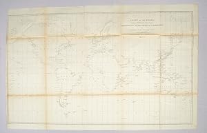
Chart of the World shewing the Track of the U.S. Steam Frigates, Mississippi, Susquehanna and Powhatan as Flagships of the Japan Squadron under the command of Commodore M.C. Perry, U.S.N., 1853-54 World Map 1854
PERRY, M. (MATTHEW), C. (CALBRAITH) COMMODORE AND EDWARD SELS.
Editore: Hydrographic Office c1854., United States., 1854
- Firmato
Da: Asia Bookroom ANZAAB/ILAB, Canberra, ACT, AustraliaAsia Bookroom ANZAAB/ILAB
Contatta il venditoreVenditore con 5 stelleCondizione: Usato
EUR 282,30
EUR 18,61 spedizioneSpedito da Australia a U.S.A.Quantità: 1 disponibili
Large black and white folded map. Some browning at the folds, some fold lines have been repaired with archival tape but overall in good condition. Scale 1:37,000,000. 54 x 91 cm "In January 1852 Perry was selected to undertake the most important diplomatic mission ever entrusted to an American naval officer, the negotiation of a… treaty with Japan, a country at this time sealed against intercourse with the Occidental powers" (DAB). By March 31, 1854, the treaty granting the U.S. trading rights had been signed by the Japanese. Drawn by Edward. Sels and engraved by Selmar Siebert this map was issued as part of the United States Naval Expedition to Japan, 1852-1854. Shows the route of the US Steam Frigates Mississippi, Susquehanna and Powhatan. Some regions such as Antarctica and Enderbury's Land appear to be un-explored, Tasmania appears at Van Diemen's Land.
