

Importo totale (1 articolo articoli):
Destinazione ordine:

petermann hassenstein (47 risultati)
Vai alla pagina principale dei risultati di ricerca
Filtri di ricerca
Tipo di articolo
- Tutti i tipi di prodotto
- Libri (23)
- Riviste e Giornali (Nessun altro risultato corrispondente a questo perfezionamento)
- Fumetti (Nessun altro risultato corrispondente a questo perfezionamento)
- Spartiti (Nessun altro risultato corrispondente a questo perfezionamento)
- Arte, Stampe e Poster (Nessun altro risultato corrispondente a questo perfezionamento)
- Fotografie (Nessun altro risultato corrispondente a questo perfezionamento)
- Mappe (24)
- Manoscritti e Collezionismo cartaceo (Nessun altro risultato corrispondente a questo perfezionamento)
Condizioni Maggiori informazioni
- Nuovo (11)
- Come nuovo, Ottimo o Quasi ottimo (Nessun altro risultato corrispondente a questo perfezionamento)
- Molto buono o Buono (24)
- Discreto o Mediocre (Nessun altro risultato corrispondente a questo perfezionamento)
- Come descritto (12)
Legatura
Ulteriori caratteristiche
- Prima ed. (Nessun altro risultato corrispondente a questo perfezionamento)
- Copia autograf. (Nessun altro risultato corrispondente a questo perfezionamento)
- Sovracoperta (Nessun altro risultato corrispondente a questo perfezionamento)
- Con foto (24)
- Non Print on Demand (36)
Lingua (2)
Spedizione gratuita
Paese del venditore
Valutazione venditore
-
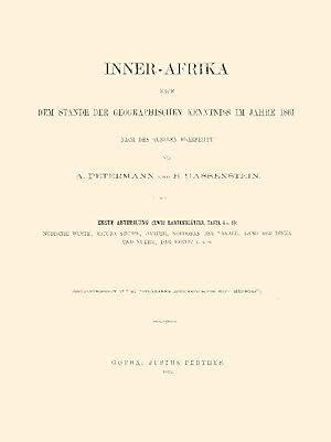
Inner-Afrika im Jahre 1861 - Teil 1
Editore: Justus Perthes, Gotha, 2020
Da: Antiquariat Fines Mundi, Saarbruecken, Germania
Valutazione del venditore 5 su 5 stelle

EUR 19,00
Spedizione EUR 18,00
Spedito da Germania a U.S.A.Quantità: 11 disponibili
Aggiungi al carrello-II, 30 Seiten -Mit 2 Kartenblättern -Tafel 4 und 6 --- August Petermann & Bruno Hassenstein:Mittheilungen aus Justus Perthes' geographischer Anstalt über wichtige neue Erforschungen auf dem Gesammtgebiet der Geographie von Dr. A. PetermannErgänzungsheft 7: Inner-Afrika nach dem Stande der geographischen Kenntniss im Jahre 1861Erste Abtheilung: Nubische Wüste, Bajuda-Steppe, Darfur, Kordofan und Takale, Land der Dinka und Nuehr, Dar Fertit usw. Verlagsfrischer, bibliophil ausgestatteter Faksimile-Reprint:Gedruckt auf einem schönen alterungsbeständigen und säurefreien Werkdruckpapier,das den Originaleindruck am besten wiedergibt.Gebunden in Interimsbroschur.Erschienen im Verlag Fines Mundi, Saarbrücken. --- 28,5 x 22,4 cm.
-

Inner-Afrika im Jahr 1861 bis 1863
Editore: Justus Perthes, Gotha, 2020
Da: Antiquariat Fines Mundi, Saarbruecken, Germania
Valutazione del venditore 5 su 5 stelle
EUR 21,00
Spedizione EUR 18,00
Spedito da Germania a U.S.A.Quantità: 12 disponibili
Aggiungi al carrello-XIV, 116 Seiten --- Bruno Hassenstein & August Petermann:Mittheilungen aus Justus Perthes' geographischer Anstalt über wichtige neue Erforschungen auf dem Gesammtgebiet der Geographie von Dr. A. PetermannErgänzungsheft 11: Inner-Afrika nach dem Stande der geographischen Kenntniss in den Jahren 1861 bis 1863Nebst Original-Berichten von M. von Beurmann, Kotschy, Brun-Rollet, Behm, Antinori, Th. von Heuglin, Morlang und von Harnier Verlagsfrischer, bibliophil ausgestatteter Faksimile-Reprint:Gedruckt auf einem schönen alterungsbeständigen und säurefreien Werkdruckpapier,das den Originaleindruck am besten wiedergibt.Gebunden in Interimsbroschur.Erschienen im Verlag Fines Mundi, Saarbrücken. --- 28,5 x 22,4 cm.
-
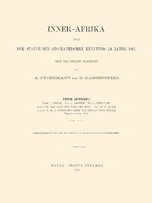
Inner-Afrika im Jahre 1861 - Teil 2
Editore: Justus Perthes, Gotha, 2020
Da: Antiquariat Fines Mundi, Saarbruecken, Germania
Valutazione del venditore 5 su 5 stelle
EUR 25,00
Spedizione EUR 18,00
Spedito da Germania a U.S.A.Quantità: 12 disponibili
Aggiungi al carrello-II, 50 Seiten -3 Tafeln --- August Petermann & Bruno Hassenstein:Mittheilungen aus Justus Perthes' geographischer Anstalt über wichtige neue Erforschungen auf dem Gesammtgebiet der Geographie von Dr. A. PetermannErgänzungsheft 8: Inner-Afrika nach dem Stande der geographischen Kenntniss im Jahre 1861Zweite AbtheilungAufsatz IV: Das Land und Volk der Tebu, von Dr. E. BehmAufsatz V: M. v. Beurmann's Reise von Bengasi nach Mursuk, Februar - April 1862 Verlagsfrischer, bibliophil ausgestatteter Faksimile-Reprint:Gedruckt auf einem schönen alterungsbeständigen und säurefreien Werkdruckpapier,das den Originaleindruck am besten wiedergibt.Gebunden in Interimsbroschur.Erschienen im Verlag Fines Mundi, Saarbrücken. --- 28,5 x 22,4 cm.
-
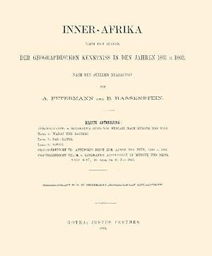
Inner-Afrika im Jahr 1861 und 1862
Editore: Justus Perthes, Gotha, 2020
Da: Antiquariat Fines Mundi, Saarbruecken, Germania
Valutazione del venditore 5 su 5 stelle
EUR 27,00
Spedizione EUR 18,00
Spedito da Germania a U.S.A.Quantità: 12 disponibili
Aggiungi al carrello-II, 18 Seiten -Mit 1 Originalkarte -3 Tafeln --- Bruno Hassenstein & August Petermann:Mittheilungen aus Justus Perthes' geographischer Anstalt über wichtige neue Erforschungen auf dem Gesammtgebiet der Geographie von Dr. A. PetermannErgänzungsheft 10: Inner-Afrika nach dem Stande der geographischen Kenntniss in den Jahren 1861 u. 1862Dritte Abtheilung:Originalbericht VI: Antinoris's Reise zum Lande der Djur, 1860 u. 1861Originalbericht VII: M.v. Beurmann's Aufenthalt in Mursuk und Reise nach Wau, 28. April bis 21. Juni 1862Originalkarte: v. Beurmann's Reise von Bengasi nach Mursuk und WauVerlagsfrischer, bibliophil ausgestatteter Faksimile-Reprint:Gedruckt auf einem schönen alterungsbeständigen und säurefreien Werkdruckpapier,das den Originaleindruck am besten wiedergibt.Gebunden in Interimsbroschur.Erschienen im Verlag Fines Mundi, Saarbrücken. --- 28,5 x 22,4 cm.
-

1881 Map of East Griqua and Pondo Land based on C. Henkel's Map and Other Sources. Also an inset: Mouth of the Umzimvubu (St. John's River).
Lingua: Tedesco
Editore: Justus Perthes, Gotha, 1881
Da: Independent Books, Long Beach, WA, U.S.A.
Valutazione del venditore 2 su 5 stelle

Mappa
No Binding. Condizione: Very Good. Bruno Hassenstein (illustratore). In German: Ost-Griqua und Pondo-Land nach C. Henkel's Karte und Anderen Quellen. Inset: Mundung des Umzimvubu.Cream and brown base map with geopolitical boundaries tinted pink. From "Mittheilungen aus Justus Perthes' Geographischer Anstalt uber Wichtige Neue Erforschungen auf dem Gessammtgebiete der Geographie von Dr. A. Petermann, 1881." Roughly: "Communications from Justus Perthes' Geographical Institute Concerning Important New Studies in the Whole Field of Geography by Dr. Augustus Petermann, 1881." Condition notes: 8.5" wide X 10.8" high, mildly toned, mild page waviness, soft fold (not creased) down the middle.
-
1881 Map of W.S. & A. Blunt's Travels in Northern Arabia. Using Research from Said Pasha, Burton, Doughty and Drawn by B. Hassenstein.
Lingua: Tedesco
Editore: Justus Perthes, Gotha, 1881
Da: Independent Books, Long Beach, WA, U.S.A.
Valutazione del venditore 2 su 5 stelle
Mappa
No Binding. Condizione: Very Good. Bruno Hassenstein (illustratore). In German: W.S. & A. Blunt's Reisen in Nord-Arabien. Mit Benutzung Forschungen vom Said Pascha, Burton, Doughty u. A. gez. v. B. Hassenstein. Black and white base map with the sea tinted blue, and travel routes marked in deep pink. From "Mittheilungen aus Justus Perthes' Geographischer Anstalt uber Wichtige Neue Erforschungen auf dem Gessammtgebiete der Geographie von Dr. A. Petermann, 1881." Roughly: "Communications from Justus Perthes' Geographical Institute Concerning Important New Studies in the Whole Field of Geography by Dr. Augustus Petermann, 1881." Condition notes: 8.5" wide X 10.8" high, mildly toned, mild page waviness, soft fold (not creased) down the middle.
-
1881 Map of Northwest Australia and the Timor Sea after Alex Forrest's Research in 1879 and the Latest Nautical Survey.
Lingua: Tedesco
Editore: Justus Perthes, Gotha, 1881
Da: Independent Books, Long Beach, WA, U.S.A.
Valutazione del venditore 2 su 5 stelle
Mappa
No Binding. Condizione: Very Good. Bruno Hassenstein (illustratore). In German: Nordwest-Australien und Timor Meer nach Alex Forrest's Forschungen 1879 und den Neuesten Nautischen Vermessungen. Black and white base map with sea tinted shades of blue by depth, and travel routes in several colors. From "Mittheilungen aus Justus Perthes' Geographischer Anstalt uber Wichtige Neue Erforschungen auf dem Gessammtgebiete der Geographie von Dr. A. Petermann, 1881." Roughly: "Communications from Justus Perthes' Geographical Institute Concerning Important New Studies in the Whole Field of Geography by Dr. Augustus Petermann, 1881." Condition notes: 10.8" wide X 8.6" high, mildly toned, mild page waviness.
-
1881 Map of the Route of the Indian Pundits in the Area of the Upper Irrawaddy 1879/80. Based on the compiled Fieldbook of the Explorer Captain J.E. Sandeman.
Lingua: Tedesco
Editore: Justus Perthes, Gotha, 1881
Da: Independent Books, Long Beach, WA, U.S.A.
Valutazione del venditore 2 su 5 stelle
Mappa
No Binding. Condizione: Very Good. Bruno Hassenstein (illustratore). In German: Reiseroute des Indischen Punditen A-a im Gebiet des Oberen Irawaddy 1879/80. Nach dem Feldbuch des Erforschers Zusammengestellt von Captn. J.E. Sandeman. Black and white base map with lands in rice cultivation tinted green, formerly cultivated lands tinted peach, and travel routes marked in red. From "Mittheilungen aus Justus Perthes' Geographischer Anstalt uber Wichtige Neue Erforschungen auf dem Gessammtgebiete der Geographie von Dr. A. Petermann, 1881." Roughly: "Communications from Justus Perthes' Geographical Institute Concerning Important New Studies in the Whole Field of Geography by Dr. Augustus Petermann, 1881." Condition notes: 8.4" wide X 10.8" high, mildly toned, mild page waviness, soft fold (not creased) down the middle, chip to right margin.
-

Inner-Afrika nach dem Stande der Geographischen Kenntniss im Jahre 1861, Vol. 1
Da: Forgotten Books, London, Regno Unito
Valutazione del venditore 4 su 5 stelle

EUR 18,48
Spedizione gratuita
Spedito da Regno Unito a U.S.A.Quantità: Più di 20 disponibili
Aggiungi al carrelloPaperback. Condizione: New. Print on Demand. This book presents a detailed account of the author's 1860 journey through the Nubian Desert from Korosko to Berber. The author, a botanist, provides meticulous observations on the region's geography, vegetation, and wildlife, along with insights into the local culture and customs. Drawing upon scientific knowledge of the time, the book offers a valuable historical record of the natural and human environment of the Nubian Desert during the 19th century. Through detailed descriptions and analysis, the author sheds light on the challenges and rewards of scientific exploration in a remote and unforgiving landscape, showcasing the significance of preserving and understanding our natural heritage. This book is a reproduction of an important historical work, digitally reconstructed using state-of-the-art technology to preserve the original format. In rare cases, an imperfection in the original, such as a blemish or missing page, may be replicated in the book. print-on-demand item.
-

Inner-Afrika nach dem Stande der geographischen Kenntniss in den Jahren 1861 u. 1862. Nach den Quellen bearbeitet. Dritte Abtheilung: Originalbericht VI: Antinori's Reise zum Lande der Djur, 1860 u. 1861. Originalbericht VII: M. v. Beurmann's Aufenthalt in Mursuk und Reise nach Wau, 28. April bis 21. Juni 1862.
Editore: Gotha: Perthes, 1862
Da: Antiquariat Gallus / Dr. P. Adelsberger, Innsbruck, A, Austria
Valutazione del venditore 5 su 5 stelle
EUR 40,00
Spedizione EUR 72,50
Spedito da Austria a U.S.A.Quantità: 1 disponibili
Aggiungi al carrelloOBrosch. 4°, Tbl., pp. 79 - 96, mit 4 großformatigen gefalt Karten, 1) Mit der Originalkarte zu Beurmanns Reise von Bengasi nach Mursuk und Wau. 2) Tafel 5: Wadai und Bagirmi 3) Tafel 7: Bar-Banda 4) Tafel 9: Kongo - (= Ergänzungsheft Nr. 10, zu Petermann's "Georgraphischen Mittheilungen") - Einwandfreier Erhaltungszustand.
-
1881 Original Map of a Route from Lado to Dara, after the Survey of R.W. Felkin & Revd. C. Wilson, M.A. Sept. to Dec. 1879, Compiled and Drawn by B. Hassenstein.
Lingua: Tedesco
Editore: Justus Perthes, Gotha, 1881
Da: Independent Books, Long Beach, WA, U.S.A.
Valutazione del venditore 2 su 5 stelle
Mappa
No Binding. Condizione: Very Good. Bruno Hassenstein (illustratore). In German: Originalkarte Einer Reiseroute von Lado bis Dara, Nach der Itinerar-Aufnahme von R.W. Felkin & Revd. C. Wilson, M.A. Sept. bis Dec. 1879, Construirt und Gezeichnet von B. Hassenstein. From "Mittheilungen aus Justus Perthes' Geographischer Anstalt uber Wichtige Neue Erforschungen auf dem Gessammtgebiete der Geographie von Dr. A. Petermann, 1881." Roughly: "Communications from Justus Perthes' Geographical Institute Concerning Important New Studies in the Whole Field of Geography by Dr. Augustus Petermann, 1881." Condition notes: 8.4" wide X 22.0" high in 3 panels (folded twice in the same direction), several closed tears at folds, top left corner has long, narrow crease.
-
1881 Overview Map of New French Fortifications Complied from C. Vogel's Map of France in 4 Sheets. With an inset of the new Fortress at Paris.
Lingua: Tedesco
Editore: Justus Perthes, Gotha, 1881
Da: Independent Books, Long Beach, WA, U.S.A.
Valutazione del venditore 2 su 5 stelle
Mappa
No Binding. Condizione: Very Good. Bruno Hassenstein (illustratore). In German: Ubersicht der Neuen Franzosischen Landesbefestigung Zusammengestellt auf C. Vogel's Karte Frankreich in 4 Bl. This map does not identify which of the four sheets it is. This sheet covers the area from Paris on the west to Strassburg on the east, and from Koln on the north to Chalon on the south. Geopolitical boundaries tinted in pastels, cities shown in pink, and fortifications shown as red dots. From "Mittheilungen aus Justus Perthes' Geographischer Anstalt uber Wichtige Neue Erforschungen auf dem Gessammtgebiete der Geographie von Dr. A. Petermann, 1881." Roughly: "Communications from Justus Perthes' Geographical Institute Concerning Important New Studies in the Whole Field of Geography by Dr. Augustus Petermann, 1881." Condition notes: 15.4" wide X 14.6" in 4 panels (folded once in each direction) high, mildly toned, mild page waviness.
-
1881 Map and Profile of the Depths and Temperatures of the Bearing Strait Measured by W.H. Dahll on U.S. Coastal Survey Schooner "Yukon" September 5, 1880. Also, another profile of the Eastern Cap and the Diomedes Islands
Lingua: Tedesco
Editore: Justus Perthes, Gotha, 1881
Da: Independent Books, Long Beach, WA, U.S.A.
Valutazione del venditore 2 su 5 stelle
Mappa
No Binding. Condizione: Very Good. Bruno Hassenstein (illustratore). In German: Tiefen un See-Temperturen der Bering-Strasse Gemessen von W.H. Dahll im U.S.C. Srvey Schr. "Yukon" 5 Sept. 1880. For the inset: Ansicht des Ost-Caps und der Diomedes Inseln. Map and temperature profile tinted blue by 2-degree isotherms. Physical profile tinted peach and blue. From "Mittheilungen aus Justus Perthes' Geographischer Anstalt uber Wichtige Neue Erforschungen auf dem Gessammtgebiete der Geographie von Dr. A. Petermann, 1881." Roughly: "Communications from Justus Perthes' Geographical Institute Concerning Important New Studies in the Whole Field of Geography by Dr. Augustus Petermann, 1881." Condition notes: 10.8" wide X 8.5" high, mildly toned, mild page waviness, soft fold (not creased) down the middle.
-
1881 Map of the Argentine Territory of Pampa, of Rio Negro, etc. After the Survey of the Expeditionary Force against the Indians, Under General D.J.A. Roca.
Lingua: Tedesco
Editore: Justus Perthes, Gotha, 1881
Da: Independent Books, Long Beach, WA, U.S.A.
Valutazione del venditore 2 su 5 stelle
Mappa
No Binding. Condizione: Very Good. Bruno Hassenstein (illustratore). In German: Die Argentinischen Territorien der Pampa, des Rio-Negro &c. Nach dem Aufnahmen der Expeditionscorps gegen Indianer, unter General D.J.A. Roca. Cream and brown base map with water bodies tinted blue, geopolitical boundaries tinted pink, and certain areas along rivers tinted green. From "Mittheilungen aus Justus Perthes' Geographischer Anstalt uber Wichtige Neue Erforschungen auf dem Gessammtgebiete der Geographie von Dr. A. Petermann, 1881." Roughly: "Communications from Justus Perthes' Geographical Institute Concerning Important New Studies in the Whole Field of Geography by Dr. Augustus Petermann, 1881." Condition notes: 10.8" wide X 8.5" high, mildly toned, slight page waviness.
-
1881 Map of the Waterways of France based on the Map of Navigable Rivers of France Issued by the Ministry of Public Work in 1878.Also 2 insets: Paris and Surroundings; Flanders.
Lingua: Tedesco
Editore: Justus Perthes, Gotha, 1881
Da: Independent Books, Long Beach, WA, U.S.A.
Valutazione del venditore 2 su 5 stelle
Mappa
No Binding. Condizione: Very Good. Bruno Hassenstein (illustratore). In German: Die Wasserstrassen Frakreich's nachh der Carte de la Navigatiom Interieure de la France Heraugegeben von Ministerium der Offentlichen Arbeiten 1878. For insets: Paris und Umgegend; Flandern. Black and white base map with rivers marked in various colors. From "Mittheilungen aus Justus Perthes' Geographischer Anstalt uber Wichtige Neue Erforschungen auf dem Gessammtgebiete der Geographie von Dr. A. Petermann, 1881." Roughly: "Communications from Justus Perthes' Geographical Institute Concerning Important New Studies in the Whole Field of Geography by Dr. Augustus Petermann, 1881." Condition notes: 13.5" wide X 10.8" high in 2 panels (folded once), mildly toned, mild page waviness.
-
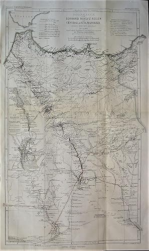
1865 Original Map of Gerhard Rohlfs' Travels in Central and South Morocco (Atlas, Talfilet, Draa, etc.) in 1862 and 1864. After Rohlfs' Journal and Personal Data and Other Sources. Drawn by B. Hassenstein. With an inset of the Tafilet Oasis.
Lingua: Tedesco
Editore: Justus Perthes, Gotha, 1865
Da: Independent Books, Long Beach, WA, U.S.A.
Valutazione del venditore 2 su 5 stelle
Mappa
No Binding. Condizione: Very Good. Bruno Hassenstein (illustratore). In German: Originalkarte von Gerhard Rohlfs' Reisen Central und Sud Marokko (Atlas, Tafilet, Draa, &c.) 1862 und 1864. Nach Rohlfs' Tagebuch und personlichen Angaben mit Benutzung Anderer Quellen. Gezeichnet von B. Hassenstein. Generally in black and white, with routes in red and orange, and country borders tinted green. From "Mittheilungen aus Justus Perthes' Geographischer Anstalt uber Wichtige Neue Erforschungen auf dem Gessammtgebiete der Geographie von Dr. A. Petermann, 1865." Roughly: "Communications from Justus Perthes' Geographical Institute Concerning Important New Studies in the Whole Field of Geography by Dr. Augustus Petermann, 1865." Condition notes: 10.8" wide X 18.0" high in 4 panels (2 folds), modestly toned, mild page waviness, top left edge crinkled outside of the border.
-
1881 Map of Northwestern Mongolia Based on the Surveys and Recording of Local Conditions by Potainin and Rafailow 1876 & 1877.
Lingua: Tedesco
Editore: Justus Perthes, Gotha, 1881
Da: Independent Books, Long Beach, WA, U.S.A.
Valutazione del venditore 2 su 5 stelle
Mappa
No Binding. Condizione: Very Good. Bruno Hassenstein (illustratore). In German: Karte der Nordwestlichen Mongolei nach den Aufnahmen und Ortsbestimmungen von Potanin und Rafailow 1876 & 1877. Cream and brown base map with water bodies tinted blue and travel routes in red. From "Mittheilungen aus Justus Perthes' Geographischer Anstalt uber Wichtige Neue Erforschungen auf dem Gessammtgebiete der Geographie von Dr. A. Petermann, 1881." Roughly: "Communications from Justus Perthes' Geographical Institute Concerning Important New Studies in the Whole Field of Geography by Dr. Augustus Petermann, 1881." Condition notes: 13.2" wide X 10.8" high in 2 panels (folded once), mildly toned, mild page waviness.
-
1880 Maps of the Deep Sea Temperatures of the European North Sea. Compiled by H. Mohn. With 8 maps of isotherms at various depths, from surface to sea floor.
Lingua: Tedesco
Editore: Justus Perthes, Gotha, 1881
Da: Independent Books, Long Beach, WA, U.S.A.
Valutazione del venditore 2 su 5 stelle
Mappa
No Binding. Condizione: Very Good. Bruno Hassenstein (illustratore). In German: Die Tiefsee-Temperaturen des Europaischen Nordmeeres Zusammengestelt von H. Mohn. Land masses tinted peach, isotherms tinted pink and blue. From "Mittheilungen aus Justus Perthes' Geographischer Anstalt. Herausgegeben von Dr. E. Behm. Erganzungsband XIV, 1880-1881." Roughly: "Communications from Justus Perthes' Geographical Institute. Edited by Dr. E. Behm. Supplement 14, 1880-1881." Condition notes: 21.7" wide X 10.8" high in 3 panels (folded twice in one direction), mildly toned, mild page waviness.
-
1881 Geological Map of the Queen Charlotte Islands after George M. Dawson's surveys 1878.With an inset of Skidegate Inlet.
Lingua: Tedesco
Editore: Justus Perthes, Gotha, 1881
Da: Independent Books, Long Beach, WA, U.S.A.
Valutazione del venditore 2 su 5 stelle
Mappa
No Binding. Condizione: Very Good. Bruno Hassenstein (illustratore). In German: Geologische Karte der Queen Charlotte Islands nach George M. Dawson's Aufnahmen 1878. Color map and inset of geologic types. Also shown are small black and white drawings of game pieces, a ceremonial spoon, fish hooks, a fishing club, a castanet made from Puffin beaks, and a rattle shaped like a raven as well as other figures. This is a beautiful and interesting map. From "Mittheilungen aus Justus Perthes' Geographischer Anstalt uber Wichtige Neue Erforschungen auf dem Gessammtgebiete der Geographie von Dr. A. Petermann, 1881." Roughly: "Communications from Justus Perthes' Geographical Institute Concerning Important New Studies in the Whole Field of Geography by Dr. Augustus Petermann, 1881." Condition notes: 8.4" wide X 10.8" high, mildly toned, mild page waviness, soft fold (not creased) down the middle, lt sm stain to bottom margin.
-
1881 Map of E. Marino's Survey of the Middle River El Abiad and of the River El Saraf September 1879 to March 1880. Based on the Original Recordings and Hand Drawn Sketches Constructed and Drawn by Christian Peip. Also 2 insets: Sketch of the Bar of the White Nile from December 7 to 15, 1880 as Surveyed by E. Marno; Sketch of the Proposed Canal at the mouth of the White Nile.
Lingua: Tedesco
Editore: Justus Perthes, Gotha, 1881
Da: Independent Books, Long Beach, WA, U.S.A.
Valutazione del venditore 2 su 5 stelle
Mappa
No Binding. Condizione: Very Good. Bruno Hassenstein (illustratore). In German: E. Marino's Aufnahme des Mittleren Bahr El Abiad und des Bahr El Seraf Sept. 1879 bis Marz 1880. Nach dem Original-Tagebuch u. Handerschrift Skizzen Construirt & Autographirt von Chr. Peip. For insets: Kizze der barre im Bahr el Abiad v 7-15 Dec. 1880 durchbrochen von E. Marno; Skizze des Projectirten Kanal's Verlegung fer Mundung des Bahr el Gebel, Black and white base map, with some areas shaded blue. From "Mittheilungen aus Justus Perthes' Geographischer Anstalt uber Wichtige Neue Erforschungen auf dem Gessammtgebiete der Geographie von Dr. A. Petermann, 1881." Roughly: "Communications from Justus Perthes' Geographical Institute Concerning Important New Studies in the Whole Field of Geography by Dr. Augustus Petermann, 1881." Condition notes: 13.0" wide X 17.7" high in 4 panels (folded once in each direction), mildly toned, mild page waviness, crescent-shaped closed tear to left margin and map area.
-
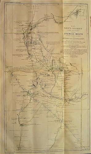
1867 Map of the Lake District and the Stony Desert of the Interior of Australia. According to the Travel Journals of Stuart 1845, Wills 1860, McKinlay 1861-1862, and Howitt 1862. Drawn by B. Hassenstein, edited by A. Petermann.
Lingua: Tedesco
Editore: Justus Perthes, Gotha, 1867
Da: Independent Books, Long Beach, WA, U.S.A.
Valutazione del venditore 2 su 5 stelle
Mappa
No Binding. Condizione: Very Good. Bruno Hassenstein (illustratore). In German: Das See'n-Gebiet und die Steinice Wuste im Innern von Australien. Nach den Reisejournalen von Stuart 1845, Wills 1860, McKinlay 1861-1862, und Howitt 1862.) Constr. Von B. Hassenstein, dir. Von A. Petermann. Black and white base map with regional boundaries in pastels, and travel routes in color. From "Mittheilungen aus Justus Perthes' Geographischer Anstalt uber Wichtige Neue Erforschungen auf dem Gessammtgebiete der Geographie von Dr. A. Petermann, 1867." Roughly: "Communications from Justus Perthes' Geographical Institute Concerning Important New Studies in the Whole Field of Geography by Dr. Augustus Petermann, 1867." Condition notes: 10.9" wide X 18.0" high, in 4 panels (folded twice, once in each direction), modestly toned, mild page waviness, narrow crease to upper left margin.
-
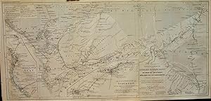
1865 Original Map from Gerhard Rohlfs' Journey to the Oases of Tuat and Tidikelt and the Northern Part of the Tuareg Region (North Africa). Designed after the Explorer's Survey and with the Use of the Maps of Duveyrier, Colonieu and Burin, de Colomb, et al. Drawn by Hassenstein. With two insets of the Tuat and Tidikelt oases groups.
Lingua: Tedesco
Editore: Justus Perthes, Gotha, 1865
Da: Independent Books, Long Beach, WA, U.S.A.
Valutazione del venditore 2 su 5 stelle
Mappa
No Binding. Condizione: Very Good. Bruno Hassenstein (illustratore). In German: Originalkarte von Gerhard Rohlfs' Reise durch Die Oasen von Tuat und Tidikelt und den Nordlichen Theil des Tuareg-Gebietes (Nord-Afrika). Nach dem Tagebuch des Reisenden entworfen und mit Benutzung der Karten und Ekundigugen von Duveyrier, Colonieu und Burin, de Colomb U.A. Gezeichnet von Hassenstein. Generally in black and white, with routes in red. From "Mittheilungen aus Justus Perthes' Geographischer Anstalt uber Wichtige Neue Erforschungen auf dem Gessammtgebiete der Geographie von Dr. A. Petermann, 1865." Roughly: "Communications from Justus Perthes' Geographical Institute Concerning Important New Studies in the Whole Field of Geography by Dr. Augustus Petermann, 1865." Condition notes: 21.0" wide X 10.4" high, landscape orientation with 3 panels (2 folds), modestly toned, mild page waviness, crinkles to upper left margin outside of the border.
-
Inner-Afrika nach dem Stande der geographischen Kenntniss in den Jahren 1861 bis 1863 : nebst Original-Berichten von M. von Beurmann, Kotschy, Brun-Rollet, Behm, Antinori, Th. Heuglin, Morlang und von Harnier
Editore: Justus Perthes, Gotha, 1863
Da: Thulin&Ohlson AntiqBookseller Since 1918, Molndal, Svezia
Valutazione del venditore 5 su 5 stelle
EUR 80,00
Spedizione EUR 25,00
Spedito da Svezia a U.S.A.Quantità: 1 disponibili
Aggiungi al carrelloUnbound. Condizione: Good. XIV, 50 pp. + 1 plate.
-
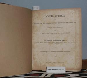
Mittheilungen aus Justus Perthes' geographischer Anstalt über wichtige neue Erforschungen auf dem Gesammtgebiet der Geographie von Dr. A. Petermann; Ergänzungsheft 7: Inner-Afrika nach dem Stande der geographischen Kenntniss im Jahre 1861; 4 Abteilung in 1 Band (unvollständig). Erste Abtheilung: Nubische Wüste, Bajuda-Steppe, Darfur, Kordofan und Takale, Land der Dinka und Nuehr, Dar Fertit usw. Zweite Abtheilung: Aufsatz IV: Das Land und Volk der Tebu, von Dr. E. Behm; Aufsatz V: M.v. Beurmann's Reise von Bengasi nach Mursuk, Februar-April 1862 / Dritte Abtheilung: Originalbericht VI: Antinoris's Reise zum Lande der Djur, 1860 u. 1861; Originalbericht VII: M.v. Beurmann's Aufenthalt in Mursuk und Reise nach Wau, 28. April bis 21. Juni 1862 / Vierte Abtheilung (ohne Titelblatt): Heuglin, Th. v.: Berichte und Arbeiten über den Ägyptischen Sudan und die Länder westlich und südlich von Chartum; Hier endet die vierte Abteilung und das Buch. Diese Abteilung ist unvollständig (!!). Es FEHLT:
Lingua: Tedesco
Editore: Gotha, Justus Perthes, 1862., 1862
Da: Antiquariat Welwitschia Dr. Andreas Eckl, Bochum, NRW, Germania
Valutazione del venditore 5 su 5 stelle
EUR 350,00
Spedizione EUR 39,00
Spedito da Germania a U.S.A.Quantità: 1 disponibili
Aggiungi al carrelloMit 10 Karten. Gebunden in schmucklosen braunen Papp-Einband, 4°, 4 Abteilung in 1 Band, 164 Seiten 10 gefalt. farbig lithogr. Karten. Seiten kaum bis mäßig stockfleckig, durchaus noch gutes Exemplar. Enthält bisher unveröffentlichte Original-Reiseberichte: Mittheilungen aus Justus Perthes' geographischer Anstalt über wichtige neue Erforschungen auf dem Gesammtgebiet der Geographie von Dr. A. Petermann; Ergänzungsheft 7: Inner-Afrika nach dem Stande der geographischen Kenntniss im Jahre 1861; 4 Abteilung in 1 Band (unvollständig). Erste Abtheilung: Nubische Wüste, Bajuda-Steppe, Darfur, Kordofan und Takale, Land der Dinka und Nuehr, Dar Fertit usw., S. 1-30. Mit Tafel 4: Nubien, und Tafel 6: Dar-Fur und Kordofan; / Zweite Abtheilung: Aufsatz IV: Das Land und Volk der Tebu, von Dr. E. Behm; Aufsatz V: M.v. Beurmann's Reise von Bengasi nach Mursuk, Februar-April 1862, Seiten 31-78. Mit Blatt 1: Fessan. Blatt 2: Ägypten (lose beiliegend). / Dritte Abtheilung: Originalbericht VI: Antinoris's Reise zum Lande der Djur, 1860 u. 1861; Originalbericht VII: M.v. Beurmann's Aufenthalt in Mursuk und Reise nach Wau, 28. April bis 21. Juni 1862. Seiten 79-96. Mit Tafel 5: Wadai und Bagirmi, Tafel 7: Dar-Banda, Tafel 9: Kongo. Und einer nicht nummerierten Karte: Originalkarte M.v. Beurmann's Reise von Bengasi nach Mursuk & Wau / Vierte Abtheilung (ohne Titelblatt): Heuglin, Th. v.: Berichte und Arbeiten über den Ägyptischen Sudan und die Länder westlich und südlich von Chartum; Seiten 97-162. Mit Tafel 8: Gondokoro und Blatt 10: Unyamwesi. Hier ENDET die vierte Abteilung und das Buch. Diese Abteilung ist unvollständig (!!). Es FEHLT: Morlang, Franz: Reisen östlich und westlich von Gondokoro 1859; Harnier, Wilhelm von: Reise auf dem Weissen Nil, Dezember 1860 bis November 1861; Heuglin, Th. v.: Bericht über seine und Dr. Steudner's Reise von Chartum den Bahr el Abiad und Bahr Ghasal hinauf bis zum See Req; Ders.: Bericht über Seine Reise vom See Req bis Bongo im Lande der Dor; Ders.: Bericht über seinen Aufenthalt im Flußgebiete des Bahr Djur. Vorhanden sind die nicht nummerierte Übersichtskarte (Tafel 3?) und die Tafeln 1, 2, 4, 5, 6, 7, 8, 9, und 10. Buch.
-
Mittheilungen aus Perthes' geographischer Anstalt - Ergänzungsband 24
Editore: Justus Perthes, Gotha, 2020
Da: Antiquariat Fines Mundi, Saarbruecken, Germania
Valutazione del venditore 5 su 5 stelle
EUR 91,00
Spedizione EUR 18,00
Spedito da Germania a U.S.A.Quantità: 12 disponibili
Aggiungi al carrelloErgänzungsband 24 (Hefte 110 - 114): -Heft 110: II, 64 Seiten -Heft 111: II, 56 Seiten -Heft 112: IV, 120 Seiten -Heft 113: IV, 60 Seiten -Heft 114: II, 56 Seiten -mit 6 Karten, 1 Karte auf 4 Blatt und 3 Skizzen im Text --- Prof. Dr. A. Supan (Hrsg.):Mittheilungen aus Justus Perthes' geographischer Anstalt über wichtige neue Erforschungen auf dem Gesammtgebiet der Geographie von Dr. A. Petermann Ergänzungsband 24 Beinhaltet die Hefte 110 - 114:Heft 110: Bludau - Die Oro- und Hydrographie der preussischen und pommerschen Seenplatte, insbesondere im Stromgebiet der Weichsel Heft 111: Baumann - Die karthographischen Ergebnisse der Massai-Expedition des Deutschen Antisklaverei-Comità s; Mit Ergänzung durch die Aufnahmen von Dr. G. A. Fischer, Premierleutn. W. Werther und Kapt. A. Spring und unter Mitwirkung von Dr. Bruno Hassenstein und Dr. L. Ambronn Heft 112: Radde & Koenig - Das Ostufer des Pontus und seine kulturelle Entwicklung im Verlaufe der letzten dreissig Jahre; Vorläufiger Bericht über die Reisen im kolchischen Tiefland, Adsharien, am Ostufer des Schwarzen Meeres, am Unterlaufe des Kuban und über die Durchquerung der Hauptkette von Psebai nach Sotschi im Sommer 1893 Heft 113: Sapper - Grundzüge der physikalischen Geographie von Guatemala Heft 114: Flottwell - Aus dem Stromgebiet des Qyzyl-Yrmaq (Halys); Ergebnisse der Forschungsreise der Premierleutnants v. Prittwitz und Gaffron vom Anhaltischen Infanterie-Regiment Nr. 93 und v. Flottwell vom Grenadier-Regiment Kronprinz Friedrich Wilhelm (2. Schlesisches) Nr. 11 vom 1. Juli bis 1. Oktober 1893Verlagsfrischer, bibliophil ausgestatteter Faksimile-Reprint: Gedruckt auf einem schönen alterungsbeständigen und säurefreien Werkdruckpapier, das den Originaleindruck am besten wiedergibt. Gebunden als robuste Bibliotheksversion in Ganzleinen mit Rückengoldprägung. Bibliophil ausgestattet mit rundem Rücken und Lesebändchen. Ein dem Stil der Zeit entsprechender Umschlag wurde auf dem Vorderdeckel aufgezogen. --- 28,5 x 22,4 cm.
-
1881 Reduced Topographical Images of the Southwest of the United States under Wheeler and Hayden, 1869 to 1876.
Lingua: Tedesco
Editore: Justus Perthes, Gotha, 1881
Da: Independent Books, Long Beach, WA, U.S.A.
Valutazione del venditore 2 su 5 stelle
Mappa
No Binding. Condizione: Very Good. Bruno Hassenstein (illustratore). In German: Reduction Topographischer Aufnahmen im Sud-Westen der Vereinn Staaten unter Wheeler und Hayden, 1869 bis 1876. Black and white base map with elevations tinted green to brown. From "Mittheilungen aus Justus Perthes' Geographischer Anstalt uber Wichtige Neue Erforschungen auf dem Gessammtgebiete der Geographie von Dr. A. Petermann, 1881." Roughly: "Communications from Justus Perthes' Geographical Institute Concerning Important New Studies in the Whole Field of Geography by Dr. Augustus Petermann, 1881." Condition notes: 13.2" wide X 10.8" high, mildly toned, mild page waviness, soft fold (not creased) down the middle.
-
1881 Maps of Temperatures of the Russian Empire by H. Wild.
Lingua: Tedesco
Editore: Justus Perthes, Gotha, 1881
Da: Independent Books, Long Beach, WA, U.S.A.
Valutazione del venditore 2 su 5 stelle
Mappa
No Binding. Condizione: Very Good. Bruno Hassenstein (illustratore). In German: Temperatur-Verhaltnisse des Russischen Reiches nach H. Wild. Isotherms mapped for January, April, July, October, Annual, and "isoaplituden." Blue and pink tinted base maps with isotherms shown in red. From "Mittheilungen aus Justus Perthes' Geographischer Anstalt uber Wichtige Neue Erforschungen auf dem Gessammtgebiete der Geographie von Dr. A. Petermann, 1881." Roughly: "Communications from Justus Perthes' Geographical Institute Concerning Important New Studies in the Whole Field of Geography by Dr. Augustus Petermann, 1881." Condition notes: 13.3" wide X 10.7" high in 2 panels (folded once), mildly toned, mild page waviness, soft fold (not creased) down the middle.
-
1880 Map of The Deep Conditions of the European North Sea Based on Observations of the Norwegian North Sea Expedition of 1876, 1877, and 1878 (as well as several other expeditions). Edited and drawn by H. Mohn. Also three insets of salinity levels and nitrogen content.
Lingua: Tedesco
Editore: Justus Perthes, Gotha, 1881
Da: Independent Books, Long Beach, WA, U.S.A.
Valutazione del venditore 2 su 5 stelle
Mappa
No Binding. Condizione: Very Good. Bruno Hassenstein (illustratore). In German: Die Tiefenverhaltnisse des Europaschen Nordmeeres nach den Beobachtungen der Norwegischen Nordmeer-Expedition 1876, 1877, 1878. Bearbeitat und gezeichnet von H. Mohn. Land masses tinted peach, sea tinted various shades of blue, depending on depth. From "Mittheilungen aus Justus Perthes' Geographischer Anstalt. Herausgegeben von Dr. E. Behm. Erganzungsband XIV, 1880-1881." Roughly: "Communications from Justus Perthes' Geographical Institute. Edited by Dr. E. Behm. Supplement 14, 1880-1881." Condition notes: 18.7" wide X 15.5" high in 6 panels (folded once in one direction and twice in the other direction), mildly toned, mild page waviness, top left corner creased.
-
1880 Graphs of Deep Conditions and Heat Distribution in the European North Sea Based on Measurements of the Norwegian North Sea Expeditions 1876-1878. With 12 graphs.
Lingua: Tedesco
Editore: Justus Perthes, Gotha, 1881
Da: Independent Books, Long Beach, WA, U.S.A.
Valutazione del venditore 2 su 5 stelle
Mappa
No Binding. Condizione: Very Good. Bruno Hassenstein (illustratore). In German: Tiefen Verhaltnisse und Warme-Vertheilung im Europaischen Nordmeer nach den Messungen der Norwegischen Nordmeer Expeditionen 1876-1878. Land tinted pink, isotherms tinted pink and blue, bottom depths shown. From "Mittheilungen aus Justus Perthes' Geographischer Anstalt. Herausgegeben von Dr. E. Behm. Erganzungsband XIV, 1880-1881." Roughly: "Communications from Justus Perthes' Geographical Institute. Edited by Dr. E. Behm. Supplement 14, 1880-1881." Condition notes: 21.8" wide X 17.7" high in 6 panels (folded once in one direction and twice in the other direction), mildly toned, mild page waviness, a few minor closed tears at seams.
-
1880 Map of Dr. W. Junkers Travel in Northeast and Central Africa: Sheet no. IV: Map of the Route by the Valley of the Chor Baraka in the Egyptian province Taka. v.1. up to March 30, 1876. With Consideration of the Newest Travel and Research in the Northern Egyptian-Abyssinian Border Area, Edited and Drawn by B. Hassenstein.
Lingua: Tedesco
Editore: Justus Perthes, Gotha, 1880
Da: Independent Books, Long Beach, WA, U.S.A.
Valutazione del venditore 2 su 5 stelle
Mappa
No Binding. Condizione: Very Good. Bruno Hassenstein (illustratore). In German: Dr. W. Junkers Reisen in Nordost & Central-Afrika: Blatt No. IV: Karte der Route durch das Thal des Chor Baraka in die Agyptische Provinz Taka. v.1. bis 30. Marz 1876. Mit Berucksichtigung der Neuesten Reisen u. Erforscgungen im Nordlichen Agyptisch-Abessinischen Grenzgebiet, bearbeitet und gezeichnet von B. Hassenstein. Cream and brown base with coastlines tinted blue and travel routes in a variety of colors. From "Mittheilungen aus Justus Perthes' Geographischer Anstalt uber Wichtige Neue Erforschungen auf dem Gessammtgebiete der Geographie von Dr. A. Petermann, 1880." Roughly: "Communications from Justus Perthes' Geographical Institute Concerning Important New Studies in the Whole Field of Geography by Dr. Augustus Petermann, 1880." Condition notes: 15.2" wide X 20.5" high in 6 panels (folded once in one direction and twice in the other direction), several small closed tears at folds tiny tear and narrow crease top left corner.


