
Importo totale (1 articolo articoli):
Destinazione ordine:

richard pflederer (23 risultati)
Vai alla pagina principale dei risultati di ricerca
Filtri di ricerca
Tipo di articolo
- Tutti i tipi di prodotto
- Libri (21)
- Riviste e Giornali (2)
- Fumetti (Nessun altro risultato corrispondente a questo perfezionamento)
- Spartiti (Nessun altro risultato corrispondente a questo perfezionamento)
- Arte, Stampe e Poster (Nessun altro risultato corrispondente a questo perfezionamento)
- Fotografie (Nessun altro risultato corrispondente a questo perfezionamento)
- Mappe (Nessun altro risultato corrispondente a questo perfezionamento)
- Manoscritti e Collezionismo cartaceo (Nessun altro risultato corrispondente a questo perfezionamento)
Condizioni Maggiori informazioni
- Nuovo (10)
- Come nuovo, Ottimo o Quasi ottimo (6)
- Molto buono o Buono (5)
- Discreto o Mediocre (Nessun altro risultato corrispondente a questo perfezionamento)
- Come descritto (2)
Legatura
Ulteriori caratteristiche
- Prima ed. (1)
- Copia autograf. (2)
- Sovracoperta (Nessun altro risultato corrispondente a questo perfezionamento)
- Con foto (11)
- Non Print on Demand (19)
Lingua (2)
Spedizione gratuita
Paese del venditore
Valutazione venditore
-

Testarossa
Da: Rarewaves.com USA, London, LONDO, Regno Unito
Valutazione del venditore 5 su 5 stelle

EUR 44,26
Spedizione gratuita
Spedito da Regno Unito a U.S.A.Quantit�: Pi� di 20 disponibili
Aggiungi al carrelloPaperback. Condizione: New.
-

TESTAROSSAMid-Sixteenth Century Maps From The Archives at The Royal Geographical Society.
Da: Naval and Military Press Ltd, Uckfield, Regno Unito
Valutazione del venditore 4 su 5 stelle

EUR 29,80
Spedizione EUR 16,79
Spedito da Regno Unito a U.S.A.Quantit�: 10 disponibili
Aggiungi al carrelloCondizione: New. Sb, colour plates In the latter years of Queen Mary's short and turbulent reign in the mid-sixteenth century, England was still on the cusp of acquiring the reputation as a great sea faring nation that would come in the Elizabethan era. Into the hotbed of religious and political turmoil that was England at this time came a gentleman of possibly Italian lineage. How he came to be in London and for what reason he produced this work, we are not sure. What we do know however, is that he created a visually stunning and technically brilliant navigation manual of which we believe this to be the only version in existence.A fascinating insight into the perspective of the physical world at that time, the manuscript has been analysed and a commentary produced in both English and Italian, by Richard Pflederer, Fellow of the RGS-IBG, and a worldwide authority on portolan charts and navigational science. Produced in full colour, this reproduction is a 'must-have' for anyone interested in the study of navigational history or simply for the lay person as a beautifully produced window into times past.As Francis Herbert, former Curator of Maps at the RGS-IBG and under whose aegis this facsimile was created, comments; 'a long way from one handwritten work of 1557, to a scanned copy available to all in 2007'.
-

Portolan Charts : vital tool of the age of discovery. An original article from the History Today Magazine, 2002.
Editore: History Today, London, 2002
Da: Cosmo Books, Shropshire., Regno Unito
Valutazione del venditore 5 su 5 stelle
Rivista / Giornale
EUR 10,37
Spedizione EUR 13,78
Spedito da Regno Unito a U.S.A.Quantit�: 3 disponibili
Aggiungi al carrelloBooklet - Unbound Pages. Condizione: Very Good. 8 pages, illustrated. An authentic standalone article, extracted from a larger volume. Not a reprint or reproduction, but an original work in its own right. Supplied without title page or cover. Size: A4 Size. Category: History Today; Cosmo Books : 29 years on ABE, 47 years taking care of customers. A bookseller you can rely on.
-

Before New England : the Popjam Colony. An original article from the History Today Magazine, 2005.
Editore: History Today, London, 2005
Da: Cosmo Books, Shropshire., Regno Unito
Valutazione del venditore 5 su 5 stelle
Rivista / Giornale
EUR 10,37
Spedizione EUR 13,78
Spedito da Regno Unito a U.S.A.Quantit�: 3 disponibili
Aggiungi al carrelloBooklet - Unbound Pages. Condizione: Very Good. 8 pages, illustrated. An authentic standalone article, extracted from a larger volume. Not a reprint or reproduction, but an original work in its own right. Supplied without title page or cover. Size: A4 Size. Category: History Today; Cosmo Books : 29 years on ABE, 47 years taking care of customers. A bookseller you can rely on.
-

Portolan Charts and Atlases in the National Maritime Museum
Lingua: Inglese
Editore: Pflederer, Richard L., USA, 2006
Hardcover. Condizione: Fine. Hardcover. Brown cloth over boards, gilt text on spine. Fold-out color maps interspersed with text. Clean, square copy. Text unmarked. 191 pp. tb/walk.
-
Portolan Charts and Atlases in the Newberry Library
Lingua: Inglese
Editore: Pflederer, Richard L., USA, 2005
Hardcover. Condizione: Fine. Hardcover. Brown cloth over boards, gilt text on spine. 119 pp. Text and fold-out color maps. Clean, square copy. Text unmarked. tb/walk.
-
Hardcover. Condizione: Near Fine. Hardcover. Brown cloth over boards, gilt text on spine. 236 pp. Clean, square copy. Text unmarked. Bottom corners gently bumped. tb/walk.
-
Portolan Charts and Atlases in the Bodleian Library
Lingua: Inglese
Editore: Pflederer, Richard L., USA, 2008
Hardcover. Condizione: Fine. Hardcover. Brown cloth over boards, gilt text on spine. 129 pp. Color maps, one fold-out, and text. Clean, square copy. Text unmarked. tb/walk.
-
Catalogue of the Portolan Charts and Atlases in the British Library
Lingua: Inglese
Editore: Pflederer, Richard L., USA, 2005
Hardcover. Condizione: Very Good. Hardcover. Brown cloth over boards, gilt text on spine. 341 pp. Clean, square copy. Text unmarked. Subtle shelf wear. Spine very slightly cocked. tb/walk.
-

TESTAROSSA Mid-Sixteenth Century Maps From The Archives at The Royal Geographical Society. (Paperback or Softback)
Lingua: Inglese
Editore: Naval & Military Press 11/16/2016, 2016
ISBN 10: 1905748582 ISBN 13: 9781905748587
Da: BargainBookStores, Grand Rapids, MI, U.S.A.
Valutazione del venditore 5 su 5 stelle
Paperback or Softback. Condizione: New. TESTAROSSA Mid-Sixteenth Century Maps From The Archives at The Royal Geographical Society. Book.
-

TESTAROSSA
Lingua: Inglese
Editore: Naval & Military Press 2016-11-16, 2016
ISBN 10: 1905748582 ISBN 13: 9781905748587
Da: Chiron Media, Wallingford, Regno Unito
Valutazione del venditore 5 su 5 stelle
EUR 35,83
Spedizione EUR 17,93
Spedito da Regno Unito a U.S.A.Quantit�: 10 disponibili
Aggiungi al carrelloPaperback. Condizione: New.
-

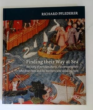
Finding their Way at Sea. The Story of Portolan Charts, the Cartographers who Drew them and the Mariners who Sailed by them.
Lingua: Inglese
Editore: Goy-Houten, HES & De Graaf Publishers. 2012, 2012
ISBN 10: 9061944902 ISBN 13: 9789061944904
Da: Antiquariaat Schot, Hendrik-Ido-Ambacht, Paesi Bassi
Valutazione del venditore 5 su 5 stelle
EUR 28,75
Spedizione EUR 25,00
Spedito da Paesi Bassi a U.S.A.Quantit�: 12 disponibili
Aggiungi al carrelloOriginal publisher's paper-covered boards, pictorial front- & backcover, large 4to: frontispiece, title-page illustration, 168pp., 100 coloured plates & illustrations, appendix, general bibliography, index, credits illustrations, acknowledgements, about the author.
-
Finding their Way at Sea
Da: Mooney's bookstore, Den Helder, Paesi Bassi
Valutazione del venditore 4 su 5 stelle
EUR 43,42
Spedizione EUR 14,95
Spedito da Paesi Bassi a U.S.A.Quantit�: 1 disponibili
Aggiungi al carrelloCondizione: Very good.
-
Catalogue of the Portolan Charts and Atlases in the Huntington Library
Lingua: Inglese
Editore: Pflederer, Richard L., USA, 2004
Copia autografata
Hardcover. Condizione: Fine. Hardcover. Brown cloth over boards, gilt text on spine. Color fold-out maps and charts comprise nearly half of the book. Clean, square copy. Text and images unmarked. 158 pp. tb/walk. Inscribed by Author(s).
-
Finding their Way at Sea: The Story of the Portolan Charts, The Cartographers Who Drew Them, and the Mariners Who Sailed By Them
Prima edizione Copia autografata
Hardcover. Condizione: Fine. 1st Edition. Fine hardcover in illustrated boards. Inscribed and Signed by Pflederer on the title page. Overall a bright and attractive copy with no signs of wear or aging. Illustrated throughout. 167 pp. Signed by Author(s).
-
Finding Their Way at Sea: The Story of Portolan Charts, the Cartographers Who Drew Them and the Mariners Who Sailed by Them
Da: Revaluation Books, Exeter, Regno Unito
Valutazione del venditore 5 su 5 stelle
EUR 55,07
Spedizione EUR 17,36
Spedito da Regno Unito a U.S.A.Quantit�: 2 disponibili
Aggiungi al carrelloHardcover. Condizione: Brand New. 01 edition. 167 pages. 11.50x9.75x0.75 inches. In Stock.
-
Finding their Way at Sea
Da: Brook Bookstore, Milano, MI, Italia
Valutazione del venditore 4 su 5 stelle
EUR 55,24
Spedizione EUR 37,99
Spedito da Italia a U.S.A.Quantit�: 16 disponibili
Aggiungi al carrelloCondizione: new.
-
Findin their way at sea. The story of portolan charts, the cartographers who drew them and the mariners who sailed by them.
Editore: Houten, Hes & de Graaf, ., 2012
Da: Bibliographica Christian H�flich, Hamburg, HH, Germania
Valutazione del venditore 5 su 5 stelle
EUR 38,00
Spedizione EUR 25,00
Spedito da Germania a U.S.A.Quantit�: 1 disponibili
Aggiungi al carrelloMit zahlr. farb. Abbildungen. 167 S. Illustr. Orig.-Pappband. 29,8 : 25,2 cm. * Mit einem Vorwort von Tony Campbell. - Reich illustrierten Darstellung zur Geschichte und Verwendung von Portolankarten. - Mit Bibliographie und Register. - Sehr gut erhalten.
-

Catalogue of the Portolan Charts and Atlases in the Huntington Library
Editore: United States of America, Richard L. Pflederer, 2004
EUR 53,90
Spedizione EUR 20,00
Spedito da Paesi Bassi a U.S.A.Quantit�: 1 disponibili
Aggiungi al carrelloCondizione: Good. Gilt artificial leather, 157p. + foldable maps in colour; based on a detailed physical inspection completed on site during the years 2001-2003.
-
Testarossa
Da: THE SAINT BOOKSTORE, Southport, Regno Unito
Valutazione del venditore 5 su 5 stelle
EUR 45,08
Spedizione EUR 18,53
Spedito da Regno Unito a U.S.A.Quantit�: Pi� di 20 disponibili
Aggiungi al carrelloPaperback. Condizione: New. This item is printed on demand. New copy - Usually dispatched within 5-9 working days.
-

EUR 57,33
Spedizione EUR 62,91
Spedito da Germania a U.S.A.Quantit�: 1 disponibili
Aggiungi al carrelloTaschenbuch. Condizione: Neu. nach der Bestellung gedruckt Neuware - Printed after ordering - In the latter years of Queen Mary's short and turbulent reign in the mid-sixteenth century, England was still on the cusp of acquiring the reputation as a great sea faring nation that would come in the Elizabethan era. Into the hotbed of religious and political turmoil that was England at this time came a gentleman of possibly Italian lineage. How he came to be in London and for what reason he produced this work, we are not sure. What we do know however, is that he created a visually stunning and technically brilliant navigation manual of which we believe this to be the only version in existence.A fascinating insight into the perspective of the physical world at that time, the manuscript has been analysed and a commentary produced in both English and Italian, by Richard Pflederer, Fellow of the RGS-IBG, and a worldwide authority on portolan charts and navigational science. Produced in full colour, this reproduction is a 'must-have' for anyone interested in the study of navigational history or simply for the lay person as a beautifully produced window into times past.As Francis Herbert, former Curator of Maps at the RGS-IBG and under whose aegis this facsimile was created, comments; 'a long way from one handwritten work of 1557, to a scanned copy available to all in 2007'.
-

EUR 81,03
Spedizione EUR 48,99
Spedito da Germania a U.S.A.Quantit�: Pi� di 20 disponibili
Aggiungi al carrelloCondizione: New. Dieser Artikel ist ein Print on Demand Artikel und wird nach Ihrer Bestellung fuer Sie gedruckt. KlappentextIn the latter years of Queen Mary s short and turbulent reign in the mid-sixteenth century, England was still on the cusp of acquiring the reputation as a great sea faring nation that would come in the Elizabethan era. Into th.
-

EUR 84,05
Spedizione EUR 70,00
Spedito da Germania a U.S.A.Quantit�: 5 disponibili
Aggiungi al carrelloTaschenbuch. Condizione: Neu. TESTAROSSA Mid-Sixteenth Century Maps From The Archives at The Royal Geographical Society. | Richard Pflederer | Taschenbuch | Kartoniert / Broschiert | Englisch | 2016 | Naval & Military Press | EAN 9781905748587 | Verantwortliche Person f�r die EU: Libri GmbH, Europaallee 1, 36244 Bad Hersfeld, gpsr[at]libri[dot]de | Anbieter: preigu Print on Demand.

