
Importo totale (1 articolo articoli):
Destinazione ordine:

ryan lanclos (44 risultati)
Vai alla pagina principale dei risultati di ricerca
Filtri di ricerca
Tipo di articolo
- Tutti i tipi di prodotto
- Libri (44)
- Riviste e Giornali (Nessun altro risultato corrispondente a questo perfezionamento)
- Fumetti (Nessun altro risultato corrispondente a questo perfezionamento)
- Spartiti (Nessun altro risultato corrispondente a questo perfezionamento)
- Arte, Stampe e Poster (Nessun altro risultato corrispondente a questo perfezionamento)
- Fotografie (Nessun altro risultato corrispondente a questo perfezionamento)
- Mappe (Nessun altro risultato corrispondente a questo perfezionamento)
- Manoscritti e Collezionismo cartaceo (Nessun altro risultato corrispondente a questo perfezionamento)
Condizioni Maggiori informazioni
- Nuovo (38)
- Come nuovo, Ottimo o Quasi ottimo (4)
- Molto buono o Buono (2)
- Discreto o Mediocre (Nessun altro risultato corrispondente a questo perfezionamento)
- Come descritto (Nessun altro risultato corrispondente a questo perfezionamento)
Legatura
- Tutte
- Rilegato (Nessun altro risultato corrispondente a questo perfezionamento)
- Brossura (44)
Ulteriori caratteristiche
- Prima ed. (Nessun altro risultato corrispondente a questo perfezionamento)
- Copia autograf. (Nessun altro risultato corrispondente a questo perfezionamento)
- Sovracoperta (Nessun altro risultato corrispondente a questo perfezionamento)
- Con foto (21)
- Non Print on Demand (42)
Lingua (1)
Spedizione gratuita
Paese del venditore
Valutazione venditore
-
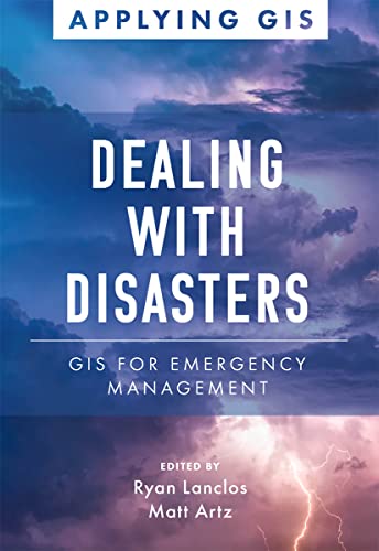
Dealing with Disasters: GIS for Emergency Management
Libro 2 di 18: Applying GISDa: ThriftBooks-Atlanta, AUSTELL, GA, U.S.A.
Valutazione del venditore 5 su 5 stelle

Paperback. Condizione: Very Good. No Jacket. May have limited writing in cover pages. Pages are unmarked. ~ ThriftBooks: Read More, Spend Less.
-
Dealing with Disasters: GIS for Emergency Management (Applying GIS, 2)
Libro 2 di 18: Applying GISDa: World of Books (was SecondSale), Montgomery, IL, U.S.A.
Valutazione del venditore 5 su 5 stelle
Condizione: Good. Item in good condition. Textbooks may not include supplemental items i.e. CDs, access codes etc.
-

Dealing With Disasters : GIS for Emergency Management
Libro 2 di 18: Applying GISDa: GreatBookPrices, Columbia, MD, U.S.A.
Valutazione del venditore 5 su 5 stelle
Condizione: New.
-

Dealing with Disasters: GIS for Emergency Management (Paperback or Softback)
Libro 2 di 18: Applying GISDa: BargainBookStores, Grand Rapids, MI, U.S.A.
Valutazione del venditore 5 su 5 stelle
Paperback or Softback. Condizione: New. Dealing with Disasters: GIS for Emergency Management. Book.
-

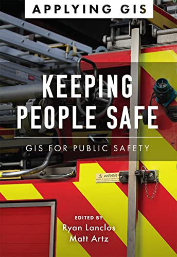
Keeping People Safe : GIS for Public Safety
Libro 5 di 18: Applying GISDa: GreatBookPrices, Columbia, MD, U.S.A.
Valutazione del venditore 5 su 5 stelle
Condizione: New.
-

Keeping People Safe: GIS for Public Safety (Paperback or Softback)
Libro 5 di 18: Applying GISDa: BargainBookStores, Grand Rapids, MI, U.S.A.
Valutazione del venditore 5 su 5 stelle
Paperback or Softback. Condizione: New. Keeping People Safe: GIS for Public Safety. Book.
-

EUR 23,27
Spedizione gratuita
Spedito in U.S.A.Quantit�: Pi� di 20 disponibili
Aggiungi al carrelloPaperback. Condizione: New. Discover a modern approach to understanding threats and hazards that are more complex, costly, and devastating than ever before. Agencies around the world rely on�geographic information systems (GIS) every day to plan for and mitigate complicated threats and hazards and coordinate emergency response and recovery efforts. Location intelligence provides the kind of deep, real-time data insights needed for managers, directors, and other decision-makers to analyze risk, gain situational awareness, and manage tomorrow's emergencies.Dealing with Disasters: GIS for Emergency Management explores a collection of real-life case studies about�emergency management agencies�successfully using GIS for real and potential hazards. Chapters are laid out to explore three primary areas of disaster management:Preparedness: To effectively reduce risks, emergency management professionals must incorporate real-time data, big data, and other critical data feeds into their analysis. Learn how organizations spanning from Arizona to Taiwan use data-driven insights to effectively prepare for worst-case scenarios.�Response: Emergency�management professionals must become more agile and informed at all points during response efforts. Find out how the US National Park Service, the Puerto Rico Emergency Operations Center, and others have successfully responded to growing threats that require agility and effective communication to save lives and property.Recovery: Recovery efforts can take years, and it's critical to avoid missteps that delay progress. See how tools like drones help refugees; imagery helps insurance companies; and maps help post-tornado efforts while aiding in prioritizing work and delivering on every recovery dollar invested in a community.Each of the three themed parts also includes a "how to get started" section�that provides ideas, strategies, tools, and actions to help jump-start your own use of GIS for emergency management, and an index organized by disaster type allows you to quickly learn or refresh yourself on GIS implementation. A collection of online resources, including additional stories, videos, new ideas and concepts, and downloadable tools and content, complements this book. Use Dealing with Disasters: GIS for Emergency Management as a guide for strategizing against and surviving the emergencies that befall communities.Introduction by Martin O'Malley, former governor of Maryland, former mayor of Baltimore, and author of Smarter Government: How to Govern for Results in the Information Age (Esri Press, 2019).
-

Keeping People Safe : GIS for Public Safety
Libro 5 di 18: Applying GISDa: GreatBookPrices, Columbia, MD, U.S.A.
Valutazione del venditore 5 su 5 stelle
Condizione: As New. Unread book in perfect condition.
-

Dealing With Disasters : GIS for Emergency Management
Libro 2 di 18: Applying GISDa: GreatBookPrices, Columbia, MD, U.S.A.
Valutazione del venditore 5 su 5 stelle
Condizione: As New. Unread book in perfect condition.
-
Keeping People Safe: GIS for Public Safety (Applying GIS, 5)
Libro 5 di 18: Applying GISDa: California Books, Miami, FL, U.S.A.
Valutazione del venditore 4 su 5 stelle

EUR 23,44
Spedizione gratuita
Spedito in U.S.A.Quantit�: Pi� di 20 disponibili
Aggiungi al carrelloCondizione: New.
-

Keeping People Safe
Libro 5 di 18: Applying GISDa: Rarewaves.com USA, London, LONDO, Regno Unito
Valutazione del venditore 5 su 5 stelle
EUR 23,84
Spedizione gratuita
Spedito da Regno Unito a U.S.A.Quantit�: 14 disponibili
Aggiungi al carrelloPaperback. Condizione: New. Discover a modern approach to help mitigate threats to public safety in your community.Creating safer, less vulnerable communities requires a modern approach to understanding threats and hazards that are more complex, costly, and devastating than ever before. Public safety agencies around the world rely on geographic information systems (GIS) technology every day to prevent, protect against, and mitigate the effects of threats and hazards in their communities. By applying GIS, you'll develop a deeper understanding of these complex threats to help you better respond to and recover from the threats that pose the greatest risk to keeping your community safe and ultimately build the resilience needed for the future.�Keeping People Safe: GIS for Public Safety�explores a collection of real-life case studies about emergency management, law enforcement, fire, rescue, emergency medical services, and homeland security agencies successfully using GIS for real and potential threats. The book also includes a "how to get started" section that provides ideas, strategies, tools, and actions to help jump-start your own use of GIS for public safety. A collection of online resources, including additional stories, videos, new ideas and concepts, and downloadable tools and content, complements this book.
-

Dealing with Disasters
Libro 2 di 18: Applying GISDa: Rarewaves.com USA, London, LONDO, Regno Unito
Valutazione del venditore 5 su 5 stelle
EUR 23,84
Spedizione gratuita
Spedito da Regno Unito a U.S.A.Quantit�: 11 disponibili
Aggiungi al carrelloPaperback. Condizione: New. Discover a modern approach to understanding threats and hazards that are more complex, costly, and devastating than ever before. Agencies around the world rely on�geographic information systems (GIS) every day to plan for and mitigate complicated threats and hazards and coordinate emergency response and recovery efforts. Location intelligence provides the kind of deep, real-time data insights needed for managers, directors, and other decision-makers to analyze risk, gain situational awareness, and manage tomorrow's emergencies.Dealing with Disasters: GIS for Emergency Management explores a collection of real-life case studies about�emergency management agencies�successfully using GIS for real and potential hazards. Chapters are laid out to explore three primary areas of disaster management:Preparedness: To effectively reduce risks, emergency management professionals must incorporate real-time data, big data, and other critical data feeds into their analysis. Learn how organizations spanning from Arizona to Taiwan use data-driven insights to effectively prepare for worst-case scenarios.�Response: Emergency�management professionals must become more agile and informed at all points during response efforts. Find out how the US National Park Service, the Puerto Rico Emergency Operations Center, and others have successfully responded to growing threats that require agility and effective communication to save lives and property.Recovery: Recovery efforts can take years, and it's critical to avoid missteps that delay progress. See how tools like drones help refugees; imagery helps insurance companies; and maps help post-tornado efforts while aiding in prioritizing work and delivering on every recovery dollar invested in a community.Each of the three themed parts also includes a "how to get started" section�that provides ideas, strategies, tools, and actions to help jump-start your own use of GIS for emergency management, and an index organized by disaster type allows you to quickly learn or refresh yourself on GIS implementation. A collection of online resources, including additional stories, videos, new ideas and concepts, and downloadable tools and content, complements this book. Use Dealing with Disasters: GIS for Emergency Management as a guide for strategizing against and surviving the emergencies that befall communities.Introduction by Martin O'Malley, former governor of Maryland, former mayor of Baltimore, and author of Smarter Government: How to Govern for Results in the Information Age (Esri Press, 2019).
-
Dealing with Disasters
Libro 2 di 18: Applying GISDa: PBShop.store US, Wood Dale, IL, U.S.A.
Valutazione del venditore 5 su 5 stelle
PAP. Condizione: New. New Book. Shipped from UK. Established seller since 2000.
-
Keeping People Safe (Paperback)
Libro 5 di 18: Applying GISDa: Grand Eagle Retail, Bensenville, IL, U.S.A.
Valutazione del venditore 5 su 5 stelle
Paperback. Condizione: new. Paperback. Discover a modern approach to help mitigate threats to public safety in your community.Creating safer, less vulnerable communities requires a modern approach to understanding threats and hazards that are more complex, costly, and devastating than ever before. Public safety agencies around the world rely on geographic information systems (GIS) technology every day to prevent, protect against, and mitigate the effects of threats and hazards in their communities. By applying GIS, you'll develop a deeper understanding of these complex threats to help you better respond to and recover from the threats that pose the greatest risk to keeping your community safe and ultimately build the resilience needed for the future.Keeping People Safe: GIS for Public Safetyexplores a collection of real-life case studies about emergency management, law enforcement, fire, rescue, emergency medical services, and homeland security agencies successfully using GIS for real and potential threats. The book also includes a "how to get started" section that provides ideas, strategies, tools, and actions to help jump-start your own use of GIS for public safety. A collection of online resources, including additional stories, videos, new ideas and concepts, and downloadable tools and content, complements this book. Shipping may be from multiple locations in the US or from the UK, depending on stock availability.
-

Paperback. Condizione: New. Discover a modern approach to help mitigate threats to public safety in your community.Creating safer, less vulnerable communities requires a modern approach to understanding threats and hazards that are more complex, costly, and devastating than ever before. Public safety agencies around the world rely on geographic information systems (GIS) technology every day to prevent, protect against, and mitigate the effects of threats and hazards in their communities. By applying GIS, you'll develop a deeper understanding of these complex threats to help you better respond to and recover from the threats that pose the greatest risk to keeping your community safe and ultimately build the resilience needed for the future.�Keeping People Safe: GIS for Public Safety�explores a collection of real-life case studies about emergency management, law enforcement, fire, rescue, emergency medical services, and homeland security agencies successfully using GIS for real and potential threats. The book also includes a "how to get started" section that provides ideas, strategies, tools, and actions to help jump-start your own use of GIS for public safety. A collection of online resources, including additional stories, videos, new ideas and concepts, and downloadable tools and content, complements this book.
-
Keeping People Safe
Libro 5 di 18: Applying GISDa: PBShop.store US, Wood Dale, IL, U.S.A.
Valutazione del venditore 5 su 5 stelle
PAP. Condizione: New. New Book. Shipped from UK. Established seller since 2000.
-
Keeping People Safe
Libro 5 di 18: Applying GISDa: PBShop.store UK, Fairford, GLOS, Regno Unito
Valutazione del venditore 5 su 5 stelle
EUR 23,45
Spedizione EUR 3,81
Spedito da Regno Unito a U.S.A.Quantit�: 15 disponibili
Aggiungi al carrelloPAP. Condizione: New. New Book. Shipped from UK. Established seller since 2000.
-
Dealing with Disasters
Libro 2 di 18: Applying GISDa: PBShop.store UK, Fairford, GLOS, Regno Unito
Valutazione del venditore 5 su 5 stelle
EUR 23,45
Spedizione EUR 3,81
Spedito da Regno Unito a U.S.A.Quantit�: 15 disponibili
Aggiungi al carrelloPAP. Condizione: New. New Book. Shipped from UK. Established seller since 2000.
-
Dealing with Disasters (Paperback)
Libro 2 di 18: Applying GISDa: Grand Eagle Retail, Bensenville, IL, U.S.A.
Valutazione del venditore 5 su 5 stelle
Paperback. Condizione: new. Paperback. Discover a modern approach to understanding threats and hazards that are more complex, costly, and devastating than ever before. Agencies around the world rely ongeographic information systems (GIS) every day to plan for and mitigate complicated threats and hazards and coordinate emergency response and recovery efforts. Location intelligence provides the kind of deep, real-time data insights needed for managers, directors, and other decision-makers to analyze risk, gain situational awareness, and manage tomorrow's emergencies.Dealing with Disasters: GIS for Emergency Management explores a collection of real-life case studies aboutemergency management agenciessuccessfully using GIS for real and potential hazards. Chapters are laid out to explore three primary areas of disaster management:Preparedness: To effectively reduce risks, emergency management professionals must incorporate real-time data, big data, and other critical data feeds into their analysis. Learn how organizations spanning from Arizona to Taiwan use data-driven insights to effectively prepare for worst-case scenarios.Response: Emergencymanagement professionals must become more agile and informed at all points during response efforts. Find out how the US National Park Service, the Puerto Rico Emergency Operations Center, and others have successfully responded to growing threats that require agility and effective communication to save lives and property.Recovery: Recovery efforts can take years, and it's critical to avoid missteps that delay progress. See how tools like drones help refugees; imagery helps insurance companies; and maps help post-tornado efforts while aiding in prioritizing work and delivering on every recovery dollar invested in a community.Each of the three themed parts also includes a "how to get started" sectionthat provides ideas, strategies, tools, and actions to help jump-start your own use of GIS for emergency management, and an index organized by disaster type allows you to quickly learn or refresh yourself on GIS implementation. A collection of online resources, including additional stories, videos, new ideas and concepts, and downloadable tools and content, complements this book. Use Dealing with Disasters: GIS for Emergency Management as a guide for strategizing against and surviving the emergencies that befall communities.Introduction by Martin O'Malley, former governor of Maryland, former mayor of Baltimore, and author of Smarter Government: How to Govern for Results in the Information Age (Esri Press, 2019). Discover a modern approach using geographic information systems (GIS) to understand threats and hazards to communities with Dealing with Disasters: GIS for Emergency Management. Shipping may be from multiple locations in the US or from the UK, depending on stock availability.
-
Keeping People Safe: GIS for Public Safety (Applying GIS, 5)
Libro 5 di 18: Applying GISDa: Russell Books, Victoria, BC, Canada
Valutazione del venditore 5 su 5 stelle
EUR 18,16
Spedizione EUR 17,49
Spedito da Canada a U.S.A.Quantit�: Pi� di 20 disponibili
Aggiungi al carrelloPaperback. Condizione: New. Special order direct from the distributor.
-
Dealing with Disasters: GIS for Emergency Management
Libro 2 di 18: Applying GISDa: Russell Books, Victoria, BC, Canada
Valutazione del venditore 5 su 5 stelle
EUR 18,16
Spedizione EUR 17,49
Spedito da Canada a U.S.A.Quantit�: 1 disponibili
Aggiungi al carrelloCondizione: New. Special order direct from the distributor.
-
Dealing with Disasters: GIS for Emergency Management: 2 (Applying GIS, 2)
Libro 2 di 18: Applying GISDa: Chiron Media, Wallingford, Regno Unito
Valutazione del venditore 5 su 5 stelle
EUR 18,46
Spedizione EUR 17,96
Spedito da Regno Unito a U.S.A.Quantit�: Pi� di 20 disponibili
Aggiungi al carrelloPaperback. Condizione: New.
-

Keeping People Safe : GIS for Public Safety
Libro 5 di 18: Applying GISDa: GreatBookPricesUK, Woodford Green, Regno Unito
Valutazione del venditore 5 su 5 stelle
EUR 21,18
Spedizione EUR 17,39
Spedito da Regno Unito a U.S.A.Quantit�: 9 disponibili
Aggiungi al carrelloCondizione: New.
-

Dealing With Disasters : GIS for Emergency Management
Libro 2 di 18: Applying GISDa: GreatBookPricesUK, Woodford Green, Regno Unito
Valutazione del venditore 5 su 5 stelle
EUR 21,18
Spedizione EUR 17,39
Spedito da Regno Unito a U.S.A.Quantit�: 8 disponibili
Aggiungi al carrelloCondizione: New.
-
Dealing With Disasters: Gis for Emergency Management
Libro 2 di 18: Applying GISDa: Revaluation Books, Exeter, Regno Unito
Valutazione del venditore 5 su 5 stelle
EUR 28,07
Spedizione EUR 11,59
Spedito da Regno Unito a U.S.A.Quantit�: 2 disponibili
Aggiungi al carrelloPaperback. Condizione: Brand New. 150 pages. 8.00x5.50x0.50 inches. In Stock.
-
Keeping People Safe: GIS for Public Safety (Applying GIS, 5)
Libro 5 di 18: Applying GISDa: Ria Christie Collections, Uxbridge, Regno Unito
Valutazione del venditore 5 su 5 stelle
EUR 25,90
Spedizione EUR 13,89
Spedito da Regno Unito a U.S.A.Quantit�: Pi� di 20 disponibili
Aggiungi al carrelloCondizione: New. In.
-
Dealing with Disasters: GIS for Emergency Management (Applying GIS, 2)
Libro 2 di 18: Applying GISDa: Ria Christie Collections, Uxbridge, Regno Unito
Valutazione del venditore 5 su 5 stelle
EUR 27,64
Spedizione EUR 13,89
Spedito da Regno Unito a U.S.A.Quantit�: Pi� di 20 disponibili
Aggiungi al carrelloCondizione: New. In.
-
Keeping People Safe : GIS for Public Safety
Libro 5 di 18: Applying GISDa: GreatBookPricesUK, Woodford Green, Regno Unito
Valutazione del venditore 5 su 5 stelle
EUR 24,99
Spedizione EUR 17,39
Spedito da Regno Unito a U.S.A.Quantit�: 9 disponibili
Aggiungi al carrelloCondizione: As New. Unread book in perfect condition.
-
Dealing With Disasters : GIS for Emergency Management
Libro 2 di 18: Applying GISDa: GreatBookPricesUK, Woodford Green, Regno Unito
Valutazione del venditore 5 su 5 stelle
EUR 24,99
Spedizione EUR 17,39
Spedito da Regno Unito a U.S.A.Quantit�: 8 disponibili
Aggiungi al carrelloCondizione: As New. Unread book in perfect condition.
-
Keeping People Safe: GIS for Public Safety
Libro 5 di 18: Applying GISDa: THE SAINT BOOKSTORE, Southport, Regno Unito
Valutazione del venditore 5 su 5 stelle
EUR 27,55
Spedizione EUR 15,13
Spedito da Regno Unito a U.S.A.Quantit�: Pi� di 20 disponibili
Aggiungi al carrelloPaperback / softback. Condizione: New. New copy - Usually dispatched within 4 working days.