Importo totale (1 articolo articoli):
Destinazione ordine:

schneider weigel (19 risultati)
Vai alla pagina principale dei risultati di ricerca
Filtri di ricerca
Tipo di articolo
- Tutti i tipi di prodotto
- Libri (10)
- Riviste e Giornali (Nessun altro risultato corrispondente a questo perfezionamento)
- Fumetti (Nessun altro risultato corrispondente a questo perfezionamento)
- Spartiti (Nessun altro risultato corrispondente a questo perfezionamento)
- Arte, Stampe e Poster (Nessun altro risultato corrispondente a questo perfezionamento)
- Fotografie (Nessun altro risultato corrispondente a questo perfezionamento)
- Mappe (9)
- Manoscritti e Collezionismo cartaceo (Nessun altro risultato corrispondente a questo perfezionamento)
Condizioni Maggiori informazioni
- Nuovo (4)
- Come nuovo, Ottimo o Quasi ottimo (1)
- Molto buono o Buono (4)
- Discreto o Mediocre (Nessun altro risultato corrispondente a questo perfezionamento)
- Come descritto (10)
Legatura
Ulteriori caratteristiche
- Prima ed. (1)
- Copia autograf. (1)
- Sovracoperta (Nessun altro risultato corrispondente a questo perfezionamento)
- Con foto (18)
- Non Print on Demand (18)
Lingua (2)
Spedizione gratuita
- Spedizione gratuita in U.S.A. (Nessun altro risultato corrispondente a questo perfezionamento)
Paese del venditore
Valutazione venditore
-
Joachim Kersten - Digitalis purpurea. Ausstellungskatalog.
Editore: Selbstverlag, Schweinfurt, 2006
ISBN 10: 393604225X ISBN 13: 9783936042252
Da: AphorismA gGmbH, Berlin-Kreuzberg, Germania
Valutazione del venditore 5 su 5 stelle

EUR 5,25
Spedizione EUR 13,50
Spedito da Germania a U.S.A.Quantità: 1 disponibili
Aggiungi al carrelloHC. Schweinfurter Museumsschriften 142/2006; 96 Seiten; Kunst Kunst Gut erhalten, Einband leichte Gebrauchsspuren, innen tadellos.
-

Hans Weigel für Anfänger - Zum Fünfundsiebzigsten zusammengestellt und mit einem Nachwort versehen von seinem Freund Rolf Schneider - Verlegt von seinen Freunden bei Ullstein.
Lingua: Tedesco
Editore: Ullstein Taschenbuchverlag., 1983
ISBN 10: 3548204031 ISBN 13: 9783548204031
Da: Antiquariat Deinbacher, Murstetten, Austria
Valutazione del venditore 5 su 5 stelle
Prima edizione Copia autografata
EUR 14,00
Spedizione EUR 42,00
Spedito da Austria a U.S.A.Quantità: 1 disponibili
Aggiungi al carrello8° , Softcover/Paperback. 1.Auflage,. 172 Seiten Einband etwas berieben, ansonst guter und sauberer Zustand. ---------------------------------------------------------------------- am Schmutztitel von Hans Weigel Signiert 9783548204031 Sprache: Deutsch Gewicht in Gramm: 170.
-

Hans Weigel für Anfänger. Zusammengestellt und mit einem Nachwort versehen von seinem Freund Rolf Schneider
Da: Antiquariat Wortschatz, Markt Hartmannsdorf, Austria
Valutazione del venditore 5 su 5 stelle
EUR 5,00
Spedizione EUR 60,00
Spedito da Austria a U.S.A.Quantità: 1 disponibili
Aggiungi al carrelloSoftcover/Taschenbuch. Condizione: Gut. kA (illustratore). kA. Auflage. Anzahl Bände: 1 - Bd.Nr.: kA - Sprache: de - Einband: Paperback - Gewicht: 200 - Illust.: kA - Zustand: Gut - leichte Benutzungspuren.
-

Informationstechnik kompakt: Theoretische Grundlagen
Lingua: Tedesco
Editore: Vieweg Verlagsgesellschaft, 1999
ISBN 10: 3528038713 ISBN 13: 9783528038717
EUR 7,33
Spedizione EUR 62,30
Spedito da Germania a U.S.A.Quantità: 1 disponibili
Aggiungi al carrellopaperback. Condizione: Gut. 384 Seiten; 9783528038717.3 Gewicht in Gramm: 1.
-

Informationstechnik kompakt
Da: Chiron Media, Wallingford, Regno Unito
Valutazione del venditore 5 su 5 stelle
EUR 63,17
Spedizione EUR 17,91
Spedito da Regno Unito a U.S.A.Quantità: 10 disponibili
Aggiungi al carrelloPaperback. Condizione: New.
-

EUR 48,30
Spedizione EUR 48,99
Spedito da Germania a U.S.A.Quantità: Più di 20 disponibili
Aggiungi al carrelloCondizione: New. KlappentextrnrnThis scarce antiquarian book is a facsimile reprint of the original. Due to its age, it may contain imperfections such as marks, notations, marginalia and flawed pages. Because we believe this work is culturally important, we have.
-
Atlas antiquus et medii Aevi, minor bestehend in XI accuraten sauber gestochenen Kärtchen zur Erlernung der Alten und Mittlern Erdbeschreibung zum Unterricht der Jugend, bei Lesung der heiligen Schrift und der Profan-Autoren.
Editore: Nürnberg, Weigel und Schneider (1791)., 1791
Da: NORDDEUTSCHES ANTIQUARIAT, Rostock, Germania
Valutazione del venditore 5 su 5 stelle
EUR 240,00
Spedizione EUR 42,00
Spedito da Germania a U.S.A.Quantità: 1 disponibili
Aggiungi al carrelloQuer-8° (ca. 20 x 24 cm) 4 S. Text, 11 altkolorierte Kupferstich-Karten. Original-Pappband mit Rückenschild. Handschriftlicher Eintrag auf Vorsatz ".Fahrenholtz (?), Halberstadt, d. II. Juni 1791". Blätter gebräunt, Ränder teils abgegriffen u. stärker braunfleckig. Durchgängig feuchtigkeitsrandig, teils Verfärbungen u. wenig Farbabklatsch auf den zwischengehefteten weissen Blättern. Hinterer Deckel unten u. teils die Blätter am unteren Rand stockfleckig. Einband stark fleckig, berieben u. bestossen. - Im Text werben die Verleger für diesen "kleinen Schulatlas . in bequemen Format", neben ihrer "grossen Ausgabe" des Atlas Antiquus Danvillianus von d'Anville und für weitere "historische und geographische Schriften, welche bei uns in Menge zu haben sind. ." - SW: Altlanten, Schultatlanten - Versandkosten innerhalb Deutschlands EUR 5,00 (versicherter Versand).
-

EUR 62,74
Spedizione EUR 63,95
Spedito da Germania a U.S.A.Quantità: 2 disponibili
Aggiungi al carrelloTaschenbuch. Condizione: Neu. Neuware - This scarce antiquarian book is a facsimile reprint of the original. Due to its age, it may contain imperfections such as marks, notations, marginalia and flawed pages. Because we believe this work is culturally important, we have made it available as part of our commitment for protecting, preserving, and promoting the world's literature in affordable, high quality, modern editions that are true to the original work.
-
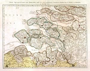
'NEUE SPECIAL-CHARTE VON ZEELAND UND DER OST- UND WESTER-SCHELDE'. Detailed map of Zeeland, the southwestern part of The Netherlands
Editore: Christoph Weigel and Adam Gottlieb Schneider 1785, 1785
Da: Garwood & Voigt, Sevenoaks, Regno Unito
Valutazione del venditore 5 su 5 stelle
Mappa
EUR 178,64
Spedizione EUR 34,69
Spedito da Regno Unito a U.S.A.Quantità: 1 disponibili
Aggiungi al carrelloCondizione: Fine. 31x41cm. Original outline colour. Excellent condition. Separately published. Rare. - Weigel and Schneider, publishers in Nürnberg.
-

Karte von Ostindien Disseits des Ganges
Editore: Nuremberg, Germany, 1788
Da: Alexandre Antique Prints, Maps & Books, Toronto, ON, Canada
Membro dell'associazione: ABAC ILAB
Valutazione del venditore 5 su 5 stelle
Mappa
EUR 243,41
Spedizione EUR 5,16
Spedito da Canada a U.S.A.Quantità: 1 disponibili
Aggiungi al carrelloAn interesting 18th century map of India published in Germany. , Size : 230x200 (mm), 9x7.875 (Inches), Original Hand Coloring Very Good, margins extended.Backed on acid free tissue paper for long term preservation.
-

Das Deutsche Reich nach neuesten Friedensschlüssen entworfen und nach den Besitzungen der Kur und Fürstlichen Häuser und der 6 Reichsstädte neu abgetheilt im Verlage Adam Gottlieb Schneider u. Weigels. Kaiserl: privil: Kunsthandlung in Nürnberg 1803. Das Deutsche Reich nach neuesten Friedensschlüssen entworfen und nach den Besitzungen der Kur und Fürstlichen Häuser und der 6 Reichsstädte neu abgetheilt im.
Editore: Nürnberg, 1803
Da: Antiquariat Reinhold Berg eK Inh. R.Berg, Regensburg, Germania
Membro dell'associazione: ILAB VDA
Valutazione del venditore 5 su 5 stelle
Mappa
EUR 225,00
Spedizione EUR 24,00
Spedito da Germania a U.S.A.Quantità: 1 disponibili
Aggiungi al carrelloOther. Hand-Colored Original Copperplate Engraving by Schneider u. Weigel, depicting Das Deutsche Reich nach neuesten Friedensschlüssen entworfen und nach den Besitzungen der Kur und Fürstlichen Häuser und der 6 Reichsstädte neu abgetheilt im Verlage Adam Gottlieb Schneider u. Weigels. Kaiserl: privil: Kunsthandlung in Nürnberg 1803. Published Nürnberg, 1803. Sheet: 530 by 685mm (20 by 27 inches). A fine and original hand-colored example of Schneider u. Weigel's celebrated cartographic work, documenting this region of Germany with the precision and decorative artistry characteristic of the 18000s. Christoph Weigel (1654-1725) was a German engraver, art dealer, and publisher based in Nuremberg. He was one of the most active publishers of illustrated books and maps in early 18th-century Germany, producing maps, city views, and topographic prints of high quality. His maps of German territories are distinguished by their careful engraving and are valued by collectors for their historical accuracy and decorative appeal.This original copperplate engraving, with original hand coloring depicts the region of Das Deutsche Reich nach neuesten Friedensschlüssen entworfen und nach den Besitzungen der Kur und Fürstlichen Häuser und der 6 Reichsstädte neu abgetheilt im Verlage Adam Gottlieb Schneider u. Weigels. Kaiserl: privil: Kunsthandlung in Nürnberg 1803., published in Nürnberg, 1803. The map records the political and geographic boundaries of the region as understood in 1803, offering a fascinating window into the history of German territorial organization. Sheet measures 530 by 685mm (20 by 27 inches). In good condition, showing expected signs of age. Ready to frame. In excellent condition. 530 by 685mm (20 by 27 inches).
-

Der Niedersächsische Kreis nach dem beygefügten Verzeichniss astronomischer Beobachtungen, und den vorzüglichsten Specialkarten entworfen. Nürnberg, in der Kais. privil. Kunsthandlung Adam Gottlieb Schneider u. Weigel. 1802. Der Niedersächsische Kreis nach dem beygefügten Verzeichniss astronomischer Beobachtungen, und den vorzüglichsten Specialkarten entworfen. Nürnberg, in der K.
Editore: Kais. privil. Kunsthandlung Adam Gottlieb Schneider u. Weigel, Nürnberg, 1802
Da: Antiquariat Reinhold Berg eK Inh. R.Berg, Regensburg, Germania
Membro dell'associazione: ILAB VDA
Valutazione del venditore 5 su 5 stelle
Mappa
EUR 290,00
Spedizione EUR 24,00
Spedito da Germania a U.S.A.Quantità: 1 disponibili
Aggiungi al carrelloOther. Hand-Colored Original Copperplate Engraving by Schneider u. Weigel, depicting Der Niedersächsische Kreis nach dem beygefügten Verzeichniss astronomischer Beobachtungen, und den vorzüglichsten Specialkarten entworfen. Nürnberg, in der Kais. privil. Kunsthandlung Adam Gottlieb Schneider u. Weigel. 1802. Published Nürnberg, Kais. privil. Kunsthandlung Adam Gottlieb Schneider u. Weigel, 1802. Sheet: 530 by 685mm (20 by 27 inches). A fine and original hand-colored example of Schneider u. Weigel's celebrated cartographic work, documenting this region of Germany with the precision and decorative artistry characteristic of the 18000s. Christoph Weigel (1654-1725) was a German engraver, art dealer, and publisher based in Nuremberg. He was one of the most active publishers of illustrated books and maps in early 18th-century Germany, producing maps, city views, and topographic prints of high quality. His maps of German territories are distinguished by their careful engraving and are valued by collectors for their historical accuracy and decorative appeal.This original copperplate engraving, with original hand coloring depicts the region of Der Niedersächsische Kreis nach dem beygefügten Verzeichniss astronomischer Beobachtungen, und den vorzüglichsten Specialkarten entworfen. Nürnberg, in der Kais. privil. Kunsthandlung Adam Gottlieb Schneider u. Weigel. 1802., published in Nürnberg, Kais. privil. Kunsthandlung Adam Gottlieb Schneider u. Weigel, 1802. The map features a decorative Baroque cartouche containing the title inscription. A distance scale is incorporated within the cartouche or alongside it. The map records the political and geographic boundaries of the region as understood in 1802, offering a fascinating window into the history of German territorial organization. Sheet measures 530 by 685mm (20 by 27 inches). In good condition, showing expected signs of age. Ready to frame. In excellent condition. 530 by 685mm (20 by 27 inches). 530 by 685mm (20 by 27 inches).
-

Generalkarte von Europa, nach den neuesten astronomischen Beobachtungen, den vorzüglichsten Special-Karten und zu Theil noch nicht gestochenen Zeichnungen auf das genaueste entworfen und nach den jetzigen Grenzen richtig abgetheilt, herausgegeben. Kunsthandlung Adam Gottlieb Schneider u. Weigel. 1804. Generalkarte von Europa A. G. Schneider & J. C. Weigel, Nürnberg 1804 Original Hand-Colored Copper Engraving Large Antique Map of Europe
Editore: Adam Gottlieb Schneider und Johann Christoph Weigel, Nürnberg, 1804
Da: Antiquariat Reinhold Berg eK Inh. R.Berg, Regensburg, Germania
Membro dell'associazione: ILAB VDA
Valutazione del venditore 5 su 5 stelle
Mappa
EUR 445,00
Spedizione EUR 24,00
Spedito da Germania a U.S.A.Quantità: 1 disponibili
Aggiungi al carrelloOther. Large and highly detailed antique map of Europe in original outline and wash color, published by Adam Gottlieb Schneider and Johann Christoph Weigel, Nuremberg, 1804. Image: 517 x 597 mm (20.25 x 23.5 inches). Political borders in color; underlined place names denoting Russian governorships. Extends north to Greenland and Iceland an exceptional large-format early 19th-century German map. Johann Christoph Weigel (Christoph Weigel the Elder; 16541725) was a prominent German engraver, art dealer, and publisher based in Nuremberg, working in close association with the great Johann Baptist Homann. His maps were immediately hand-colored in outline and decorative wash upon printing, maintaining the high standard of the Nuremberg cartographic school. Adam Gottlieb Schneider (active 17941805) continued this tradition, following the lineage of Homann, Seutter, and Lotter, maintaining the Nuremberg school's reputation into the early 19th century.This large and impressive map of Europe was published in 1804 just as Napoleon was reshaping the continent and captures the political geography in remarkable detail. The underlined place names denote Russian governorships, a distinctive feature reflecting the administrative geography of the Russian Empire. The map extends from the British Isles and Iberian Peninsula east through Russia, with mountains, rivers, and hundreds of engraved place names throughout. In the northwest, Greenland and Iceland are depicted. At 517 x 597 mm, this is a substantial large-format map in the finest Nuremberg tradition. In excellent condition. Strong, sharp impression. Colors fresh and well-preserved. No tears, creases, or foxing. 517 x 597 mm. In excellent condition. 517 by 597mm (20 by 23 inches). 517 by 597mm (20 by 23 inches).
-

Die Oestliche Halbkugel nach den zuverlässigsten und neuesten Nachrichten besonders aber nach der 2 ten Ausgaben von Arrowsmiths Weltkarte und dessen Globular Projection den Gattererschen Angaben gemäss entworfen von S.n, herausgegeben mit Kayserl. Allergnädigsten Privilegio Nürnberg bey Adam Gottl. Schneider u. Weigel 1805.
Editore: Nürnberg, 1805
Da: Antiquariat Reinhold Berg eK Inh. R.Berg, Regensburg, Germania
Membro dell'associazione: ILAB VDA
Valutazione del venditore 5 su 5 stelle
Mappa
EUR 750,00
Spedizione EUR 24,00
Spedito da Germania a U.S.A.Quantità: 1 disponibili
Aggiungi al carrelloOther. Original antique copper engraving, hand colored in outline and wash when published. This is a hemispherical map of Eastern Hemisphere with notes and dates of discovery. In very good condition. 557 by 695mm (22 by 27 inches). 557 by 695mm (22 by 27 inches).
-

Die Westliche Halbkugel nach den zuverlässigsten und neuesten Nachrichten entworfen und nach A. Arrowsmiths Weltkarte heraus gegeben Nürnberg in der Kayserlichen privilegirten Kunst und Buchhandlung bey Ad. Gottl. Schneider und Weigel 1805.
Editore: Nürnberg, 1805
Da: Antiquariat Reinhold Berg eK Inh. R.Berg, Regensburg, Germania
Membro dell'associazione: ILAB VDA
Valutazione del venditore 5 su 5 stelle
Mappa
EUR 950,00
Spedizione EUR 24,00
Spedito da Germania a U.S.A.Quantità: 1 disponibili
Aggiungi al carrelloOther. Original antique copper engraving, hand colored in outline and wash when published. This is a hemispherical map of Western Hemisphere with notes and dates of discovery. In very good condition. 557 by 695mm (22 by 27 inches). 557 by 695mm (22 by 27 inches).
-

Hundert und acht Aesopische und andere auserlesene Fabeln nebst beigefügter Moral für die Jugend Mit Kupfern
Lingua: Tedesco
Editore: Nürnberg
EUR 560,10
Spedizione EUR 46,00
Spedito da Germania a U.S.A.Quantità: 1 disponibili
Aggiungi al carrelloAltdeutsche Schrift, seltenes Exemplar, fleckig, altersbedingt Seiten nachgedunkelt, beschädigte Seite 125 Sprache: Deutsch Gewicht in Gramm: 149.
-
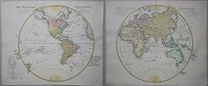
Die Westliche Halbkugel nach den zuverlässigsten und neuesten Nachrichten entworfen und nach A. Arrowsmiths Weltkarte herausgegeben - Die östliche Halbkugel nach den zuverlässigsten und neuesten Nachrichten entworfen und nach A. Arrowsmiths Weltkarte herausgegeben
Lingua: Tedesco
Data di pubblicazione: 1805
Da: Kunstantiquariat Andreas Senger, Hamburg, Germania
Valutazione del venditore 5 su 5 stelle
Mappa
EUR 1.299,00
Spedizione EUR 35,00
Spedito da Germania a U.S.A.Quantità: 1 disponibili
Aggiungi al carrelloKein Einband. Condizione: Gut. Es handelt sich hierbei um eine originale, kolorierte Kupferstich-Weltkarte in zwei Teilen von Adam Gottlieb Schneider aus dem Jahr 1805. *** Titel: Die Westliche Halbkugel nach den zuverlässigsten und neuesten Nachrichten entworfen und nach A. Arrowsmiths Weltkarte herausgegeben - Die östliche Halbkugel nach den zuverlässigsten und neuesten Nachrichten entworfen und nach A. Arrowsmiths Weltkarte herausgegeben *** Ort: Weltkarte auf zwei Blatt - Westliche Hemisphäre (Nord- und Südamerika, Ozeanien, Grönland) und östliche Hemisphäre (Europa, Afrika, Asien, Australien) *** Kartograph: Adam Gottlieb Schneider (1745 - 1815) bei Schneider & Weigel *** Jahr: 1805 *** Größe des Plattenbereichs: je 54 cm x 64 cm *** Technik: Kupferstich *** Zustand (Perfekt/ Sehr gut/ Gut/ Ordentlich/ Mäßig/ Schlecht): In gutem Erhaltungszustand. Westliche Halbkugel: Unterer linker Randbereich ergänzt, untere rechte Ecke ergänzt. --- Östliche Halbkugel: Obere und untere rechte Ecke ergänzt. Einriß am rechten Rand restauriert. *** Bemerkungen: Sehr seltene, dekorative und äußerst dekorative Weltkarte nach A. Arrowsmiths auf zwei Blatt. Der erste Kupferstich zeigt die westliche Hemisphäre mit Nord- und Südamerika, Ozeanien und Grönland. Der zweite Kupferstich zeigt die östliche Hemisphäre mit Europa, Afrika, Asien und Australien. Die westliche Hemisphäre mit detaillierten Angaben zu den europäischen Besitztümern in der Neuen Welt und zu der Inselwelt im Atlantischen- und Pazifischen Ozean. Im Nordwesten Russland mit dem russischen Archipel und der Beringstraße, im Nordosten die Baffin Bay sowie Grönland mit Island. Ganz im Südwesten Neuseeland. Referenz: Tooley, Mapmakers IV 124; Tooley Australia 1127 - - - International buyers welcome. If you have any questions, please don't hesitate to ask. --- Auf Wunsch stellen wir Ihnen gerne ein kostenfreies Echtheitszertifikat aus --- If you wish, we will gladly provide a certificate of authenticity free of charge ---.
-
America nach der zweyten Ausgabe von Arrowsmiths Weltcharte und dessen Globular-Projection
Lingua: Tedesco
Data di pubblicazione: 1806
Da: Kunstantiquariat Andreas Senger, Hamburg, Germania
Valutazione del venditore 5 su 5 stelle
Mappa
EUR 999,00
Spedizione EUR 35,00
Spedito da Germania a U.S.A.Quantità: 1 disponibili
Aggiungi al carrelloKein Einband. Condizione: Gut. Es handelt sich hierbei um eine originale, kolorierte Kupferstich-Landkarte Gesamtamerikas von Conrad Mannert aus dem Jahr 1806. *** Titel: America nach der zweyten Ausgabe von Arrowsmiths Weltcharte und dessen Globular-Projection *** Gebiet bzw. Ort: Nord- und Südamerika *** Kartograph: Conrad Mannert (1756 - 1834) bei Schneider & Weigel *** Jahr: 1806 *** Größe des Plattenbereichs: 53 x 60 cm *** Technik: Kupferstich *** Zustand (Perfekt/ Sehr gut/ Gut/ Ordentlich/ Mäßig/ Schlecht): In gutem Erhaltungszustand. Oberer Rand hinterlegt, eine geglättete vertikale Knickspur *** Bemerkungen: Eine dekorative und seltene Karte des amerikanischen Kontinents. Unten links Farblegende zu den Besitzungen der Engländer, Portugiesen, Holländer, Franzosen, Spanier, Nordamerikanern und Russen. -- Tooley's Dic. of Mapm. Rev. Ed. K - P, S. 201 (Conrad (Konrad) Mannert, 1756-1834. Historian and geographer. .); Tooley's Dic. of Mapm. Rev. Ed. Q - Z, S. 124 f. (Adam Gottlieb Schneider, 1745-1815. Cartographer and publisher of Nuremberg. Worked with Weigel. .). - - - International buyers welcome. If you have any questions, please don't hesitate to ask. - - - America USA United states ----- Auf Wunsch stellen wir Ihnen gerne ein kostenfreies Echtheitszertifikat aus ------ If you wish, we will gladly provide a certificate of authenticity free of charge ---.
-

Warburgs Denkraum
Lingua: Tedesco
Editore: Brill Fink|Wilhelm Fink Verlag, 2014
ISBN 10: 3770550773 ISBN 13: 9783770550777
EUR 62,00
Spedizione EUR 48,99
Spedito da Germania a U.S.A.Quantità: Più di 20 disponibili
Aggiungi al carrelloKartoniert / Broschiert. Condizione: New. Dieser Artikel ist ein Print on Demand Artikel und wird nach Ihrer Bestellung fuer Sie gedruckt. Zu den besonderen Wortpraegungen des Hamburger Kunst- und Kulturwissenschaftlers Aby Warburg gehoert die Figur des Denkraums. Darunter verstand er den im Kampf mit den daemonischen Lebensmaechten gewonnenen Ort zwischen Objekt und Betrachter, an dem Reflexion.