Importo totale (1 articolo articoli):
Destinazione ordine:

stanford geographical (7 risultati)
Vai alla pagina principale dei risultati di ricerca
Filtri di ricerca
Tipo di articolo
- Tutti i tipi di prodotto
- Libri (2)
- Riviste e Giornali (Nessun altro risultato corrispondente a questo perfezionamento)
- Fumetti (Nessun altro risultato corrispondente a questo perfezionamento)
- Spartiti (Nessun altro risultato corrispondente a questo perfezionamento)
- Arte, Stampe e Poster (Nessun altro risultato corrispondente a questo perfezionamento)
- Fotografie (Nessun altro risultato corrispondente a questo perfezionamento)
- Mappe (4)
- Manoscritti e Collezionismo cartaceo (1)
Condizioni Maggiori informazioni
- Nuovo (Nessun altro risultato corrispondente a questo perfezionamento)
- Come nuovo, Ottimo o Quasi ottimo (2)
- Molto buono o Buono (3)
- Discreto o Mediocre (1)
- Come descritto (1)
Legatura
Ulteriori caratteristiche
- Prima ed. (1)
- Copia autograf. (Nessun altro risultato corrispondente a questo perfezionamento)
- Sovracoperta (Nessun altro risultato corrispondente a questo perfezionamento)
- Con foto (5)
- Non Print on Demand (7)
Lingua (1)
Prezzo
- Qualsiasi prezzo
- Inferiore a EUR 20 (Nessun altro risultato corrispondente a questo perfezionamento)
- EUR 20 a EUR 45
- Superiore a EUR 45
Spedizione gratuita
- Spedizione gratuita in U.S.A. (Nessun altro risultato corrispondente a questo perfezionamento)
Paese del venditore
Valutazione venditore
-

Principal Trade Routes of the Clipper Ships (c.1895)
Editore: Stanford Geographical, UK, 1895
Da: Maynard & Bradley, Leicester, Regno Unito
Valutazione del venditore 5 su 5 stelle

EUR 35,72
Spedizione EUR 25,41
Spedito da Regno Unito a U.S.A.Quantit�: 1 disponibili
Aggiungi al carrelloSoftcover. Condizione: Very Good. c.1895. A very presentable chart of trade routes produced for Stanford Geographical Magazine in the 1890s. Clean and well-presented across the entire image surface, with two vertical fold lines as originally presented but no other significant creases or wear. Why on Amazon do most sellers not describe their actual book? Buy with confidence and support a genuine Independent Bricks & Mortar Real Bookshop. We are Maynard & Bradley CAMBO & PBFA(now lapsed) members here in Leicester City Centre. Size: 560 x 310 mm. 1. Item Type: Book. Quantity Available: 1. Shipped Weight: Under 500 grams. Category: Geography & Maps; Britain/UK; 19th century; Inventory No: 35240.
-
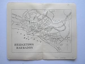
Bridgetown, Barbados
Editore: Duckworth & Co. London, 1914
Da: Angelika C. J. Friebe Ltd. - MapWoman, Dorking, Regno Unito
Membro dell'associazione: ABA ILAB
Valutazione del venditore 5 su 5 stelle
Mappa
EUR 23,85
Spedizione EUR 23,16
Spedito da Regno Unito a U.S.A.Quantit�: 1 disponibili
Aggiungi al carrelloNo Binding. Condizione: Near Fine. colour printed map; overll 17 x 18 cm. fold as issued; exc. cond. A detailed townplan of Bridgetown, Barbados from Stanford's "The Pocket Guide to The West Indies"; edited by Algeron E. Aspinall; 3rd edition.
-
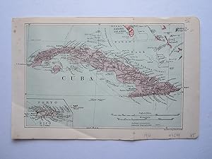
Cuba
Editore: Duckworth & Co. London, 1914
Da: Angelika C. J. Friebe Ltd. - MapWoman, Dorking, Regno Unito
Membro dell'associazione: ABA ILAB
Valutazione del venditore 5 su 5 stelle
Mappa
EUR 29,81
Spedizione EUR 23,16
Spedito da Regno Unito a U.S.A.Quantit�: 1 disponibili
Aggiungi al carrelloNo Binding. Condizione: Near Fine. colour printed map; overall 17 x 26 cm. folds as issued; exc. cond. A very detailed map of Cuba from Stanford's "The Pocket Guide to The West Indies"; edited by Algeron E. Aspinall; 3rd edition. With insets of Puerto Rico.
-

An Atlas of the World War
Editore: The Dangerfield Printing Co., Ltd circa 1918, London, England, 1918
Da: Ground Zero Books, Ltd., Silver Spring, MD, U.S.A.
Valutazione del venditore 5 su 5 stelle
Prima edizione
Wraps. Condizione: Good. Stanford Geographical Establishment (maps) (illustratore). 12 pages. Oversized volume, measuring 9-3/14 inches by 14-1/2 inches. The lower corner of pages creased. Maps are colored. Stanfords is a specialist bookshop of maps and travel books in London, established in 1853 by Edward Stanford. Its collection of maps, globes, and maritime charts is considered the world's largest. It has also supplied cartography for the British Army and for James Bond films. At the time of the shop's opening, it was the only mapmaker in London since it commissioned John Bolton as an in-house cartographer. Stanfords opened at the height of global exploration and colonialism, hence, cartographic works were in great demand. The store on Long Acre in Covent Garden, central London, was the location of the company's printing business before the entire operation moved there in January 1901. The first five maps show, without comment, the theaters of war in the West, in the East, on the Italian front, in the Balkans, and in the Asiatic possessions in Turkey. The sixth map illustrates in greater detail the British front in the West; the seventh map shows the various theaters of war in which British troops were engaged and the vast distances which they have safely traveled under the protection of the British Navy. The eighth maps demonstrates the collapse of Germany's ambitions in the East, and the ninth map illustrates the vast extent of the possessions which she has lost overseas. The tenth map shows the isolation in which Germany has placed herself by her criminal outrages on civilization, and the eleventh explains the claims to world domination. The twelfth map illustrates the growth of the military domination of Prussia, while the thirteenth is an effective exposure of the professed desire of the Central Empires for the "free devilment" of other races. The last map shows how Germany, at the commencement of the fourth year of war, is gripped in a relentless vice of steel, and points to the final and decisive victory of Great Britain and her Allies. Presumed First Edition, First printing thus.
-
[Trelawney Saunders, cartographer and map seller.] First part of long Autograph Letter to Commander James Mangles, RN, discussing his 'Illustrated Geography & Hydrography' and other works, and his desire for a London 'depot' for the sale of maps.
Editore: 6 Charing Cross London. 14 May, 1846
Da: Richard M. Ford Ltd, London, Regno Unito
Membro dell'associazione: ABA ILAB
Valutazione del venditore 5 su 5 stelle
Manoscritto / Collezionismo cartaceo
EUR 298,14
Spedizione EUR 5,21
Spedito da Regno Unito a U.S.A.Quantit�: 1 disponibili
Aggiungi al carrelloFour pages, 12mo. Bifolium. In good condition, on aged paper, with small pinholes to both leaves and slight loss at the head of the second. Substantial first part of long letter, and hence lacking the signature. BBTI has Trelawny [for Trelawney] William Saunders at 6 Charing Cross between 1846 and 1853, and Edward Stanford's entry in the Oxford DNB records that he was an apprentice there, returning as partner in 1852 ('The partnership was dissolved by mutual consent in July 1853.'), and that it was Saunders who proposed Stanford for membership of the Royal Geographical Society. A good association and a scarce example of Saunders' handwriting, which has been verified by comparison with a specimen (which will be included with the item) in the Royal Geographical Society archives. Saunders begins by expressing his 'unfeigned respect' for Mangles' 'firm & unconquerable efforts towards the production of so grand & entire a work as "The Illustrated Geography & Hydrography," of which I have received prospectuses from the Geographic[a]l. Society on Wednesday'. (Mangles published a 'Synopsis' with London publisher John Bumpus in 1848, but there is no record that the work itself was ever published.) Saunders hopes he will not be thought 'presumptuous', or acting 'from interested motives', when he states that he has 'read through all your prospectuses with avidity & am now anxious to learn something more of your fine work, and as there is no publication name mentioned, nor any other person referred to for enquiries, I have taken the liberty of addressing you directly'. He hopes Mangles will admit, on reading the enclosed 'short address', that Saunders is also 'employing the humble capacity in which providence has placed me, to promote the study of Geography'. The prospectus of Saunders' unidentified work 'has only been printed a few days', but he has 'already obtained such support, as encourages me to persevere in the plan I have laid down'. He hopes before long that there will be 'a depot in this great centre of geographic enterprise where the maps of & from all countries y be readily obtained. The pursuit of a science which requires an accumulation of materials for its successful development must be dilatory, while the means of supplying & procuring such material is confined to private societies, or scattered amongst innumerable establishments, each having a conflicting interest.' He praises Mangles' 'unique work', which he will promote, in the hope that 'the addition of my name to the splendid "Physical Atlas" [by Alexander Keith Johnston (1804-1871)] of which i enclose a prospectus, will be esteemed as one mark in my favour.' As he does not want to allow 'feelings of restraint' to curb him in communicating with Mangles on the subject, he is glad his 'person is unknown to me, inasmuch as a previous connection in our respecti positions in society would no doubt have imbued me with an idea of distance, the chains of which would now gall me excessively.' Before the letter breaks off, Saunders discusses Mangles' intention 'to divide the whole globe into sections, just like England is divided in the maps of the Ordnance Survey, with the addition of Hydrographic detail along the shores & at sea, & both variations in scale suited to the peculiar exigencies of this undertaking'. He is not sure from the prospectus whether 'you contemplate this happy continuity & oneness of plan, though I doubt not such is your intention'. The letter ends abruptly at the foot of the fourth page, with the incomplete sentence: 'Is it not possible to describe the Hydrographic portion in continuance of the Geographic, so as to avoid '. Note: None of his letters listed on the NRA, but A2A records correspondence [as "Trelawny", confusingly] at the RGS, and has other material illustrating Saunders' importance in the history of map-making and exploration, contributions ranging from "Saunders' official map of the Australian Gold Country" to the map in "Stray leaves from.
-
Stanford's Popular Map of the Seat of War in the East, including Turkey in Europe and Asia, Greece, the Black Sea, the Adjacent Parts of Austria, Russia &c; Egypt, Cairo, and Suez on the South; the Caspian Sea on the East; and Venice, Rome, and Malta on the West
Editore: Edward Stanford, London, 1877
Mappa
EUR 417,40
Spedizione EUR 28,95
Spedito da Regno Unito a U.S.A.Quantit�: 1 disponibili
Aggiungi al carrelloHardcover. Condizione: Very Good. The long title is from the front panel. The map itself is simply titled "Stanford's Popular Map of the Seat of War". Colour folding map 68 x 50cm dissected in 18 sections mounted on linen, folding into the original red cloth case 12 x 18cm with Stanford's printed label to the front and advert for Stanford's Series of New Library Maps to inner panels. Map very good, tanned with some spotting, creased to the lower right corner. Case good, marked, with partial splits and minor loss to spine cloth. Undated, c1877, dating to the Russo-Turkish War of 1877-78, which weakened and diminished the Ottoman Empire. Scale approx 1:5,000,000. Features include railways, submarine telegraph lines, and relief shown by hachures. Scarce.
-
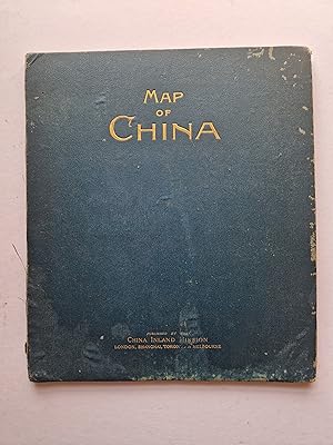
Map of China prepared for the China Inland Mission 1899.
Editore: Stanford, 1899
Da: Angelika C. J. Friebe Ltd. - MapWoman, Dorking, Regno Unito
Membro dell'associazione: ABA ILAB
Valutazione del venditore 5 su 5 stelle
Mappa
EUR 1.192,58
Spedizione EUR 23,16
Spedito da Regno Unito a U.S.A.Quantit�: 1 disponibili
Aggiungi al carrelloHardcover. Condizione: Fair. colour lithographed folding map with outline colour; overall 95 x 110 cm; folds down to 32 x 27 cm. 12 sections of cloth. Map: folds as issued; some wear and tear; paper lifting off in folds; some small paper losses within the image; pin holes in corners; stains on verso on cloth; remnants of paper where the map was attached to the cover; o/w g cond. blueish-green cloth cover; wear and tear, some staining; gold printed title; information sheet on inside; wormhole; o/w fair cond. A huge and very detailed map of China, Corea and Formosa which is regarded as one of the finest general maps of China, produced at the fin-de-siecle. This map is part of a map sequence for the China Inland Mission (CIM), published by Edward Stanford, and the first issue to be based upon the revolutionary cartography of the Russian sinologist Emil Bretschneider, labelling the locations of all the Protestant missions, while interestingly delineating the historical travel routes of the various missionary-explorers who were often the first Westerners to visit many parts of the country s interior. There s a pencil written annotation on the verso, alluding the ownership to Rev.G.W.Hinman , who was a Protestant missionary.