
Importo totale (1 articolo articoli):
Destinazione ordine:

terry bills (21 risultati)
Vai alla pagina principale dei risultati di ricerca
Filtri di ricerca
Tipo di articolo
- Tutti i tipi di prodotto
- Libri (21)
- Riviste e Giornali (Nessun altro risultato corrispondente a questo perfezionamento)
- Fumetti (Nessun altro risultato corrispondente a questo perfezionamento)
- Spartiti (Nessun altro risultato corrispondente a questo perfezionamento)
- Arte, Stampe e Poster (Nessun altro risultato corrispondente a questo perfezionamento)
- Fotografie (Nessun altro risultato corrispondente a questo perfezionamento)
- Mappe (Nessun altro risultato corrispondente a questo perfezionamento)
- Manoscritti e Collezionismo cartaceo (Nessun altro risultato corrispondente a questo perfezionamento)
Condizioni Maggiori informazioni
- Nuovo (17)
- Come nuovo, Ottimo o Quasi ottimo (3)
- Molto buono o Buono (1)
- Discreto o Mediocre (Nessun altro risultato corrispondente a questo perfezionamento)
- Come descritto (Nessun altro risultato corrispondente a questo perfezionamento)
Legatura
- Tutte
- Rilegato (Nessun altro risultato corrispondente a questo perfezionamento)
- Brossura (21)
Ulteriori caratteristiche
- Prima ed. (Nessun altro risultato corrispondente a questo perfezionamento)
- Copia autograf. (Nessun altro risultato corrispondente a questo perfezionamento)
- Sovracoperta (1)
- Con foto (11)
- Non Print on Demand (21)
Lingua (1)
Spedizione gratuita
Paese del venditore
Valutazione venditore
-
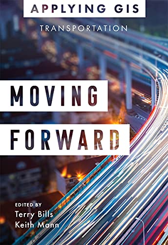
Moving Forward: GIS for Transportation
Libro 4 di 18: Applying GISDa: ThriftBooks-Atlanta, AUSTELL, GA, U.S.A.
Valutazione del venditore 5 su 5 stelle

Paperback. Condizione: Very Good. No Jacket. May have limited writing in cover pages. Pages are unmarked. ~ ThriftBooks: Read More, Spend Less.
-
Soft cover. Condizione: New. Condizione sovraccoperta: New. New Softcover book. All books Ship NEXT DAY from Wize Books (m-f) excluding holidays, when ordered before 2 PM PST with tracking and guarantee.
-

Moving Forward : Gis for Transportation
Libro 4 di 18: Applying GISDa: GreatBookPrices, Columbia, MD, U.S.A.
Valutazione del venditore 5 su 5 stelle
Condizione: As New. Unread book in perfect condition.
-
Condizione: As New. Unread copy in mint condition.
-

Moving Forward : Gis for Transportation
Libro 4 di 18: Applying GISDa: GreatBookPrices, Columbia, MD, U.S.A.
Valutazione del venditore 5 su 5 stelle
Condizione: New.
-
Condizione: New. Brand New.
-

Paperback. Condizione: New. Drive innovation, expand capacity, coordinate maintenance, and reduce costs.Location intelligence is changing the way transportation agencies and departments protect and maintain their infrastructure and achieve operational excellence. Mapping plays a big part, but geospatial analytics, real-time dashboards, and mobile applications are driving new, more efficient workflows and paving the way for innovative, cost-effective solutions.��With advancements in smart technologies, location intelligence for transportation management is not just for GIS specialists. In�Moving Forward: GIS for Transportation, see how ports, airports, transit authorities, and departments of transportation around the world have implemented geographic information systems (GIS) to visualize and analyze data for operational efficiency, safety and security, asset management, and planning and sustainability.In this collection of case studies and guidance, learn about how GIS was used to:�������Expand airport capacity within limited space, while saving millions.�������Centralize multi-faceted port security for monitoring daily operations.�������Coordinate daily transit maintenance work on $1 trillion in hard assets.�������Plan modern data governance for a state-wide department of transportation.Through web apps, online maps, dashboards, and other GIS solutions, transportation professionals develop a deeper understanding of infrastructure maintenance and operational performance within a real-world context, increasing efficiency, while improving communication and collaboration.Discover how GIS and location intelligence are helping transportation organizations strengthen their ability to maintain roads and highways, railway systems, and other vital infrastructures with�Moving Forward: Applying GIS for Transportation.
-

Moving Forward
Libro 4 di 18: Applying GISDa: Rarewaves.com USA, London, LONDO, Regno Unito
Valutazione del venditore 5 su 5 stelle
EUR 23,62
Spedizione gratuita
Spedito da Regno Unito a U.S.A.Quantit�: 6 disponibili
Aggiungi al carrelloPaperback. Condizione: New. Drive innovation, expand capacity, coordinate maintenance, and reduce costs.Location intelligence is changing the way transportation agencies and departments protect and maintain their infrastructure and achieve operational excellence. Mapping plays a big part, but geospatial analytics, real-time dashboards, and mobile applications are driving new, more efficient workflows and paving the way for innovative, cost-effective solutions.��With advancements in smart technologies, location intelligence for transportation management is not just for GIS specialists. In�Moving Forward: GIS for Transportation, see how ports, airports, transit authorities, and departments of transportation around the world have implemented geographic information systems (GIS) to visualize and analyze data for operational efficiency, safety and security, asset management, and planning and sustainability.In this collection of case studies and guidance, learn about how GIS was used to:�������Expand airport capacity within limited space, while saving millions.�������Centralize multi-faceted port security for monitoring daily operations.�������Coordinate daily transit maintenance work on $1 trillion in hard assets.�������Plan modern data governance for a state-wide department of transportation.Through web apps, online maps, dashboards, and other GIS solutions, transportation professionals develop a deeper understanding of infrastructure maintenance and operational performance within a real-world context, increasing efficiency, while improving communication and collaboration.Discover how GIS and location intelligence are helping transportation organizations strengthen their ability to maintain roads and highways, railway systems, and other vital infrastructures with�Moving Forward: Applying GIS for Transportation.
-
Moving Forward
Libro 4 di 18: Applying GISDa: PBShop.store US, Wood Dale, IL, U.S.A.
Valutazione del venditore 5 su 5 stelle
PAP. Condizione: New. New Book. Shipped from UK. Established seller since 2000.
-
Moving Forward
Libro 4 di 18: Applying GISDa: PBShop.store UK, Fairford, GLOS, Regno Unito
Valutazione del venditore 4 su 5 stelle

EUR 22,35
Spedizione EUR 3,77
Spedito da Regno Unito a U.S.A.Quantit�: 15 disponibili
Aggiungi al carrelloPAP. Condizione: New. New Book. Shipped from UK. Established seller since 2000.
-
Moving Forward (Paperback)
Libro 4 di 18: Applying GISDa: Grand Eagle Retail, Bensenville, IL, U.S.A.
Valutazione del venditore 5 su 5 stelle
Paperback. Condizione: new. Paperback. Drive innovation, expand capacity, coordinate maintenance, and reduce costs.Location intelligence is changing the way transportation agencies and departments protect and maintain their infrastructure and achieve operational excellence. Mapping plays a big part, but geospatial analytics, real-time dashboards, and mobile applications are driving new, more efficient workflows and paving the way for innovative, cost-effective solutions.With advancements in smart technologies, location intelligence for transportation management is not just for GIS specialists. InMoving Forward: GIS for Transportation, see how ports, airports, transit authorities, and departments of transportation around the world have implemented geographic information systems (GIS) to visualize and analyze data for operational efficiency, safety and security, asset management, and planning and sustainability.In this collection of case studies and guidance, learn about how GIS was used to:Expand airport capacity within limited space, while saving millions.Centralize multi-faceted port security for monitoring daily operations.Coordinate daily transit maintenance work on $1 trillion in hard assets.Plan modern data governance for a state-wide department of transportation.Through web apps, online maps, dashboards, and other GIS solutions, transportation professionals develop a deeper understanding of infrastructure maintenance and operational performance within a real-world context, increasing efficiency, while improving communication and collaboration.Discover how GIS and location intelligence are helping transportation organizations strengthen their ability to maintain roads and highways, railway systems, and other vital infrastructures withMoving Forward: Applying GIS for Transportation. Discover how GIS and location intelligence are helping transportation organizations strengthen their vital infrastructures withMoving Forward: Applying GIS for Transportation. Shipping may be from multiple locations in the US or from the UK, depending on stock availability.
-

Moving Forward : Gis for Transportation
Libro 4 di 18: Applying GISDa: GreatBookPricesUK, Woodford Green, Regno Unito
Valutazione del venditore 5 su 5 stelle
EUR 21,80
Spedizione EUR 17,20
Spedito da Regno Unito a U.S.A.Quantit�: 17 disponibili
Aggiungi al carrelloCondizione: New.
-
Moving Forward: GIS for Transportation (Applying GIS, 4)
Libro 4 di 18: Applying GISDa: Ria Christie Collections, Uxbridge, Regno Unito
Valutazione del venditore 5 su 5 stelle
EUR 27,16
Spedizione EUR 13,73
Spedito da Regno Unito a U.S.A.Quantit�: Pi� di 20 disponibili
Aggiungi al carrelloCondizione: New. In.
-
Moving Forward: GIS for Transportation
Libro 4 di 18: Applying GISDa: THE SAINT BOOKSTORE, Southport, Regno Unito
Valutazione del venditore 5 su 5 stelle
EUR 26,98
Spedizione EUR 14,24
Spedito da Regno Unito a U.S.A.Quantit�: Pi� di 20 disponibili
Aggiungi al carrelloPaperback / softback. Condizione: New. New copy - Usually dispatched within 4 working days.
-
Moving Forward: Gis for Transportation
Libro 4 di 18: Applying GISDa: Revaluation Books, Exeter, Regno Unito
Valutazione del venditore 5 su 5 stelle
EUR 39,43
Spedizione EUR 11,46
Spedito da Regno Unito a U.S.A.Quantit�: 1 disponibili
Aggiungi al carrelloPaperback. Condizione: Brand New. 108 pages. 7.75x5.25x0.50 inches. In Stock.
-

Moving Forward
Libro 4 di 18: Applying GISDa: Rarewaves USA United, OSWEGO, IL, U.S.A.
Valutazione del venditore 5 su 5 stelle
Paperback. Condizione: New. Drive innovation, expand capacity, coordinate maintenance, and reduce costs.Location intelligence is changing the way transportation agencies and departments protect and maintain their infrastructure and achieve operational excellence. Mapping plays a big part, but geospatial analytics, real-time dashboards, and mobile applications are driving new, more efficient workflows and paving the way for innovative, cost-effective solutions.��With advancements in smart technologies, location intelligence for transportation management is not just for GIS specialists. In�Moving Forward: GIS for Transportation, see how ports, airports, transit authorities, and departments of transportation around the world have implemented geographic information systems (GIS) to visualize and analyze data for operational efficiency, safety and security, asset management, and planning and sustainability.In this collection of case studies and guidance, learn about how GIS was used to:�������Expand airport capacity within limited space, while saving millions.�������Centralize multi-faceted port security for monitoring daily operations.�������Coordinate daily transit maintenance work on $1 trillion in hard assets.�������Plan modern data governance for a state-wide department of transportation.Through web apps, online maps, dashboards, and other GIS solutions, transportation professionals develop a deeper understanding of infrastructure maintenance and operational performance within a real-world context, increasing efficiency, while improving communication and collaboration.Discover how GIS and location intelligence are helping transportation organizations strengthen their ability to maintain roads and highways, railway systems, and other vital infrastructures with�Moving Forward: Applying GIS for Transportation.
-

EUR 27,95
Spedizione EUR 48,99
Spedito da Germania a U.S.A.Quantit�: Pi� di 20 disponibili
Aggiungi al carrelloCondizione: New. InhaltsverzeichnisTentative TOC: CONTENTS Introduction How to use this book PART 1: OPERATIONAL EFFICIENCY Keeping travelers informed Wyoming Department of Transportation Sav.
-

Moving Forward (Paperback)
Libro 4 di 18: Applying GISDa: AussieBookSeller, Truganina, VIC, Australia
Valutazione del venditore 5 su 5 stelle
EUR 53,51
Spedizione EUR 31,83
Spedito da Australia a U.S.A.Quantit�: 1 disponibili
Aggiungi al carrelloPaperback. Condizione: new. Paperback. Drive innovation, expand capacity, coordinate maintenance, and reduce costs.Location intelligence is changing the way transportation agencies and departments protect and maintain their infrastructure and achieve operational excellence. Mapping plays a big part, but geospatial analytics, real-time dashboards, and mobile applications are driving new, more efficient workflows and paving the way for innovative, cost-effective solutions.With advancements in smart technologies, location intelligence for transportation management is not just for GIS specialists. InMoving Forward: GIS for Transportation, see how ports, airports, transit authorities, and departments of transportation around the world have implemented geographic information systems (GIS) to visualize and analyze data for operational efficiency, safety and security, asset management, and planning and sustainability.In this collection of case studies and guidance, learn about how GIS was used to:Expand airport capacity within limited space, while saving millions.Centralize multi-faceted port security for monitoring daily operations.Coordinate daily transit maintenance work on $1 trillion in hard assets.Plan modern data governance for a state-wide department of transportation.Through web apps, online maps, dashboards, and other GIS solutions, transportation professionals develop a deeper understanding of infrastructure maintenance and operational performance within a real-world context, increasing efficiency, while improving communication and collaboration.Discover how GIS and location intelligence are helping transportation organizations strengthen their ability to maintain roads and highways, railway systems, and other vital infrastructures withMoving Forward: Applying GIS for Transportation. Discover how GIS and location intelligence are helping transportation organizations strengthen their vital infrastructures withMoving Forward: Applying GIS for Transportation. Shipping may be from our Sydney, NSW warehouse or from our UK or US warehouse, depending on stock availability.
-

Moving Forward : Gis for Transportation
Libro 4 di 18: Applying GISDa: GreatBookPricesUK, Woodford Green, Regno Unito
Valutazione del venditore 5 su 5 stelle
EUR 73,60
Spedizione EUR 17,20
Spedito da Regno Unito a U.S.A.Quantit�: 17 disponibili
Aggiungi al carrelloCondizione: As New. Unread book in perfect condition.
-

EUR 33,24
Spedizione EUR 60,80
Spedito da Germania a U.S.A.Quantit�: 2 disponibili
Aggiungi al carrelloTaschenbuch. Condizione: Neu. Neuware - GIS for Transportation.
-

Moving Forward
Libro 4 di 18: Applying GISDa: Rarewaves.com UK, London, Regno Unito
Valutazione del venditore 5 su 5 stelle
EUR 21,79
Spedizione EUR 74,51
Spedito da Regno Unito a U.S.A.Quantit�: 6 disponibili
Aggiungi al carrelloPaperback. Condizione: New. Drive innovation, expand capacity, coordinate maintenance, and reduce costs.Location intelligence is changing the way transportation agencies and departments protect and maintain their infrastructure and achieve operational excellence. Mapping plays a big part, but geospatial analytics, real-time dashboards, and mobile applications are driving new, more efficient workflows and paving the way for innovative, cost-effective solutions.��With advancements in smart technologies, location intelligence for transportation management is not just for GIS specialists. In�Moving Forward: GIS for Transportation, see how ports, airports, transit authorities, and departments of transportation around the world have implemented geographic information systems (GIS) to visualize and analyze data for operational efficiency, safety and security, asset management, and planning and sustainability.In this collection of case studies and guidance, learn about how GIS was used to:�������Expand airport capacity within limited space, while saving millions.�������Centralize multi-faceted port security for monitoring daily operations.�������Coordinate daily transit maintenance work on $1 trillion in hard assets.�������Plan modern data governance for a state-wide department of transportation.Through web apps, online maps, dashboards, and other GIS solutions, transportation professionals develop a deeper understanding of infrastructure maintenance and operational performance within a real-world context, increasing efficiency, while improving communication and collaboration.Discover how GIS and location intelligence are helping transportation organizations strengthen their ability to maintain roads and highways, railway systems, and other vital infrastructures with�Moving Forward: Applying GIS for Transportation.