
Importo totale (1 articolo articoli):
Destinazione ordine:

wheat james clement (5 risultati)
Vai alla pagina principale dei risultati di ricerca
Filtri di ricerca
Tipo di articolo
- Tutti i tipi di prodotto
- Libri (5)
- Riviste e Giornali (Nessun altro risultato corrispondente a questo perfezionamento)
- Fumetti (Nessun altro risultato corrispondente a questo perfezionamento)
- Spartiti (Nessun altro risultato corrispondente a questo perfezionamento)
- Arte, Stampe e Poster (Nessun altro risultato corrispondente a questo perfezionamento)
- Fotografie (Nessun altro risultato corrispondente a questo perfezionamento)
- Mappe (Nessun altro risultato corrispondente a questo perfezionamento)
- Manoscritti e Collezionismo cartaceo (Nessun altro risultato corrispondente a questo perfezionamento)
Condizioni Maggiori informazioni
- Nuovo (Nessun altro risultato corrispondente a questo perfezionamento)
- Come nuovo, Ottimo o Quasi ottimo (Nessun altro risultato corrispondente a questo perfezionamento)
- Molto buono o Buono (2)
- Discreto o Mediocre (Nessun altro risultato corrispondente a questo perfezionamento)
- Come descritto (3)
Legatura
Ulteriori caratteristiche
Lingua (2)
Spedizione gratuita
- Spedizione gratuita in U.S.A. (Nessun altro risultato corrispondente a questo perfezionamento)
Paese del venditore
Valutazione venditore
-

An Exhibition of Maps Engraved within the Present Limits of the United States Mostly Prior to 1800.
Editore: Ann Arbor, Clements Library, University of Michigan, 1933., 1933
Da: Alexanderplatz Books, New York, NY, U.S.A.
Valutazione del venditore 5 su 5 stelle

Wrappers. Large 8vo, 16 pp. Very good copy, oversized edges of wrappers chipped at upper inside corner and with a couple of edge tears along the upper edge. Two illustrations of early maps of Michigan. 500 copies printed. Light item.
-
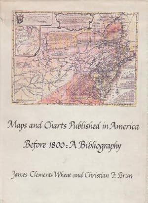
Maps and Charts Published in America before 1800, A Bibliography
Editore: Yale University Press, New Haven, Connecticut & London, 1969
Da: About Books, Henderson, NV, U.S.A.
Valutazione del venditore 5 su 5 stelle
Prima edizione Copia autografata
Hardcover. Condizione: Very Good condition. No jacket. First Edition. New Haven, Connecticut & London: Yale University Press, 1969. SIGNED by co-author Christian Brun on the title page (his signature only, NOT personalized to anyone). Very Good condition. Mild crease to one corner of a few early leaves. NOT a library discard. NO owner's name or bookplate. NO underlining. NO highlighting. NO margin notes. 1969. First Edition. Expertly described here are all separately published maps and charts in America until 1800, as well as those in books, pamphlets, almanacs, magazines, atlases, and gazetteers. Illustrated with 18 map reproductions (frontispiece in color; 1 folding). Bibliography. Index. Bound in the original gilt-stamped blue cloth. 7.75" wide by 10.25" tall. Signed by Christian F. Brun. First Edition. Hardcover. Very Good condition/No jacket. xxii, 215pp. + 18 plates . Great Packaging, Fast Shipping.
-
Maps and Charts published in America before 1800. A Bibliography. Mit 17 Abbildungen auf Tafeln.
Lingua: Inglese
Editore: New Haven, Yale University Press, 1969., 1969
Da: Antiquariat Heinz Tessin, Quickborn, Germania
Valutazione del venditore 5 su 5 stelle
EUR 85,00
Spedizione EUR 4,00
Spedito da Germania a U.S.A.Quantit�: 1 disponibili
Aggiungi al carrelloGr.-8�, XII,215 Seiten, Originalleinenband mit farbig illustriertem Original-Schutzumschlag (dieser etwas angestaubt und mit hinterlegten Einrissen).
-

Maps and Charts Published in America Before 1800: A Biography
Editore: New Haven & London. Yale University Press. 1969, 1969
Da: J. Patrick McGahern Books Inc. (ABAC), Ottawa, ON, Canada
Membro dell'associazione: ABAC ILAB
Valutazione del venditore 4 su 5 stelle

EUR 48,07
Spedizione EUR 8,58
Spedito da Canada a U.S.A.Quantit�: 1 disponibili
Aggiungi al carrellosm4to., 25cm, xxii,215p., colour frontis and 17 map & chart plates including 1 folding, references, index, blue cloth, fine in very good edge worn jacket (Ho2.3). Listing 915 maps & charts: United States (by State & Northwest), Canada (40), West Indies, Africa, Europe, Asia, and Arctic (polar projection map of 1795). Excellent reference.
-
Maps and Charts Published in America before 1800: a Bibliography.
Editore: Holland Press, 1985
Da: Yushodo Co., Ltd., Fuefuki-shi, Yamanashi Pref., Giappone
Membro dell'associazione: ILAB
Valutazione del venditore 5 su 5 stelle
EUR 108,58
Spedizione EUR 30,05
Spedito da Giappone a U.S.A.Quantit�: 1 disponibili
Aggiungi al carrelloHardcover. Condizione: Good. xxiv, 215 pp. (Holland Press Cartographica, vol. 3.) (0270 0511 Y63 2) (107).
