9781566952927 - national geographic trails illustrated topographic map holy cross / reudi reservoir: colorado di national geographic maps (12 risultati)
Da: World of Books (was SecondSale), Montgomery, IL, U.S.A.World of Books (was SecondSale)
Contatta il venditoreVenditore con 5 stelleCondizione: Usato - Buono
EUR 7,01
Spedizione gratuitaSpedito in U.S.A.Quantità: 1 disponibili
Condizione: Good. Item in good condition. Textbooks may not include supplemental items i.e. CDs, access codes etc.
Da: HPB-Ruby, Dallas, TX, U.S.A.HPB-Ruby
Contatta il venditoreVenditore con 5 stelleCondizione: Usato - Buono
EUR 3,62
EUR 3,30 spedizioneSpedito in U.S.A.Quantità: 1 disponibili
map. Condizione: Good. Connecting readers with great books since 1972! Used books may not include companion materials, and may have some shelf wear or limited writing. We ship orders daily and Customer Service is our top priority.
Da: Lakeside Books, Benton Harbor, MI, U.S.A.Lakeside Books
Contatta il venditoreVenditore con 5 stelleCondizione: Nuovo
EUR 11,21
EUR 3,51 spedizioneSpedito in U.S.A.Quantità: 1 disponibili
Condizione: New. Brand New! Not Overstocks or Low Quality Book Club Editions! Direct From the Publisher! We're not a giant, faceless warehouse organization! We're a small town bookstore that loves books and loves it's customers! Buy from Lakeside Books.

Da: Rarewaves.com USA, London, LONDO, Regno UnitoRarewaves.com USA
Contatta il venditoreVenditore con 5 stelleCondizione: Nuovo
EUR 18,08
Spedizione gratuitaSpedito da Regno Unito a U.S.A.Quantità: 5 disponibili
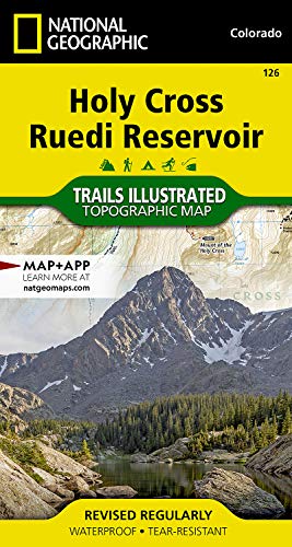
Map. Condizione: New. 2019th ed. . Waterproof . Tear-Resistant . Topographic MapNational Geographic's Trails Illustrated map of Holy Cross and Ruedi Reservoir delivers unmatched detail and valuable information to assist you in your exploration of this rugged area. Expertly researched and created in partnership with the U.S. Fore…st Service and others, this map features key points of interest including White River National Forest, Hunter-Fryingpan and Holy Cross Wilderness areas, Mount of the Holy Cross, Sawatch Range, Turquoise Lake, Sylvan Lake State Park and Continental Divide. Trailheads will lead you to precisely mapped trails with clear mileage indicators and marked according to their designated usage, whether your adventure involves hiking, cross-country skiing, biking, snowmobiling or using some other motorized vehicle. The Continental Divide Trail and Colorado Trail are both highlighted. The map displays contour lines labeled with elevations; passes, peaks and summits; reservoirs, lakes and other water features; and boundaries between public and private land. Some of the many recreation features include campgrounds, fishing areas, including gold medal fishing streams; boat launch points and canoe areas; and 10th Mountain Division huts.Every Trails Illustrated map is printed on 'Backcountry Tough' waterproof, tear-resistant paper. A full UTM grid is printed on the map to aid with GPS navigation.Other features found on this map include: Holy Cross Wilderness, Hunter-Fryingpan Wilderness, Mount of the Holy Cross, Red Table Mountain, San Isabel National Forest, White River National Forest.
Da: PBShop.store UK, Fairford, GLOS, Regno UnitoPBShop.store UK
Contatta il venditoreVenditore con 5 stelleCondizione: Nuovo
EUR 18,04
EUR 3,81 spedizioneSpedito da Regno Unito a U.S.A.Quantità: 9 disponibili
UNK. Condizione: New. New Book. Shipped from UK. Established seller since 2000.
Da: PBShop.store US, Wood Dale, IL, U.S.A.PBShop.store US
Contatta il venditoreVenditore con 5 stelleCondizione: Nuovo
EUR 22,16
Spedizione gratuitaSpedito in U.S.A.Quantità: 9 disponibili
UNK. Condizione: New. New Book. Shipped from UK. Established seller since 2000.
Da: Grand Eagle Retail, Bensenville, IL, U.S.A.Grand Eagle Retail
Contatta il venditoreVenditore con 5 stelleCondizione: Nuovo
EUR 22,41
Spedizione gratuitaSpedito in U.S.A.Quantità: 1 disponibili
Folded. Condizione: new. Folded. National Geographic's Trails Illustrated Maps are the most detailed and up-to-date topographic recreation maps available for US National Parks, National Forests and other popular outdoor recreation areas. A necessity for exploring the outdoors, each map is printed on waterproof, tear-resistant ma…terial. They also contain key safety and contact information, GPS and compass coordinates, Leave No Trace ethical guidelines and hundreds of points-of-interest, including scenic viewpoints, campgrounds, boat launches, swimming areas, marine sanctuaries and wildlife refuges. Shipping may be from multiple locations in the US or from the UK, depending on stock availability.
- Mappa
Da: Revaluation Books, Exeter, Regno UnitoRevaluation Books
Contatta il venditoreVenditore con 5 stelleCondizione: Nuovo
EUR 14,42
EUR 11,59 spedizioneSpedito da Regno Unito a U.S.A.Quantità: 2 disponibili
Map. Condizione: Brand New. map edition. 2 pages. 0.25x9.25x4.25 inches. In Stock.
Da: Russell Books, Victoria, BC, CanadaRussell Books
Contatta il venditoreVenditore con 5 stelleCondizione: Nuovo
EUR 10,85
EUR 17,61 spedizioneSpedito da Canada a U.S.A.Quantità: 2 disponibili
Map. Condizione: New. Special order direct from the distributor.
- Mappa
Da: Revaluation Books, Exeter, Regno UnitoRevaluation Books
Contatta il venditoreVenditore con 5 stelleCondizione: Nuovo
EUR 29,17
EUR 11,59 spedizioneSpedito da Regno Unito a U.S.A.Quantità: 1 disponibili
Map. Condizione: Brand New. map edition. 2 pages. 0.25x9.25x4.25 inches. In Stock.
Da: AussieBookSeller, Truganina, VIC, AustraliaAussieBookSeller
Contatta il venditoreVenditore con 5 stelleCondizione: Nuovo
EUR 46,00
EUR 32,59 spedizioneSpedito da Australia a U.S.A.Quantità: 1 disponibili
Folded. Condizione: new. Folded. National Geographic's Trails Illustrated Maps are the most detailed and up-to-date topographic recreation maps available for US National Parks, National Forests and other popular outdoor recreation areas. A necessity for exploring the outdoors, each map is printed on waterproof, tear-resistant ma…terial. They also contain key safety and contact information, GPS and compass coordinates, Leave No Trace ethical guidelines and hundreds of points-of-interest, including scenic viewpoints, campgrounds, boat launches, swimming areas, marine sanctuaries and wildlife refuges. Shipping may be from our Sydney, NSW warehouse or from our UK or US warehouse, depending on stock availability.

Da: Rarewaves.com UK, London, Regno UnitoRarewaves.com UK
Contatta il venditoreVenditore con 5 stelleCondizione: Nuovo
EUR 18,03
EUR 75,36 spedizioneSpedito da Regno Unito a U.S.A.Quantità: 5 disponibili
Map. Condizione: New. 2019th ed. . Waterproof . Tear-Resistant . Topographic MapNational Geographic's Trails Illustrated map of Holy Cross and Ruedi Reservoir delivers unmatched detail and valuable information to assist you in your exploration of this rugged area. Expertly researched and created in partnership with the U.S. Fore…st Service and others, this map features key points of interest including White River National Forest, Hunter-Fryingpan and Holy Cross Wilderness areas, Mount of the Holy Cross, Sawatch Range, Turquoise Lake, Sylvan Lake State Park and Continental Divide. Trailheads will lead you to precisely mapped trails with clear mileage indicators and marked according to their designated usage, whether your adventure involves hiking, cross-country skiing, biking, snowmobiling or using some other motorized vehicle. The Continental Divide Trail and Colorado Trail are both highlighted. The map displays contour lines labeled with elevations; passes, peaks and summits; reservoirs, lakes and other water features; and boundaries between public and private land. Some of the many recreation features include campgrounds, fishing areas, including gold medal fishing streams; boat launch points and canoe areas; and 10th Mountain Division huts.Every Trails Illustrated map is printed on 'Backcountry Tough' waterproof, tear-resistant paper. A full UTM grid is printed on the map to aid with GPS navigation.Other features found on this map include: Holy Cross Wilderness, Hunter-Fryingpan Wilderness, Mount of the Holy Cross, Red Table Mountain, San Isabel National Forest, White River National Forest.


