landmarks map making illustrated survey di tooley charles bricker (1 risultati)
Filtri di ricerca
Tipo di articolo
- Tutti i tipi di prodotto
- Libri (1)
- Riviste e Giornali (Nessun altro risultato corrispondente a questo perfezionamento)
- Fumetti (Nessun altro risultato corrispondente a questo perfezionamento)
- Spartiti (Nessun altro risultato corrispondente a questo perfezionamento)
- Arte, Stampe e Poster (Nessun altro risultato corrispondente a questo perfezionamento)
- Fotografie (Nessun altro risultato corrispondente a questo perfezionamento)
- Mappe (Nessun altro risultato corrispondente a questo perfezionamento)
- Manoscritti e Collezionismo cartaceo (Nessun altro risultato corrispondente a questo perfezionamento)
Condizioni Maggiori informazioni
- Nuovo (Nessun altro risultato corrispondente a questo perfezionamento)
- Come nuovo, Ottimo o Quasi ottimo (1)
- Molto buono o Buono (Nessun altro risultato corrispondente a questo perfezionamento)
- Discreto o Mediocre (Nessun altro risultato corrispondente a questo perfezionamento)
- Come descritto (Nessun altro risultato corrispondente a questo perfezionamento)
Legatura
- Tutte
- Rilegato (1)
- Brossura (Nessun altro risultato corrispondente a questo perfezionamento)
Ulteriori caratteristiche
- Prima ed. (1)
- Copia autograf. (Nessun altro risultato corrispondente a questo perfezionamento)
- Sovracoperta (1)
- Con foto (1)
- Non Print on Demand (1)
Lingua (1)
Prezzo
- Qualsiasi prezzo
- Inferiore a EUR 20 (Nessun altro risultato corrispondente a questo perfezionamento)
- EUR 20 a EUR 45 (Nessun altro risultato corrispondente a questo perfezionamento)
- Superiore a EUR 45
Spedizione gratuita
- Spedizione gratuita in U.S.A. (Nessun altro risultato corrispondente a questo perfezionamento)
Paese del venditore
Valutazione venditore
-
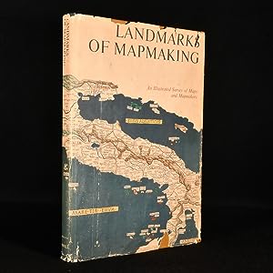
Landmarks of Map Making An Illustrated Survey of Maps and Mapmakers
Editore: Thomas Y. Crowell Company, New York, 1976
Prima edizione
EUR 57,24
EUR 17,00 per la spedizione da Regno Unito a U.S.A.Quantità: 1 disponibili
Aggiungi al carrelloCloth. Condizione: Fine. Condizione sovraccoperta: Very Good. Not Stated (illustratore). First edition. A stunning volume on the history of maps and mapmaking with numerous illustrations and folding maps throughout. A first US edition of this work on maps and mapmaking, the maps were chosen and displayed by R. V. Tooley and the text was written by Charles Bricker.This is a spectacular survey of maps and their creators that spans more than two thousand years. The innumerable social, political and economic influences that shaped the creation of maps are charted within this volume as well as the evolution of cartography and the chronological exploration of Europe, Asia, Africa, the Americas and Australia.The volume is richly illustrated with over three hundred and fifty illustrations including maps, portraits of explorers and cartographers. With fourteen stunning colour folded maps.Collated, complete.In the original unclipped dust wrapper. In the publisher's original cloth binding. Externally, lovely. Internally, firmly bound with bright and clean pages. In the original unclipped dust wrapper which is smart with some chipping to the extremities and a few marks to the wraps. Fine. book.


