Co maps by (9 risultati)

- Rilegato
- Prima edizione
Da: Arroyo Seco Books, Pasadena, Member IOBA, Pasadena, CA, U.S.A.Arroyo Seco Books, Pasadena, Member IOBA
Contatta il venditoreVenditore con 4 stelleCondizione: Usato - Ottimo
EUR 17,97
EUR 6,98 spedizioneSpedito in U.S.A.Quantità: 1 disponibili
Brown Boards. Condizione: Fine. Condizione sovraccoperta: Near Fine Dustjacket. First American Edition. 524 Page Blue Cloth, Beige Boards. Very Slightly Used. Covers And Dj, Almost As New Except For A 1/2" Faint Waterspot On The Spine Of The Dj. Maps And Drawings By Cassell & Co. (illustratore).

Editore: AMERICAN HERITAGE PUB; Smithsonian; d.van nostrand co., USA 1968
- Rilegato
- Prima edizione
Da: WONDERFUL BOOKS BY MAIL, CHICO-CA, CA, U.S.A.WONDERFUL BOOKS BY MAIL
Contatta il venditoreVenditore con 5 stelleCondizione: Usato - Molto buono
EUR 17,97
EUR 3,27 spedizioneSpedito in U.S.A.Quantità: 1 disponibili
HARDCOVER. Condizione: Very Good. Condizione sovraccoperta: Very Good. First Edition.. VERY GOOD CONDITION IN VERY GOOD UNCLIPT(S4.95) DUST JACKET, clean, solid,bright.; GOLD SPINE TITLES & 1X1" COVER DECORATION ALL ON BRIGHT Red Clothbound HARDCOVERS.DJ SHOWS IMPRESSIVE CLOSE UP photo OF STONE FACE.Back cover large photo f AUTH…OR & Stone figure holding small figure. ; 304pg pages; Mayan Culture & stone art described. Index, Bibliography .Gold spine titles & cover ilust showing dolphin & waves. Illustrated by Maps,drawings & Photos (illustratore).
Editore: Ward, Lock [1913], London 1913
- Brossura
Da: Vashon Island Books, Vashon, WA, U.S.A.Vashon Island Books
Contatta il venditoreVenditore con 5 stelleCondizione: Usato - Buono
EUR 17,97
EUR 4,80 spedizioneSpedito in U.S.A.Quantità: 1 disponibili
Paperback. Condizione: Good+. Third Edition. Good+ in cloth over flex. boards (fold to board, frayed, worn) three fold out maps (one plan missing) 8vo 128+96pp+ads Charming pre-WWI guide to Scotland's Inverness region. Size: 8vo - over 7¾" - 9¾" tall. Illustrated by Illus; 3 Folding maps. (illustratore). Book.
Editore: Thomas Nelson and Sons, London, Edinburgh, Dublin, and New York 1911
- Rilegato
- Prima edizione
Da: Bailgate Books Ltd, Doncaster, , Regno UnitoBailgate Books Ltd
Contatta il venditoreVenditore con 5 stelleCondizione: Usato - Discreto
EUR 9,49
EUR 16,71 spedizioneSpedito da Regno Unito a U.S.A.Quantità: 1 disponibili
Hardcover. Condizione: Fair. No Dust Jacket. First Edition. Dark green covers with rounded corners and rubbed gilt lettering on the spine, cloth is rubbed on the edges, and there are "creases" on both the front and rear. The free loose rear end-paper containing half of the Key Map - Southern Section is missing, paper over front…inner hinge is split, internal binding is slightly shaken. Contains many plans showing routes and towns. 200 pages. No dust jacket, as published. Illustrator: Maps by J Bartholomew and Co. Quantity Available: 1. Shipped Weight: under 1 kg. Pictures of this item not already displayed here available upon request. Inventory No: 53925011055. All our books are sent by tracked mail. Maps by J Bartholomew and Co. (illustratore).
Editore: Art Publishing Company, London, UK 1111
- Brossura
Da: Ryde Bookshop Ltd, Isle of Wight, , Regno UnitoRyde Bookshop Ltd
Contatta il venditoreVenditore con 5 stelleCondizione: Usato - Buono
EUR 7,12
EUR 23,00 spedizioneSpedito da Regno Unito a U.S.A.Quantità: 1 disponibili
Soft cover. Condizione: Good. Undated, text references no later in date than 1912. Stapled edition with rusted staples. Folded pamphlet format. Some handling marks with minimal wear. Illustrated with various black and white maps, figures and vintage advertisments (illustratore).
Lingua: Inglese
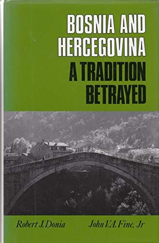
Editore: Columbia University Press, New York, New York 1994
- Rilegato
Da: Andover Books and Antiquities, Andover, MA, U.S.A.Andover Books and Antiquities
Contatta il venditoreVenditore con 4 stelleCondizione: Usato - Molto buono
EUR 44,93
EUR 11,34 spedizioneSpedito in U.S.A.Quantità: 1 disponibili
Hardcover. Condizione: Very good condition. dj. xi, 318 pp. Dustjacket. LCC: 94162223.
- Rilegato
Da: A Few Books More. . ., Billings, MT, U.S.A.A Few Books More. . .
Contatta il venditoreVenditore con 5 stelleCondizione: Usato - Discreto
EUR 49,42
EUR 5,23 spedizioneSpedito in U.S.A.Quantità: 1 disponibili
Leather Bound. Condizione: Fair. Illustrated throughout with b/w photos. Two MAPS of Edgar Co. 1. Bird's eye view by J.J.Stoner, and 2. County Highway Map, 1969. (illustratore).

Editore: Published by Lower Hardres Parish Appraisal Committee . 1980
Da: Little Stour Books PBFA Member, Canterbury, Regno UnitoLittle Stour Books PBFA Member
Contatta il venditoreVenditore con 5 stelleCondizione: Usato - Molto buono
EUR 47,47
EUR 34,57 spedizioneSpedito da Regno Unito a U.S.A.Quantità: 1 disponibili
Condizione: Very Good. Original wire stitched light green card wrap covers (soft back). 4to. 12'' x 8¼''. Lower Hardres and nearby Upper Hardres, take their name from the Hardres family, who owned the manor for some 700 years from the Norman Conquest. John Marius Wilson's Imperial Gazetteer of England and Wales described Lower H…ardres as: 'A parish in Bridge district, Kent; on Stone-street, 3 miles East of Chartham, and 3¼ miles south of Canterbury.' Contains (ii), 51 mimeograph pages with 3 full-page maps and 5 illustrations throughout. Front and rear covers with light foxing and handling marks, contents in Very Good condition. Scarce. Member of the P.B.F.A. KENT [Canterbury].
 Altre immagini
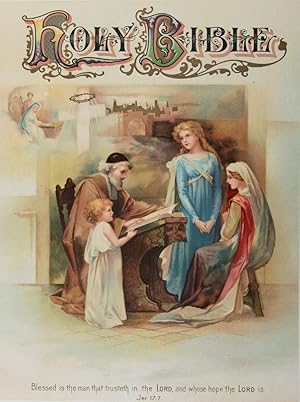
Editore: The John C. Winston Co, Philadelphia 1903
- Rilegato
Da: ERIC CHAIM KLINE, BOOKSELLER (ABAA ILAB), Santa Monica, CA, U.S.A.ERIC CHAIM KLINE, BOOKSELLER (ABAA ILAB)
Contatta il venditoreVenditore con 3 stelleCondizione: Usato
EUR 247,12
EUR 4,36 spedizioneSpedito in U.S.A.Quantità: 1 disponibili
Hardcover. Condizione: g- to vg. Later edition. Folio (12 x 10"). [10]pp (Half-title, Presentation leaf, Frontispiece, chromolithographic leaf, and title page), 32pp (Gallery of Scripture Illustrations), 104pp (A Comprehensive Dictionary of the Bible), 18pp (A History of Religious Denominations), 16pp (Biblical Antiquities), 32p…p (The Story of the Books of the Old Testament), 16pp (A Self-Pronouncing Dictionary of Scripture Proper Names), VIII, [9]-667, [3]pp (Old Testament), [8]pp (Family section), 24pp (The Parables of the Lord), [671]-879, [1]pp (New Testament), 48pp (Questions and Answers on the Sacred Scriptures), 80pp (Standard Concordance to the Bible). Full blind-stamped morocco, with gold lettering to spine and front cover. Beveled edges. All edges gilt. Moire endpapers. Chromolithographic half-title. Engraved tissue-guarded frontispiece. Both title pages in red and black lettering. Lavishly illustrated throughout with hundreds of in-text and full-page wood and steel engravings, b/w photographic reproductions, color maps, and 10 chromolithographs, the Authorized Version has been strictly followed in this handsome Bible. The text has been carefully compared with that of the most accurate editions printed in England and in the United States. Previous owner's name on fly leaf (David Robinson). Presentation leaf inscribed as followed: "Presented to my beloved friend David Robinson by Edward A. Reisler." Family section unused. Binding rubbed along front joint and at head and tail of spine. Some creasing to fly leaf. Fore-edge of pages 12 to 17 slightly and partly water-stained (not affecting text or illustrations). Binding in overall good-, interior in very good condition.


