
Environs de paris (13 risultati)

Editore: Editions G. A. de Neef. Vers 1900., 1900
- Brossura
Da: Loïc Simon, Blaison-Saint Sulpice, FR, FranciaLoïc Simon
Contatta il venditoreVenditore con 5 stelleCondizione: Usato
EUR 18,00
EUR 19,00 spedizioneSpedito da Francia a U.S.A.Quantità: 1 disponibili
Début XXe. Broché. 40 pages. A l'italienne.
LES 60 PLUS BELLES PROMENADES AUTOUR DE PARIS
GUIDE TARIDE DES ENVIRONS DE PARIS POUR AUTOMOBILISTES, MOTOCYCLISTES ET CYCLISTES
- Brossura
Da: Librairie Philosophique J. Vrin, Paris, FranciaLibrairie Philosophique J. Vrin
Contatta il venditoreVenditore con 4 stelleCondizione: Usato - Buono
EUR 10,00
EUR 21,96 spedizioneSpedito da Francia a U.S.A.Quantità: 1 disponibili
Couverture souple. Condizione: Satisfaisant. Guide Taride des environs de Paris pour automobilistes, motocyclistes et cyclistes.Les 60plus belles promenades autour de Paris.Itinéraires détaillés, kilométrés et documentés. Circuits de 30 à 250 km (adaptés pour cyclistes). Avec schémas d'orientation.9e éd.P., 1942, in-12, br., sig…net, couv. lég. défr. 200 gr.
Editore: Paris. 1932., 1932
- Brossura
Da: Loïc Simon, Blaison-Saint Sulpice, FR, FranciaLoïc Simon
Contatta il venditoreVenditore con 5 stelleCondizione: Usato
EUR 27,00
EUR 19,00 spedizioneSpedito da Francia a U.S.A.Quantità: 1 disponibili
Broché. 286 pages.
A. Taride Editeur de cartes Cyclistes et automobiles
Carte Routiere Pour Cyclistes & Automobiles Environs De Paris No. 7 Section Sud Est 1:100.000 Les Routes De France A L Usage Des Automobiles (Routen Landkarte Karte für Radfahrer und Automobilisten Gebiet von Paris Süd Ost Maßstab 1:100.000)
Editore: Wohl 1913, Paris, 1913
- Rilegato
Da: Bücher-Insel Antiquariat Rolf Selbert, Kassel, GermaniaBücher-Insel Antiquariat Rolf Selbert
Contatta il venditoreVenditore con 4 stelleCondizione: Usato
EUR 8,00
EUR 40,00 spedizioneSpedito da Germania a U.S.A.Quantità: 1 disponibili
Format 90x69cm, 8x4 Segmente original auf Leinen kaschiert, 4farbiger präziser Druck Dekorative Land- bzw. Wander-/Radfahrer-/Autokarte. Französisch, wohl vom September 1913 (Druckvermerk 9.13). Ausführliche Legende etc. Schön, präzise und unberührt! Solche für Rad- und Autofahrer verlegten Karten waren in den Jahren vor dem 1.…Weltkrieg sehr in Mode und in ähnlicher Form in vielen europäischen Ländern verbreitet. Mit dem Ausbau des Straßennetzes bzw. dem Aufkommen reiner Spezialkarten für die verschiedenen Fortwegungsarten kamen sie in den 1920er Jahren aus der Mode und verschwanden wieder vom Markt. Zeitgeschichtlich interessantes Stück! Leichte Altersspuren, intakt, guter Zustand.
A. Taride Editeur de cartes Cyclistes et automobiles
Carte Routiere Pour Cyclistes & Automobiles Environs De Paris No. 3 Section Nord Est 1:100.000 Les Routes De France A L Usage Des Automobiles (Routen Landkarte Karte für Radfahrer und Automobilisten Gebiet von Paris Nord Ost Maßstab 1:100.000)
Editore: Wohl 1909, Paris, 1909
- Rilegato
Da: Bücher-Insel Antiquariat Rolf Selbert, Kassel, GermaniaBücher-Insel Antiquariat Rolf Selbert
Contatta il venditoreVenditore con 4 stelleCondizione: Usato
EUR 8,00
EUR 40,00 spedizioneSpedito da Germania a U.S.A.Quantità: 1 disponibili
Format 90x69cm, 8x4 Segmente original auf Leinen kaschiert, 4farbiger präziser Druck Dekorative Land- bzw. Wander-/Radfahrer-/Autokarte. Französisch, wohl vom April 1909 (Druckvermerk 4-09). Ausführliche Legende etc. Schön, präzise und unberührt! Solche für Rad- und Autofahrer verlegten Karten waren in den Jahren vor dem 1. Welt…krieg sehr in Mode und in ähnlicher Form in vielen europäischen Ländern verbreitet. Mit dem Ausbau des Straßennetzes bzw. dem Aufkommen reiner Spezialkarten für die verschiedenen Fortwegungsarten kamen sie in den 1920er Jahren aus der Mode und verschwanden wieder vom Markt. Zeitgeschichtlich interessantes Stück! Leichte Altersspuren, intakt, guter Zustand.
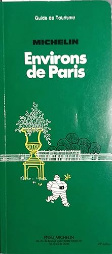
Editore: Michelin et Cie, Clermont-Ferrand, 1986
- Brossura
Da: Librairie Et Cætera - Sophie Rosière, Belin-Béliet, FranciaLibrairie Et Cætera - Sophie Rosière
Contatta il venditoreVenditore con 5 stelleCondizione: Usato
EUR 10,00
EUR 65,00 spedizioneSpedito da Francia a U.S.A.Quantità: 1 disponibili
Couverture souple. Livre en français. Broché. 186 pages. 12 x 26 cm. Ile-de-France. Livre.

Editore: Librairie Larousse, 1930
- Arte / Stampa / Poster
Da: Librairie Et Cætera - Sophie Rosière, Belin-Béliet, FranciaLibrairie Et Cætera - Sophie Rosière
Contatta il venditoreVenditore con 5 stelleCondizione: Usato
EUR 5,00
EUR 65,00 spedizioneSpedito da Francia a U.S.A.Quantità: 1 disponibili
Gravure en français. Une feuille 24 x32 cm. Gravure.
Editore: Paris, Haar & Steinert, coll. « Diamant », Paris, 1908
- Rilegato
Da: Librairie de l'Avenue - Henri Veyrier, Saint-Ouen, FR, FranciaLibrairie de l'Avenue - Henri Veyrier
Contatta il venditoreVenditore con 5 stelleCondizione: Usato - Quasi ottimo
EUR 107,00
EUR 35,00 spedizioneSpedito da Francia a U.S.A.Quantità: 1 disponibili
Couverture rigide. Condizione: Bon état. In-16 16,5 x 9,5 cm. Cartonnage éditeur pleine percaline bleu-marine, dos muet, titre doré sur le premier plat, 12 pp., 20 cartes en couleus avec texte-guide alphabétique,prface, liste des curiosités aux environs de Paris, excursions aux environs de Paris. Exemplaire en bon état.
 Altre immagini
Kupferstich-Landkarte Frankreich 1813: Carte des Environs de Paris, 53,5 x 75,5 cm.
Kupferstich-Landkarte Frankreich 1813: Carte des Environs de Paris, 53,5 x 75,5 cm.
Editore: Paris, Jean 1813, 1813
- Rilegato
- Mappa
Da: Antiquariat Thomas Mertens, Berlin, GermaniaAntiquariat Thomas Mertens
Contatta il venditoreVenditore con 4 stelleCondizione: Usato - Molto buono
EUR 120,00
EUR 55,00 spedizioneSpedito da Germania a U.S.A.Quantità: 1 disponibili
Hardcover. Condizione: Gut. Kupferstich-Landkarte Frankreich 1813: Carte des Environs de Paris, 53,5 x 75,5 cm. Landkarte von Paris und Umgebung --- "Carte des Environs de Paris, divisés en départements, préfectures et sous préfectures. Chez Jean, Rue St. Jean de Beauvais No. 10." --- Mit laienhaften farbigen Grenzkolorierungen.… Paris, Jean 1813 Kupferstich-Karte auf sehr kräftigem Papier im Format 53,5 x 75,5 cm (Papp-Einband 19,5 x 12,8 cm). --- Zustand: Sehr gut.
Editore: Librairie Hachette, Paris, 1868
- Rilegato
Da: Librairie Blaizot, Paris, FranciaLibrairie Blaizot
Contatta il venditoreVenditore con 5 stelleMembro dell’associazione: ILAB
Condizione: Usato
EUR 160,00
EUR 20,00 spedizioneSpedito da Francia a U.S.A.Quantità: 1 disponibili
In-12, percaline noire, impressions or sur le premier plat et le dos, doublures et gardes de papier marbré, tranches lisses rouges (cartonnage de l'éditeur).Seconde édition, comportant le texte imprimé sur deux colonnes et illustrée de 245 vignettes à pleine page ou in-texte, de 7 planches sur double page (plans ou cartes) et d'…une grande carte (H. 330 x 475 mm) imprimée en deux couleurs et pliée pour se ranger dans la pochette à soufflet montée sur la première doublure du cartonnage. Exemplaire enrichi de deux vues, l'une du château de Rambouillet, l'autre de la chambre de Napoléon 1er au château de Compiègne.

Arrêt du Conseil d'état du Roi, qui proroge jusqu'au premier octobre 1786 les augmentations sur le Prix des Voitures de Places & des environs de Paris, ordonnées par Arrêt du 11 novembre 1784. Du 19 juin 1785.
[VOITURES DES PLACES ET ENVIRONS DE PARIS] - BRETEUIL (Baron de)
Da: Librairie de l'Amateur, Strasbourg, FranciaLibrairie de l'Amateur
Contatta il venditoreVenditore con 5 stelleMembro dell’associazione: ILAB
Condizione: Usato
EUR 30,00
EUR 29,90 spedizioneSpedito da Francia a U.S.A.Quantità: 1 disponibili
Paris, De l'Imprimerie de la Veuve Ballard & Fils, s.d. ; in-4, 3 pp., un feuillet plié en deux. Extrait des registres du Conseil d'État. Rousseurs. 0.
 Altre immagini
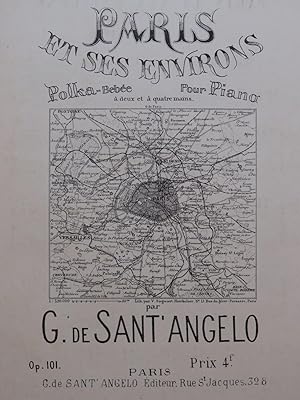
DE SANT'ANGELO G. Paris et ses Environs Polka Piano ou Piano 4 mains ca1900
DE SANT'ANGELO G. Paris et ses Environs Polka Piano ou Piano 4 mains ca1900
- Spartito
Da: partitions-anciennes, Blois, Franciapartitions-anciennes
Contatta il venditoreVenditore con 4 stelleCondizione: Usato
EUR 36,00
EUR 39,00 spedizioneSpedito da Francia a U.S.A.Quantità: 1 disponibili
Condizione: 1900-1930. Paris et ses Environs Polka-Bébée pour Piano à deux ou quatre mains par G. de Sant'Angelo op 101 Paris, G. de Sant'Angelo Editeur XXe siècle ca1900 4 pages 33.4 x 26.0 cm Très bon état 035146 Piano 4 mains.

- Mappa
Da: Geographicus Rare Antique Maps, Brooklyn, NY, U.S.A.Geographicus Rare Antique Maps
Contatta il venditoreVenditore con 4 stelleCondizione: Usato
EUR 656,85
EUR 14,89 spedizioneSpedito in U.S.A.Quantità: 1 disponibili
Excellent. Size 9 x 12.75 Inches. This is a fascinating 1716 Nicholas de Fer schematic map of the aqueducts, fountains, and underground pipes of Paris, France. Paris was growing quickly at this time and faced a major challenge in that its water supply system was inadequate for its swelling population. The map addresses some of t…he immediate concerns of the period: sanitation and water supply. A Closer Look Oriented towards the northeast, this map covers what is now the central section of Paris, roughly from the Place Vendôme at top to the Place de la Bastille at bottom, and the area around the Jardin du Luxembourg at left to the area that today is just south of Gare de l'Est in the 10th Arrondissement at right. Abbreviations are explained above the scale at bottom-left; 'R.' here is not an abbreviation for 'rue' but for 'regard,' meaning 'manhole,' which in this context was a small stone hut that allowed access to the wells, pipes, and aqueducts providing water to the city. Explanatory text at bottom-right refers to other pages in the Atlas Curieux where all the fountains were listed. Historical Context The context for this map is that Paris had long suffered chronic shortages of water, a problem that was only worsening by the year as the capital's population grew (from 415,000 in 1637 to 600,000 in 1700). Some of the city's water came from springs and wells, but the majority came from the Seine, which was filled with wastewater and other impurities. There was very little understanding of the sources of waterborne disease at the time, and Paris' sewer system was equally inadequate, so that the result was a city rife with disease. Still, even the tainted water supply was insufficient to meet the city's needs. Efforts undertaken in the reign of Henry IV and his successor Louis XIII (discussed below) improved the situation somewhat. Still, it was only in the last days of the Ancien Régime and into the Napoleonic Period that more noticeable improvements came. Only the remaking of Paris by Georges-Eugène Haussmann (and the development of germ theory) in the 1850s and 1860s left Paris with a ready supply of clean water, and good sewers to boot. The 'Aqueduc Médicis' The 'Grands reservoirs des eaux de Rungis' referred to at left were connected to the city via the 'Aqueduc Médicis,' named after Marie de Médicis, the wife of Henry IV and queen until his assassination in 1610, and then regent to her young son, Louis XIII (r. 1610 - 1643). Improving Paris' water supply had been a major concern for Henry IV, and during her regency, Mary was determined to complete an aqueduct from Rungis, as discussed by the late king. Louis XIII laid the first stone for the aqueduct in honor of his slain father in 1613, and it was completed and went into service a decade later, in 1623. Mostly built underground, the aqueduct has one large and impressive bridge across the Bièvre Valley. It closely follows the path of a Roman aqueduct built in the 2nd or early 3rd century CE, which was only briefly in use before attacks on the city forced residents of the left (south) bank to flee to the Île de la Cité. Parisian Pumps 'Samaritaine' near the center refers to the Pompe de la Samaritaine, a large water wheel built along the Seine at the Pont Neuf to provide water to the fountains and royal palaces nearby. It was originally completed in 1608 (at the request of Henry IV) and elaborated several times, including a significant upgrade in 1712, becoming a major source of water in the central part of the city. A similar pump was built on the Pont Notre-Dame in 1676 and was likewise an important feature in the city's water system. Both pumps can be seen alongside their respective bridges in the famous, monumental 1739 Turgot map of Paris (also sold by us, Paris-turgot-1739-2). Publication History and Census This map was prepared by Nicholas de Fer in 1716 for his Atlas Curieux . It also appeared in some printings of his similar, contemporary work Beautés de.


