Goodall george editor (9 risultati)

Editore: George Philip & Son, London
- Brossura
Da: 4 THE WORLD RESOURCE DISTRIBUTORS, Springfield, MO, U.S.A.4 THE WORLD RESOURCE DISTRIBUTORS
Contatta il venditoreVenditore con 5 stelleCondizione: Usato - Buono
EUR 11,30
EUR 4,38 spedizioneSpedito in U.S.A.Quantità: 1 disponibili
Softcover. Condizione: Good. Some Markings; 4to - over 9¾" - 12" tall.

Editore: George Philip & Son Ltd, London, 1942
- Brossura
Da: Godley Books, Hyde, Regno UnitoGodley Books
Contatta il venditoreVenditore con 5 stelleCondizione: Usato - Molto buono
EUR 9,05
EUR 18,67 spedizioneSpedito da Regno Unito a U.S.A.Quantità: 1 disponibili
Soft Cover. Condizione: Very Good. No marks or inscriptions. Minor creasing to upper corners. A very clean very tight copy with bright unmarked slightly rubbed covers and no bumping to corners. 33pp. A fascinating collection of maps in colour showing WW2 events and campaigns, essential industrial resources and even a German map…with dates shown across Europe setting out the German expectation to have conquered each country by then. Britain was dated 1948. We do not use stock photos, the picture displayed is of the actual book for sale. Every one of our books is in stock in the UK ready for immediate delivery. Size: 7.5 x 10 inches.
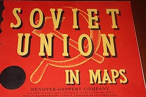
Editore: Denoyer Geppert, Chicago, 1954
- Brossura
- Prima edizione
Da: Wagon Tongue Books, Linden, AB, CanadaWagon Tongue Books
Contatta il venditoreVenditore con 2 stelleCondizione: Usato - Molto buono
EUR 13,53
EUR 27,19 spedizioneSpedito da Canada a U.S.A.Quantità: 1 disponibili
Stapled Paper. Condizione: Very Good +. First Edition. This 32 page booklet was seemingly conceived for use in schools. LEARN more about : Kingdom of Poland, Caspian Sea, Peter the Great, Ivan III, Tatars, Soratov, Bashkiria, Kuzbas, Moscow, Arctic Ocean, Urals, Karaganda, and Akmolinsk. A publisher's card tucked into front, spe…aks to the accuracy of population figures since 1939. Verso front cover serves as Table of Contents. Verso back cover carries production increases (1940 to 1950) for coal, grain, etc. Also provides population data by republic. Thus : Azerbaijan, has 33,000 square miles and 3.100,000 people. Cond : Paper wrapper is Soviet Red. Letters and `hammer-and-sickle' graphic are yellow. Staples tight. Colours bright. Mostly without wear. Clean. Name of previous owner on front cover. Decidedly collectible ! ! Quote (p. 01) : " In the 10th century the Viking Rurik and his descendants first organized the nomad peoples of Russia into small principalties. The more westerly ._._._. ." Size: 12mo. Maps (illustratore). Album Shaped.
Editore: G. PHILIP&SON, London, 1942
- Brossura
- Prima edizione
Da: Come See Books Livres, Canton de Hatley, QC, CanadaCome See Books Livres
Contatta il venditoreVenditore con 5 stelleCondizione: Usato - Molto buono
EUR 19,88
EUR 28,90 spedizioneSpedito da Canada a U.S.A.Quantità: 1 disponibili
Soft cover. Condizione: Very Good. First Edition. W.W. 2. BOOK ON SOVIET RUSIA. CRAMMED FULL OF COLOR MAPS AND STATS ACCOMPANIED BY EXPLANATORY TEXT . COVERS; STATE FARMS, PLANNING, RAILWAYS, MINES, AGRICULTURE, RUSSIAN EXPANSION, INDUSTRY, ETC. CORNERS SLIGHTLY BENT, VERY SLIGHTLY SOILED COVERS. INSIDES EXCELLENT. SCANS ON REQU…EST. THANKS.
Editore: George Philip and Son Ltd, 1941
- Brossura
Da: Daisyroots Books, GRANGE OVER SANDS, CMA, Regno UnitoDaisyroots Books
Contatta il venditoreVenditore con 5 stelleCondizione: Usato - Molto buono
EUR 16,88
EUR 35,12 spedizioneSpedito da Regno Unito a U.S.A.Quantità: 1 disponibili
Condizione: Very Good. The War in Maps: Its Background and Course GOODALL, George (Editor) George Philip and Son Ltd, London, 1941, landscape format, softback with stiff card wraps, VG, illustrated from over 30 colour maps (see scans), 32 No inscription or annotations, sound tight binding, pages clean, tanned, rubs to fore-edge…corners Wraps quite grubby, rubs to edges Wire stitching rusted Good sound copy HISTORY, WW II, THE STATUS AND PROGRESSION OF THE WAR, EUROPE AND THE PACIFIC, ILLUSTRATED, COLOUR MAPS 46588 HISTORY/WWII £1400 32.
Editore: George Philip & Son Ltd / Edward Stanford Ltd, London, 1951
- Rilegato
Da: The Print Room, Cockernhoe nr Luton, Regno UnitoThe Print Room
Contatta il venditoreVenditore con 5 stelleCondizione: Usato - Quasi ottimo
EUR 24,11
EUR 29,27 spedizioneSpedito da Regno Unito a U.S.A.Quantità: 1 disponibili
Leather Bound. Condizione: Near Fine. Revised Edition. First published in 1917, this is a fifteenth impression, thoroughly revised, of 1951. Brown full leather binding (pigskin?). Some slight edge wear to top and bottom of polished leather covered boards and spine, crest and title embossed on front cover, corners slightly rubbed… and bruised, no price, no inscriptions, internally clean tight and square, overall a vg+ copy for its age. 128 colour maps.335pp.A book for the world traveller. Philip's has been at the forefront of creating maps and atlases since 1834. How to get to almost anywhere, the distances and time involved. A decorative and scarce book, the perfect accompaniment to a vintage car or plane. An ornament to any library.
- Brossura
Da: Anthony C. Hall, Bookseller ABA ILAB, Isleworth, MIDDX, Regno UnitoAnthony C. Hall, Bookseller ABA ILAB
Contatta il venditoreVenditore con 4 stelleCondizione: Usato
EUR 24,11
EUR 23,41 spedizioneSpedito da Regno Unito a U.S.A.Quantità: 1 disponibili
Paperback. 32pp of coloured maps, oblong 8vo, card covers, London 1954. Very good.

Metallocene Catalyzed Polymers: Materials, Properties, Processing & Markets
Benedikt, George M. (Editor)/ Benedikt, George M./ Goodall, Brian L. (Editor)
Lingua: Inglese
Editore: Plastics Design Library, 1996
Serie: Plastics Design Library, Libro 2 di 128. Libro 2 di 128 - Plastics Design Library
- Rilegato
Da: Revaluation Books, Exeter, Regno UnitoRevaluation Books
Contatta il venditoreVenditore con 5 stelleCondizione: Nuovo
EUR 176,39
EUR 14,63 spedizioneSpedito da Regno Unito a U.S.A.Quantità: 2 disponibili
Hardcover. Condizione: Brand New. 1st edition. 394 pages. 9.00x7.50x1.00 inches. In Stock.
 Altre immagini
Editore: London: George Philip & Son, Ltd. / The London Geographical Institute, 1947
- Rilegato
Da: RightWayUp Books, Woodbridge, SUFFO, Regno UnitoRightWayUp Books
Contatta il venditoreVenditore con 5 stelleCondizione: Usato - Buono
EUR 57,87
EUR 36,87 spedizioneSpedito da Regno Unito a U.S.A.Quantità: 1 disponibili
Hardcover. Condizione: Good. Goodall, George, editor. Muir's historical atlas mediaeval and modern. Seventh edition. London: George Philip & Son, Ltd. / The London Geographical Institute, 1947. Hardback, Good, no dustjacket. Red cloth, generally grubby, faded to spine and edges, with shelfwear to edges and slight damaage to top…and base of spine. Backstrip starting to split along the rear hinge. Gilt lettering, dulled, to front and spine. Binding strong. Foxing spots to endpapers and prelims. Ownership signature to ffep. Title page in red and black. xx, 68, 96 (colour maps), 32 (index) pp., maps in colour and b/w. Text in two columns. Two school stamps to rear endpapers, otherwise contents clean and bright. RightWayUp Books aims to provide accurate and detailed descriptions. All images are of the actual book for sale - no stock images are ever used. Thank you for looking at this listing.


