
Importo totale (1 articolo articoli):
Destinazione ordine:

guthorn peter (54 risultati)
Vai alla pagina principale dei risultati di ricerca
Filtri di ricerca
Tipo di articolo
- Tutti i tipi di prodotto
- Libri (52)
- Riviste e Giornali (2)
- Fumetti (Nessun altro risultato corrispondente a questo perfezionamento)
- Spartiti (Nessun altro risultato corrispondente a questo perfezionamento)
- Arte, Stampe e Poster (Nessun altro risultato corrispondente a questo perfezionamento)
- Fotografie (Nessun altro risultato corrispondente a questo perfezionamento)
- Mappe (Nessun altro risultato corrispondente a questo perfezionamento)
- Manoscritti e Collezionismo cartaceo (Nessun altro risultato corrispondente a questo perfezionamento)
Condizioni Maggiori informazioni
Legatura
Ulteriori caratteristiche
- Prima ed. (12)
- Copia autograf. (Nessun altro risultato corrispondente a questo perfezionamento)
- Sovracoperta (16)
- Con foto (21)
- Non Print on Demand (53)
Lingua (2)
Spedizione gratuita
Paese del venditore
Valutazione venditore
-
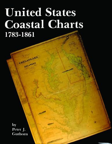
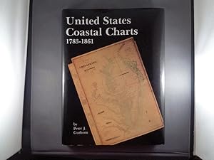
United States Coastal Charts, 1738-1861
Da: Wonder Book, Frederick, MD, U.S.A.
Membro dell'associazione: ABAA ILAB
Valutazione del venditore 5 su 5 stelle

Condizione: Very Good. Very Good condition. Very Good dust jacket. A copy that may have a few cosmetic defects. May also contain light spine creasing or a few markings such as an owner's name, short gifter's inscription or light stamp. NOT AVAILABLE FOR SHIPMENT OUTSIDE OF THE UNITED STATES.
-
United States Coastal Charts, 1738-1861
Da: ThriftBooks-Atlanta, AUSTELL, GA, U.S.A.
Valutazione del venditore 5 su 5 stelle
Hardcover. Condizione: Good. No Jacket. Former library book; Pages can have notes/highlighting. Spine may show signs of wear. ~ ThriftBooks: Read More, Spend Less.
-
United States Coastal Charts 1783 - 1861
Da: Doc O'Connor, Ft. Wright, KY, U.S.A.
Valutazione del venditore 5 su 5 stelle
Hardcover. Condizione: Fine. Condizione sovraccoperta: Very Good. Hardback. Tall 4to. (1984). Fine in Very Good dust jacket. Few short tears to dust jacket. No names or marks.
-
UNITED STATES COASTAL CHARTS 1783-1861
Lingua: Inglese
Editore: Schiffer Pub. Co, West Chester, PA, 1984
ISBN 10: 0887400191 ISBN 13: 9780887400193
Da: Terra Firma Books, San Diego, CA, U.S.A.
Valutazione del venditore 5 su 5 stelle
Hardcover. Condizione: Fine. Condizione sovraccoperta: Very Good. FINE condition! 224pp. No name or writing. Originally $59. CLEAN!
-
The Sea Bright Skiff and Other Shore Boats
Da: Old Book Shop of Bordentown (ABAA, ILAB), Bordentown, NJ, U.S.A.
Membro dell'associazione: ABAA ILAB
Valutazione del venditore 4 su 5 stelle

Prima edizione
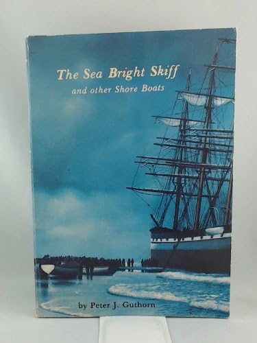
Hardcover. Condizione: Very Good. First edition. First edition (no statement as is correct) Oversized hardcover in blue cloth. 239 pp. with glossary, index. Illustrated with photographs and diagrams of various types of skiffs. The history of skiffs specifically designed and built for use in the waters off the New Jersey shore in response to the fact that the state has few sheltered inlets and often poor weather conditions. The sea skiff was ideally functional and adapted for rum-running and life saving and are used up and doen the entire United States eastern coast. Very good. No dust jacket.
-
The Sea Bright Skiff and Other Shore Boats
Lingua: Inglese
Editore: Schiffer Publishing, Exton, PA, 1982
ISBN 10: 0916838730 ISBN 13: 9780916838737
Da: Lowry's Books, Three Rivers, MI, U.S.A.
Valutazione del venditore 4 su 5 stelle
Paperback. Condizione: Good. No Jacket. Various (Photographs) (illustratore). Cover is in good condition, save for edge wear and rubbing. Text is otherwise tight in binding. Text is clean and free of blemishes throughout. No other markings or indications of note. Size: 4to - over 9�" - 12" Tall.
-

American Maps and Map Makers of the Revolution (Revolutionary War Bicentennial)
Da: ThriftBooks-Atlanta, AUSTELL, GA, U.S.A.
Valutazione del venditore 5 su 5 stelle
Hardcover. Condizione: Fair. No Jacket. Readable copy. Pages may have considerable notes/highlighting. ~ ThriftBooks: Read More, Spend Less.
-

United States Coastal Charts 1783-1861
Prima edizione
Hardcover. Condizione: Very Good+. Condizione sovraccoperta: Near Fine. 1st Edition. First Edition of this illustrated survey of United States coastal charts produced between 1783 and 1861. Cloth, 224 pages. Has a previous owner name inked on the title page, otherwise minimal sign of previous use. Due to the size and weight of this volume, available for shipping only in the U.S.
-

UNITED STATES COASTAL CHARTS, 1783-1861
Da: Easton's Books, Inc., Mount Vernon, WA, U.S.A.
Valutazione del venditore 5 su 5 stelle
Hardcover. Condizione: VG+. Hardback in Very Good+ condition with Near Fine dust jacket. 9.25 X 1 X 12.5 inches. 224 pages. Beautiful book that has a small nick to upper edge of rear board. Quick shipping, excellent customer service. All books carefully packaged in boxes and ship with tracking information.
-

United States Coastal Charts, 1738-1861
Da: Birkitt's Books, SARASOTA, FL, U.S.A.
Valutazione del venditore 5 su 5 stelle
Hardcover. Condizione: Very Good. Condizione sovraccoperta: Very Good. Jacket is edge-worn and rubbed, binding sound, internally clean. The years between the end of the American Revolution and the beginning of the Civil War were crucial ones in the history of American coastal charting. At the beginning, foreign charts, principally British, were available; and a few of American origin. The latter were largely copies of British charts, and a few were compiled by local shipmasters and pilots. The more successful publishers were able to compile hydrographic data using their own resources, and added corrections in new editions of their charts. A survey of the coast was initiated by Congress in 1807 under Thomas Jefferson's administration. Delays due to the War of 1812 and political disagreements slowed progress and the production of the first important chart, that of New York harbour, was not published until 1843. Private publishers filled an important void between the time the Coast Survey was initiated and the time they produced usable charts. Data on the private publishers has been collected for publication here for the first time. Nevertheless, the survey was to increase the availability of charts which were accurate within the framework of hydrographic knowledge at the time. The Coast Survey succeeded in charting the entire coastline by the beginning of the Civil War. This volume is the first definitive study of these charts.
-

United States Coastal Charts, 1738-1861
Lingua: Inglese
Editore: Schiffer Publishing Ltd (US), 1999
ISBN 10: 0887400191 ISBN 13: 9780887400193
Da: WeBuyBooks, Rossendale, LANCS, Regno Unito
Valutazione del venditore 5 su 5 stelle
EUR 19,03
Spedizione EUR 15,45
Spedito da Regno Unito a U.S.A.Quantit�: 1 disponibili
Aggiungi al carrelloCondizione: Good. Most items will be dispatched the same or the next working day. A copy that has been read but remains in clean condition. All of the pages are intact and the cover is intact and the spine may show signs of wear. The book may have minor markings which are not specifically mentioned.
-
American Maps and Map Makers of the Revolution
Da: Better World Books Ltd, Dunfermline, Regno Unito
Valutazione del venditore 5 su 5 stelle
EUR 30,52
Spedizione EUR 5,78
Spedito da Regno Unito a U.S.A.Quantit�: 1 disponibili
Aggiungi al carrelloCondizione: Good. Former library copy. Pages intact with minimal writing/highlighting. The binding may be loose and creased. Dust jackets/supplements are not included. Includes library markings. Stock photo provided. Product includes identifying sticker. Better World Books: Buy Books. Do Good.
-
The Sea Bright Skiff and Other Shore Boats
Da: Sunshine State Books, Lithia, FL, U.S.A.
Valutazione del venditore 5 su 5 stelle
paperback. Condizione: Good. 2nd. Paperback--foxing on outer page edge--cover slight wear--spine and pages excellent.
-
United States Coastal Charts, 1783-1861
Lingua: Inglese
Editore: Schiffer Publishing, Exton, 1984
ISBN 10: 0887400191 ISBN 13: 9780887400193
Da: Dale A. Sorenson, Silver Spring, MD, U.S.A.
Membro dell'associazione: IOBA
Valutazione del venditore 5 su 5 stelle
Prima edizione
Hardcover. Condizione: Fine. Condizione sovraccoperta: Fine. First Edition. Exton: Schiffer Publishing, (1984). First Edition. 12" x 9.25". 224pp, Index. Cloth. Fine condition in fine dj. First definitive study with information about compilers and publishers, printing methods and projections, covering the entire coast, with numerous b&w illustrations. ISBN 0887400191; 12 x 9.25 inches; 224 pages.
-
United States Coastal Charts, 1783-1861
Lingua: Inglese
Editore: Atglen, Pennsylvania, U.S.A.: Schiffer Pub Ltd, 1984
ISBN 10: 0887400191 ISBN 13: 9780887400193
Da: Bingo Books 2, Vancouver, WA, U.S.A.
Valutazione del venditore 4 su 5 stelle
Prima edizione
Hardcover. Condizione: Near Fine. Condizione sovraccoperta: Very Good. 1st Edition. hardback book in near fine condition,dust jacket is very good.
-
United States Coastal Charts, 1783-1861
Da: Strawberry Hill Books, Rotherfield, East Sussex, Regno Unito
Valutazione del venditore 5 su 5 stelle
Prima edizione
EUR 32,77
Spedizione EUR 11,57
Spedito da Regno Unito a U.S.A.Quantit�: 1 disponibili
Aggiungi al carrelloHardcover. Condizione: As New. Condizione sovraccoperta: Fine. 1st Edition. Type: Book 1st printing. DJ shows very slight signs of use.
-

United States Coastal Charts, 1783-1861
Da: GreatBookPrices, Columbia, MD, U.S.A.
Valutazione del venditore 5 su 5 stelle
EUR 43,32
Spedizione EUR 2,27
Spedito in U.S.A.Quantit�: Pi� di 20 disponibili
Aggiungi al carrelloCondizione: As New. Unread book in perfect condition.
-

American Maps and Map Makers of the Revolution
Editore: Philip Frenau Press, Monmouth Beach, New Jersey, 1966
Da: Montreal Books, Westmount, QC, Canada
Valutazione del venditore 5 su 5 stelle
EUR 26,56
Spedizione EUR 4,25
Spedito da Canada a U.S.A.Quantit�: 1 disponibili
Aggiungi al carrelloHardcover. Condizione: Very Good. No Jacket. Mild shelfwear to covers, otherwise very good. Text clean, binding sturdy. Size: Folio - over 12 - 15" tall. Book.
-

United States Coastal Charts, 1783-1861
Da: GreatBookPrices, Columbia, MD, U.S.A.
Valutazione del venditore 5 su 5 stelle
EUR 44,52
Spedizione EUR 2,27
Spedito in U.S.A.Quantit�: Pi� di 20 disponibili
Aggiungi al carrelloCondizione: New.
-

United States Coastal Charts, 1738-1861 (Hardcover)
Lingua: Inglese
Editore: Schiffer Publishing Ltd, Atglen, 1997
ISBN 10: 0887400191 ISBN 13: 9780887400193
Da: Grand Eagle Retail, Bensenville, IL, U.S.A.
Valutazione del venditore 5 su 5 stelle
Hardcover. Condizione: new. Hardcover. The years between the end of the American Revolution and the beginning of the Civil War were crucial ones in the history of American coastal charting. At the beginning, foreign charts, principally British, were available; and a few of American origin. The latter were largely copies of British charts, and a few were compiled by local shipmasters and pilots. The more successful publishers were able to compile hydrographic data using their own resources, and added corrections in new editions of their charts. A "survey of the coast" was initiated by Congress in 1807 under Thomas Jefferson's administration. Delays due to the War of 1812 and political disagreements slowed progress and the production of the first important chart, that of New York harbour, was not published until 1843. Private publishers filled an important void between the time the Coast Survey was initiated and the time they produced usable charts. Data on the private publishers has been collected for publication here for the first time. Nevertheless, the survey was to increase the availability of charts which were accurate within the framework of hydrographic knowledge at the time. The Coast Survey succeeded in charting the entire coastline by the beginning of the Civil War. This volume is the first definitive study of these charts. 140 charts The years between the end of the American Revolution and the beginning of the Civil War were crucial ones in the history of American coastal charting. This volume contains these navigational charts, as well as a detailed look at the hydrographers and companies who produced them. Shipping may be from multiple locations in the US or from the UK, depending on stock availability.
-
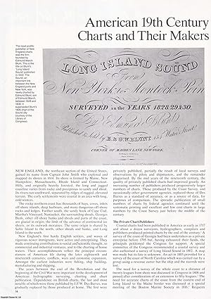
American, 19th Century, New England Charts and their Makers. An original article from Map Collector Magazine, 1984.
Editore: Map Collector, 1984
Da: Cosmo Books, Shropshire., Regno Unito
Valutazione del venditore 5 su 5 stelle
Rivista / Giornale
EUR 10,36
Spedizione EUR 13,77
Spedito da Regno Unito a U.S.A.Quantit�: 1 disponibili
Aggiungi al carrelloBooklet - Unbound Pages. Condizione: Very Good. 14 pages, illustrated. An authentic standalone article, extracted from a larger volume. Not a reprint or reproduction, but an original work in its own right. Supplied without title page or cover. Size: 21 x 30 cms. Category: Map Collector; Cosmo Books : 29 years on ABE, 47 years taking care of customers. A bookseller you can rely on.
-
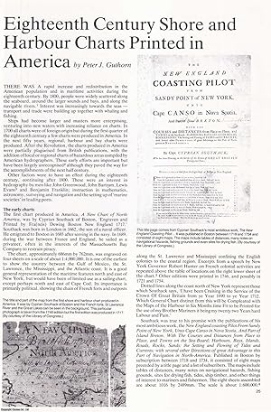
Eighteenth Century Shore and Harbour Charts Printed in America. An original article from Map Collector Magazine, 1980.
Editore: Map Collector, 1980
Da: Cosmo Books, Shropshire., Regno Unito
Valutazione del venditore 5 su 5 stelle
Rivista / Giornale
EUR 10,36
Spedizione EUR 13,77
Spedito da Regno Unito a U.S.A.Quantit�: 1 disponibili
Aggiungi al carrelloBooklet - Unbound Pages. Condizione: Very Good. 7 pages, illustrated. An authentic standalone article, extracted from a larger volume. Not a reprint or reproduction, but an original work in its own right. Supplied without title page or cover. Size: 21 x 30 cms. Category: Map Collector; Cosmo Books : 29 years on ABE, 47 years taking care of customers. A bookseller you can rely on.
-
American Maps and Map Makers of the Revolution
Editore: Philip Frenau Press, Monmouth Beach, New Jersey, 1966
Hardcover. Condizione: Very Good. No Jacket. Mild shelfwear to covers, otherwise very good. Text clean, binding sturdy. Size: Folio - over 12 - 15" tall. Book.
-
BRITIAH MAPS OF THE AMERICAN REVOLUTION
Editore: Peter Freneau Press, Monmouth Beach, N.J., 1972
Da: Bookseller, Inc., Akron, OH, U.S.A.
Valutazione del venditore 5 su 5 stelle
Prima edizione
79p, 12" x 10", cloth, maps, very good. First edition. Index.
-

United States Coastal Charts, 1738-1861
Lingua: Inglese
Editore: Schiffer Publishing, Limited, Atglen, PA, 1984
ISBN 10: 0887400191 ISBN 13: 9780887400193
Da: Looking for Books?, CORPUS CHRISTI, TX, U.S.A.
Valutazione del venditore 3 su 5 stelle

Hardcover. Condizione: Near Fine. Condizione sovraccoperta: Near Fine. Book is clean and tight would be fine except has shelf wear on tips of corners and spine. Dust jacket is shelf worn at corners and spine also.; 4to - over 9�" - 12" tall.
-
United States Coastal Charts 1783-1861
Lingua: Inglese
Editore: Schiffer Publishing Limited, Exton, PA, 1984
ISBN 10: 0887400191 ISBN 13: 9780887400193
Da: Brillig's Books, Kingston, NY, U.S.A.
Valutazione del venditore 4 su 5 stelle
Prima edizione
Cloth. Condizione: Good. Condizione sovraccoperta: Good. First Edition. 224 pps. Gilt titles: sp. Illust. w/ b/w charts & facsim. docs. Marbled endpapers. Blue cloth bds. Interior leaves are clean and tight. The first definitive study of these early nautical charts and their publishers. Covering the entire U. S. coastline, on both oceans and the Gulf of Mexico. The charts are heavily annotated by the author. Includes appendix & index.
-

United States Coastal Charts, 1738-1861
Lingua: Inglese
Editore: Schiffer Publishing Ltd, US, 1997
ISBN 10: 0887400191 ISBN 13: 9780887400193
EUR 54,26
Spedizione gratuita
Spedito in U.S.A.Quantit�: Pi� di 20 disponibili
Aggiungi al carrelloHardback. Condizione: New. The years between the end of the American Revolution and the beginning of the Civil War were crucial ones in the history of American coastal charting. At the beginning, foreign charts, principally British, were available; and a few of American origin. The latter were largely copies of British charts, and a few were compiled by local shipmasters and pilots. The more successful publishers were able to compile hydrographic data using their own resources, and added corrections in new editions of their charts. A "survey of the coast" was initiated by Congress in 1807 under Thomas Jefferson's administration. Delays due to the War of 1812 and political disagreements slowed progress and the production of the first important chart, that of New York harbour, was not published until 1843. Private publishers filled an important void between the time the Coast Survey was initiated and the time they produced usable charts. Data on the private publishers has been collected for publication here for the first time. Nevertheless, the survey was to increase the availability of charts which were accurate within the framework of hydrographic knowledge at the time. The Coast Survey succeeded in charting the entire coastline by the beginning of the Civil War. This volume is the first definitive study of these charts.
-
United States Coastal Charts 1783-1861
Editore: Schiffer Publishing 1984, 1984
Da: Hard to Find Books NZ (Internet) Ltd., Dunedin, OTAGO, Nuova Zelanda
Membro dell'associazione: IOBA
Valutazione del venditore 5 su 5 stelle
EUR 21,01
Spedizione EUR 17,42
Spedito da Nuova Zelanda a U.S.A.Quantit�: 1 disponibili
Aggiungi al carrelloLg quarto, blue heavy boards, gilt lettering to spine, marbled eps, 224pp, illus, VG (light rubbing & bruising to extrems, light soiling to boards, light tanning & foxing to page edges, moderate foxing to prelims & terminals, sporadic light foxing throughout) in d/w, VG+ (light creasing to edges, light chafing, light foxing to flaps).
-

THE SEA BRIGHT SKIFF, and other Shore Boats
Editore: Schiffer Publishing. Exton, Pennsylvania. c. ., 1984
ISBN 10: 0916838730 ISBN 13: 9780916838737
Da: Jean-Louis Boglio Maritime Books, CYGNET, TAS, Australia
Membro dell'associazione: ANZAAB ILAB
Valutazione del venditore 5 su 5 stelle
Prima edizione
EUR 19,02
Spedizione EUR 19,77
Spedito da Australia a U.S.A.Quantit�: 1 disponibili
Aggiungi al carrello1st paperback edition. (10), 239 PP with b/w illustrations (adverts, line drawings & sketches, plans & photos), plus17 pages with 11 for illustrations (2 set of plans and 25 photos), 2 for glossary, 4 for index. Pictorial card covers. Fine. Scarce. 25.4 x 17.8.
-
United States Coastal Charts 1783-1861
Lingua: Inglese
Editore: Schiffer Pub Ltd., 1997
Da: Arader Galleries of Philadelphia, PA, Philadelphia, PA, U.S.A.
Valutazione del venditore 4 su 5 stelle
Hardcover. Condizione: Very Good. A fine volume featuring many images of sea charts depicting American coastlines. The book would make a fine addition to the personal library of any with an interest in coastal cartography. This description was written by Athen Schaper. My interest in printed books and maps is strong and it would be my great pleasure to share the allure of this volume with you. In order to learn more about Arader Galleries and the materials we offer, I encourage you to explore the websites specific to our Philadelphia and New York locations, along with our Rare Books site to discover more materials which could be of interest to you. Dust jacket in very good conditi.

