Importo totale (1 articolo articoli):
Destinazione ordine:

h e c robinson pty (8 risultati)
Vai alla pagina principale dei risultati di ricerca
Filtri di ricerca
Tipo di articolo
- Tutti i tipi di prodotto
- Libri (7)
- Riviste e Giornali (Nessun altro risultato corrispondente a questo perfezionamento)
- Fumetti (Nessun altro risultato corrispondente a questo perfezionamento)
- Spartiti (Nessun altro risultato corrispondente a questo perfezionamento)
- Arte, Stampe e Poster (Nessun altro risultato corrispondente a questo perfezionamento)
- Fotografie (Nessun altro risultato corrispondente a questo perfezionamento)
- Mappe (1)
- Manoscritti e Collezionismo cartaceo (Nessun altro risultato corrispondente a questo perfezionamento)
Condizioni Maggiori informazioni
- Nuovo (Nessun altro risultato corrispondente a questo perfezionamento)
- Come nuovo, Ottimo o Quasi ottimo (1)
- Molto buono o Buono (3)
- Discreto o Mediocre (1)
- Come descritto (3)
Legatura
- Tutte
- Rilegato (Nessun altro risultato corrispondente a questo perfezionamento)
- Brossura (3)
Ulteriori caratteristiche
- Prima ed. (1)
- Copia autograf. (Nessun altro risultato corrispondente a questo perfezionamento)
- Sovracoperta (Nessun altro risultato corrispondente a questo perfezionamento)
- Con foto (5)
- Non Print on Demand (8)
Lingua (2)
Prezzo
- Qualsiasi prezzo
- Inferiore a EUR 20 (Nessun altro risultato corrispondente a questo perfezionamento)
- EUR 20 a EUR 45
- Superiore a EUR 45
Spedizione gratuita
Paese del venditore
Valutazione venditore
-

Soft cover. Condizione: Very Good. No Jacket. Light general wear with rubbing to the edges of the covers. Overall a nice clean copy. 48 pages.
-
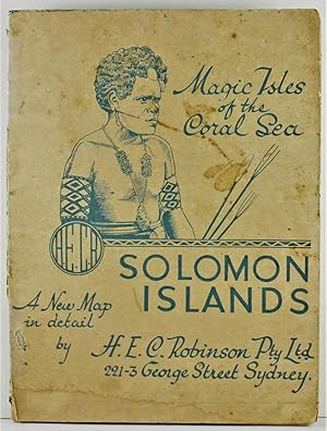
Magic Isles of the Coral Sea Solomon Islands a new map in detail by H.E.C. Robinson Pty Ltd
Editore: H.E.C. Robinson Pty Ltd no date (1940's?), Sydney, 1940
Da: Gotcha By The Books, Brisbane, QLD, Australia
Valutazione del venditore 5 su 5 stelle

EUR 28,49
Spedizione EUR 13,74
Spedito da Australia a U.S.A.Quantità: 1 disponibili
Aggiungi al carrellopaperback. Condizione: fair. colour map (illustratore). Map of the Solomon Islands titled '2nd Edition Map of the Solomon Islands Mercator Projection'; no publishing date but c1940's; size is 25 x 19 cm (closed) 75 x 50 cm (open); map in fair condition with occasional minor loss, and some folds no longer joined (with minor acid-free tape-repair); wraps rubbed and stained. . . 75 x 50 cm (open). fair.
-

New Guinea, a detailed map : Map of the territory of New Guinea and Papua
Editore: H.E.C. Robinson Pty Ltd, [between 1950 and 1965], Sydney, 1950
Da: Joseph Burridge Books, Dagenham, Regno Unito
Valutazione del venditore 5 su 5 stelle
Mappa
EUR 35,78
Spedizione EUR 26,63
Spedito da Regno Unito a U.S.A.Quantità: 1 disponibili
Aggiungi al carrello1 map : colour ; 71 x 96 cm, folded to 20 x 26 cm. Notes: Panel title: New Guinea, a detailed map Map no. 315 Cartographic Mathematical Data: Scale [ca. 1:2,000,000].
-

Official Blue Mountains Tourist Guide and Street Directory from Penrith to Mount Victoria
Editore: Blue Mountains City Council/H.E.C. Robinson Pty. Ltd., Sydney NSW, nd.
Da: lamdha books, Wentworth Falls, NSW, Australia
Valutazione del venditore 5 su 5 stelle
EUR 27,86
Spedizione EUR 21,26
Spedito da Australia a U.S.A.Quantità: 1 disponibili
Aggiungi al carrelloOctavo; paperback, stapled booklet; 42pp., with maps and many monochrome illustrations. Minor wear; covers lightly rubbed with small tear on rear upper edge and one or two chips on lower rear edge. Very good. Postage quoted is for a standard format octavo book. Final charges may vary depending on size and weight.
-
China & Japan with Adjoining Countries. Map 1:6,000,000,
Lingua: Inglese
Editore: Sydney, n.d. (ca. 1940ies)., 1940
Da: Books and Beaches, Anna Bechteler, Icking, Germania
Valutazione del venditore 5 su 5 stelle
Prima edizione
EUR 35,00
Spedizione EUR 48,00
Spedito da Germania a U.S.A.Quantità: 1 disponibili
Aggiungi al carrelloCondizione: Sehr gut. Large folding map, ca. 75 x 101 cm, some tears at the folds, some old tape repair (mostly outside printed area, but some within), tear at lower edge which should be repaired (no loss so far). The map shows, apart from China and Japan also the then existing state of Manchuria, as well as Inner and Outer Mongolia and Tannu Tuva. Part of Central Tibet is shown as part f China, as well as the Chinese province Sikang, comprising most of Tibet east of Lhasa. Uncommon, condition reflected in the price. Sprache: Englisch Gewicht in Gramm: 550.
-
Robinson's Week-end Motor Map. Extending from Gosford to Bulli and West to Springwood and Picton. For Projecting and Recording Short Motor Tours Around Sydney.
Editore: c.1940, 1940
Da: Berkelouw Rare Books, Berrima, NSW, Australia
Membro dell'associazione: ANZAAB ILAB
Valutazione del venditore 4 su 5 stelle

EUR 22,16
Spedizione EUR 32,64
Spedito da Australia a U.S.A.Quantità: 1 disponibili
Aggiungi al carrelloLarge folding coloured map measuring 100 x 65cm. in printed 8vo size limp board portfolio. 5th ed. Sydney (ca 1940). Fine.
-

Central North Coast Tourist Guide & Street Directory.
Editore: c.1945, 1945
Da: Berkelouw Rare Books, Berrima, NSW, Australia
Membro dell'associazione: ANZAAB ILAB
Valutazione del venditore 4 su 5 stelle
EUR 25,33
Spedizione EUR 32,64
Spedito da Australia a U.S.A.Quantità: 1 disponibili
Aggiungi al carrelloSydney: W.E. Smith Ltd., n.d. (circa 1945). 8vo. Orig. illust. wrapper. (64pp.). With maps, illusts., and adverts. Fine.
-

Magic Isles of the Coral Sea: Solomon Islands
Editore: Sydney: H. E. C. Robinson Pty. Ltd.
Da: Wonder Book, Frederick, MD, U.S.A.
Membro dell'associazione: ABAA ILAB
Valutazione del venditore 5 su 5 stelle
Condizione: Good. Sydney: H. E. C. Robinson Pty. Ltd., No date stated. Sm 4to fold-out map. Color map. Good map. Slightly dampstained. Writing inside. In polypropylene bag. (maps, oceania, travel, geography) Inquire if you need further information.