
Importo totale (1 articolo articoli):
Destinazione ordine:

map central africa (11 risultati)
Vai alla pagina principale dei risultati di ricerca
Filtri di ricerca
Tipo di articolo
- Tutti i tipi di prodotto
- Libri (2)
- Riviste e Giornali (Nessun altro risultato corrispondente a questo perfezionamento)
- Fumetti (Nessun altro risultato corrispondente a questo perfezionamento)
- Spartiti (Nessun altro risultato corrispondente a questo perfezionamento)
- Arte, Stampe e Poster (1)
- Fotografie (Nessun altro risultato corrispondente a questo perfezionamento)
- Mappe (8)
- Manoscritti e Collezionismo cartaceo (Nessun altro risultato corrispondente a questo perfezionamento)
Condizioni Maggiori informazioni
- Nuovo (Nessun altro risultato corrispondente a questo perfezionamento)
- Come nuovo, Ottimo o Quasi ottimo (Nessun altro risultato corrispondente a questo perfezionamento)
- Molto buono o Buono (1)
- Discreto o Mediocre (Nessun altro risultato corrispondente a questo perfezionamento)
- Come descritto (10)
Legatura
Ulteriori caratteristiche
- Prima ed. (1)
- Copia autograf. (Nessun altro risultato corrispondente a questo perfezionamento)
- Sovracoperta (Nessun altro risultato corrispondente a questo perfezionamento)
- Con foto (10)
- Non Print on Demand (11)
Lingua (2)
Prezzo
- Qualsiasi prezzo
- Inferiore a EUR 20 (Nessun altro risultato corrispondente a questo perfezionamento)
- EUR 20 a EUR 45
- Superiore a EUR 45
Spedizione gratuita
- Spedizione gratuita in U.S.A. (Nessun altro risultato corrispondente a questo perfezionamento)
Paese del venditore
Valutazione venditore
-

Map of Central Africa - Fine Detailed Map - an Original Engraving
Lingua: Inglese
Data di pubblicazione: 1850
Da: K Books Ltd ABA ILAB, York, YORKS, Regno Unito
Membro dell'associazione: ABA ILAB PBFA
Valutazione del venditore 5 su 5 stelle

EUR 41,63
Spedizione EUR 22,52
Spedito da Regno Unito a U.S.A.Quantit�: 1 disponibili
Aggiungi al carrelloNo Binding. Condizione: Very Good. A fine engraving - printed circa 1850. Mounted and ready to frame. Hand colouring not contemporary, but delicately and expertly executed. A fine opportunity to purchase an attractive and decorative engraving - Map of Central Africa.
-
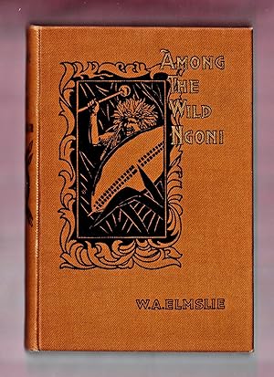
Among the Wild Ngoni, Being Some Chapters in the History of the Livingstonia Mission in British Central Africa
Editore: Fleming H. Revell Company, New York, 1899
Da: Frogtown Books, Inc. ABAA, Toledo, OH, U.S.A.
Membro dell'associazione: ABAA ILAB
Valutazione del venditore 4 su 5 stelle

Prima edizione
With Introduction by The Right Hon Lord Overtoun. Illustrated with 14 photographs. Crisp color 19" x 14" fold out map of central Africa. (illustratore). First Edition. Dr. Elmslie, who with his devoted wife has just sailed for Africa to begin his third term of service, vividly pictures the lofty plateau of Ngoniland, with its native villages and the dark background of vice and cruelty which lies behind the village life, with the horrors of the slave trade which harried peaceful homes, leaving the smoking ruins, while the inmates were massacred, or reserved for a more cruel fate, and how their perils drove the people to live in swamps or inaccessible rocks. The first advance of the missionaries to Ngoniland was in 1878 in the face of much personal danger. The first interviews with Mombera and his bloodthirsty chiefs, picture not only the danger of the situation, but the faith, courage, and tact of the men who, taking their life in their hands, went as ambassadors of Christ to these bloodstained savages. Ink inscription at top of free front endpaper, otherwise fine condition 8vo. Pictorial mustard colored cloth covered boards stamped in black and gold.
-
Karte der Shire Highlands in Malawi mit einer �bersichtskarte auf 1 Blatt. Lake Chilwa (Chilwa-See) oben rechts im Kartenbild, die Stadt Chiromo bildet den s�dlichsten Punkt der Karte.
Da: Antiquariat Martin Barbian & Grund GbR, Saarbruecken, Germania
Valutazione del venditore 5 su 5 stelle
Arte / Stampa / Poster
EUR 35,00
Spedizione EUR 45,00
Spedito da Germania a U.S.A.Quantit�: 1 disponibili
Aggiungi al carrelloFarblithographie von Johnston, London, Royal Geographical Society, 1899, 48,5x34 cm (Faltspuren) *Afrika / S�dostafrika.
-

The Country Between Lake Chiuta and River Luli. British Central Africa.
Data di pubblicazione: 1900
Da: Geographicus Rare Antique Maps, Brooklyn, NY, U.S.A.
Membro dell'associazione: ABAA ESA ILAB
Valutazione del venditore 4 su 5 stelle
Mappa
Soft cover. Very good. Light foxing. Light wear along original fold lines. Blank on verso. Size 10.5 x 15.75 Inches. Depicting what Pearce calls 'the hitherto blank piece of country between Lake Chiuta and the Luli river', this is a 1900 Captain F. B. Pearce map of part of Malawi and Mozambique. Then divided between British Central Africa and Portuguese Mozambique, this map focuses on a portion of East Africa between Lake Chilwa in Malawi and the Lurio River in Mozambique. Per an article in The Geographical Journal , the map was surveyed by Pearce during a joint Anglo-Portuguese military expedition undertaken in 1899 against the slave-raiding chief Kwamba. Numerous villages are labeled throughout the region, along with hills, ridges, mountains, and forests. The flood plains of both Lake Chilwa and Lake Chiuta are illustrated, demonstrating to its viewers the vast differences between the African wet and dry season in this part of the continent. An inset map in the lower right corner situates the depicted region in East Africa in general, allowing the viewer to note that Lake Chilwa is not far from Lake Nyassa (Lake Malawi), that it borders Portuguese East Africa, and that German East Africa is not far to the north. This map was created by Captain F. B. Pearce and printed by the Royal Geographical Society in its Geographical Journal in 1900. References: OCLC 65644981.
-

Sketch Map of the Shire Highlands shewing the routes of B.L. Sclater, R.E. F.R.G.S.
Data di pubblicazione: 1893
Da: Geographicus Rare Antique Maps, Brooklyn, NY, U.S.A.
Membro dell'associazione: ABAA ESA ILAB
Valutazione del venditore 4 su 5 stelle
Mappa
Soft cover. Very good. Light wear and toning along original fold lines. Blank on verso. Size 12 x 16.5 Inches. This is an 1893 William Shawe map of the Shire Highlands in Malawi, which then was part of the British Central Africa Protectorate. Depicting the region just south of Lake Malawi, known then as Lake Nyasa, black lines track the movements of Lieutenant B.L. Sclater during the two years when he served as an assistant to the Commissioner of British Central Africa. Numerous towns and villages are labeled, as are rivers, mountains, and other locations. Printed notes, such as 'open grass plain' and 'rolling plain, poorly forested', provide some insight into the terrain. The Shire River arcs through the left half of the map. The Shire Highlands The Shire Highlands, a plateau situated in southern Malawi, are the most densely populated region in the country today. They are also a major agricultural area that covers 7,250 square kilometers. The British first arrived in the area when David Livingstone established a missionary station in 1861. In the following decades, more missions were established alongside British-owned plantations. Because of the large contingent of British subjects in the area, the Shire Highlands held significant influence in the minds of British politicians during the Anglo-Portuguese disputes concerning colonial possessions in central Africa in the late 19th century. Several treaties were refused by either one party or the other, until finally, in 1890, the British issued an ultimatum that the Portuguese withdraw all their troops from Mashonaland, Matabeleland, and all the land between the Shire River north of the Ruo River and Lake Nyasa (Lake Malawi), which included the disputed Shire Highlands. This ultimatum eventually led to the signing of the Anglo-Portuguese Treaty of 1891 and the establishment of relatively firm borders between Portuguese and British colonial possessions in central Africa. Publication History and Census This map was created by William Shawe and published by the Royal Geographical Society in the November 1893 edition of The Geographical Journal to accompany Lieutenant B.L. Sclater's paper 'Routes and Districts in Southern Nyasaland'. Three examples are catalogued in the OCLC as being part of the institutional collections at the University of Chicago, the University of Manchester, and The British Library. References: OCLC 138478902.
-

1930s Bobby Benson and the H-O Rangers in Africa
Da: New World Cartographic, Chicago, IL, U.S.A.
Membro dell'associazione: ABAA ILAB
Valutazione del venditore 4 su 5 stelle
Mappa
By: HeckerDate:1930s (circa) Buffalo, NYDimensions: 17.75 x 23.25 inchesThis brightly colored, fun pictorial map featuring the African continent is based on the themes of Bobby Benson and the B-Bar-B Riders, an old-time radio juvenile western adventure program in the United States, one of the first juvenile radio programs. It was broadcast on CBS from October of 1932 through December of 1936, and on Mutual from June 1949 through June1955.The map is covered with bright cheerful illustrations of indigenous African peoples, their villages, a witch doctor, flora and fauna of Africa abound, with jungle animals and those of the desert, African plant life in myriad forms. Mountains and valleys fill a portion of the map, including a mountain range in which is depicted a valley full of glittering diamonds. A brightly colored inset map of the African continent plus Spain and a portion of the Levant in brightly red is in the lower right quadrant, with a yellow colored circle in the center marked 'Belgian Congo', and a note in the inset stating that 'the area shown in the detailed map lies within the yellow circle.' Encircled by the title cartouche is a Bobby Benson portrait.The border is a playful rendering of monkeys connected hand to hand and tail to tail which encompasses the entire map. This marvelous decorative pictorial map would be a cheerful conversation piece.Condition: This folding map is in B condition. Most separations at folds have been repaired with archival material on the verso.Inventory #116371200 W. 35th Street #425 Chicago, IL 60609 | P: (312) 496 - 3622.
-

Africa Interior
Data di pubblicazione: 1729
Da: Geographicus Rare Antique Maps, Brooklyn, NY, U.S.A.
Membro dell'associazione: ABAA ESA ILAB
Valutazione del venditore 4 su 5 stelle
Mappa
Very Good condition. Minor foxing throughout. Minor centerfold darkening. Size 8.25 x 12.25 Inches. A very curious map of central Africa dating to approximately 1730. Covers the mid-section of Africa roughly from the Gulf of Guinea and the Atlantic eastward to the Red Sea and the horn. Extends southward as far as modern day Tanzania. Full of curious and often spurious information. Identifies the kingdoms of the Axuxmites in modern day Ethiopia, as well as the Nubians, the Amanites, and many other mysterious peoples. In the west the map, the Niger River begins and ends without a source or oceanic outlet. Further east, the map follows the course of the Nile river southward, past the lands of the Elephantophagi, to two mysterious lakes. These great lakes, at the foot of the mountains of the moon, were part of a long enduring myth in African cartography that dates to the works of Claudius Ptolemy. In fact, though issued nearly 1600 years after Ptolemy's death, most of the information here is based directly on his work. Cartographically this map is very similar to Culver's map of the same name issued in 1736.
-

Carte des Royaumes de Congo, Angola, et Benguela. Avec les Pays Voisins.
Data di pubblicazione: 1780
Da: Geographicus Rare Antique Maps, Brooklyn, NY, U.S.A.
Membro dell'associazione: ABAA ESA ILAB
Valutazione del venditore 4 su 5 stelle
Mappa
Very good. Exhibits light offsetting. Size 10.25 x 13 Inches. This is a 1780 Jacques-Nicolas Bellin map of west-central Africa. Focusing on the kingdoms surrounding the Congo River, Bellin provides a snapshot of Portuguese colonial dominance in the region. Numerous towns and villages are labeled, some of them Portuguese, some of them African. Short comments provide some information where it was available, such as, concerning the Royaume de Dongo , 'destroyed by the Portuguese.' Or, just below Benguela, where savages or sauvages apparently live, 'it is said that language is not used here.' African Kingdoms Many of these kingdoms were important states in early-modern Africa. The Kingdom of Ndongo (also known as Dongo or Angola), existed as early as the 1530s, probably earlier. It was then destroyed, as Bellin relates, by colonial Portuguese who wanted to control parts of modern-day Angola and build forts and bring settlers. The Kingdom of Matamba was another powerful early-modern African kingdom that resisted Portuguese advances for several years before its kingdom was invaded in 1744, divided in two, and then eventually annexed by Portuguese Angola. Portuguese Colonialism in Angola Portuguese Angola was founded in 1575 with the settlement of Luanda. The Portuguese founded Benguela in 1617. Thus, this map captures a moment in the history of European colonialism in Africa. It highlights Portugal's efforts to consolidate rule in Angola after their conquest of the Kingdom of Ndongo and before the complete subjugation of the Kingdom of Matamba. Publication History and Census Originally created for of Abb� Pr�vost's Histoire G�n�rale des Voyages by Jacques-Nicolas Bellin, this map was published by Jean Fran�ois de La Harpe's in his Abr�g� de l'Histoire G�n�rale des Voyages in 1780. Two examples of the 1780 edition of this map are cataloged in OCLC and are part of the institutional collections at Universit�tsbibliothek M�nchen in Munich and Bayerische Staatsbibliothek, also in Munich. The works by Pr�vost and de la Harpe are well represented institutionally. References: OCLC 635220101 ; 231963690.
-

Regna Congo et Angola.
Data di pubblicazione: 1686
Da: Geographicus Rare Antique Maps, Brooklyn, NY, U.S.A.
Membro dell'associazione: ABAA ESA ILAB
Valutazione del venditore 4 su 5 stelle
Mappa
Very good. Verso repair of minor border tear. Verso reinforcement of left and right margin. Blank on verso. Size 11.5 x 13.5 Inches. This is a 1686 Olfert Dapper map of the western central Africa. The map depicts the Atlantic coast of Africa from approximately Gabon to Angola, with the inland portions of the map depicting parts of the Republic of the Congo and the Democratic Republic of the Congo. Highly detailed, numerous towns and smaller settlements are labeled throughout, along with rivers, lakes, and mountain ranges. Mountains are illustrated along the coast and farther inland, with trees dotting the landscape and lining the tributaries of the Congo River (Rio Zaire). Several African animals are illustrated, including lions and elephants. The political divisions on the map are not well defined, but the Kingdom of the Congo and the Kingdom of Angola are both labeled. Lake Aquilunda, an apocryphal lake believed to be in Angola, is depicted here, with numerous rivers flowing out of it. Dapper consulted numerous sources when compiling Description of Africa , and Lake Aquilunda was widely reported by explorers in their accounts of the region, thus its inclusion here. Through a series of rivers, water from Lake Aquilunda both reaches the Atlantic and traverses the continent to join the Congo River. Some ships are illustrated in the Atlantic off the coast. A decorative title cartouche is situated in the lower left corner, surrounded by an ostrich, a rhinoceros, a monkey, and an elephant, along with three figures who appear to be slaves, and most likely a slave trader. This view was produced by Olfert Dapper and published by in the French edition of Description of Africa entitled Description de L'Afrique and published in 1686. References: OCLC 992155189.
-

Abissinorum Sive Pretiosi Ioannis Imperiu.
Data di pubblicazione: 1606
Da: Geographicus Rare Antique Maps, Brooklyn, NY, U.S.A.
Membro dell'associazione: ABAA ESA ILAB
Valutazione del venditore 4 su 5 stelle
Mappa
Average. Centerfold split mended; else very good with a bold strike and bright hand color. Size 13.5 x 19.25 Inches. This is the 1606 Jodocus Hondius map of Abyssinia or East Africa, showing the headwaters of the Nile, as assumed in antiquity. The region thus depicted encompasses the apocryphal Christian Empire of Prester John. This example is from the first French text edition of the Mercator / Hondius atlas, dating to 1609. Hondius has drawn heavily on what was still the most authoritative take on the mythical kingdom: Abraham Ortelius' 1573 Presbiteri Iohannis, Sive, Abissionrum Imperii Descriptio . The Legend of Prester John The legend of Prester John dates to about 1145 when the Syrian priest Hugh traveled to Europe to canvas for a fifth Crusade. Hugh described Prester John as a great Christian king whose empire was located somewhere in India - the idea being that the two great Christian empires, that of John and that of the Pope, would together make war on the Saracens occupying the Holy Land, thus sandwiching the enemy between two indomitable armies. About 20 years letter a curious letter began to circulate around Europe, purportedly by John himself, wherein the King claimed to be some 562 years old and the ruler of the 'Three Indias'. 'India' at this time referred not just to the subcontinent, but also to much of southern Asia and Africa east of the Nile. It was divided into three parts, 'Farther India' or what is today India and Southeast Asia, 'Nearer India' or the modern-day Middle East, and 'Middle India' or the parts of Africa to the east of the Nile . Having failed to pinpoint the Kingdom of Prester John in Asia, scholars as early as the 14th century began locating John's Kingdom in east Africa. Here they had a bit luck for explorers in the region, starting with the Francisco Alveres of Portugal in the 1500s, soon came into to contact with the Christian Solomonic Kings of Ethiopia or Abyssinia. The Coptic Ethiopian Emperor David II fit the mold of the 'Prester John,' and Alveres believed him to be a descendent of the legendary John, thus firmly entrenching the mythical kingdom of Prester John on maps of East Africa well into the 18th century. Ptolemaic Sources of the Nile The map follows the Ptolemaic model with regard to the course of the White Nile and its source in two great lakes the Zaire Lacus (Zembre Lacus) and the Zaflan Lacus, themselves in the foothills of the Mountains of the Moon or Lunae Montes, located at the base of the map. The Blue Nile, which has its source is modern-day Ethiopia, is expressed as a complex network of rivers and valleys bearing little resemblance to reality - though the observer will note that many of the place names, Amara, Tigre, Dobas, and Dangali, do reflect real places and remain in use today. Pigafetta's Map of the Congo An insert map, entitled 'Congi Regni in Africa Christiani Nova Descriptio,' shows the lands south of the Congo River, and part of what is now understood as Angola. It was included to illustrate the site of Christian communities, apparently threatened by the presence just north of the Congo of the Anzicana, described here as cannibals. This map, possibly with Ortelius as an intermediary, is a reduced copy of Filippo Pigafetta's 1597 Tabulam Hanc Regni Congo ; that map, based on the travels of the Portuguese Duarte Lopes, brings an element of actual exploration to a map that is otherwise a work of imagination. Lopes traveled the Congo basin (partially in an effort to determine the sources of the Nile) and his journeys did lead to the lake pictured on the inset map: 'Aquilunda Lacus', or Lagoa Quilunda in present-day Angola. While Lopes' lake did not find its way onto most contemporaneous complete maps of Africa, Pigafetta's iteration of the map appears as an inset on maps by Ortelius, Hondius, and as a separate map in the Mercator/Hondius pocket atlases. Publication History and Census This map was first engraved by Jodocus Hondius to accompany in 1606 the.
-

Aethiopia Superior vel Interior vulgo Abissinorum sive Presbiteri Joannis Imperium.
Data di pubblicazione: 1635
Da: Geographicus Rare Antique Maps, Brooklyn, NY, U.S.A.
Membro dell'associazione: ABAA ESA ILAB
Valutazione del venditore 4 su 5 stelle
Mappa
Very good condition. Reinforced lower centerfold; printer's crease in upper right. Else excellent with a bold, sharp strike and generous margins. Size 15.25 x 19.75 Inches. This is the map of the mythical Kingdom of Prester John in eastern Africa, issued by Willem Blaeu in 1635, in a beautiful example. The map covers from the Bight of Benin to the Indian Ocean and from Arabia and the Red Sea to Mozambique. It includes two decorative cartouches, as well as stylized images of African fauna, including elephants, monkeys, and ostriches. While the African coast exhibits considerable advances over earlier maps of the region, the interior of Africa exhibits a cartography primarily based on the literature of antiquity and little changed from the days of Ptolemy, and its primary subject matter is that of legend. The Kingdom of Prester John This map frames the legendary Kingdom of Prester John (Presbiteri Ioannis) - a persistent and popular figure in European legend. The legend of Prester John dates to about 1145 when a Syrian priest named Hugh traveled to Europe to canvas for a Fifth Crusade. Hugh described Prester John as a great Christian king whose empire was located somewhere in India - the idea being that the two great Christian empires, that of John and that of the Pope, would together make war on the Saracens occupying the Holy Land, thus sandwiching the enemy between two indomitable armies. About 20 years later a curious letter began to circulate around Europe, purportedly by John himself, wherein the mythical King claimed to be some 562 years old and the ruler of the 'Three Indias'. 'India' at this time referred not just to the subcontinent, but much of southern Asia. It was divided into three parts, 'Farther India' or what is today India and Southeast Asia, 'Nearer India' or the modern-day Middle East, and 'Middle India' or the parts of Africa to the east of the Nile River. Having failed to pinpoint the Kingdom of Prester John in Asia, scholars as early as the 14th century began locating John's Kingdom in east Africa. Here they had a bit luck for explorers in the region, starting with the Francisco Alveres of Portugal in the 1500s, soon came into to contact with the Christian Solomonic Kings of Ethiopia or Abyssinia. The Coptic Ethiopian emperor David II fit the mold of the 'Prester John,' and Alveres believed him to be a descendent of the legendary John, thus firmly entrenching the mythical kingdom Prester John on maps of east Africa well into the 18th century. Abraham Ortelius committed the kingdom to a printed map in 1573, and his depiction of the kingdom remained sufficiently canonical for Blaeu to produce this modernized depiction of it using his own map of Africa for a framework. The Updated Map Cartographically this map is derived from Blaeu's own 1608 wall map of Africa one of the most important maps of the continent ever drawn. Most of the interior details offered here, notably the course and sources of the White Nile and its source in two great lakes, are derived from classical texts such as Ptolemy's Geographia. The Lake of Zaire (Zembre Lacus) and Lake Zaflan, themselves appear in the foothills of the Mountains of the Moon or Lunae Montes , located at the base of the map. The Blue Nile, which has its source is modern day Ethiopia, is expressed as a complex network of rivers and valleys bearing little resemblance to reality - although the observer will note that many of the place names, Amara, Tigre, Dobas, and Dangali, do in fact reflect real places and are still in use today. Blaeu also draws a lake at the source of the Niger River, set just north of the West African Kingdom of Biafara, but fails to properly connect the river to its southern extension - which is vaguely noted. Blaeu's place names relating to Prester John's kingdom and the multiplicity of rivers to the east of the Upper Nile are derived from Ortelius' 1571 map focusing on the same theme: an instance of the cartographic authority of his own gen.

