
Importo totale (1 articolo articoli):
Destinazione ordine:

meadows ian (33 risultati)
Vai alla pagina principale dei risultati di ricerca
Filtri di ricerca
Tipo di articolo
- Tutti i tipi di prodotto
- Libri (33)
- Riviste e Giornali (Nessun altro risultato corrispondente a questo perfezionamento)
- Fumetti (Nessun altro risultato corrispondente a questo perfezionamento)
- Spartiti (Nessun altro risultato corrispondente a questo perfezionamento)
- Arte, Stampe e Poster (Nessun altro risultato corrispondente a questo perfezionamento)
- Fotografie (Nessun altro risultato corrispondente a questo perfezionamento)
- Mappe (Nessun altro risultato corrispondente a questo perfezionamento)
- Manoscritti e Collezionismo cartaceo (Nessun altro risultato corrispondente a questo perfezionamento)
Condizioni Maggiori informazioni
- Nuovo (22)
- Come nuovo, Ottimo o Quasi ottimo (3)
- Molto buono o Buono (6)
- Discreto o Mediocre (Nessun altro risultato corrispondente a questo perfezionamento)
- Come descritto (2)
Legatura
Ulteriori caratteristiche
- Prima ed. (2)
- Copia autograf. (Nessun altro risultato corrispondente a questo perfezionamento)
- Sovracoperta (1)
- Con foto (7)
- Non Print on Demand (33)
Lingua (2)
Spedizione gratuita
Paese del venditore
Valutazione venditore
-

GRANTA,MAGAZINE OF NEW WRITING .LOVE STORIES.#68 WINTER 1999.call me if you need me by Ray. c.
Editore: Granta Pub, London, 1999
ISBN 10: 1929001045 ISBN 13: 9781929001040
Da: WONDERFUL BOOKS BY MAIL, CHICO-CA, CA, U.S.A.
Valutazione del venditore 5 su 5 stelle

paperback. Condizione: Very Good. Illustrated by Photos,smilly Face Cover (illustratore). Original ed. VERY GOOD Condition PAPERBACK,CLEAN, SOLID, BRIGHT; Volor photograph cover art shows man in red shorts, woman in green top.red couch. ; MAGAZINE; 254pg pages; .
-

paperback. Condizione: Good. Connecting readers with great books since 1972! Used textbooks may not include companion materials such as access codes, etc. May have some wear or writing/highlighting. We ship orders daily and Customer Service is our top priority!
-
The Pioneer Burial: A high-status Anglian warrior burial from Wollaston Northamptonshire
Da: Books From California, Simi Valley, CA, U.S.A.
Valutazione del venditore 4 su 5 stelle

Paperback. Condizione: Very Good.
-
Pioneer Burial
Prima edizione
paperback. Condizione: New. 1st.
-

Neolithic Pits, Late Bronze Age/Early Iron Age Pit Alignments and Iron Age to Roman Settlements at Wollaston Quarry, Northamptonshire
Da: GreatBookPrices, Columbia, MD, U.S.A.
Valutazione del venditore 5 su 5 stelle
Condizione: New.
-
Neolithic Pits, Late Bronze Age/Early Iron Age Pit Alignments and Iron Age to Roman Settlements at Wollaston Quarry, Northamptonshire
Da: PBShop.store US, Wood Dale, IL, U.S.A.
Valutazione del venditore 5 su 5 stelle
PAP. Condizione: New. New Book. Shipped from UK. Established seller since 2000.
-

Finite resources and the human future.
Editore: Minneapolis, MN: [1976], Augsburg Publ. House, 1976
Da: Alec R. Allenson, Inc., Westville, FL, U.S.A.
Valutazione del venditore 4 su 5 stelle
Softcover. 192 p.; 19.5 cm. VG in maroon and green on white wrapper. An unread copy.
-
Neolithic Pits, Late Bronze Age/Early Iron Age Pit Alignments and Iron Age to Roman Settlements at Wollaston Quarry, Northamptonshire
Da: GreatBookPrices, Columbia, MD, U.S.A.
Valutazione del venditore 5 su 5 stelle
Condizione: As New. Unread book in perfect condition.
-
Neolithic Pits, Late Bronze Age/Early Iron Age Pit Alignments and Iron Age to Roman Settlements at Wollaston Quarry, Northamptonshire
Da: PBShop.store UK, Fairford, GLOS, Regno Unito
Valutazione del venditore 5 su 5 stelle
EUR 41,18
Spedizione EUR 5,79
Spedito da Regno Unito a U.S.A.Quantit�: 2 disponibili
Aggiungi al carrelloPAP. Condizione: New. New Book. Shipped from UK. Established seller since 2000.
-

Neolithic Pits, Late Bronze Age/Early Iron Age Pit Alignments and Iron Age to Roman Settlements at Wollaston Quarry, Northamptonshire
Da: Rarewaves.com USA, London, LONDO, Regno Unito
Valutazione del venditore 5 su 5 stelle
EUR 50,38
Spedizione gratuita
Spedito da Regno Unito a U.S.A.Quantit�: 1 disponibili
Aggiungi al carrelloPaperback. Condizione: New. Between 1990 and 1998, MOLA (Museum of London Archaeology) undertook a series of archaeological excavations within Wollaston Quarry covering an area of 116ha. Eight excavation areas and a watching brief were undertaken. The proximity of the River Nene and at least four palaeochannels formed the dominant natural landscape features. This dynamic environment affected settlement and land use throughout prehistoric and Roman periods.Seventeen pits, largely in small groups, were identified containing early Neolithic to late Neolithic/early Bronze Age pottery. Some of these features were located within the area of the palaeochannels. Later, of especial interest was a notable collection of eleven different late Bronze Age to early Iron Age pit alignments, which were part of a co-axial landscape over an area of 2.5km�. There was also a small area of domestic activity reflected by pits dating to the early Iron Age as well as two large watering holes in other locations. The pit alignment boundaries influenced subsequent settlement from the middle Iron Age to the late Roman periods. While individual settlements and related agricultural enclosures changed location over time, they followed the same alignments as the earlier pit alignments suggesting some form of continuity for over 800 years.In the middle to late Iron Age four separate farmsteads were established of which two overlaid the former pit alignments. All four comprised sub-rectangular enclosed farmsteads with internal roundhouses and paddocks. Towards the end of the Iron Age at least one of the middle Iron Age settlements was abandoned, while at roughly the same time an unenclosed settlement was created nearby which continued to the late Roman period. Overall, within the quarry, six new late Iron Age and Roman settlements were established and two more have been preserved without excavation. In the middle Roman period, there was extensive and organised agriculture activity which included two vineyards in two different parts of the site as well as two areas of paddock type enclosures. This level of planning suggests significant investment and could reflect the development by a villa estate. In the early to middle Saxon period there were four different areas of activity which comprised a sunken featured building, pits and a late 7th century grave of a high-status Anglian warrior burial (the latter has previously been reported on separately).
-
Pioneer Burial : A High-Status Anglian Warrior Burial from Wollaston Northamptonshire
Da: GreatBookPrices, Columbia, MD, U.S.A.
Valutazione del venditore 5 su 5 stelle
Condizione: As New. Unread book in perfect condition.
-
Pioneer Burial : A High-Status Anglian Warrior Burial from Wollaston Northamptonshire
Da: GreatBookPrices, Columbia, MD, U.S.A.
Valutazione del venditore 5 su 5 stelle
Condizione: New.
-
The Pioneer Burial: A high-status Anglian warrior burial from Wollaston Northamptonshire (Paperback)
Da: Grand Eagle Retail, Bensenville, IL, U.S.A.
Valutazione del venditore 5 su 5 stelle
Paperback. Condizione: new. Paperback. MOLA (Museum of London Archaeology) undertook evaluation and subsequent excavation at Wollaston Quarry, near Wellingborough through the 1990s. These excavations took place in advance of gravel extraction on land to the north and south of Hardwater Road, Wollaston. The archaeological work found Iron Age and Roman farms arranged along a single routeway and the remains of at least two Roman vineyards. A single late 7th century grave, the Pioneer burial, lay alongside a long-lived routeway at the southern end of the quarry, close to the floodplain and any burial mound would have overlooked the River Nene. The burial was an isolated feature; the only other Saxon artefacts recovered from other parts of the quarry were limited to two scatters of pottery and two fragments of small long brooch recovered by metal detection. All were located some distance from the grave. The Pioneer burial was adjacent to the south-western corner of the later Saxon Higham Hundred boundary where it meets the River Nene. It is probable the burial had originally been within a barrow, but no evidence was found for it. Within the grave there was an individual adult of slender build probably in their early to middle 20s equipped with a boar-crested iron helmet, a pattern-welded sword, a copper alloy hanging bowl with enamelled escutcheon, an iron knife, a copper alloy clothing hook and three iron buckles. The burial contained artefacts indicative of very high status, with the early to middle Saxon helmet being at the time only the fourth to have been recovered from a burial in England. Excavations at Wollaston Quarry, near Wellingborough, uncovered a single late 7th century grave, the Pioneer burial. The burial contained artefacts indicative of very high status, with the early to middle Saxon helmet being at the time only the fourth to have been recovered from a burial in England. Shipping may be from multiple locations in the US or from the UK, depending on stock availability.
-

Paperback. Condizione: New. Between 1990 and 1998, MOLA (Museum of London Archaeology) undertook a series of archaeological excavations within Wollaston Quarry covering an area of 116ha. Eight excavation areas and a watching brief were undertaken. The proximity of the River Nene and at least four palaeochannels formed the dominant natural landscape features. This dynamic environment affected settlement and land use throughout prehistoric and Roman periods.Seventeen pits, largely in small groups, were identified containing early Neolithic to late Neolithic/early Bronze Age pottery. Some of these features were located within the area of the palaeochannels. Later, of especial interest was a notable collection of eleven different late Bronze Age to early Iron Age pit alignments, which were part of a co-axial landscape over an area of 2.5km�. There was also a small area of domestic activity reflected by pits dating to the early Iron Age as well as two large watering holes in other locations. The pit alignment boundaries influenced subsequent settlement from the middle Iron Age to the late Roman periods. While individual settlements and related agricultural enclosures changed location over time, they followed the same alignments as the earlier pit alignments suggesting some form of continuity for over 800 years.In the middle to late Iron Age four separate farmsteads were established of which two overlaid the former pit alignments. All four comprised sub-rectangular enclosed farmsteads with internal roundhouses and paddocks. Towards the end of the Iron Age at least one of the middle Iron Age settlements was abandoned, while at roughly the same time an unenclosed settlement was created nearby which continued to the late Roman period. Overall, within the quarry, six new late Iron Age and Roman settlements were established and two more have been preserved without excavation. In the middle Roman period, there was extensive and organised agriculture activity which included two vineyards in two different parts of the site as well as two areas of paddock type enclosures. This level of planning suggests significant investment and could reflect the development by a villa estate. In the early to middle Saxon period there were four different areas of activity which comprised a sunken featured building, pits and a late 7th century grave of a high-status Anglian warrior burial (the latter has previously been reported on separately).
-

Paleo Diet In A Nutshell: The Ultimate Beginner's Guide For Mastering The Time-Tested Weight Loss Principles Of The Paleo Diet To Lose Excess Weight And Feel Healthy
Da: Revaluation Books, Exeter, Regno Unito
Valutazione del venditore 5 su 5 stelle
EUR 39,83
Spedizione EUR 14,41
Spedito da Regno Unito a U.S.A.Quantit�: 1 disponibili
Aggiungi al carrelloPaperback. Condizione: Brand New. 92 pages. 9.00x6.00x0.23 inches. In Stock.
-
Neolithic Pits, Late Bronze Age/Early Iron Age Pit Alignments and Iron Age to Roman Settlements at Wollaston Quarry, Northamptonshire
Da: Chiron Media, Wallingford, Regno Unito
Valutazione del venditore 5 su 5 stelle
EUR 39,63
Spedizione EUR 17,86
Spedito da Regno Unito a U.S.A.Quantit�: 2 disponibili
Aggiungi al carrellopaperback. Condizione: New.
-
Neolithic Pits, Late Bronze Age/Early Iron Age Pit Alignments and Iron Age to Roman Settlements at Wollaston Quarry, Northamptonshire
Da: Ria Christie Collections, Uxbridge, Regno Unito
Valutazione del venditore 5 su 5 stelle
EUR 44,54
Spedizione EUR 13,81
Spedito da Regno Unito a U.S.A.Quantit�: 2 disponibili
Aggiungi al carrelloCondizione: New. In.
-
Neolithic Pits, Late Bronze Age/Early Iron Age Pit Alignments and Iron Age to Roman Settlements at Wollaston Quarry, Northamptonshire
Da: GreatBookPricesUK, Woodford Green, Regno Unito
Valutazione del venditore 5 su 5 stelle
EUR 41,16
Spedizione EUR 17,30
Spedito da Regno Unito a U.S.A.Quantit�: 1 disponibili
Aggiungi al carrelloCondizione: New.
-
Neolithic Pits, Late Bronze Age/Early Iron Age Pit Alignments and Iron Age to Roman Settlements at Wollaston Quarry, Northamptonshire
Da: Kennys Bookshop and Art Galleries Ltd., Galway, GY, Irlanda
Valutazione del venditore 5 su 5 stelle
EUR 48,55
Spedizione EUR 10,50
Spedito da Irlanda a U.S.A.Quantit�: 2 disponibili
Aggiungi al carrelloCondizione: New. 2024. paperback. . . . . .
-
Neolithic Pits, Late Bronze Age/Early Iron Age Pit Alignments and Iron Age to Roman Settlements at Wollaston Quarry, Northamptonshire
Da: Revaluation Books, Exeter, Regno Unito
Valutazione del venditore 5 su 5 stelle
EUR 48,29
Spedizione EUR 14,41
Spedito da Regno Unito a U.S.A.Quantit�: 2 disponibili
Aggiungi al carrelloPaperback. Condizione: Brand New. 152 pages. 11.42x8.03x11.42 inches. In Stock.
-
Neolithic Pits, Late Bronze Age/Early Iron Age Pit Alignments and Iron Age to Roman Settlements at Wollaston Quarry, Northamptonshire
Da: GreatBookPricesUK, Woodford Green, Regno Unito
Valutazione del venditore 5 su 5 stelle
EUR 45,76
Spedizione EUR 17,30
Spedito da Regno Unito a U.S.A.Quantit�: 1 disponibili
Aggiungi al carrelloCondizione: As New. Unread book in perfect condition.
-
Neolithic Pits, Late Bronze Age/Early Iron Age Pit Alignments and Iron Age to Roman Settlements at Wollaston Quarry, Northamptonshire
Da: Kennys Bookstore, Olney, MD, U.S.A.
Valutazione del venditore 5 su 5 stelle
Condizione: New. 2024. paperback. . . . . . Books ship from the US and Ireland.
-
The Pioneer Burial: A high-status Anglian warrior burial from Wollaston Northamptonshire
Da: Kennys Bookshop and Art Galleries Ltd., Galway, GY, Irlanda
Valutazione del venditore 5 su 5 stelle
Prima edizione
EUR 57,82
Spedizione EUR 10,50
Spedito da Irlanda a U.S.A.Quantit�: 2 disponibili
Aggiungi al carrelloCondizione: New. 2019. 1st Edition. Paperback. . . . . .
-
The Pioneer Burial: A high-status Anglian warrior burial from Wollaston Northamptonshire
Da: Kennys Bookstore, Olney, MD, U.S.A.
Valutazione del venditore 5 su 5 stelle
Condizione: New. 2019. 1st Edition. Paperback. . . . . . Books ship from the US and Ireland.
-
NEOLITHIC PITS LATE BRONZE AGEEARLY IRON
Da: Speedyhen, Hertfordshire, Regno Unito
Valutazione del venditore 5 su 5 stelle
EUR 36,98
Spedizione EUR 47,28
Spedito da Regno Unito a U.S.A.Quantit�: 2 disponibili
Aggiungi al carrelloCondizione: NEW.
-
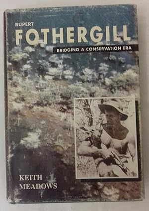
Rupert Fothergill: Bridging a Conservation Era
Da: Secret Bookshop, Johannesburg, GAUTE, Sudafrica
Valutazione del venditore 5 su 5 stelle
EUR 89,76
Spedizione EUR 5,00
Spedito da Sudafrica a U.S.A.Quantit�: 1 disponibili
Aggiungi al carrelloHardcover. Condizione: Good. Condizione sovraccoperta: Fair. 2nd Edition. Green boards with gilt text. Dust jacket scratched and shelf worn. Ownership name and book plate on ffep.Otherwise pages clean and tight. Introduction by Dr John Cody. Illustrated with original line drawings by Ian Henderson. Stated second edition published in Zimbabwe 1997.
-

Neolithic Pits, Late Bronze Age/Early Iron Age Pit Alignments and Iron Age to Roman Settlements at Wollaston Quarry, Northamptonshire
Da: Rarewaves USA United, OSWEGO, IL, U.S.A.
Valutazione del venditore 5 su 5 stelle
Paperback. Condizione: New. Between 1990 and 1998, MOLA (Museum of London Archaeology) undertook a series of archaeological excavations within Wollaston Quarry covering an area of 116ha. Eight excavation areas and a watching brief were undertaken. The proximity of the River Nene and at least four palaeochannels formed the dominant natural landscape features. This dynamic environment affected settlement and land use throughout prehistoric and Roman periods.Seventeen pits, largely in small groups, were identified containing early Neolithic to late Neolithic/early Bronze Age pottery. Some of these features were located within the area of the palaeochannels. Later, of especial interest was a notable collection of eleven different late Bronze Age to early Iron Age pit alignments, which were part of a co-axial landscape over an area of 2.5km�. There was also a small area of domestic activity reflected by pits dating to the early Iron Age as well as two large watering holes in other locations. The pit alignment boundaries influenced subsequent settlement from the middle Iron Age to the late Roman periods. While individual settlements and related agricultural enclosures changed location over time, they followed the same alignments as the earlier pit alignments suggesting some form of continuity for over 800 years.In the middle to late Iron Age four separate farmsteads were established of which two overlaid the former pit alignments. All four comprised sub-rectangular enclosed farmsteads with internal roundhouses and paddocks. Towards the end of the Iron Age at least one of the middle Iron Age settlements was abandoned, while at roughly the same time an unenclosed settlement was created nearby which continued to the late Roman period. Overall, within the quarry, six new late Iron Age and Roman settlements were established and two more have been preserved without excavation. In the middle Roman period, there was extensive and organised agriculture activity which included two vineyards in two different parts of the site as well as two areas of paddock type enclosures. This level of planning suggests significant investment and could reflect the development by a villa estate. In the early to middle Saxon period there were four different areas of activity which comprised a sunken featured building, pits and a late 7th century grave of a high-status Anglian warrior burial (the latter has previously been reported on separately).
-

British Image 1
Lingua: Inglese
Editore: The Arts Council of Great Britain, 1975
ISBN 10: 0728700352 ISBN 13: 9780728700352
EUR 88,00
Spedizione EUR 20,00
Spedito da Paesi Bassi a U.S.A.Quantit�: 1 disponibili
Aggiungi al carrelloCondizione: Good. Original wrappers, softcover, illustrated with (full page) b/w photographs, small 4to.; Slightly foxed on top cut; small wrinkle edge front cover.
-

EUR 47,85
Spedizione EUR 62,82
Spedito da Germania a U.S.A.Quantit�: 1 disponibili
Aggiungi al carrelloTaschenbuch. Condizione: Neu. Neuware - Between 1990 and 1998, MOLA (Museum of London Archaeology) undertook a series of archaeological excavations within Wollaston Quarry covering an area of 116ha. Eight excavation areas and a watching brief were undertaken. The proximity of the River Nene and at least four palaeochannels formed the dominant natural landscape features. This dynamic environment affected settlement and land use throughout prehistoric and Roman periods. Seventeen pits, largely in small groups, were identified containing early Neolithic to late Neolithic/early Bronze Age pottery. Some of these features were located within the area of the palaeochannels. Later, of especial interest was a notable collection of eleven different late Bronze Age to early Iron Age pit alignments, which were part of a co-axial landscape over an area of 2.5km. There was also a small area of domestic activity reflected by pits dating to the early Iron Age as well as two large watering holes in other locations. The pit alignment boundaries influenced subsequent settlement from the middle Iron Age to the late Roman periods. While individual settlements and related agricultural enclosures changed location over time, they followed the same alignments as the earlier pit alignments suggesting some form of continuity for over 800 years. In the middle to late Iron Age four separate farmsteads were established of which two overlaid the former pit alignments. All four comprised sub-rectangular enclosed farmsteads with internal roundhouses and paddocks. Towards the end of the Iron Age at least one of the middle Iron Age settlements was abandoned, while at roughly the same time an unenclosed settlement was created nearby which continued to the late Roman period. Overall, within the quarry, six new late Iron Age and Roman settlements were established and two more have been preserved without excavation. In the middle Roman period, there was extensive and organised agriculture activity which included two vineyards in two different parts of the site as well as two areas of paddock type enclosures. This level of planning suggests significant investment and could reflect the development by a villa estate. In the early to middle Saxon period there were four different areas of activity which comprised a sunken featured building, pits and a late 7th century grave of a high-status Anglian warrior burial (the latter has previously been reported on separately).
-

Neolithic Pits, Late Bronze Age/Early Iron Age Pit Alignments and Iron Age to Roman Settlements at Wollaston Quarry, Northamptonshire
Da: Rarewaves.com UK, London, Regno Unito
Valutazione del venditore 5 su 5 stelle
EUR 46,38
Spedizione EUR 74,95
Spedito da Regno Unito a U.S.A.Quantit�: 1 disponibili
Aggiungi al carrelloPaperback. Condizione: New. Between 1990 and 1998, MOLA (Museum of London Archaeology) undertook a series of archaeological excavations within Wollaston Quarry covering an area of 116ha. Eight excavation areas and a watching brief were undertaken. The proximity of the River Nene and at least four palaeochannels formed the dominant natural landscape features. This dynamic environment affected settlement and land use throughout prehistoric and Roman periods.Seventeen pits, largely in small groups, were identified containing early Neolithic to late Neolithic/early Bronze Age pottery. Some of these features were located within the area of the palaeochannels. Later, of especial interest was a notable collection of eleven different late Bronze Age to early Iron Age pit alignments, which were part of a co-axial landscape over an area of 2.5km�. There was also a small area of domestic activity reflected by pits dating to the early Iron Age as well as two large watering holes in other locations. The pit alignment boundaries influenced subsequent settlement from the middle Iron Age to the late Roman periods. While individual settlements and related agricultural enclosures changed location over time, they followed the same alignments as the earlier pit alignments suggesting some form of continuity for over 800 years.In the middle to late Iron Age four separate farmsteads were established of which two overlaid the former pit alignments. All four comprised sub-rectangular enclosed farmsteads with internal roundhouses and paddocks. Towards the end of the Iron Age at least one of the middle Iron Age settlements was abandoned, while at roughly the same time an unenclosed settlement was created nearby which continued to the late Roman period. Overall, within the quarry, six new late Iron Age and Roman settlements were established and two more have been preserved without excavation. In the middle Roman period, there was extensive and organised agriculture activity which included two vineyards in two different parts of the site as well as two areas of paddock type enclosures. This level of planning suggests significant investment and could reflect the development by a villa estate. In the early to middle Saxon period there were four different areas of activity which comprised a sunken featured building, pits and a late 7th century grave of a high-status Anglian warrior burial (the latter has previously been reported on separately).
