Importo totale (1 articolo articoli):
Destinazione ordine:

oriel steven (28 risultati)
Vai alla pagina principale dei risultati di ricerca
Filtri di ricerca
Tipo di articolo
- Tutti i tipi di prodotto
- Libri (26)
- Riviste e Giornali (Nessun altro risultato corrispondente a questo perfezionamento)
- Fumetti (Nessun altro risultato corrispondente a questo perfezionamento)
- Spartiti (Nessun altro risultato corrispondente a questo perfezionamento)
- Arte, Stampe e Poster (Nessun altro risultato corrispondente a questo perfezionamento)
- Fotografie (Nessun altro risultato corrispondente a questo perfezionamento)
- Mappe (2)
- Manoscritti e Collezionismo cartaceo (Nessun altro risultato corrispondente a questo perfezionamento)
Condizioni Maggiori informazioni
- Nuovo (7)
- Come nuovo, Ottimo o Quasi ottimo (5)
- Molto buono o Buono (14)
- Discreto o Mediocre (Nessun altro risultato corrispondente a questo perfezionamento)
- Come descritto (2)
Legatura
Ulteriori caratteristiche
- Prima ed. (3)
- Copia autograf. (Nessun altro risultato corrispondente a questo perfezionamento)
- Sovracoperta (Nessun altro risultato corrispondente a questo perfezionamento)
- Con foto (14)
- Non Print on Demand (24)
Lingua (2)
Spedizione gratuita
Paese del venditore
Valutazione venditore
-

Gravity and magnetic anomalies in the Soda Springs region, southeastern Idaho: USGS Professional Paper 646-E
Da: GreatBookPrices, Columbia, MD, U.S.A.
Valutazione del venditore 5 su 5 stelle

EUR 14,25
Spedizione EUR 2,27
Spedito in U.S.A.Quantit�: Pi� di 20 disponibili
Aggiungi al carrelloCondizione: New.
-

Gravity and magnetic anomalies in the Soda Springs region, southeastern Idaho: USGS Professional Paper 646-E
Da: GreatBookPrices, Columbia, MD, U.S.A.
Valutazione del venditore 5 su 5 stelle
EUR 15,24
Spedizione EUR 2,27
Spedito in U.S.A.Quantit�: Pi� di 20 disponibili
Aggiungi al carrelloCondizione: As New. Unread book in perfect condition.
-

Preliminary Geologic Map of the SW1/4 of the Bancroft Quadrangle, Bannock and Caribou Counties, Idaho (United States Geological Survey Miscellaneous Field Studies Map MF-229).
Editore: United States Geological Survey., 1965
Da: Eryops Books, Stephenville, TX, U.S.A.
Valutazione del venditore 5 su 5 stelle
No Binding. Condizione: Very Good. Large folded sheet in printed envelope; includes geologic map superposed on topographic contours, a columnar section with description of units, and references cited; ex-corporate library; in very good condition. Map.
-
Preliminary Geologic Map of the Fort Hill Quadrangle, Lincoln County, Wyoming (United States Geological Survey Oil and Gas Investigations Map OM-212).
Editore: United States Geological Survey., 1963
Da: Eryops Books, Stephenville, TX, U.S.A.
Valutazione del venditore 5 su 5 stelle
No Binding. Condizione: Very Good. Large folded sheet in printed envelope (includes a geologic map superposed on topographic contours, a columnar section with description of units, an idealized section of Wasatch and Green River Stratigraphic Units, and a table summarizing wells drilled for oil and gas); ex-corporate library; in very good condition. Map.
-
Preliminary Geologic Map Of The Fort Hill Quadrangle, Lincoln County, Wyoming [map]
Editore: U. S. Department of the Interior, Washington, DC, 1963
Da: Willis Monie-Books, ABAA, Cooperstown, NY, U.S.A.
Membro dell'associazione: ABAA ESA ILAB
Valutazione del venditore 5 su 5 stelle
Softcover. Condizione: Very Good. Upper edge of envelope folded over. Owner's name written on envelope. ; U. S. Geological Survey Oil and Gas Investigations Map OM-212. Folded map in an envelope.
-
Geology of the Fort Hill Quadrangle Lincoln County Wyoming
Editore: US Government Printing Office, Washington, D C, 1969
Da: Second Edition Books, Butte, MT, U.S.A.
Valutazione del venditore 5 su 5 stelle
Soft cover. Condizione: Very Good. Claan tight copy. A bit of edge wear and a faded strip along the outer edge front. Surface and subsurface data of an area along the eastern margin of the Idaho-Wyoming thrust belt establish the geometry and times of movement of two major frontal thrust faults. Lots of charts, maps, and b/w photos as well as two full color geol maps in back envelope. Pages M-1-38.
-
Geology of the Sage and Kemmerer 15-Minute Quadrangles, Lincoln County, Wyoming: USGS Professional Paper 855
Editore: U. S. Geological Survey, Wash, D. C., 1975
Da: Reader's Corner, Inc., Raleigh, NC, U.S.A.
Valutazione del venditore 5 su 5 stelle
Prima edizione
Trade Paperback. Condizione: New. First Edition. This is a new copy with both maps, stapled paperback, pale gray wraps.
-

GEOLOGY OF THE SAGE AND KEMMERER 15-MINUTE QUADRANGLES, LINCOLN COUNTY, WYOMING. GEOLOGICAL SURVEY PROFESSIONAL PAPER 855
Lingua: Inglese
Editore: United States Geological Survey / USGS / Government Printing Office / GPO, Washington, DC, 1975
Da: Robert Gavora, Fine & Rare Books, ABAA, Talent, OR, U.S.A.
Membro dell'associazione: ABAA CBA ILAB
Valutazione del venditore 5 su 5 stelle
Prima edizione
Soft cover. Condizione: Near Fine. First edition. Geologic map and structure sections depict the geometry of part of the western Wyoming thrust belt where overlapped by mainly Tertiary strata of northern Fossil Basin. 18 pages with map, two photographs, plus the required two folded color plates in the rear pocket. A near fine copy.
-
Paleotectonic Maps of the Permian System in the United States, 1967, Geological Survey Miscellaneous Geologic Investigation Maps, I-450
Lingua: Inglese
Editore: U. S. Geological Survey, Washington, DC, 1967
Da: Robert Fulgham, Bookseller, Idaho Falls, ID, U.S.A.
Valutazione del venditore 5 su 5 stelle
Hardcover. Condizione: Very Good++. Very Good++ hardcover with soft cover and maps neatly folded in a pouch. Previous owner's name on the cover. No other writing or other marks. We wrap and box our books for shipping.
-
GEOLOGY OF THE SAGE AND KEMMERER 15-MINUTE QUADRANGLES, LINCOLN COUNTY, WYOMING. GEOLOGICAL SURVEY PROFESSIONAL PAPER 855, PLATES 1 & 2 ONLY
Lingua: Inglese
Editore: United States Geological Survey / USGS / Government Printing Office / GPO, Washington, DC, 1975
Da: Robert Gavora, Fine & Rare Books, ABAA, Talent, OR, U.S.A.
Membro dell'associazione: ABAA CBA ILAB
Valutazione del venditore 5 su 5 stelle
Mappa
Maps. Condizione: Fine. Plates only. Two folded color plates within the folder fixed to the rear cover of the professional paper. Maps measure 39 x 23 inches. Plates are fine and bright, as new.
-
Paleotectonic Maps of the Permian System.
Editore: USGS Miscellaneous Geologic Investigations Map I-450, 1967, 164 Pp. + 20 Folded Plates., 1967
Da: Eryops Books, Stephenville, TX, U.S.A.
Valutazione del venditore 5 su 5 stelle
Condizione: Good. ORIGINAL 1967 PUBLICATION; Softcovers text and 25 folded plates/table (complete for this publication) in hardcover slipcase; ex-corporate library; shelfwear w/ corners bumped; joints reinforced with tape; o/w in good condition. This is a heavy volume; extra shipping may be required for priority mail or international orders.
-
Paleotectonic Maps of the Permian System.
Editore: USGS Miscellaneous Geologic Investigations Map I-450, 1967, 164 Pp. + 25 Folded Plates., 1967
Da: Eryops Books, Stephenville, TX, U.S.A.
Valutazione del venditore 5 su 5 stelle
Condizione: Good. ORIGINAL 1967 PUBLICATION; Softcovers text and 25 folded plates/table (complete for this publication) in hardcover slipcase; ex-corporate library; shelfwear w/ corners bumped; joints reinforced with tape; o/w in good condition. This is a heavy volume; extra shipping may be required for priority mail or international orders.
-

Gravity and magnetic anomalies in the Soda Springs region, southeastern Idaho: USGS Professional Paper 646-E
Da: GreatBookPricesUK, Woodford Green, Regno Unito
Valutazione del venditore 5 su 5 stelle
EUR 20,23
Spedizione EUR 17,37
Spedito da Regno Unito a U.S.A.Quantit�: Pi� di 20 disponibili
Aggiungi al carrelloCondizione: As New. Unread book in perfect condition.
-
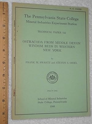
Ostracoda from Middle Devon Windom Beds in Western New York
Editore: School of Mineral Industries, State College, Pennsylvania, 1948
Soft cover. Condizione: Very Good. Flat with a good binding, mild edge tanning. Owner's stamp front cover, no other markings. 19 pages + plates.
-

UPPERMOST PRECAMBRIAN AND LOWEST CAMBRIAN ROCKS IN SOUTHEASTERN IDAHO: PROFESSIONAL PAPER 394
Editore: United States Geological Survey/USGS/Government Printing Office/GPO, Washington, DC, 1971
Da: Robert Gavora, Fine & Rare Books, ABAA, Talent, OR, U.S.A.
Membro dell'associazione: ABAA CBA ILAB
Valutazione del venditore 5 su 5 stelle
Soft cover. Condizione: Very good plus. Contrasts in rock sequences in the Bancroft, Soda Springs, and Preston quadrangles require new units for, and modified usages of, the names Brigham, Langston, and Ute. 52 pages with map, section, refernces and index, plus the six folded plates in the rear pocket. ound in original light gray paper covers with printing in black. Short tears at the spine ends. Owner's signatures on the front cover. A very good plus copy. Book.
-

Gravity and magnetic anomalies in the Soda Springs region, southeastern Idaho: USGS Professional Paper 646-E
Da: GreatBookPricesUK, Woodford Green, Regno Unito
Valutazione del venditore 5 su 5 stelle
EUR 25,57
Spedizione EUR 17,37
Spedito da Regno Unito a U.S.A.Quantit�: Pi� di 20 disponibili
Aggiungi al carrelloCondizione: New.
-

Guidebook to the Geology of Northwest Colorado 1955: Intermountain Association of Petroleum Geologists: Rocky Mountain Association of Geologists
Editore: Intermountain Association of Petroleum Geologists/Rocky Mountain Association of Geologists, Salt Lake City/Denver, 1955
Da: Clausen Books, RMABA, Colorado Springs, CO, U.S.A.
Membro dell'associazione: IOBA RMABA
Valutazione del venditore 5 su 5 stelle
Cloth. Condizione: Very Good. Photographs/Maps/Folded Diagrams & Charts/Folded Maps (illustratore). Retired library copy, usual stamps, stickers, markings, labels, and rear withdrawn pocket. Some minor wear to the gutters, blind-embossed seal on title page, otherwise textblock is clean and tight. Large pocket on bep with plates accompanying papers and separate plates folded and slipped in. No remainder marks or library stamps to all page edges. Minimally rubbed tips and some shelf wear. 185pp. Size: 4to - over 9�" - 12" tall. Ex-Library Hardcover.
-
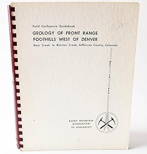
Geology of Front Range Foothills West of Denver: Deer Creek to Ralston Creek, Jefferson County, Colorado (Field Conference Guidebook)
Editore: Rocky Mountain Association of Geologists, 1955
Da: Flamingo Books, Menifee, CA, U.S.A.
Valutazione del venditore 5 su 5 stelle
Plastic Comb. Condizione: Very Good. 1955 First edition Rocky Mountain Association of Geologists (Denver, Color.) 8 1/2 x 11 inches tall spiral bound (brown plastic comb), 98pp. plus 2 folding color topo maps and one folding stratigraphic log, complete. Otherwise, a very good copy clean, bright and unmarked.~ZZ~ The purpose of this guidebook are threefold. First, it summarizes summarizes geological interpretations and data. Second, it serves as an introduction to rock formations and to occurrences of oil, uranium, and ground water for the layman. Third it provides a handy 'backyard' guide to rock units that extend into the subsurface of the Denver Basin. Toward this end, full technical articles are included in the guidebook.
-

Geologic Map of the Preston 1 x 2 Quadrangle Southeastern Idaho and Western Wyoming. Nr. I-1127.
Lingua: Inglese
Editore: U.S. Geological Survey, 1980
Da: Antiquariat Bookfarm, L�bnitz, Germania
Valutazione del venditore 5 su 5 stelle
EUR 9,50
Spedizione EUR 40,00
Spedito da Germania a U.S.A.Quantit�: 1 disponibili
Aggiungi al carrelloSoftcover. w24568 'MPX' # Geologic Map of the Preston 1 x 2 Quadrangle Southeastern Idaho and Western Wyoming. Nr. I-1127. Sprache: Englisch Gewicht in Gramm: 450.
-
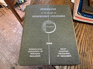
Guidebook to the Geology of Northwest Colorado 1955: Intermountain Association of Petroleum Geologists: Rocky Mountain Association of Geologists
Editore: Intermountain Association of Petroleum Geologists/Rocky Mountain Association of Geologists, Salt Lake City/Denver, 1955
Da: Riverow Bookshop, Owego, NY, U.S.A.
Membro dell'associazione: ABAA ILAB
Valutazione del venditore 5 su 5 stelle
Hardcover. Condizione: VG/NO DUSTJACKET. Maps/ B&W Illustrations (illustratore). Salt Lake City/Denver: Intermountain Association of Petroleum Geologists/Rocky Mountain Association of Geologists. VG/NO DUSTJACKET. 1955. Hardcover. 4to., 186 pp. .
-

Geology of Sage and Kemmerer 15-Minute Quadrangles, Lincoln County, Wyoming
Da: Forgotten Books, London, Regno Unito
Valutazione del venditore 4 su 5 stelle

EUR 15,21
Spedizione gratuita
Spedito da Regno Unito a U.S.A.Quantit�: Pi� di 20 disponibili
Aggiungi al carrelloPaperback. Condizione: New. Print on Demand. This book dives deep into the complex geological formations of a specific region in Wyoming. The author meticulously documents the various layers of rock, from the oldest Cambrian formations to the younger Tertiary deposits. The book provides a detailed analysis of the stratigraphy of the region, mapping out the different rock types and their distinctive features. The book's main focus is on the intricate interplay of geological forces, specifically the thrust faulting that has dramatically reshaped the landscape. The author meticulously describes the Absaroka fault and other major geological features, including their formation and their impact on the deposition of rock strata. This book presents a fascinating glimpse into the forces that have shaped our planet over eons. This detailed exploration of the region's geological history provides valuable insights into the geological history of Wyoming, as well as the broader context of the Cordilleran thrust belt, a major geological feature stretching from western Wyoming to southeastern Idaho. This book is a reproduction of an important historical work, digitally reconstructed using state-of-the-art technology to preserve the original format. In rare cases, an imperfection in the original, such as a blemish or missing page, may be replicated in the book. print-on-demand item.
-
Gravity and Magnetic Anomalies in the Soda Springs Region, Southeastern Idaho: Geological Survey Professional Paper 646-E (USGS)
Lingua: Inglese
Editore: United States Department of the Interior / United States Government Printing Office, Washington, DC, 1970
Da: Singularity Rare & Fine, Baldwinsville, NY, U.S.A.
Valutazione del venditore 5 su 5 stelle
Prima edizione
Soft cover. Condizione: Near Fine. 1st Edition. Washington, DC: United States Department of the Interior and United States Government Printing Office, 1970. Quarto, stapled wraps, iii + 15 pp. + two maps as published in rear pouch. Near Fine, trace points of peripheral wear. Contents are Fine, including maps. Handsomely preserved example. See scans. l-eph.
-

Uppermost Precambrian and Lowest Cambrian Rocks in Southeastern Idaho
Editore: United States Government Printing Office, WASHINGTON, 1971
ISBN 13: 2565726321689
Da: Biblioteca di Babele, Tarquinia, VT, Italia
Valutazione del venditore 5 su 5 stelle
EUR 10,00
Spedizione EUR 42,00
Spedito da Italia a U.S.A.Quantit�: 1 disponibili
Aggiungi al carrelloCondizione: BUONO USATO. Geological Survey Professional Paper INGLESE Volume numero 394 della serie Geological Survey Professional Paper. Brossura in cartoncino, lievemente ingiallita, con strappetti al dorso e con traccia di inchiostro in copertina. Pagine appena ingiallite, con testo a due colonne e corredate da 8 figure nel testo; alla controguardia posteriore tasca contenente 7 carte ripiegate. Numero pagine 52.
-

Gravity and magnetic anomalies in the Soda Springs region southeastern Idaho
Da: Majestic Books, Hounslow, Regno Unito
Valutazione del venditore 4 su 5 stelle
EUR 20,89
Spedizione EUR 7,53
Spedito da Regno Unito a U.S.A.Quantit�: 4 disponibili
Aggiungi al carrelloCondizione: New. Print on Demand pp. 24.
-
Paleotectonic Maps, Triassic System
Editore: United States Geological Survey, Washington, DC, 1959
Da: Prairie Creek Books LLC., Torrington, WY, U.S.A.
Valutazione del venditore 4 su 5 stelle
Mappa
Soft cover. Condizione: Good. No Jacket. G/none, illustrated stiff paper wraps, 33pp plus 9 plates of maps to rear. 15 inch tall X 22 inch long, green cloth tape covering the spine. Interior clean except stamp from former owner on upper and title page "Property of Union Oil Co of California". Shelf rubbing to wraps, no chips or tears, corners slightly rounding. Folio states "Miscellaneous Geologic Investigations, Map 1-300".
-
Paleotectonic Maps of the Jurassic System. (United States Geological Survey Miscellaneous Geologic Investigations Map I-175).
Editore: United States Geological Survey., 1956
Da: Eryops Books, Stephenville, TX, U.S.A.
Valutazione del venditore 5 su 5 stelle
Soft cover. Condizione: Very Good. ORIGINAL 1956 PUBLICATION; a couple of light creases where folded, o/w in very good condition. This is an Elephant Folio-size volume (30 X 24 inches), with maps folding out to 45 inches width; extra shipping may be required for priority mail or international orders. Book.
-
Gravity and magnetic anomalies in the Soda Springs region southeastern Idaho
Da: Books Puddle, New York, NY, U.S.A.
Valutazione del venditore 4 su 5 stelle
Condizione: New. Print on Demand pp. 24.
-
Gravity and magnetic anomalies in the Soda Springs region southeastern Idaho
Da: Biblios, Frankfurt am main, HESSE, Germania
Valutazione del venditore 4 su 5 stelle
EUR 21,60
Spedizione EUR 9,95
Spedito da Germania a U.S.A.Quantit�: 4 disponibili
Aggiungi al carrelloCondizione: New. PRINT ON DEMAND pp. 24.