Importo totale (1 articolo articoli):
Destinazione ordine:

speed john taylor edited (1 risultati)
Vai alla pagina principale dei risultati di ricerca
Filtri di ricerca
Tipo di articolo
- Tutti i tipi di prodotto
- Libri (1)
- Riviste e Giornali (Nessun altro risultato corrispondente a questo perfezionamento)
- Fumetti (Nessun altro risultato corrispondente a questo perfezionamento)
- Spartiti (Nessun altro risultato corrispondente a questo perfezionamento)
- Arte, Stampe e Poster (Nessun altro risultato corrispondente a questo perfezionamento)
- Fotografie (Nessun altro risultato corrispondente a questo perfezionamento)
- Mappe (Nessun altro risultato corrispondente a questo perfezionamento)
- Manoscritti e Collezionismo cartaceo (Nessun altro risultato corrispondente a questo perfezionamento)
Condizioni Maggiori informazioni
- Nuovo (Nessun altro risultato corrispondente a questo perfezionamento)
- Come nuovo, Ottimo o Quasi ottimo (Nessun altro risultato corrispondente a questo perfezionamento)
- Molto buono o Buono (Nessun altro risultato corrispondente a questo perfezionamento)
- Discreto o Mediocre (Nessun altro risultato corrispondente a questo perfezionamento)
- Come descritto (1)
Legatura
- Tutte
- Rilegato (Nessun altro risultato corrispondente a questo perfezionamento)
- Brossura (Nessun altro risultato corrispondente a questo perfezionamento)
Ulteriori caratteristiche
- Prima ed. (Nessun altro risultato corrispondente a questo perfezionamento)
- Copia autograf. (Nessun altro risultato corrispondente a questo perfezionamento)
- Sovracoperta (Nessun altro risultato corrispondente a questo perfezionamento)
- Con foto (1)
- Non Print on Demand (1)
Lingua (1)
Prezzo
- Qualsiasi prezzo
- Inferiore a EUR 20
- EUR 20 a EUR 45 (Nessun altro risultato corrispondente a questo perfezionamento)
- Superiore a EUR 45 (Nessun altro risultato corrispondente a questo perfezionamento)
Spedizione gratuita
- Spedizione gratuita in U.S.A. (Nessun altro risultato corrispondente a questo perfezionamento)
Paese del venditore
Valutazione venditore
-
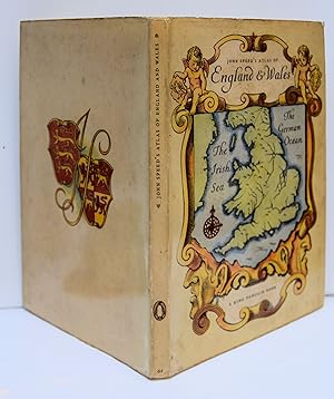
AN ATLAS OF TUDOR ENGLAND AND WALES Forty Plates from John Speed's Pocket Atlas of 1627 introduced and described by E. G. R. Taylor. (King Penguin. 61).
Editore: Penguin Books., London, 1951
Da: Marrins Bookshop, Folkestone, KENT, Regno Unito
Membro dell'associazione: ABA ILAB PBFA
Valutazione del venditore 4 su 5 stelle

EUR 17,92
Spedizione EUR 29,40
Spedito da Regno Unito a U.S.A.Quantità: 1 disponibili
Aggiungi al carrelloSmall 8vo. 7.5 x 5 inches. 31 + [1] pp. In pictorial stiff card boards, in matching unclipped dust wrapper which has minor edge wear. Small dent at tail of spine and a little foxing largely confined to edges; otherwise a very good copy. Illustrated by 40 pages of coloured map plates. Decorated by title page vignette. King Penguin edition of the the county maps of England (and one of The Kingdom of England and one of Wales and Monmouthshire). From the 1627 pocket edition of England, Wales, Scotland and Ireland, described and abridged, by the cartographer and historian, John Speed (1552?-1629). Edited by Eva Germaine Rimington Taylor (1879-1966), geographer and historian of science, who was professor of geography at the University of London, 1930-44. KING PENGUIN ATLAS ATLAS 17TH CENTURY ILLUSTRATED KING PENGUIN.