Turner d b editors (7 risultati)
 Altre immagini
Pulltrouser Swamp: Ancient Maya Habitat, Agriculture and Settlement in Northern Belize
Billie Lee Turner II (1945- ) and Peter D Harrison (editors)
Lingua: Inglese
Editore: University of Texas Press, Austin 1983
Serie: Texas Pan American, Libro 96 di 109. Libro 96 di 109 - Texas Pan American
- Rilegato
- Prima edizione
Da: The Book Collector, Inc. ABAA, ILAB, Fort Worth, TX, U.S.A.The Book Collector, Inc. ABAA, ILAB
Contatta il venditoreVenditore con 4 stelleCondizione: Usato - Molto buono
EUR 8,89
EUR 6,04 spedizioneSpedito in U.S.A.Quantità: 1 disponibili
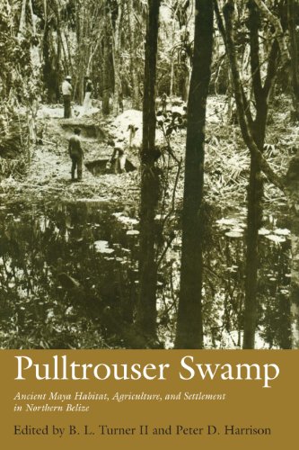
Hardcover. Condizione: Very Good. Condizione sovraccoperta: Very Good. 1st Edition. xiii+294 pages with tables, figures and index. Royal octavo (9 1/4" x 6 1/4") issued in green cloth with black lettering to spine. Texas Pan American Series. First edition. Contents: B L Turner II and Peter D Harrison "Wetlands and the Maya: An o…verview of the Problem and the Pulltrouser Swamp Project"; William C Johnson: "The Physical Setting: Northern Belize and Pulltrouser Swamp"; Janice P Darch: "Vegetation Associations at Pulltrouser Swamp"; B L Turner II "The Excavations of Raised and Channelized Fields at Pulltrouser Swamp"; Janice P Darch with further comments by William C Johnson "The Soils of Pulltrouser Swamp: Classification and Characteristics"; Charles H Miksicek "Marcrofloral Remains of the Pulltrouser Area: Settlements and Fields"; Frederick M Wiseman "Analysis of Pollen from the Fields at Pulltrouser Swamp"; Alan P Covich "Mollusca: A Contrast in Species Diversity from Aquatic and Terrestial Habitats"; Peter D Harrison "The Pulltrouser Settlement Survey and Mapping of Kokeal"; Nancy Ettlinger "The Excavations at Southern Kokeal"; Robert E Fry "The Ceramics of the Pulltrouser Area: Settlements and Fields"; Harry J Shafer "The Lithic Artifacts of the Pulltrouser Area: Settlements and Fields"; B L Turner II and Peterd D Harrison "Pulltrouser Swamp and Maya Raised Fields: A Summation. Among Mesoamericanists, the agricultural basis of the ancient Maya civilization of the Yucatan Peninsula has been an important topic of research-and controversy-in recent years. Interest in the agricultural system of the Maya has greatly increased as new discoveries have shown that the lowland Maya were not limited to slash-and-burn technology, as had been previously believed, but used a variety of more sophisticated agricultural techniques and practices, including terracing, raised fields, and perhaps, irrigation. Because of the nature of the data and because this form of agricultural technology has been key to explanations of state formation elsewhere in Mesoamerica, raised-filed agriculture has become a particular focus of investigation. Pulltrouser Swamp conclusively demonstrates the existence of hydraulic, raised-field agriculture in the Maya lowlands between 150 BC and AD 850. It presents the findings of the University of Oklahoma' Pulltrouser Swamp Project, an NSF-supported interdisciplinary study that has combined the talents of archaeologists, anthropologists, geographers, paleobotanists, biologists and zoologists to investigate the remains of the Maya agricultural system in the swamp region of northern Belize. Condition: Jacket hinges, edges and fold over edges rubbed, some edge wear with some chips and tears. A better than very good in a very good dust jacket.
Lingua: Inglese
Editore: University of Texas Press, Austin 1983
Serie: Texas Pan American, Libro 96 di 109. Libro 96 di 109 - Texas Pan American
- Rilegato
- Prima edizione
Da: Sheila B. Amdur, Coventry, CT, U.S.A.Sheila B. Amdur
Contatta il venditoreVenditore con 4 stelleCondizione: Usato - Ottimo
EUR 10,66
EUR 4,74 spedizioneSpedito in U.S.A.Quantità: 1 disponibili
Light green Cloth. Condizione: Fine. Condizione sovraccoperta: Near Fine. First Edition Stated. xiii, 294 pp with charts, diagrams, illustrations.

- Rilegato
- Prima edizione
Da: Hay Cinema Bookshop Limited, Hay on Wye, , Regno UnitoHay Cinema Bookshop Limited
Contatta il venditoreVenditore con 5 stelleCondizione: Usato
EUR 10,49
EUR 21,99 spedizioneSpedito da Regno Unito a U.S.A.Quantità: 1 disponibili
1st edition. Royal 8vo. viii + 434pp. 1 colour plate, b/w. diagrams. Original brown cloth, d/w. rubbed to edges. Includes: A behavioural model for the evolution of spatial dynamics, by R.A.J. Taylor and L.R. Taylor; Genetical factors in animal population dynamics, by R.J. Berry; Sycamore aphid numbers: the role of weather, host…and aphid, by A.F.G. Dixon; Tropical rain forests and coral reefs as open nonequilibrium systems, by J.H. Connell. ISBN 0632001844 US$12.

British Columbia. Atlas of Resources
Chapman, J. D. Turner, D. B. Editors. Farley, A. L. Ruggles, R. I. Cartographic editors
Editore: Vancouver, B.C. 1956
- Brossura
- Mappa
Da: Regent College Bookstore, Vancouver, BC, CanadaRegent College Bookstore
Contatta il venditoreVenditore con 5 stelleCondizione: Usato - Buono
EUR 17,78
EUR 9,27 spedizioneSpedito da Canada a U.S.A.Quantità: 1 disponibili
Soft cover. Condizione: Good.

- Rilegato
Da: Alhambra Books, Edmonton, AB, CanadaAlhambra Books
Contatta il venditoreVenditore con 5 stelleCondizione: Usato - Molto buono
EUR 38,10
EUR 30,19 spedizioneSpedito da Canada a U.S.A.Quantità: 1 disponibili
Hardcover. Condizione: Very Good. Condizione sovraccoperta: Good. 612 pp, index, plates. Dj scuffed, edgewear. Boards have wome wear to extremities.
British Columbia. Atlas of Resources.
Chapman, J. D. Turner, D. B. Editors. Farley, A. L. Ruggles, R. I. Cartographic editors.
Editore: Vancouver, B.C. 1956
- Brossura
Da: antiquariat RABENSCHWARZ, Braunschweig, Germaniaantiquariat RABENSCHWARZ
Contatta il venditoreVenditore con 4 stelleCondizione: Usato
EUR 50,40
EUR 25,00 spedizioneSpedito da Germania a U.S.A.Quantità: 1 disponibili
OKarton (Lederimitat). (Edited by) The British Columbia Natural Resources Conferenc. Draughting, reproduction and lithography by Smith Lithograph Co. First edition. (3), 92 Seiten, davon 46 Seiten Karten und je eine Seite Text und Fotografien. Zustand: Ausgeschiedenes Bibliotheksexemplar, Vortitelblatt und Titelblatt gestempelt,… Kanten minimal berieben. Verschraubt mit drei Schrauben. Enthält Karten zu : Physical Elements (Geologie, Meteorologie, Klimakarten, Wasserresorcen) Human Elements ( Ureinwohner, Bevölkerungsverteilung, Entdeckung und Besiedlung, Bevölkerungsentwicklung), Agriculture, Fisheries, Forestry, Mining, Energy, Recreation, Water, Wild Life, Manufacturing, Transportation, Air Photos etc. Size: Folio (Quer 56 x 45 cm).
Editore: The British Columbia Natural Resources Conference 1956, Vancouver B.C. 1956
- Brossura
- Prima edizione
Da: RareNonFiction, IOBA, Ladysmith, BC, CanadaRareNonFiction, IOBA
Contatta il venditoreVenditore con 5 stelleCondizione: Usato - Buono
EUR 177,67
EUR 17,24 spedizioneSpedito da Canada a U.S.A.Quantità: 1 disponibili
Paperback. Condizione: Good. First Edition. 92 pages. Oblong: approx 22 inches wide by over 17 inches high. Regards and reviews the course of the province's development and use of the magnificent heritage with which it has been blessed. Here is the story of British Columbia concisely and vividly told through maps, photographs an…d text. Produced by more than one hundred members and associates of the British Columbia Natural Resources Conference over a period of more than two years. An original and major accomplishment of a volunteer group, this atlas is unique in North America, presenting for the first time for any province or state, in colour map form and in associated text and photographs, the story of a people and their resources. An invaluable, and now historical, reference. Includes two extra pages dated 1968 entitled Province of British Columbia Department of Lands, Forests, and Water Resources - Lands Service - Index to Published Maps. This page has some creases and small tears. Overall the book shows moderate to average wear and soiling. Bound in very sturdy red plasticized covers, the corners of which are curling upon front cover. Pages secured by three sturdy metal screw posts. Gold writing and graphic upon front cover. Contents include: relief and oceanography, landforms, geology, glacial geology, soils, meteorological and hydrogeological measurement, annual precipitation, water, temperature, climactic regions, biotic regions, types of farming, crop production, livestock production, irrigation, pacific salmon, herring-groundfish-halibut, whales-shellfish-crustaceans, forest resources, forest administration, mining, energy, hydro electric power, recreation, provincial parks, water consumption-storage facilities and flood control, native Indians-distribution of ethnic groups 1850, native Indians-population distribution and economic activities, exploration and survey, sequence of settlement, population-1951, population-regional analysis of labour force by industry 1951, population - characteristics and migration, big game, fur bearers, game birds, sport fish, manufacturing, milling and processing, road and air transportation, rail and water transportation, regional and national topographic maps, national topographic series 1" to 1 mile, basic air photo cover, special air photo cover and gazetteer map and index. Former owner's name atop first page. Farley, A.L.; Ruggles, R.I.: Cartographic Editors (illustratore).


