
Importo totale (1 articolo articoli):
Destinazione ordine:

andriveau goujon (237 risultati)
Vai alla pagina principale dei risultati di ricerca
Filtri di ricerca
Tipo di articolo
- Tutti i tipi di prodotto
- Libri (121)
- Riviste e Giornali (Nessun altro risultato corrispondente a questo perfezionamento)
- Fumetti (Nessun altro risultato corrispondente a questo perfezionamento)
- Spartiti (Nessun altro risultato corrispondente a questo perfezionamento)
- Arte, Stampe e Poster (84)
- Fotografie (Nessun altro risultato corrispondente a questo perfezionamento)
- Mappe (31)
- Manoscritti e Collezionismo cartaceo (1)
Condizioni Maggiori informazioni
- Nuovo (2)
- Come nuovo, Ottimo o Quasi ottimo (17)
- Molto buono o Buono (100)
- Discreto o Mediocre (Nessun altro risultato corrispondente a questo perfezionamento)
- Come descritto (118)
Legatura
Ulteriori caratteristiche
Lingua (5)
Spedizione gratuita
Paese del venditore
Valutazione venditore
-
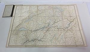
Carte Physique et Routiere de Las Suisse Public (New Edition)
Lingua: Francese
Data di pubblicazione: 1855
Da: Shelley and Son Books (IOBA), Hendersonville, NC, U.S.A.
Membro dell'associazione: IOBA
Valutazione del venditore 5 su 5 stelle

Hardcover. Condizione: Very Good. New Edition. Large fold out map bound in hardcover. Blue and green cloth covers with gilt lettering. Map has a few small smudges. Back of map has some discoloration and owners name. Covers have rubbing and discoloration. Spine is sunned. Overall a very nice copy. Full refund if not satisfied.
-
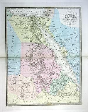
"Carte du cours du Nil comprenant l'Egypie" - Egypt �gypten Red Sea Karte map
Lingua: Tedesco
Editore: Paris, 1860
Da: Antiquariat Steffen V�lkel GmbH, Seubersdorf, Germania
Membro dell'associazione: ILAB VDA
Valutazione del venditore 5 su 5 stelle
Mappa
EUR 9,99
Spedizione EUR 30,00
Spedito da Germania a U.S.A.Quantit�: 1 disponibili
Aggiungi al carrellooriginal handkolorierte alte Stahlstich-Landkarte von ca. 1860 von Eugene Andriveau-Goujon (1832-1897) - Blatmasse: ca. 68 x 53 cm - im Mittelfalz mit Randeinriss au�erhalb der Karte, sonst gut erhalten. | original hand colored old steel engraving from circa 1860 by Eugene Andriveau-Goujon - size of sheet: circa 26.7 x 20.8 inches - with marginal tear in middle fold outside the map, otherwise in good condition. | Dies ist ein Original! - Kein Nachdruck! - Keine Kopie! -- This is an original! - No copy! - No reprint! // Wir, das Antiquariat Steffen V�lkel, kaufen und verkaufen alte B�cher, Handschriften, Zeichnungen, Autographen, Grafiken und Fotografien. Wir sind stets am Ankauf von kompletten Bibliotheken, Sammlungen und Nachl�ssen interessiert. Sprache: Deutsch Gewicht in Gramm: 1500.
-
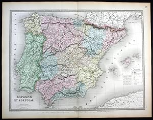
"Espagne et Portugal" - Spain Espana Spanien Portugal map Karte
Lingua: Tedesco
Editore: Paris, 1862
Da: Antiquariat Steffen V�lkel GmbH, Seubersdorf, Germania
Membro dell'associazione: ILAB VDA
Valutazione del venditore 5 su 5 stelle
Mappa
EUR 9,99
Spedizione EUR 30,00
Spedito da Germania a U.S.A.Quantit�: 1 disponibili
Aggiungi al carrellooriginal handkolorierte alte Stahlstich-Landkarte von 1862 von Eugene Andriveau-Goujon (1832-1897) - Blatmasse: ca. 68 x 53 cm - gut erhalten. | original hand colored old steel engraving from 1862 by Eugene Andriveau-Goujon - size of sheet: circa 26.7 x 20.8 inches - good condition. | Dies ist ein Original! - Kein Nachdruck! - Keine Kopie! -- This is an original! - No copy! - No reprint! // Wir, das Antiquariat Steffen V�lkel, kaufen und verkaufen alte B�cher, Handschriften, Zeichnungen, Autographen, Grafiken und Fotografien. Wir sind stets am Ankauf von kompletten Bibliotheken, Sammlungen und Nachl�ssen interessiert. Sprache: Deutsch Gewicht in Gramm: 1500.
-

Carte sp�ciale des chemins de fer, des routes et des voies navigables de la France d'apr�s les meilleurs documents.
Editore: E. Andriveau-Goujon, 1880
Da: LIVRES ANCIENS ET CONTEMPORAINS, HASPARREN, Francia
Valutazione del venditore 5 su 5 stelle
EUR 39,20
Spedizione EUR 23,00
Spedito da Francia a U.S.A.Quantit�: 1 disponibili
Aggiungi al carrelloCouverture rigide. Condizione: Satisfaisant. 0 Couverture et dos d'usage. GLN-65. . La librairie Aux Livres Anciens et Contemporains offre aux clients d'AbeBooks 30% de r�duction sur l'ensemble de son catalogue. Prix d'origine : 56 EUR. Livre.
-
Carte des environs de Toulouse. 1/200.000
Editore: Andriveau-Goujon, C1880,, Paris,, 1880
Da: Librairie Christian Chaboud, Bruxelles, Belgio
Valutazione del venditore 5 su 5 stelle
EUR 30,00
Spedizione EUR 25,00
Spedito da Belgio a U.S.A.Quantit�: 1 disponibili
Aggiungi al carrello66X40cm, Carte d�pliante entoil�e. Tr�s bon �tat. Sans d�fauts. NB. Les commandes et questions sont trait�es dans les 24h, les exp�ditions reprendront le 13 juin. Tous les ouvrages de notre catalogue peuvent �tre consult�s et retir�s sous quelques jours � Saint-Gilles ou Paris, 5e arr. Merci de nous contacter.
-
CARTE N�6 - LAGNY (et ses environs) au 1/50,000 - 1895-
Lingua: Francese
Editore: Andriveau - Goujon, paris, 1895
Da: Librairie Guimard, Nantes, Francia
Valutazione del venditore 4 su 5 stelle

EUR 36,00
Spedizione EUR 30,00
Spedito da Francia a U.S.A.Quantit�: 1 disponibili
Aggiungi al carrelloE. Andriveau-Goujon paris Andriveau - Goujon 1895 une Carte Routi�re au 1/50000 reproduit sur cuivre et imp. par Erhard, d�pliante entoil�e, format repli�e : 12,6 x 22,2, de 8 panneaux (45,5 x 50,6 cm) grav�e en noir et en couleurs , vignette de l'�diteur. 1895 Paris E. Andriveau-Goujon Editeur, Toutes premi�res Cartes Routi�res.RARE.en Parfait �tat (as new condition).
-
CARTE N�4 - VERSAILLES (et ses environs) au 1/50,000 - 1895-
Lingua: Francese
Editore: Andriveau - Goujon, paris, 1895
Da: Librairie Guimard, Nantes, Francia
Valutazione del venditore 4 su 5 stelle
EUR 36,00
Spedizione EUR 30,00
Spedito da Francia a U.S.A.Quantit�: 1 disponibili
Aggiungi al carrelloE. Andriveau-Goujon paris Andriveau - Goujon 1895 une Carte Routi�re au 1/50000 reproduit sur cuivre et imp. par Erhard, d�pliante entoil�e, format repli�e : 12,6 x 22,2, de 8 panneaux (45,5 x 50,6 cm) grav�e en noir et en couleurs , vignette de l'�diteur. 1895 Paris E. Andriveau-Goujon Editeur, Toutes premi�res Cartes Routi�res.RARE.en Parfait �tat (as new condition).
-
CARTE N�2 - SAINT-DENIS (et ses environs) au 1/50,000 - 1895-
Lingua: Francese
Editore: Andriveau - Goujon, paris, 1895
Da: Librairie Guimard, Nantes, Francia
Valutazione del venditore 4 su 5 stelle
EUR 36,00
Spedizione EUR 30,00
Spedito da Francia a U.S.A.Quantit�: 1 disponibili
Aggiungi al carrelloE. Andriveau-Goujon paris Andriveau - Goujon 1895 une Carte Routi�re au 1/50000 reproduit sur cuivre et imp. par Erhard, d�pliante entoil�e, format repli�e : 12,6 x 22,2, de 8 panneaux (45,5 x 50,6 cm) grav�e en noir et en couleurs , vignette de l'�diteur. 1895 Paris E. Andriveau-Goujon Editeur, Toutes premi�res Cartes Routi�res.RARE.en Parfait �tat (as new condition).
-
CARTE N�1 - PONTOISE (et ses environs) au 1/50,000 - 1895-
Lingua: Francese
Editore: Andriveau - Goujon, paris, 1895
Da: Librairie Guimard, Nantes, Francia
Valutazione del venditore 4 su 5 stelle
EUR 36,00
Spedizione EUR 30,00
Spedito da Francia a U.S.A.Quantit�: 1 disponibili
Aggiungi al carrelloE. Andriveau-Goujon paris Andriveau - Goujon 1895 une Carte Routi�re au 1/50000 reproduit sur cuivre et imp. par Erhard, d�pliante entoil�e, format repli�e : 12,6 x 22,2, de 8 panneaux (45,5 x 50,6 cm) grav�e en noir et en couleurs , vignette de l'�diteur. 1895 Paris E. Andriveau-Goujon Editeur, Toutes premi�res Cartes Routi�res.RARE.en Parfait �tat (as new condition).
-

Carte Speciale des Chemins de fer des routes et des voies navigables de la France d'apres les meilleurs Documents.
Lingua: Francese
Editore: Lan�e, successeur de Longuet, Paris, 1873
Da: Librairie de l'Escurial, NICE, Francia
Membro dell'associazione: ILAB
Valutazione del venditore 4 su 5 stelle
Mappa
EUR 50,00
Spedizione EUR 50,00
Spedito da Francia a U.S.A.Quantit�: 1 disponibili
Aggiungi al carrelloCouverture souple. Condizione: Bon. Carte entoil�e en couleurs (980 x 860 mm) avec son �tui cartonn�. �tui l�g�rement accident�.
-

CARTE DE L'ASIE PUBLI�E PAR J ANDRIVEAU-GOUJON 1850
Lingua: Inglese
Editore: ANDRIVEAU-GOUJON, Paris, France, 1850
Da: Hornseys, Ripon, Regno Unito
Membro dell'associazione: PBFA
Valutazione del venditore 5 su 5 stelle
Prima edizione
EUR 77,52
Spedizione EUR 28,95
Spedito da Regno Unito a U.S.A.Quantit�: 1 disponibili
Aggiungi al carrelloNo Binding. Condizione: Very Good. 1st Edition. Sheet Size: 59.1cm x 47.8cm. The edition from 1850. Scale: 1:26000000. Central fold lines. Original hand-colouring. Minor repairs to the head and tail of the central fold line. Dusty mark to the bottom right hand corner which is mainly confined to the margin. In very good condition overall. Location: Map Drawer C: FS: Folder M2000 002564.
-

"Hemisphere Occidental" - America North South continent map Karte
Lingua: Tedesco
Editore: Paris, 1850
Da: Antiquariat Steffen V�lkel GmbH, Seubersdorf, Germania
Membro dell'associazione: ILAB VDA
Valutazione del venditore 5 su 5 stelle
Mappa
EUR 19,99
Spedizione EUR 30,00
Spedito da Germania a U.S.A.Quantit�: 1 disponibili
Aggiungi al carrellooriginal handkolorierte alte Stahlstich-Landkarte von ca. 1850 von Eugene Andriveau-Goujon (1832-1897) - Blatmasse: ca. 68 x 53 cm - gut erhalten. | original hand colored old steel engraving from circa 1850 by Eugene Andriveau-Goujon - size of sheet: circa 26.7 x 20.8 inches - good condition. | Dies ist ein Original! - Kein Nachdruck! - Keine Kopie! -- This is an original! - No copy! - No reprint! // Wir, das Antiquariat Steffen V�lkel, kaufen und verkaufen alte B�cher, Handschriften, Zeichnungen, Autographen, Grafiken und Fotografien. Wir sind stets am Ankauf von kompletten Bibliotheken, Sammlungen und Nachl�ssen interessiert. Sprache: Deutsch Gewicht in Gramm: 1500.
-
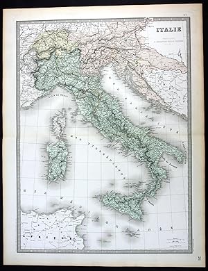
"Italie" - Italia Italy Italien Sicilia Sardegna Corse map Karte
Lingua: Tedesco
Editore: Paris, 1862
Da: Antiquariat Steffen V�lkel GmbH, Seubersdorf, Germania
Membro dell'associazione: ILAB VDA
Valutazione del venditore 5 su 5 stelle
Mappa
EUR 19,99
Spedizione EUR 30,00
Spedito da Germania a U.S.A.Quantit�: 1 disponibili
Aggiungi al carrellooriginal handkolorierte alte Stahlstich-Landkarte von 1862 von Eugene Andriveau-Goujon (1832-1897) - Blatmasse: ca. 68 x 53 cm - gut erhalten. | original hand colored old steel engraving from 1862 by Eugene Andriveau-Goujon - size of sheet: circa 26.7 x 20.8 inches - good condition. | Dies ist ein Original! - Kein Nachdruck! - Keine Kopie! -- This is an original! - No copy! - No reprint! // Wir, das Antiquariat Steffen V�lkel, kaufen und verkaufen alte B�cher, Handschriften, Zeichnungen, Autographen, Grafiken und Fotografien. Wir sind stets am Ankauf von kompletten Bibliotheken, Sammlungen und Nachl�ssen interessiert. Sprache: Deutsch Gewicht in Gramm: 1500.
-

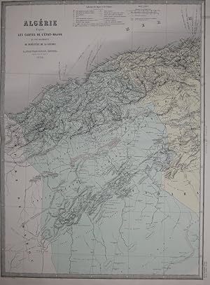
"Algerie" - Algeria Algerien North Africa Afrika map Karte
Lingua: Tedesco
Editore: Paris, 1862
Da: Antiquariat Steffen V�lkel GmbH, Seubersdorf, Germania
Membro dell'associazione: ILAB VDA
Valutazione del venditore 5 su 5 stelle
Mappa
EUR 19,99
Spedizione EUR 30,00
Spedito da Germania a U.S.A.Quantit�: 1 disponibili
Aggiungi al carrellooriginal handkolorierte alte Stahlstich-Landkarte von 1862 von Eugene Andriveau-Goujon (1832-1897) - Blatmasse: je ca. 68 x 53 cm - im Falz mit Randeinriss, sonst gut erhalten. | original hand colored old steel engraving from 1862 by Eugene Andriveau-Goujon - size of sheet: each circa 26.7 x 20.8 inches - with marginal tear in middle fold, otherwise in good condition. | Dies ist ein Original! - Kein Nachdruck! - Keine Kopie! -- This is an original! - No copy! - No reprint! // Wir, das Antiquariat Steffen V�lkel, kaufen und verkaufen alte B�cher, Handschriften, Zeichnungen, Autographen, Grafiken und Fotografien. Wir sind stets am Ankauf von kompletten Bibliotheken, Sammlungen und Nachl�ssen interessiert. Sprache: Deutsch Gewicht in Gramm: 1500.
-
Guides Automobiles Diamant.: PARIS ET PRINCIPALES EXCURSIONS DES ENVIRONS DE PARIS .
Editore: Paris: Hachette, 1938
Da: Antiquariat Bergische B�cherstube Mewes, Overath, Germania
Membro dell'associazione: GIAQ ILAB VDA
Valutazione del venditore 5 su 5 stelle
EUR 30,00
Spedizione EUR 54,00
Spedito da Germania a U.S.A.Quantit�: 1 disponibili
Aggiungi al carrellofester Einband. XX, 319 /96 S., einige Kartenskizzen, 1 mehrf. gef. Karte. 16� Ln. Sprache: Franz�sisch.
-
Beaux traits du jeune age Suivis de l'histoire de Jeanne d'Arc et ou Panth�on des enfans cel�bres par A. F. J. Fr�ville. 2., Ed. rev. & cor.
Editore: Paris: Genets, 1818
Da: Antiquariat Bergische B�cherstube Mewes, Overath, Germania
Membro dell'associazione: GIAQ ILAB VDA
Valutazione del venditore 5 su 5 stelle
EUR 30,00
Spedizione EUR 54,00
Spedito da Germania a U.S.A.Quantit�: 1 disponibili
Aggiungi al carrellofester Einband. IV, 394 S., mit einer gestochenen Titelvignette und 3 Kupfertafeln. Ldr. *etwas berieben*. Sprache: Franz�sisch.
-
Plan de Paris. 1:20.000. Avec le guide compl. des Rues, Omnibus, Musees et le Metropolitan.
Editore: Paris: Guilmin um, 1925
Da: Antiquariat Bergische B�cherstube Mewes, Overath, Germania
Membro dell'associazione: GIAQ ILAB VDA
Valutazione del venditore 5 su 5 stelle
EUR 30,00
Spedizione EUR 54,00
Spedito da Germania a U.S.A.Quantit�: 1 disponibili
Aggiungi al carrellofester Einband. 64 S, Nouv. Nomcenclature + mehrf. gef Pan. ca. 40x60 in 16� Mappe. *sch�nes Expl.*. Sprache: Franz�sisch.
-

Departements de la France: Carte Nr 77: Departement De La Somme
Editore: Andriveau-Goujon, Paris
Da: Antiquariat Clement, Bonn, Germania
Valutazione del venditore 4 su 5 stelle
EUR 35,00
Spedizione EUR 51,00
Spedito da Germania a U.S.A.Quantit�: 1 disponibili
Aggiungi al carrelloLeinen Sehr gut. Condizione: 0. Ohne Jahr, ca 1840. Sehr sch�ne mehrfarbige topographische Karte des franz�sischen Departements "Somme"(Hauptstadt Amiens) blind-/goldgepr�gter Einband, tadellos. Die Karte: 72 cm x 57,5 cm, auf Leinen gepannt, minimal stockfleckig. Insgesamt sehr gut erhalten. +++ Carte topographique polychrome du departement de la Somme, sans date (vers 1840) dans sa reliure pleine toile avec lettres dor�es et timbre de l'editeur. Grav�e par Abel Malo et Laguillermie. Mesures de la carte 72 x 57,5 cm. Mont�e sur toile, rares rousseurs, dans l'ensemble excellent �tat. +++ 72 x 57,5 cm, 0,2 kg. +++ Stichw�rter: Geographie Frankreich Reise Reisen Tourismus Gewicht in Gramm: 200.
-
Carte de L'Italie Ancienne at des Contrees Adjacentes [Linen backed map of Italy c1837]
Editore: Published by J. Andriveau-Goujon, Paris, 1837
Da: Keoghs Books, Skipton, Regno Unito
Membro dell'associazione: PBFA
Valutazione del venditore 5 su 5 stelle
Mappa Prima edizione
EUR 59,63
Spedizione EUR 32,42
Spedito da Regno Unito a U.S.A.Quantit�: 1 disponibili
Aggiungi al carrello, linen backed map of ancient Italy partly coloured and dated 1837, map no. 7 of Atlas Universel, inset map of Rome Ancienne First Edition , some light foxing to map, previous owner's name to rear dated 1842, very good condition , paper slipcase worn with part of bottom missing, fair condition , linen backed map , 52 cm x 41 cm (open) Paperback ISBN:
-

(United Kingdom, Eire) Carte Generale Des Iles Britanniques Contenant L'Angleterre, L'Ecosse Et L'Irlande
Lingua: Inglese
Data di pubblicazione: 1851
Da: Hornseys, Ripon, Regno Unito
Membro dell'associazione: PBFA
Valutazione del venditore 5 su 5 stelle
EUR 47,70
Spedizione EUR 28,95
Spedito da Regno Unito a U.S.A.Quantit�: 1 disponibili
Aggiungi al carrelloNo Binding. Condizione: Good. Original steel engraving. Date: 1851. Sheet size: 69.4cm x 100.3cm. Original hand-colouring and good detail showing railways, canals and postal routes. Blank to the reverse. Minor age toning, staining and closed tears to the outer margins with a small amount of loss to the central fold line. In good clean condition. SR: Sleeve 1111. Map Drawer D.
-
Plan de Paris - 1/12.500 - � l'�chelle de 2 mm. pour 25 m�tres, indiquant les nouveaux percements et les changements de noms de voies publiques, avec plans suppl�mentaires pour les bois de Boulogne et de Vincenne.
Editore: Andriveau - Goujon, Paris, 1877
Da: Pierre de RONSARD, CH�DIGNY, FR, Francia
Valutazione del venditore 5 su 5 stelle
EUR 90,00
Spedizione EUR 8,00
Spedito da Francia a U.S.A.Quantit�: 1 disponibili
Aggiungi al carrelloavec, coll�s sur le premier contre plat, deux feuillets de Suppl�ment pour les rues dont les noms ont �t� chang�s ; plat de couverture orn� des titres en caract�res dor�s. in-8 Importante trace d'eau en t�te de la couverture, surtout sur le dernier plat, avec toile d�lav�e et ondul�e, mais sans atteinte sur le plan qui est en bon �tat. en 36 sections colori�es, entoil�es et pli�es, sous cartonnage toil� mauve,
-
Carte de l'Alg�rie, d'apr�s les cartes de l'Etat-Major et les documents du Minist�re de la Guerre. Aus "Atlas Usuel"
Lingua: Francese
Editore: Paris, 1876
Da: Antiquariat Braun, Gengenbach, Germania
Valutazione del venditore 5 su 5 stelle
Mappa
EUR 40,00
Spedizione EUR 40,00
Spedito da Germania a U.S.A.Quantit�: 1 disponibili
Aggiungi al carrelloCondizione: Gut. 45 x 62 cm (Blattgr��e: 70 x 52,5 cm). *Sauber und gut erhalten. Sprache: Franz�sisch Gewicht in Gramm: 1000.
-
ETAT-MAJOR -NOUVELLE CARTE DE FRANCE au 1/80,000 : (44) COUTANCES - 1866-
Lingua: Francese
Data di pubblicazione: 1866
Da: Librairie Guimard, Nantes, Francia
Valutazione del venditore 4 su 5 stelle
EUR 50,00
Spedizione EUR 30,00
Spedito da Francia a U.S.A.Quantit�: 1 disponibili
Aggiungi al carrelloE. Andriveau-Goujon 1866 une Carte d'Etat Major au 1/80000 lev�e par les Officiers du Corps d'Etat-Major et publi�e par le D�p�t de la Guerre en 1866. - 1 Carte entoil�e, de 21 panneaux (88X58 cm) grav�e en noir sous chemise cartonn�e d'�diteur (20X13 cm) pleine percaline verte estamp�e, texte dor� sur 1er plat, vignette de l'�diteur. sans date (1866 environ) Paris E. Andriveau - Goujon Editeur RARE.en Parfait �tat (as new condition).
-
Empire Ottoman [ Carte de l'Asie Mineure - 1904 ]
Lingua: Francese
Editore: Maison Andriveau-Goujon, Henry Barri�re, 1904
Da: Librairie du Cardinal, GRADIGNAN, Francia
Valutazione del venditore 5 su 5 stelle
Mappa
EUR 145,00
Spedizione EUR 25,00
Spedito da Francia a U.S.A.Quantit�: 1 disponibili
Aggiungi al carrellosouple. Condizione: Bon. Carte entoil�e en couleur au format 94 x 68 cm, �chelle 1 : 3500000, Maison Andriveau-Goujon, Henry Barr�re, Paris, 1904 (mention rev. 1904), carte n� 15, atlas usuel n� 21 ; atlas universel n� 34, grav� : le trait par Smith, la topographie par G�rin, les Ecritures par Rousset, les Eaux par Mme Fontaine Belle grande carte entoil�e de l'Empire ottoman (petites usures aux pliures, une petite annotation marginale). Langue: Fran�ais.
-
Carte g�n�rale des routes de France a l'Usage des Voyageurs. Grenzkolorierte Karte, frischer sauber Zustand. In 28 Teilem, auf Leinen aufgezogen, gefaltet (Faltkarte in kolor. Stahlstich auf Leinen). In der Original-Papph�lse, diese leicht berieben.
Editore: ANDRIVEAU-GOUJON,Paris, 1831
Da: Fabri Antiquariat Dr. J�rgen Aschoff, Ulm, BW, Germania
Valutazione del venditore 4 su 5 stelle
EUR 90,00
Spedizione EUR 13,00
Spedito da Germania a U.S.A.Quantit�: 1 disponibili
Aggiungi al carrelloCarte g�n�rale des routes de France a l'Usage des Voyageurs. Grenzkolorierte Karte, frischer sauber Zustand. In 28 Teilem, auf Leinen aufgezogen, gefaltet (Faltkarte in kolor. Stahlstich auf Leinen). In der Original-Papph�lse, diese leicht berieben. 1 S.
-

France. Carte des Rivieres Navigables et des Canaux Executes, en Construction et Projetes.
Editore: Paris: E. Andriveau-Goujon, 1880
Da: Bristow & Garland, Shaftesbury, Regno Unito
Valutazione del venditore 4 su 5 stelle
EUR 53,67
Spedizione EUR 16,21
Spedito da Regno Unito a U.S.A.Quantit�: 1 disponibili
Aggiungi al carrelloColoured map dissected and mounted on linen. Size overall 39 1/2 x 33 1/4 inches. Folding down to 6 3/4 x 5 inches and contained in slipcase.
-
Carte de l'Am�rique du Sud.
Da: Libros El Trovador, TALAVERA DE LA REINA, TO, Spagna
Valutazione del venditore 5 su 5 stelle
EUR 24,00
Spedizione EUR 26,45
Spedito da Spagna a U.S.A.Quantit�: 1 disponibili
Aggiungi al carrelloParis, J. Andriveau-Goujon, 1845. Atlas Universel, Carte n� 42 a doble p�gina de 66x52 cm. con mapa en color de 50x38 cm. P�rdida parcial en m�rgenes superior e inferior y peque�a perforaci�n sin p�rdida en grabado. (Ref. N-001-A).
-
Carte des Royaumes d'Espagne et Portugal.
Da: Libros El Trovador, TALAVERA DE LA REINA, TO, Spagna
Valutazione del venditore 5 su 5 stelle
EUR 24,00
Spedizione EUR 26,45
Spedito da Spagna a U.S.A.Quantit�: 1 disponibili
Aggiungi al carrelloParis, J. Andriveau-Goujon, 1845. Atlas Universel, Carte n� 29. Doble p�gina de 66x52 cm. con mapa en color de 50x38 cm. Echelles: Myriam�tres ou Lieues Nouvelles, Lieues communes de France de 25 au Degr�, Lieues de Portugal de 19 au Degr�, Lieues d'Espagne 17 � au Degr�. Mapa reparado por rasgadura completa de la juntura entre p�ginas. No p�rdida de papel. (Ref. N-001-A).
-
Carte de l'Europa dans son �tat actuel.
Da: Libros El Trovador, TALAVERA DE LA REINA, TO, Spagna
Valutazione del venditore 5 su 5 stelle
EUR 24,00
Spedizione EUR 26,45
Spedito da Spagna a U.S.A.Quantit�: 1 disponibili
Aggiungi al carrelloParis, J. Andriveau-Goujon, 1845. Atlas Universel, Carte n� 15. Doble p�gina de 52x66 cm. (apaisado) con mapa en color de 36x52 cm. Buen estado, con marca de agua en zona inferior, rasgadura sin p�rdida y pliegues en zona inferior sin afectar grabado. (Ref. N-001-A).
-
Carte du Gouvernement d'Alger et de la Regence de Tunis: avec une partie du bassin infe�rieur de la Me�diterrane�e.
Lingua: Inglese
Editore: J. Andriveau-Goujon, Paris, 1834
Da: FOLIOS LIMITED, Oxford, Regno Unito
Valutazione del venditore 5 su 5 stelle
Mappa
EUR 238,52
Spedizione EUR 40,52
Spedito da Regno Unito a U.S.A.Quantit�: 1 disponibili
Aggiungi al carrelloNo Binding. Condizione: Very Good. Lithograph hand coloured map: 38 x 51 cm, Scale [ca. 1:675,000] (W 08�--E 11�/?N 43�--N33�), folding on linen, fitted in an original slipcase, title gilt on spine, includes insets of "Territoire d'Alger," "Golfe de Bo^ne," "Environs de Constantine," "Bougie," and "Province d'Oran." This map was published at " Classical and universal Atlas of geography ancient and modern, containing the discoveries and the most new divisions in the five parts of the world to serve on reading trips, historical works and the best drafts geography. Published by J. Andriveau-Goujon. Adopted by the Minister of War for regimental libraries. #32604.


![Immagine del venditore per Carte de L'Italie Ancienne at des Contrees Adjacentes [Linen backed map of Italy c1837] venduto da Keoghs Books](https://pictures.abebooks.com/inventory/md/md22845782084.jpg)
![Immagine del venditore per Empire Ottoman [ Carte de l'Asie Mineure - 1904 ] venduto da Librairie du Cardinal](https://pictures.abebooks.com/inventory/md/md2749356696.jpg)
