
Map paris (57 risultati)

Editore: E. Paeghin, Paris, 1928
- Brossura
Da: Vashon Island Books, Vashon, WA, U.S.A.Vashon Island Books
Contatta il venditoreVenditore con 5 stelleCondizione: Usato - Buono
EUR 13,51
EUR 4,81 spedizioneSpedito in U.S.A.Quantità: 1 disponibili
Paperback. Condizione: Good. No Jacket As Issued. First edition / 1st Printing. First edition / First printing. Good to very good, Slight soiling to covers, pages darkening. 11 x 16cm. soft cover. 40pp. Size: 16mo - over 5¾" - 6¾". Illustrated with 2pp Map of Paris (illustratore). Book.
- Brossura
Da: Xerxes Fine and Rare Books and Documents, Glen Head, NY, U.S.A.Xerxes Fine and Rare Books and Documents
Contatta il venditoreVenditore con 5 stelleCondizione: Usato - Molto buono
EUR 21,62
EUR 5,20 spedizioneSpedito in U.S.A.Quantità: 1 disponibili
Condizione: VG. no date. very early 20thc? 16mo. red paper wraps. Includes the 12 page booklet with text in English, French and German with information on "musees, monuments, bibliotheques, curiosites". Very large foldout color foldout map . Map is VG plus, booklet is VG (toned) and cover is Good, lightly worn but no tears or ch…ips. no owner marks.
Editore: Librairie Hachette n.y., Paris
- Rilegato
- Mappa
Da: Main Street Fine Books & Mss, ABAA, Galena, IL, U.S.A.Main Street Fine Books & Mss, ABAA
Contatta il venditoreVenditore con 5 stelleCondizione: Usato
EUR 135,14
EUR 5,25 spedizioneSpedito in U.S.A.Quantità: 1 disponibili
Hardcover. Folio (32½" X 27½") color map that folds down into 12mo hard case (light green and blue cloth with dark green lettering), into front of which is bound 16mo 48pp printed text. Near fine/near fine. Hard case is slightly age toned; bright map with a number of small discreet archival strengthening (all on verso) at folds.… Superb later printing of this glorious cased map first published in 1867. Eiffel Tower is clearly marked, so this undated printing is post-1889 and likely turn of the century. The roughly-circular city is machine colored in tan; the River Seine, all parks and woods as well as major roads, are all in light green; all train routes and important buildings are in bold red. Small legend in upper left corner identifies "Signes Conventionnels," while another at lower left is titled "Paris Divise par Arrondissements et par Quartiers" and small map numbers all 20 arrondissements as they spiral from center outwards. The text bound into the front of the case is titled "List Alphabétique des Rues de Paris" and is a detailed street directory that also identifies important structures (hospitals, schools, etc.) Quite an attractive copy.
 Altre immagini
Editore: August Logerot., 1843
- Rilegato
Da: Roe and Moore, London, Regno UnitoRoe and Moore
Contatta il venditoreVenditore con 4 stelleCondizione: Usato - Molto buono
EUR 338,34
EUR 13,49 spedizioneSpedito da Regno Unito a U.S.A.Quantità: 1 disponibili
Hardcover. Condizione: Very Good. No Jacket. LARGE FOLDING MAP. Nouveau Plan Illustré. Guide aux Fortifications de Paris. Published by August Logerot, Paris (1843). Large folding map in the original boards, with mounted engraved plate on upper cover. 1000x690mm. Fortifications with original hand-colouring. Tape repair to reverse… of one panel, tape repair to one fold, a few tears, thumbed. Engraved vignette illustrations in margins, alphabetical street directory.
 Altre immagini
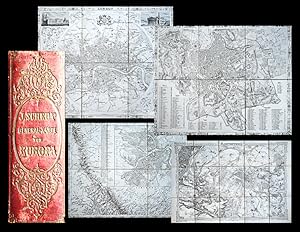
General - Karte von Europa in 25 Blättern. Hier mit 3 Zusatzblättern und Überscht, zusammen 29 Blätter.
Europa, London city map, Paris, Wien, Petersburg, München, Berlin, Neapel, Stadtpläne - Scheda, Joseph:
Editore: Wien, Militärisch-Geographisches Institut 1845-, 1847., 1847
- Rilegato
- Arte / Stampa / Poster
Da: Antiquariat Thomas Rezek, München, GermaniaAntiquariat Thomas Rezek
Contatta il venditoreVenditore con 5 stelleCondizione: Usato
EUR 900,00
EUR 44,00 spedizioneSpedito da Germania a U.S.A.Quantità: 1 disponibili
jeweils circa 36,5 x 46 cm (Paris grösser). 25 Segmente + 1 Übersichtskarte + 3 Supplement-Karten Mit Leinenhülle im originalen Halbleder-Schuber "Frühe Ausgabe der sehr grossen Wandkarte von Europa mit mehreren eingefügten Stadtplänen und Spezialkarten. Vorhanden sind hier: Stadtplan von Petersburg, Umgebung von Wien, Stadtplan… von Berlin, Stadtplan von München, Stadtplan von Neapel, Stadtplan von Rom, Stadtplan von London (als VI). Zusätzlich beigegeben ist die seltene, farbige geognostische Karte des österreichischen Kaiserstaates, die den meisten anderen Exemplaren fehlt, ebenso ein Stadtplan von Paris, der Plan von Wien und Umgebung hier als Blatt XXVI - Die Ausführung von 1845-1847 ist wesentlich seltener als die späteren Neuauflagen aus den 1850-70 Jahren. - Schuber berieben und mit alten Ausbesserungen, die kleine Übersicht ("Skelett") mit handschriftlichen Enträgen zur Lage der Stadtpläne, zwei Etiketten mit alten Stempeln einer aufgelösten Klosterbibliothek, Karten sauber und schön. - With the RARE MAP OF LONDON in a circle with ornaments, two engraved views and the description of the mahor squares and public buildings. Also with other city maps, here a total of 29 maps (the usual 25 and 1 overview + 3 supplementary maps). ".

Lingua: Inglese
- Mappa
Da: Anah Dunsheath RareBooks ABA ANZAAB ILAB, Auckland, NZ, Nuova ZelandaAnah Dunsheath RareBooks ABA ANZAAB ILAB
Contatta il venditoreVenditore con 5 stelleCondizione: Usato - Molto buono
EUR 778,49
EUR 21,87 spedizioneSpedito da Nuova Zelanda a U.S.A.Quantità: 1 disponibili
No Binding. Condizione: Very Good. Large hand-coloured folding map of Paris at the time when fortifications were still present, before the Franco Prussian War and the Commune. With 28 engraved scenes of Paris landmarks. Minor damage at some folds. 77 x 99 cm folding into marbled-covered boards 20 x 12 cm. Very interesting and at…tractive item.
Editore: Paris, Fatout, 1841. ca. 54 x 84 cm. A detailed folding plan of Paris, with vignettes of the important buildings and extensive keys down the sides., 1841
Da: Antiquariaat Hortus Conclusus, Bergambacht, Paesi BassiAntiquariaat Hortus Conclusus
Contatta il venditoreVenditore con 5 stelleCondizione: Usato
EUR 195,00
EUR 14,50 spedizioneSpedito da Paesi Bassi a U.S.A.Quantità: 1 disponibili
Folded map in cardboard wrapper. Tear in margin / index without loss, some light wear on folds (few corners of folds with holes but without loss of image), bit browned, still a good copy. Please see description or ask for photos.

- Brossura
- Mappa
Da: Geographicus Rare Antique Maps, Brooklyn, NY, U.S.A.Geographicus Rare Antique Maps
Contatta il venditoreVenditore con 4 stelleCondizione: Usato
EUR 327,93
EUR 14,87 spedizioneSpedito in U.S.A.Quantità: 1 disponibili
Soft cover. Very good. Light wear along original centerfold. Small areas of loss where once stapled into magazine. Two closed tears (.75 and .5 inches respectively) professionally repaired on verso. Size 13.5 x 20.25 Inches. Created by U.S. Army soldiers for U.S. Army soldiers during World War II, this fantastic 1944 pictorial m…ap of Paris published in Yank magazine highlights the fascination U.S. military personnel had with the City of Light. The map proclaims this desire to see Paris just below the title. The text reads: Ever since 1918, the best minds have been trying to figure out how to keep 'em down on the farm after they see this collection of streets and places. We can't throw any light on that subject, but for those GIs who will be lucky enough to get near the Eiffel Tower city, here's a rue by rue view of one of the world's loveliest capitals. It doesn't show the wine and women, though. A Closer Look Large red dots and pictorial illustrations mark thirty-two locations across the city sure to be on any visiting GI's 'must-see' list, including the Eiffel Tower (23), the Louvre (14), and Notre Dame. All Paris's train stations are marked, likely important places for any visiting GI because they might have to take a train back to their unit. Publication History and Census This map was created for and published in the September 1, 1944 edition of Yank magazine. While Yank had a wide distribution, it is impossible to know how many examples of each issue survive. We have been unable to locate any other cataloged examples of the separate map or cataloged examples of the entire issue.

Editore: Paris: chez Le Roi, Libraire. 1820, 1820
Da: Jarndyce, The 19th Century Booksellers, London, Regno UnitoJarndyce, The 19th Century Booksellers
Contatta il venditoreVenditore con 4 stelleCondizione: Usato
EUR 332,30
EUR 41,06 spedizioneSpedito da Regno Unito a U.S.A.Quantità: 1 disponibili
Engraved map, 32 compartments printed on linen-backed card, 94 x 74cm. Illus. with 28 architectural designs in margins, boundary lines marked in colour. A v.g. example in orig. sl. worn marbled card slipcase, pale blue paper label on front a little torn in one corner without loss of text. PLEASE NOTE: For customers within the UK… this item is subject to VAT at 20%.

The Returning Buyer's Map of Paris.
1928 Cody Proof Pictorial Map of Paris, France w/ Manuscript Annotations
- Brossura
- Mappa
Da: Geographicus Rare Antique Maps, Brooklyn, NY, U.S.A.Geographicus Rare Antique Maps
Contatta il venditoreVenditore con 4 stelleCondizione: Usato
EUR 655,86
EUR 14,87 spedizioneSpedito in U.S.A.Quantità: 1 disponibili
Soft cover. Good. Some edge wear and scuffing. Laid down on card. Size 12 x 9.5 Inches. This is a proof print of E. M. Cody's 1928 pictorial map of Paris that appeared on the cover of Fairchild's International Magazine , a trade journal for the fashion industry. A humorous work, it satirizes Americans' attitudes towards the Fren…ch capital, particularly those of the American fashion elite who flooded Paris in September when the winter Haute Couture collections were released. A Closer Look Despite the joke compass at left, the map is oriented roughly towards the north, with the River Seine and the Eiffel Tower (labeled Citroen) in the foreground. Landmarks, restaurants, bars, hotels, and other recognizable locations are labeled throughout, with mock Anglicized names, such as the 'Champs Eliza' for the Champs-Élysées and the 'Rue de Ravioli' for the Rue de Rivoli. Other locations and illustrations refer to the expatriate and literary scene in Paris, such as 'The Two Magots' (Les Deux Magots) café in the foreground and the Café de la Paix near the center, longtime meeting places of literary and artistic types of many nations. The Louvre ('The Louvy') is described as 'the biggest department store I ever seen!' The map's title, the magazine's name, the Folies Bergère (at right), and an illustration of an automobile at the end of the Champs-Élysées are ghosted in. Many of the jokes poke fun at Americans' consumerism, crudeness, and America-centrism, as with the replacement of Napoleon's statue on the Colonne Vendôme with George Washington and the stream of people leaving the American Express location towards the Café de la Paix. Americans in Paris Largely as a result of World War I (1914 - 1918), when many thousands of American doughboys passed through, Paris took on a revered and almost mythical status in the American imagination in the Interwar Period, especially among writers, artists, musicians, and fashion designers. An Anglo-American group of writers and artists, including Ernest Hemingway, Gertrude Stein, Ezra Pound, and James Joyce, all resided, worked (sometimes), and partied (often) throughout the 'années folles' of 1920s Paris, memorialized in Hemingway's first novel, the roman à clef The Sun Also Rises (1926). Others, most famously Josephine Baker, found Paris far more accepting of Black people than the United States and decided to stay there. Composer George Gershwin only lived in Paris for a short time, but in 1928 composed one of the defining works of this milieu, the tone poem An American in Paris . Although cultural and linguistic barriers persisted, the era between roughly 1921 and the onset of the Great Depression witnessed considerable cross-cultural interaction and influence. The result was the distinctive, defining Art Deco aesthetic of the Jazz Age. Fairchild's International Magazine Fairchild's International Magazine was a richly-illustrated but relatively short-lived (Aug. 1926 - Feb. 1932) venture of the Interwar Period by the fashion-themed American company Fairchild Publications. Founded in 1892 by Edmund Fairchild, the company initially focused on men's fashion but found greater success in discussing and advertising women's fashion. Capitalizing on the increasing Transatlantic connections in the fashion world, Fairchild established offices in London, Paris, Berlin, and Vienna, and published Fairchild's International Magazine from both London and Paris. Likewise, the publication included advertisements in both French and English, although the articles were generally written in English. In effect, the magazine existed to disseminate the newest fashion trends from Paris each season to readers in London, New York, and beyond, including professionals in the clothing trade. However, some articles dealt with other trends in women's clothing; for example, the issue in which the present map appeared on the cover included an article on English clothiers designing practical outfits for female aviators. While perhaps.

- Brossura
- Mappa
Da: Geographicus Rare Antique Maps, Brooklyn, NY, U.S.A.Geographicus Rare Antique Maps
Contatta il venditoreVenditore con 4 stelleCondizione: Usato
EUR 22.198,30
EUR 14,87 spedizioneSpedito in U.S.A.Quantità: 1 disponibili
Soft cover. Fine. Original folds. Size 17 x 42.75 Inches. This is the only known example of Nöel Cochin and Nicolas Berey's 1660 view of Paris - the earliest known large-format view of Paris published in Paris (an earlier large view was issued in Amsterdam). This view is likely a proof state or perhaps a study for a larger view…of the same issued two years later in 1662 (c.f. Boutier #105). A Closer Look The panoramic view looks southeast on Paris from Charonne to the northwest, part of the modern-day 20th Arrondissement, located just south of the famous Cimetière du Père-Lachaise. Coverage extends from the Faubourg and Abbaye de Saint-Antoine in the southeast to the hills of Montmartre in the northwest. Prominent landmarks visible in the scene, moving from left to right, include: Faubourg Saint-Antoine Faubourg Saint-Marceau Les Cordeliers Faubourg Saint-Jacques The Bastille Former cathedral of Saint-Étienne The Sorbonne Notre-Dame Church of Saint-Gervais The Louvre Old Grosse Tour of the Temple Montmartre Most visually dominant and the key point of orientation, at the center of the image, is the towering Notre-Dame Cathedral, seen from the rear, with its famous flying buttresses recognizable. Beyond the city, the southern hills are dotted with settlements such as Montrouge, all of which have since been incorporated into urban Paris. In the foreground are lively illustrations of Parisian aristocrats, merchants, and citizens enjoying leisure time in the rural outskirts. In a nod of acknowledgment to Matthäus Merian (1593 - 1650), whose 1638 view Parys doubtless inspired this much grander work, Cochin follows suit and incorporates himself among those in the foreground, a seated artist sketching this very image. Publication History and Census This view was engraved and printed in 1660. As such, it must be considered the first large-scale view of Paris printed in Paris. The view was drawn by Noël Cochin and published by Nicolas Berey, likely the elder. Scratch marks and plate haze suggest this is an early strike off the plate, and in fact, the blank rectangular floral frame in the upper right strongly suggests it is an incomplete proof - typically, there would be a dedication here. This is further underscored by this piece's unique rarity, this being the only known example. Berey reintroduced the image in a new double-sized, though more crudely engraved, plate in 1662, with an elaborate surround. Although also rare, that larger view is known in 3 states and about 6 examples, making it, compared to the present view, relatively common.

- Rilegato
- Print on Demand
Da: True World of Books, Delhi, IndiaTrue World of Books
Contatta il venditoreVenditore con 5 stelleCondizione: Nuovo
EUR 28,82
Spedizione gratuitaSpedito da India a U.S.A.Quantità: 18 disponibili
LeatherBound. Condizione: New. BOOKS ARE EXEMPT FROM IMPORT DUTIES AND TARIFFS; NO EXTRA CHARGES APPLY. LeatherBound edition. Condition: New. Reprinted from 1877 edition. Leather Binding on Spine and Corners with Golden leaf printing on spine. Bound in genuine leather with Satin ribbon page markers and Spine with raised gilt ban…ds. A perfect gift for your loved ones. Pages: 403 NO changes have been made to the original text. This is NOT a retyped or an ocr'd reprint. Illustrations, Index, if any, are included in black and white. Each page is checked manually before printing. As this print on demand book is reprinted from a very old book, there could be some missing or flawed pages, but we always try to make the book as complete as possible. Fold-outs, if any, are not part of the book. If the original book was published in multiple volumes then this reprint is of only one volume, not the whole set. Sewing binding for longer life, where the book block is actually sewn (smythe sewn/section sewn) with thread before binding which results in a more durable type of binding. Pages: 403 Volume 5 Paulin Paris, Robert , Walter Map.

- Rilegato
- Print on Demand
Da: True World of Books, Delhi, IndiaTrue World of Books
Contatta il venditoreVenditore con 5 stelleCondizione: Nuovo
EUR 28,82
Spedizione gratuitaSpedito da India a U.S.A.Quantità: 18 disponibili
LeatherBound. Condizione: New. BOOKS ARE EXEMPT FROM IMPORT DUTIES AND TARIFFS; NO EXTRA CHARGES APPLY. LeatherBound edition. Condition: New. Reprinted from 1872 edition. Leather Binding on Spine and Corners with Golden leaf printing on spine. NO changes have been made to the original text. This is NOT a retyped or an ocr'd repr…int. Illustrations, Index, if any, are included in black and white. Each page is checked manually before printing. Pages: 409 As this print on demand book is reprinted from a very old book, there could be some missing or flawed pages, but we always try to make the book as complete as possible. Fold-outs, if any, are not part of the book. If the original book was published in multiple volumes then this reprint is of only one volume, not the whole set. Sewing binding for longer life, where the book block is actually sewn (smythe sewn/section sewn) with thread before binding which results in a more durable type of binding. Pages: 409 Volume 3 Language: French.

- Rilegato
- Print on Demand
Da: True World of Books, Delhi, IndiaTrue World of Books
Contatta il venditoreVenditore con 5 stelleCondizione: Nuovo
EUR 28,82
Spedizione gratuitaSpedito da India a U.S.A.Quantità: 18 disponibili
LeatherBound. Condizione: New. BOOKS ARE EXEMPT FROM IMPORT DUTIES AND TARIFFS; NO EXTRA CHARGES APPLY. LeatherBound edition. Condition: New. Reprinted from 1875 edition. Leather Binding on Spine and Corners with Golden leaf printing on spine. NO changes have been made to the original text. This is NOT a retyped or an ocr'd repr…int. Illustrations, Index, if any, are included in black and white. Each page is checked manually before printing. Pages: 409 As this print on demand book is reprinted from a very old book, there could be some missing or flawed pages, but we always try to make the book as complete as possible. Fold-outs, if any, are not part of the book. If the original book was published in multiple volumes then this reprint is of only one volume, not the whole set. Sewing binding for longer life, where the book block is actually sewn (smythe sewn/section sewn) with thread before binding which results in a more durable type of binding. Pages: 409 Volume 4 Language: French.

- Mappa
Da: Geographicus Rare Antique Maps, Brooklyn, NY, U.S.A.Geographicus Rare Antique Maps
Contatta il venditoreVenditore con 4 stelleCondizione: Usato
EUR 151,35
EUR 14,87 spedizioneSpedito in U.S.A.Quantità: 1 disponibili
Very good. Minor wear along original centerfold. Original platemark visible. Minor spotting. Size 15 x 17.5 Inches. This is a scarce and beautiful 1874 map of Paris and Environs by Ambroise Tardieu. It covers the Seine valley in a roughly 50 mile radius of Paris. Chartres appears in the extreme southwest and Laon in the extreme…northeast. It offers extraordinary detail throughout showing forests, fields, roads, cities, farms, rivers, trains, and topographical features. This map was prepared by Ambroise Tardieu and issued as plate no. 29 in his 1874 edition of Atlas Universel de Geographie Ancienne et Moderne . References: Rumsey 4697.033 (1863 edition).

- Mappa
Da: Geographicus Rare Antique Maps, Brooklyn, NY, U.S.A.Geographicus Rare Antique Maps
Contatta il venditoreVenditore con 4 stelleCondizione: Usato
EUR 201,80
EUR 14,87 spedizioneSpedito in U.S.A.Quantità: 1 disponibili
Very good. Light wear along original fold. Text on verso. Size 5 x 7.75 Inches. A charming c. 1960 map of the Marais neighborhood of Paris, straddling the 3rd and 4th arrondissement, by an unknown artist. It highlights many of the famous sites in the area, particularly Les Halles, Paris's main agricultural exchange and food mark…et until its controversial demolition in the early 1970s. A Closer Look Oriented somewhat towards the northeast, this pictorial map covers the Marais and neighboring locations, including Les Halles and the Île de la Cité. One of the most storied neighborhoods in Paris, the Marais spans French history from the Knights Templar to the French Revolution and Paris' post-World War II revival. It contains museums dedicated to the history of Paris (Musée Carnavalet) and France (Musée des Archives Nationales). Churches, museums, and other historic buildings are labeled throughout. Crossed forks and knives near Les Halles indicate several famed restaurants. Illustrations of local landmarks and the culinary smorgasbord of les Halles appear in the margins. The verso includes text from two non-consecutive pages of an article relating to Les Halles. Publication History and Census This pictorial map was drawn by an unknown artist and, despite the text on the verso, we have been unable to identify in which publication it appeared. It is undated, but from the appearance of the illustrations and the depiction of Les Halles here (prior to its demolition in the early 1970s) it dates from around 1960.

Carte du Gouvernement de L'Isle de France et de celui de L'Orleanios.
1771 Bonne Map of Isle de France (vicinity of Paris), France
- Mappa
Da: Geographicus Rare Antique Maps, Brooklyn, NY, U.S.A.Geographicus Rare Antique Maps
Contatta il venditoreVenditore con 4 stelleCondizione: Usato
EUR 201,80
EUR 14,87 spedizioneSpedito in U.S.A.Quantità: 1 disponibili
Very good. Even overall toning. Original plate mark visible. Blank on verso. Size 16.5 x 12 Inches. This is a 1771 Rigobert Bonne decorative map of the French regions of Isle de France and Orléans. The map depicts the region in full from Picardie to Touraine and Berri and from Normandy to Champagne. This region, centered around…Paris, is France's most populous province. Intricately detailed, myriad cities are labeled, including St. Denis, Amiens, Fontainebleau, Orléans, Versailles, and Chartres. Fontainebleau and Versailles are celebrated for their chateaux, and Chartres is home to a beautiful cathedral. Numerous rivers and forests are depicted on the map as well. A large decorative title cartouche appears on the lower righ. This map was drawn by Rigobert Bonne in 1771 for issue in Jean Lattre's Atlas Moderne . References: Rumsey 2612.011. Phillips (Atlases) 664. National Maritime Museum, 215.

Carte du Gouvernement de L'Isle de France et de celui de L'Orleanios.
1778 Bonne Map of Isle de France (vicinity of Paris), Orleans Region of France
- Mappa
Da: Geographicus Rare Antique Maps, Brooklyn, NY, U.S.A.Geographicus Rare Antique Maps
Contatta il venditoreVenditore con 4 stelleCondizione: Usato
EUR 201,80
EUR 14,87 spedizioneSpedito in U.S.A.Quantità: 1 disponibili
Very good. Some toning and wear along original centerfold. Minor foxing. Original platemark visible. Size 16.5 x 12 Inches. A lovely example of Rigobert Bonne's c. 1778 decorative map of the French regions of Isle de France and Orleans. Covers the region in full from Picardie to Berriand from Normandy to Champagne. This region,…centered around Paris, is France's most populous province. Surrounding the city of Orleans, Loiret is considered the heart of France and is a registered Unesco World Heritage Site. This area of France is also part of the Loire Valley wine region, and is especially known for its production of Pinot Noirs and Gris Meuniers in the Orleans area. A large decorative title cartouche appears in the lower right quadrant. Drawn by R. Bonne for issue as plate no. E 5 in Jean Lattre's Atlas Moderne . References: Rumsey 2612.011. Phillips (Atlases) 664. National Maritime Museum, 215.
 Altre immagini
- Mappa
Da: Geographicus Rare Antique Maps, Brooklyn, NY, U.S.A.Geographicus Rare Antique Maps
Contatta il venditoreVenditore con 4 stelleCondizione: Usato
EUR 252,25
EUR 14,87 spedizioneSpedito in U.S.A.Quantità: 1 disponibili
Very good. Light wear along original folds. Several small tears along border professionally repaired. Map on verso. Size 21 x 27 Inches. An iconic tourist pocket map and guidebook of Paris, France, prepared by André Leconte c. 1946. Designed for tourists, it highlights the monuments and other attractions of the City of Light whi…le also providing practical information for the traveler. A Closer Look Maps are printed on both sides of the sheet. On the recto, the map centers on the Seine River and covers the heart of Paris. All major monuments, museums, and historic attractions are illustrated, including the Eiffel Tower, Louvre, and Notre Dame. Several more modern structures appear along the periphery of Paris' arrondissements and nearby suburbs. Paris itself is set as if in a verdant garden surrounded by the Bois de Boulogne, Bois de Vincennes, and various suburban villages. Streets are labeled throughout and references are made to the city's rail and subway network. These are displayed much more prominently on the verso, which focuses on the Métropolitain and provides a more thorough accounting of the streets of Paris. Publication History and Census This map was published in various editions from roughly 1900 to the 1960s, originally by Garnier Frères and then by André Leconte. Here, it is issued as part of a tourist guidebook consisting of a street index along with other important tourist information. The monumental map was engraved by L. Poulmaire, while both maps were edited by Leconte (who also published the guidebook) and printed by Gaston Maillet and Co. The maps are undated, but from context (such as the Hôpital Beaujon and cynodrome at the top-left and the Musée Permanent des Colonies at right) must date from the late 1930s to the early 1950s.

Gouvermement General de l'Isle de France divise par Pays.
1754 Vaugondy Map of the Ile de France Region, France (Paris)
- Mappa
Da: Geographicus Rare Antique Maps, Brooklyn, NY, U.S.A.Geographicus Rare Antique Maps
Contatta il venditoreVenditore con 4 stelleCondizione: Usato
EUR 277,48
EUR 14,87 spedizioneSpedito in U.S.A.Quantità: 1 disponibili
Very good. Minor wear along original centerfold. Original platemark visible. Some spotting and offsetting. Size 20 x 21 Inches. This is a beautiful 1754 map of the Ile de France region of France by Robert de Vaugondy. This region around Paris is France's most populous province. The map covers the area from Chartres to Reims and…from Marle south as far as Chateau-Landon. It includes the whole or parts of the French departments of Seine-Saint-Denis, Seine-et-Marne, Val-de-Marne, Essonne, Hauts-de-Seine, Aisne, Oise and Val-d'Oise. Paris figures prominently in the left section of the map. Also shows the city walls surrounding Paris as well as the ring of fortifications completed in 1848. The embastillement of Paris was perhaps the most extravagant waste of resources of the July Monarchy. Oise is known for its production of Maroilles, a cowÂ's milk cheese. This cheese is produced in rectangular blocks with a moist orange-red washed rind and a strong, distinct odor. The Seine-et-Marne region produces a wide variety of wines and hosts an annual wine and cheese fair. This area is known for its production of a brie-style cheese called 'Fromage de Meaux.' Over 25 liters of milk are used produce just one wheel of this raw-milk cheese. When ripe, its rind breaks at the slightest touch, allowing the beautiful, hay-colored, almost liquid paste to ooze out. The map includes a beautifully engraved title cartouche in the top right quadrant. This map was drawn by Robert de Vaugondy in 1754 and published in the 1757 issue of his Atlas Universal . References: Rumsey 3353.029. Pedley, Mary Sponberg Belle et Utile: The Work of the Robert de Vaugondy Family of Mapmakers, 113.

- Mappa
Da: Geographicus Rare Antique Maps, Brooklyn, NY, U.S.A.Geographicus Rare Antique Maps
Contatta il venditoreVenditore con 4 stelleCondizione: Usato
EUR 302,70
EUR 14,87 spedizioneSpedito in U.S.A.Quantità: 1 disponibili
Very good. Even overall toning. Size 15.5 x 21.25 Inches. This colorful pictorial map of Ile-de-France, including Paris, was drawn by Jacques Liozu in 1951. A Closer Look Coverage includes Ile-de-France, the most populous région of France, including its constituent départements. Ile-de-France is dominated by Paris and surroundin…g towns, which at this time (the early postwar period) were in the process of being absorbed into the metropolis. Some of these, especially to the west of Paris, such as Saint-Germain (en-Laye) and Versailles, are posh suburbs, while others, especially to the north of Paris, such as St. Denis, are low-income banlieues (outside the arrondissements of Paris proper), rapidly constructed after the war and mostly housing working-class immigrants and their descendants. In the départements around Paris, illustrations refer to churches, local landmarks (including palaces of the French crown and nobility), historical figures (such as heroine Jeanne Hachette in Beauvais), writers (Jean Racine and Jean de La Fontaine), and artists (the Barbizon School). Pastoral scenes of farm animals and peasants also appear in the countryside. Rivers are traced in solid grey lines and labeled, while major roads are also marked, with major cities to which they travel noted. The borders of départements are outlined with dashed lines, while the names of neighboring régions are written in ornate script. Publication History and Census This map was prepared by artist Jacques Lizou as part of a series on the provinces of France, printed by Odé Paris in 1951. Aside from the David Rumsey Historical Map Collection, the map does not appear in any institutional catalogs and is scarce to the market. References: Rumsey 8491.017.

- Mappa
Da: New World Cartographic, Chicago, IL, U.S.A.New World Cartographic
Contatta il venditoreVenditore con 4 stelleCondizione: Usato
EUR 360,36
EUR 2,62 spedizioneSpedito in U.S.A.Quantità: 1 disponibili
By: Sebastian MünsterDate: 1560 (circa) BaselDimensions: 9.75 x 12.5 inches (25 x 32 cm)This splendid woodcut engraving of the city of Paris was published by Sebastian Münster in his Cosmographia, circa 1560. Initially published at least a decade earlier, it was the primary source for cartographic information regarding Paris for… decades, and later served as a master plan for the Braun & Hogenberg map of the city.Due to its ideal location on the Seine, Paris and its environs have been inhabited for many millennia. Archaeological findings include evidence of hunter-gatherer sites dating to the Mesolithic period, with more permanent settlement of areas of the city by around 4000 BCE. By the 3rd century BCE, a Celtic Gaul tribe known as the Parisii had made the city their capital and settled on the Île de la Cité, the large island in the middle of the Seine. Trade with other river settlements quickly established the city as an important mercantile centre due to the use of the Rhone-Seine rivers as a major trade route between Marseille and London.Münster showcased the city's fortifications, with its first Renaissance city wall extensions on the north side (north is left in the map) and the original inner medieval walls still intact. Further reinforcing the defense of the walls is the moat which encircles the entire city. In the centre of the map is Isle de la Cité, with the Cathedral of Notre Dame shown prominently at the upper end (index D: "Der Thümstifft"). At the lower end of the island is the Royal Palace (index B: "Des Königs Pallast"), at the location of today's Palace of Justice. Other imposing landmarks include such well-known edifices as the Louvre Palace and Hôtel de Ville, powerful symbols of Paris' dominance in religious, cultural and political domains. These prominent structures stand as powerful symbols of Pariss religious, cultural, and political significance. Other structures such as the Tuileries Palace, the Bastille, Les Hales marketplace and the Pont Notre Dame emphasize Paris as a thriving urban and economic center.The Sorbonne, one of Europe's leading intellectual institutions, and the majestic Sainte-Chapelle highlight the city's rich educational and religious heritage. Two hand-colored coats of arms enhance the maps beauty, with the River Seine (Saquana) shown flowing through the heart of the city, dividing its historical districts.Beyond the city walls are depicted estates with chateaux of varying sizes, some of which are encircled by defensive walls. Well established agricultural enterprises are evidenced by carefully divided plots of land, myriad windmills, and interconnecting streets and roads for transporting produce. Many churches and monasteries are shown in the environs, and in two places are gallows with corpses hanging as reminders to observe the law. The map documents Paris at a time when it was experiencing immense cultural growth under the reigns of Francis I and Henry II.The extravagant decorative border of the map is thought to have been done by Hans Holbein the Younger. German text on the verso.Condition: This map is in B condition with the top right corner torn away and a small stain in the central portion of the map. The print image appears light in the middle of the map.Inventory #12857 1200 W. 35th Street #425 Chicago, IL 60609 | P: (312) 496 - 3622.

1871 View of Paris Under Siege | Franco-Prussian War
Pictorial Map of the City of Paris | Franco-Prussian War, 1871
- Mappa
Da: New World Cartographic, Chicago, IL, U.S.A.New World Cartographic
Contatta il venditoreVenditore con 4 stelleCondizione: Usato
EUR 405,41
EUR 2,62 spedizioneSpedito in U.S.A.Quantità: 1 disponibili
Pictorial map of the city of Paris and its environs, showing the principal buildings, monuments, parks, etc., the French fortifications, and the Prussian lines of investment.By: Harper's WeeklyDate: 1871 (published) New York, NYDimensions:35.25 x 25.5 inches (90 x 65 cm)Published in Harper's Weekly on February 11, 1871, this bir…d's eye view of Paris in wartime is a captivating look at a European city in crisis. Oriented east, the map showcases many boulevards, monuments, bridges, and churches with proper labels throughout.The map is drawn from a vantage point high up on a hill to the west of the city of Paris. In the foreground at the bottom of the print is a line of cannons firing into the city. Dispersed among the cannons are Prussian soldiers, and in the fields below there are farms, houses, woods, and a military fort.The Arc de Triomphe is shown right beyond the original wall of the city. Looking eastward, one can see the Louvre Museum, Place de la Concorde, the Champs-Elysées, Hôtel de Ville, and Place du Châtelet. Across the river on the Left Bank of the Seine, Sorbonne University, Hôtel des Invalides, and the Pantheon are featured, among other monuments and institutions.Smoke and cannon fire is shown coming from every direction outside of the city. Showing just a moment in the 1870-71 Siege of Paris, the map shows the terrors of war. The Siege of Paris culminated in France's defeat in the Franco-Prussian War (1870-71) and established the German Empire. Published about two weeks after the conclusion of the Siege of Paris, this map featured in Harper's Weekly is about as close as one could get to on-the-ground reportingin a visual mediumat the time.Condition: Map is in B condition. Slight foxing with small fold separations that have been filled in. The print presents wide margins and fine dark image. This piece hasreceived archival linen-backing for preservation purposes.Inventory #121661200 W. 35th Street #425 Chicago, IL 60609 | P: (312) 496 - 3622.
 Altre immagini
- Mappa
Da: Geographicus Rare Antique Maps, Brooklyn, NY, U.S.A.Geographicus Rare Antique Maps
Contatta il venditoreVenditore con 4 stelleCondizione: Usato
EUR 403,61
EUR 14,87 spedizioneSpedito in U.S.A.Quantità: 1 disponibili
Good. Light wear along original fold lines. Verso repairs to fold separations. Pictorial map of the environs of Paris on verso. Size 20.75 x 27.25 Inches. This is a c. 1928 A. Leconte pictorial monumental map of Paris, France. The map highlights monuments and other attractions throughout the City of Light, as well as the city's…growing Metro network. A Closer Look Monuments throughout Paris are pictorially illustrated, providing tourists with a better understanding of where the landmarks are. Among these are the Eiffel Tower, the Arc de Triomphe, the Louvre, the Opéra, the Madeleine, and the Panthéon. Paris' many parks are also illustrated in detail, including the Jardin des Tuileries, the Jardin du Luxembourg, the Jardin des Plantes, and the Parc des Buttes-Chaumont. Blue lines trace the evolving Paris Metro with blue text labeling stops. Paris' suburbs appear as idyllic green fields surrounding the center, with the Bois de Boulogne just outside the city walls. Verso Content A broader pictorial map of monuments in Paris' environs occupies the verso. These include cathedrals, chateaux, chapels, and bridges. Among the most famous are the Chartres Cathedral, the Château de Fontainebleau, the Château de Versailles, and the Château Fort de Vincennes. Dating This Piece We have dated this map based on the depiction of the Paris Metro. Line 8 was extended from Opéra to Richelieu-Druout in June 1928, which is reflected here. The Nord-Sud Company is also still referenced. The CMP, or Compagnie du chemin de fer métropolitain de Paris (which was the name of the company that initially operated most of the network) bought the Nord-Sud Company in 1930 and incorporated their two lines into the CMP network. Publication History and Census This map was published in various editions from roughly 1900 to the 1960s, initially by Garnier Frères and then by André Leconte. The monumental map was engraved by L. Poulmaire, printed by the Imprimerie Dufrénoy, and edited and published by A. Leconte c. 1928. References: Conley, Tom, Cartographic Cinema, (Minneapolis: University of Minnesota Press, 2007), 141-2. Vallee, Leon, Catalogue des plans de Paris et des cartes de I'lle de France, (Paris: Bibliotheque Nationale, 1908),172, nos. 1306 - 1311.

- Mappa
Da: Geographicus Rare Antique Maps, Brooklyn, NY, U.S.A.Geographicus Rare Antique Maps
Contatta il venditoreVenditore con 4 stelleCondizione: Usato
EUR 504,51
EUR 14,87 spedizioneSpedito in U.S.A.Quantità: 1 disponibili
Very good. Even overall toning. Wear along original fold lines. Verso repairs to fold separations. Size 23.5 x 29.5 Inches. This is a 1940 Paris-Soir map of Europe at the beginning of World War II, specifically during the 'Phoney War' or the 'Drôle de Guerre'. The novel map features astedowns of the French, British, Soviet, and…Nazi flags. These could be moved about the map to differentiate belligerent powers, neutral powers, and illustrate alliances, thus allowing one to follow the war's progress. A Closer Look Coverage embraces continental Europe from the Atlantic to the Aral Sea and from the Arctic to North Africa. A key situated along the left border explains how colors identify alliances and invasions. Nazi Germany is shaded dark green, with all the territory it has annexed/invaded shaded a lighter green, including Austria, Czechoslovakia, and western Poland. The Soviet Union and eastern Poland are in two shades of yellow, illustrating how Nazi Germany and the Soviet Union divided Poland. The Baltic states and Finland are colored to suggest the influence of the Soviet Union. Countries affiliated with Britain are striped purple and pink. Pink nations are neutral, including (at that time) Italy, since it did not declare war on France and Britain until June 1940. The Phoney War or the Drôle de Guerre The Phoney War was a period of about eight months (September 3, 1939 - May 10, 1940) between when Great Britain and France declared war on Germany, and when Germany invaded Belgium, the Netherlands, and Luxembourg. During these eight months, almost no fighting occurred in Western Europe, with only small skirmishes between French and German troops. Other 'Phoney War' events include the Soviet invasion of Finland and the German invasion of Denmark and Norway, neither of which was strongly opposed by France or Britain. Both nations were thus nearly caught by surprise when Germany invaded Belgium, the Netherlands, and Luxembourg. Publication History and Census This map was created and published by Paris-Soir in 1940, most likely in the early spring. We note 7 examples cataloged in OCLC: Bibliothèque nationale de France; the Université catholique de Ouest in Angers, France; the Bibliothèque, archives, musée des mondes contemporains in Nanterre, France; the Bibliothèque Nationale Universitaire de Strasbourg, the National Library of Poland, the University of Oxford, and the Bayerische Staatsbibliothek. It appears on the market from time to time, however this is the only example we have encountered bearing the flag pastedowns. References: OCLC 494709261, 492330426, 899784045, 1353783444, 165853305.

- Mappa
Da: Geographicus Rare Antique Maps, Brooklyn, NY, U.S.A.Geographicus Rare Antique Maps
Contatta il venditoreVenditore con 4 stelleCondizione: Usato
EUR 504,51
EUR 14,87 spedizioneSpedito in U.S.A.Quantità: 1 disponibili
Good. Verso repairs to fold separations. Some glue residue on verso, near top right border. Size 16 x 22.5 Inches. A striking art deco style c. 1942 map of Paris issued during the World War II German occupation of Paris. The map is printed on both sides. The recto features a classic map of central Paris highlighted in bright red…. Following in the monumental style popular for Paris guides from as early as the late 19th century, the map illustrates important touristic sites in profile - in this case in bright blue. The verso features a map of the greater region around Paris, covering from Rouen to Sens, and from Rémalard to Soissons. Like the city plan, important buildings and chateaux are highlighted in bright blue profile. German Occupation Nazi Germany invaded France in May of 1940. The French were quickly overrun, and Paris was captured. The British urged the French to fight street-to-street, but the French, not desiring to see their beautiful city in ruins, surrendered. The government went into exile and the Nazi's took over completely, instituting their particular brand of horror on the City of Lights. Paris was liberated along with the rest of France in August of 1944. We are not sure why a tourist map of Paris was issued during the occupation when tourism reached an all time low. Publication History and Census The map was issued by Éditions Greff (S.E.R.P.) Paris and prepared by Fernand Saimond. References: OCLC 27084524.

- Mappa
Da: Geographicus Rare Antique Maps, Brooklyn, NY, U.S.A.Geographicus Rare Antique Maps
Contatta il venditoreVenditore con 4 stelleCondizione: Usato
EUR 504,51
EUR 14,87 spedizioneSpedito in U.S.A.Quantità: 1 disponibili
Very good. Exhibits wear and light toning along original fold lines. Minor verso reinforcement at a few fold intersections and on margins. Size 25.5 x 34.5 Inches. This 1855 Lallemand city plan or map of Paris, France combines charming pictorial views and the functionality of a city plan to create an incredible artifact. The Arc… de Triomphe, the Place de la Concorde, the Louvre, and Notre Dame are among the world-famous sites illustrated in profile. The Champ de Mars, which would host the Eiffel Tower thirty-four years later, is filled with trees and Parisians gallivanting on walks or horseback. The city's gardens are appear in detail, presenting the layout of the Jardin des Tuileries, the Jardin du Luxembourg, and the Jardin des Plantes. Paris's twelve arrondissements are shaded to allow for easy differentiation, in stark contrast to the uncolored suburbs circling the city. Two lovely views are situated along the bottom of the map. The first illustrates from the Tuileries Gardens toward the Arc de Triomphe and the second overlooks the Seine River from Pont Neuf. Lallemand's New Method Departing from conventional cartographic conventions, Lallemand overlays a system of numbered grid squares instead of a utilizing numbered columns and alphabetized rows. Then, he includes an alphabetized street and square index on the upper right and lower left that provides the numbered square for each. Since only major roads are illustrated and labeled, the index allows the viewer to easily locate any street in Paris. Publication History and Census This map was created and published by Lallemand in 1855. The OCLC catalogs this map as being present in over a dozen institutional collections worldwide. References: OCLC 18178614.

- Mappa
Da: Geographicus Rare Antique Maps, Brooklyn, NY, U.S.A.Geographicus Rare Antique Maps
Contatta il venditoreVenditore con 4 stelleCondizione: Usato
EUR 605,41
EUR 14,87 spedizioneSpedito in U.S.A.Quantità: 1 disponibili
Printed on linen. Some staining. Edge wear. Size 28 x 30 Inches. Stay fashionable, wipe the sweat from your brow, and know your way around Paris like a local! This is Renault's c. 1875 foulard map of Paris. Geared toward tourists, this handsome map is printed on linen and promises durability and practicality. As the author comme…nts, this foulard ne craint ni L'humidite ni la pluie ni le vent (fears neither humidity, nor rain, nor wind). The map details the fortified center of Paris with all major streets, boulevards, and important buildings noted. It is surrounded by extensive textual annotation describing train stations, tramways, bals d'ete (summer balls), theaters, cafes, and more. This itself is surround by engraved images of 51 important Parisian monuments along with descriptions. Publication History and Census The map is undated, but in the description of the Elysée Palace, Patrice de MacMahon (1808 - 1893) is mentioned. MacMahon was president of the republic from 1873 - 1879, so the scarf was printed during this period. It was engraved by Alexandre Buquet of Rouen for E. Renaut.

- Mappa
Da: Geographicus Rare Antique Maps, Brooklyn, NY, U.S.A.Geographicus Rare Antique Maps
Contatta il venditoreVenditore con 4 stelleCondizione: Usato
EUR 605,41
EUR 14,87 spedizioneSpedito in U.S.A.Quantità: 1 disponibili
Very good. Dissected and mounted on linen in twenty-one (21) panels. Slight loss to linen at a few fold intersections. Size 18 x 24.5 Inches. This is Auguste Logerot's 1852 pictorial city plan or map of Paris, published on the eve of the Haussmann Renovations. Pictorial illustrations highlight monuments, landmarks, and other imp…ortant buildings, including the Palais du Louvre, Notre Dame de Paris, the Palais du Luxembourg, the Arc de Triomphe, and the Hotel des Invalides. Paris's celebrated gardens, including the Tuileries, the Champ de Mars, and the Jardin des Plantes are illustrated and labeled. Hand coloring highlights the city's twelve arrondissements. A street index occupies the left and right borders. Haussmannization or the 'Grands Travaux' This map was published just before the 'Grand Traveaux', the transformation of Paris by Emperor Napoléon III and Baron Georges-Eugène Haussmann, began. Completed between 1853 and 1870, the renovation of Paris consisted of the demolition of medieval neighborhoods that were deemed overcrowded and unhealthy; the building of wide avenues; new parks and squares; the annexation of the suburbs surrounding Paris; and the construction of new sewers, fountains, and aqueducts. Known in French as the 'Grands Travaux,' Haussmann's redesign of Paris defined it as a modern city, with narrow alleyways and confusing streets replaced by a broad network of grand boulevards, imposing facades, parks, and monuments. Some of the more famous parts of Paris today, including the famous design of Étoile , where the Arc de Triomphe is located, were constructed during Haussmann's tenure as Prefect. Publication History and Census This map was created by Auguste Logerot, and engraved by Charles Dyonnet. The monuments were drawn by Thénot and engraved by Duchez. The map was published by Logerot in 1852. We note a single cataloged example, at the Bibliothèque nationale de France. References: OCLC 887563212.

- Mappa
Da: Geographicus Rare Antique Maps, Brooklyn, NY, U.S.A.Geographicus Rare Antique Maps
Contatta il venditoreVenditore con 4 stelleCondizione: Usato
EUR 655,86
EUR 14,87 spedizioneSpedito in U.S.A.Quantità: 1 disponibili
Excellent. Size 9 x 12.75 Inches. This is a fascinating 1716 Nicholas de Fer schematic map of the aqueducts, fountains, and underground pipes of Paris, France. Paris was growing quickly at this time and faced a major challenge in that its water supply system was inadequate for its swelling population. The map addresses some of t…he immediate concerns of the period: sanitation and water supply. A Closer Look Oriented towards the northeast, this map covers what is now the central section of Paris, roughly from the Place Vendôme at top to the Place de la Bastille at bottom, and the area around the Jardin du Luxembourg at left to the area that today is just south of Gare de l'Est in the 10th Arrondissement at right. Abbreviations are explained above the scale at bottom-left; 'R.' here is not an abbreviation for 'rue' but for 'regard,' meaning 'manhole,' which in this context was a small stone hut that allowed access to the wells, pipes, and aqueducts providing water to the city. Explanatory text at bottom-right refers to other pages in the Atlas Curieux where all the fountains were listed. Historical Context The context for this map is that Paris had long suffered chronic shortages of water, a problem that was only worsening by the year as the capital's population grew (from 415,000 in 1637 to 600,000 in 1700). Some of the city's water came from springs and wells, but the majority came from the Seine, which was filled with wastewater and other impurities. There was very little understanding of the sources of waterborne disease at the time, and Paris' sewer system was equally inadequate, so that the result was a city rife with disease. Still, even the tainted water supply was insufficient to meet the city's needs. Efforts undertaken in the reign of Henry IV and his successor Louis XIII (discussed below) improved the situation somewhat. Still, it was only in the last days of the Ancien Régime and into the Napoleonic Period that more noticeable improvements came. Only the remaking of Paris by Georges-Eugène Haussmann (and the development of germ theory) in the 1850s and 1860s left Paris with a ready supply of clean water, and good sewers to boot. The 'Aqueduc Médicis' The 'Grands reservoirs des eaux de Rungis' referred to at left were connected to the city via the 'Aqueduc Médicis,' named after Marie de Médicis, the wife of Henry IV and queen until his assassination in 1610, and then regent to her young son, Louis XIII (r. 1610 - 1643). Improving Paris' water supply had been a major concern for Henry IV, and during her regency, Mary was determined to complete an aqueduct from Rungis, as discussed by the late king. Louis XIII laid the first stone for the aqueduct in honor of his slain father in 1613, and it was completed and went into service a decade later, in 1623. Mostly built underground, the aqueduct has one large and impressive bridge across the Bièvre Valley. It closely follows the path of a Roman aqueduct built in the 2nd or early 3rd century CE, which was only briefly in use before attacks on the city forced residents of the left (south) bank to flee to the Île de la Cité. Parisian Pumps 'Samaritaine' near the center refers to the Pompe de la Samaritaine, a large water wheel built along the Seine at the Pont Neuf to provide water to the fountains and royal palaces nearby. It was originally completed in 1608 (at the request of Henry IV) and elaborated several times, including a significant upgrade in 1712, becoming a major source of water in the central part of the city. A similar pump was built on the Pont Notre-Dame in 1676 and was likewise an important feature in the city's water system. Both pumps can be seen alongside their respective bridges in the famous, monumental 1739 Turgot map of Paris (also sold by us, Paris-turgot-1739-2). Publication History and Census This map was prepared by Nicholas de Fer in 1716 for his Atlas Curieux . It also appeared in some printings of his similar, contemporary work Beautés de.


