ordnance survey large scale map (40 risultati)
Filtri di ricerca
Tipo di articolo
- Tutti i tipi di prodotto
- Libri (10)
- Riviste e Giornali (1)
- Fumetti (Nessun altro risultato corrispondente a questo perfezionamento)
- Spartiti (Nessun altro risultato corrispondente a questo perfezionamento)
- Arte, Stampe e Poster (1)
- Fotografie (Nessun altro risultato corrispondente a questo perfezionamento)
- Mappe (28)
- Manoscritti e Collezionismo cartaceo (Nessun altro risultato corrispondente a questo perfezionamento)
Condizioni Maggiori informazioni
- Nuovo (Nessun altro risultato corrispondente a questo perfezionamento)
- Come nuovo, Ottimo o Quasi ottimo (3)
- Molto buono o Buono (24)
- Discreto o Mediocre (2)
- Come descritto (11)
Legatura
Ulteriori caratteristiche
- Prima ed. (Nessun altro risultato corrispondente a questo perfezionamento)
- Copia autograf. (Nessun altro risultato corrispondente a questo perfezionamento)
- Sovracoperta (1)
- Con foto (38)
- Non Print on Demand (40)
Lingua (2)
Spedizione gratuita
- Spedizione gratuita in U.S.A. (Nessun altro risultato corrispondente a questo perfezionamento)
Paese del venditore
Valutazione venditore
-
Ordnance Survey Map: BOURNEMOUTH, DORCHESTER AND POOLE TOWNS: Dorset Navigator Map 2005: Ultra -Large Scale Road Map:
Editore: Ordnance Survey, Southampton, Hampshure, England, 2005
Da: Artifacts eBookstore, Gosport, Regno Unito
Mappa
EUR 6,72
EUR 17,03 per la spedizione da Regno Unito a U.S.A.Quantità: 1 disponibili
Aggiungi al carrelloSoft cover. Condizione: Fine. No Jacket. ## Ordnance Survey Map: BOURNEMOUTH, DORCHESTER AND POOLE TOWNS: Dorset Navigator Map 2005: Ultra -Large Scale Road Map: ## ## Please note: The map's condition, not its cover, determines its categorisation. All maps are pre-owned and may show signs of wear if folded incorrectly. The images displayed on our site are of our actual maps in stock, not generic ones. They are allowing you to assess the condition of the cover before purchase. While the cover may exhibit various degrees of creasing, wear and tear, or damage, the maps are generally in good condition and categorised accordingly. Please refer to the provided images for more details.## ## THIS MAP: Categorised as FINE. This 2005 edition was published first in 2005. The paper slipcover has general wear and tear, proportional to its age. The detailing of these early maps is remarkable. PLEASE READ ON for interesting information and details. SEE THE IMAGES. ### ## Ordnance Survey (O.S.) is the national mapping agency of Great Britain, producing detailed and accurate maps for various purposes. Its origins date back to the 18th century as a military project to survey the Scottish Highlands and the southern coasts of England in response to the Jacobite rebellion and the French Revolution. The name Ordnance Survey reflects its connection to the Board of Ordnance, the defence ministry of the time.## ## One of the pioneers of O.S. was William Roy, a young engineer who conducted the first small-scale survey of Scotland from 1747 to 1755, using simple instruments such as compasses and chains. He later undertook a more ambitious project to geodetically connect the Royal Observatories of Greenwich and Paris, using a sophisticated theodolite by Jesse Ramsden. This project, which started in 1784 and lasted until 1790, laid the foundation for the trigonometrical survey of Britain, which aimed to create a network of accurately measured triangles across the country.## ## The trigonometrical survey, also known as the Principal Triangulation, was officially initiated in 1791, marking the birth of O.S. It involved measuring baselines on flat ground, such as Hounslow Heath, and then extending the triangles to hills and mountains, where observatories were built to house the theodolites. The surveyors had to deal with various challenges like weather, terrain, visibility, and accuracy. The survey was completed in 1853, covering over 300,000 square kilometres and 5,000 stations.## ## The trigonometrical survey provided the basis for the first accurate map of Britain, which was published by O.S. in 1801. It was a one-inch-to-the-mile map of Kent, showing roads, rivers, hills, settlements, and land cover. It was followed by maps of other counties and regions, using different scales and symbols. O.S. also produced maps of overseas British colonies, such as India, Africa, and the Caribbean, under the Directorate of Colonial Surveys and the Directorate of Overseas Surveys.## ##Over the years, O.S. has evolved and adapted to the changing needs and technologies of mapping. It has introduced new methods and standards of surveying, such as levelling, photogrammetry, aerial photography, and satellite positioning. It has diversified its products and services, such as digital mapping, online platforms, mobile apps, and geospatial data. Today, O.S. is one of the world's leading mapping agencies, aiming to provide the most up-to-date and comprehensive geospatial information about Great Britain.## ### INTERNATIONAL BUYERS: Please Note. FREE SHIPPING IS FOR THE UK ONLY. Please get in touch with me for a shipping quotation. ####.
-
More than a Thumb-Nail: the Large Scale Plans of the Ordnance Survey., An original article from Map Collector Magazine, 1991.
Editore: Map Collector, 1991
Da: Cosmo Books, Shropshire., Regno Unito
Rivista / Giornale
EUR 12,75
EUR 11,35 per la spedizione da Regno Unito a U.S.A.Quantità: 1 disponibili
Aggiungi al carrelloBooklet - Unbound Pages. Condizione: Very Good. 5 pages, illustrated. An authentic standalone article, extracted from a larger volume. Not a reprint or reproduction, but an original work in its own right. Supplied without title page or cover. Size: 21 x 30 cms. Quantity Available: 1. Category: Map Collector; Inventory No: 417089. Cosmo Books : 28 years selling on ABE; 28 years of taking care of customers on ABE; A seller you can rely on.
-
1:2500 Ordnance Survey Map, Leicestershire Sheet XIV.1, Second Edition 1904, Surveyed in 1884, Revised in 1902, Reprint 40/41, Large-scale plan of the area north of the village of Saltby in Leicestershire
Editore: Ordnance Survey, 1904
Da: Bailgate Books Ltd, Doncaster, Regno Unito
Mappa
EUR 8,89
EUR 16,46 per la spedizione da Regno Unito a U.S.A.Quantità: 1 disponibili
Aggiungi al carrelloSingle sheet. Condizione: Very Good. Condizione sovraccoperta: No Dust Jacket. Revised Edition. Includes: Saltby Lodge, farm (Swallow Hole Farm), farm (Barn Lodge Farm) , farm (Heath Farm), Swallowhole Covert, Swallow Hole (geological feature), Bescaby Oaks and Croxton Park (Old Wood). Parts of parishes included are: Saltby, Bescaby and Croxton Kerrial. The area is in the Melton Mowbray Union & RD and Grantham Union and Bevoir RD. Information included is buildings, property/field boundaries, acreage, parish and other boundaries, footpaths, tracks, roads, railways, watercourses, orchards and forestation, levels, earthworks, antiquities etc. The map has an inked stamp in the bottom margin and reference number in the bottom right corner (margin). Item Type: Map. Quantity Available: 1. Shipped Weight: under 1 kg. Pictures of this item not already displayed here available upon request. Inventory No: 45110120060. All our books are sent by tracked mail.
-
1:2500 Ordnance Survey Map, Yorkshire (East Riding) Sheet CXCII 13, Edition of 1910, Re-Surveyed in 1890, Revised in 1908, Reprint 25/45 Wa, Large-scale plan of the area between the villages of Wheldrake, Thorganby and Escrick, SE of York.
Editore: Ordnance Survey, 1908
Da: Bailgate Books Ltd, Doncaster, Regno Unito
Mappa
EUR 8,89
EUR 16,46 per la spedizione da Regno Unito a U.S.A.Quantità: 1 disponibili
Aggiungi al carrelloSingle sheet. Condizione: Very Good. Condizione sovraccoperta: No Dust Jacket. Revised Edition. Large-scale plan of the area between the villages of Wheldrake, Thorganby and Escrick, SE of York. Map shows; part Leonard Scales Lane, South Plantation, South Close, Keld Carrs, Keld Carrs Drain, Simpson's Wood, Crinklety's Wood, Common Drain, Common Lane, Common Bottoms Wood, Westhow Field, Westhow Closes, Sandhole Lane, Common Farm, Southmoor Drain, South moor, Poor's Close, Pallion Dike, Gray Reins, Acorn Plantation, West Cottingwith Common, Keldcarrs Plantation, Gilbertson's Wood, Gilbertson's Farm, Wheldrake Wrays and Grange Farm. Includes parts of Thorganby with West Cottingwith, Escrick and Wheldrake Parish and York Union & Escrick RD along with Howdenshire Division. Information included is buildings, property/field boundaries, acreage, parish and other boundaries, footpaths, tracks, roads, railways, watercourses, orchards and forestation, levels, earthworks, antiquities etc. The map has a small area of faint 'ink spots', and an ID number in the bottom RH margin. Minor closed tears to margins with slight creasing to map. Item Type: Map. Quantity Available: 1. Shipped Weight: under 1 kg. Pictures of this item not already displayed here available upon request. Inventory No: 45110120066. All our books are sent by tracked mail.
-
Ordnance Survey Map England and Wales. Large Series Sheet 125 . Scale : 1 inch to a mile Guildford and Horsham
Editore: Ordnance Survey Office / Edward Stanford, 1914
Da: Gwyn Tudur Davies, Aberystwyth, Regno Unito
Mappa
EUR 11,69
EUR 14,19 per la spedizione da Regno Unito a U.S.A.Quantità: 1 disponibili
Aggiungi al carrelloSoft cover. Condizione: Good. Condizione sovraccoperta: Good. 3rd Edition. 1 folded folded cloth map. Some annotations and small stain on on covers o/w the map itself is clean unmarked and in very good condition. Railways revised in 1914. e1030 / m11766.
-
Ordnance Survey (Large Sheet Series) Map of England & Wales, Sheet 67: Norwich. Scale: 1 Inch. to a Mile
Editore: The Ordnance Survey, 1912
Da: Paul Hughes - PBFA, Bishop Auckland, Regno Unito
Mappa
EUR 14,03
EUR 27,24 per la spedizione da Regno Unito a U.S.A.Quantità: 1 disponibili
Aggiungi al carrelloSoft cover. Condizione: Very Good. Linen-backed folding map. Some foxing to linen. Name of a Corporal of the London Rifle Brigade inscribed on front cover (1915).
-
Ordnance Survey Map of England and Wales : Large Series Sheet 81 (Scale: One Inch to a Mile)
Editore: Edward Stanford / Ordnance Survey, London
Da: CHARLES BOSSOM, Ely, CAMBS, Regno Unito
EUR 17,54
EUR 17,03 per la spedizione da Regno Unito a U.S.A.Quantità: 1 disponibili
Aggiungi al carrelloCloth. Condizione: Very Good. Pre 1909, Cloth. Beige card cover, with black titles and sketch map of area covered to front. Neat name and address on front cover, Colour map mounted on cloth - fine condition, no tearing or marking, folds neatly. Price on front cover (2/6).
-
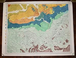
Large Hand Coloured Geological Ordnance Survey MAP SHEET 12 Basingstoke Hampshire Geological Survey of England & Wales Scale 1 inch to 1 mile.
Editore: Geological Survey of England & Wales Colonel Colby 1860 Revised 1885, 1885
Da: PROCTOR / THE ANTIQUE MAP & BOOKSHOP, DORCHESTER, Regno Unito
Membro dell'associazione: PBFA
EUR 23,38
EUR 22,70 per la spedizione da Regno Unito a U.S.A.Quantità: 1 disponibili
Aggiungi al carrelloOriginal rolled flat map. Hand-coloured engraving With ORDNANCE SURVEY Blind Stamp top margin. Size 33.5 inches X 26.5 inches. 84cm x 66cm Ordnance survey map showing Basingstoke, Whitchurch, Andover & surrounding areas. In good condition. Some foxing & a little dusty on margins & tear on right hand side of map. A few small nicks top edge. Unfolded. It will be rolled up and posted in a poster tube.
-
LARGE Ordnance Survey MAP Sheet XXXV.14 DORSET. Knighton & Canford Magna, Bear Wood. Scale 1:2500 or 25.344 inches to 1 mile.
Editore: ORDNANCE SURVEY 1934, 1934
Da: PROCTOR / THE ANTIQUE MAP & BOOKSHOP, DORCHESTER, Regno Unito
Membro dell'associazione: PBFA
EUR 23,38
EUR 22,70 per la spedizione da Regno Unito a U.S.A.Quantità: 1 disponibili
Aggiungi al carrelloOriginal Folded flat map. Approximate size is 100cm x 74cm. Shows areas of Knighton & Canford Magna, Bear Wood In good condition. Some light rubbing on edges, with a few small creases lightly tanned. With vertical and horizontal folds. County Borders Changed in 1974 From Hampshire to Dorset It will be rolled up and posted in a poster tube.
-
LARGE Ordnance Survey MAP Sheet XLIV.6 Trinidad Estate Branksome - Bourne Valley Poole DORSET Scale 1:2500 or 25.344 inches to 1 mile.
Editore: ORDNANCE SURVEY 1937, 1937
Da: PROCTOR / THE ANTIQUE MAP & BOOKSHOP, DORCHESTER, Regno Unito
Membro dell'associazione: PBFA
EUR 23,38
EUR 22,70 per la spedizione da Regno Unito a U.S.A.Quantità: 1 disponibili
Aggiungi al carrelloOriginal Folded flat map. Approximate size is 100cm x 74cm. Shows areas of Newtown, Trinidad Estate Branksome - Bourne Valley Wallisdown Poole. In good condition. Some light rubbing on edges. Small pin holes in corners. Small nick top & bottom edge. A little creased on corners. With vertical and horizontal folds. It will be rolled up and posted in a poster tube.
-
Large Hand Coloured Geological Ordnance Survey MAP SHEET 47 S.W Essex Geological Survey of England & Wales Scale 1 inch to 1 mile.
Editore: Geological Survey of England & Wales 1884, 1884
Da: PROCTOR / THE ANTIQUE MAP & BOOKSHOP, DORCHESTER, Regno Unito
Membro dell'associazione: PBFA
EUR 25,72
EUR 22,70 per la spedizione da Regno Unito a U.S.A.Quantità: 1 disponibili
Aggiungi al carrelloOriginal rolled flat map. Hand-coloured engraving With ORDNANCE SURVEY Blind Stamp top margin. Size 40 inches X 26.5 inches. 100cm x 68cm Ordnance survey map showing Saffron Walden, Whitham, Royston & surrounding areas. In generally good condition. Some foxing & a little dusty on margins & right hand side. A few small nicks on edges, a little tatty top left corner. Unfolded. It will be rolled up and posted in a poster tube.
-
Large Hand Coloured Geological Ordnance Survey MAP SHEET 8 Guildford SURREY Geological Survey of England & Wales Scale 1 inch to 1 mile.
Editore: Geological Survey of England & Wales Colonel Colby 1816 Revised 1891, 1891
Da: PROCTOR / THE ANTIQUE MAP & BOOKSHOP, DORCHESTER, Regno Unito
Membro dell'associazione: PBFA
EUR 32,74
EUR 22,70 per la spedizione da Regno Unito a U.S.A.Quantità: 1 disponibili
Aggiungi al carrelloOriginal rolled flat map. Hand-coloured engraving With ORDNANCE SURVEY Blind Stamp top margin. Size 33.5 inches X 26 inches. 85cm x 66cm Ordnance survey map showing Guildford & surrounding areas. In good condition. Some foxing & a little dusty on margins. Margin has small tear on left, crease down right hand margin, Top edge a little nicked with one tear. MAP not affected by edge nicks etc. Unfolded. It will be rolled up and posted in a poster tube.
-
Large Hand Coloured Geological Ordnance Survey MAP SHEET 12 Basingstoke Hampshire Geological Survey of England & Wales Scale 1 inch to 1 mile.
Editore: Geological Survey of England & Wales Colonel Colby 1860 Revised 1885, 1885
Da: PROCTOR / THE ANTIQUE MAP & BOOKSHOP, DORCHESTER, Regno Unito
Membro dell'associazione: PBFA
EUR 38,58
EUR 22,70 per la spedizione da Regno Unito a U.S.A.Quantità: 1 disponibili
Aggiungi al carrelloOriginal rolled flat map. Hand-coloured engraving With ORDNANCE SURVEY Blind Stamp top margin. Size 32.5 inches X 27.5 inches. 82cm x 70cm Ordnance survey map showing Basingstoke, Whitchurch, Andover & surrounding areas. In good condition. Some foxing & a little dusty on margins & slightly on right hand side of map. A few small nicks lower edge. Unfolded. It will be rolled up and posted in a poster tube.
-
HARDENDALE FELL; WESTMORLAND SHEET XIV. 14. - Very Large Ordnance Survey Map 1898; Scale 1:2500
Editore: Ordnance Survey, Southampton, 1898
Da: LOE BOOKS, Bathpool, CORNW, Regno Unito
Arte / Stampa / Poster
EUR 35,08
EUR 14,19 per la spedizione da Regno Unito a U.S.A.Quantità: 1 disponibili
Aggiungi al carrelloUnframed. Condizione: Very Good. Second Edition. A very large original map measuring 104 x 136cm, 64 sections dissected onto a linen backing; folding into original brown covers, the upper with a label of Edward Stanford, Ltd, London. A very good copy in very good condition. Map/Print.
-
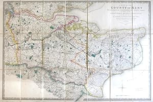
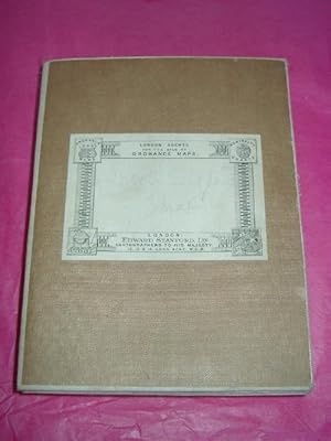
A Map of The County of Kent Drawn from the Topographical Survey Taken by Order of the Honourable Board of Ordnance under the Direction of Lt. Colonel Wm. Mudge [.] Reduced from the Large Map [.] by a Scale of One Inch to Two Statute Miles
Editore: James Wyld, 1843
Lingua: Inglese
Da: Morning Mist Books and Maps, Cirencester, Regno Unito
Mappa
EUR 233,84
EUR 45,41 per la spedizione da Regno Unito a U.S.A.Quantità: 1 disponibili
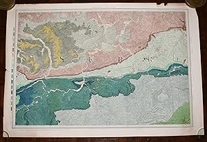
Aggiungi al carrelloNo Binding. Condizione: Very Good. An excellent copy of Wyld's map, close to being 'fine'. Rigid slipcase with Wyld's label to front, a little worn. Map mounted in sections on linen: slight spotting and toning to verso, consistent with age. Folds tight with minimal wear. Light toning and dust-marking to map face. Outline colouring, along with colour for parks, roads etc. Basic adjustment to the original map with blue line showing the rail route to Folkestone. Tiny print detail to the title: new edition, 1843. Clear, sharp printing. Title explanation: Mudge's 4 sheet map of Kent for the OS was recognised as being of exceptional quality but the OS did not choose to 'protect' their rights, so the OS maps were copied and used by others for many years. Wyld took the Mudge one inch map and reduced the detail to half-inch, enabling this map to be a single sheet that also included the Thames up to London, with part of Essex. Sheet size 93cm by 64cm approx. Further details available on request (Uc3).
-
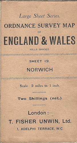
Ordnance Survey Large Sheet Series Map of England & Wales, Sheet 19: Norwich, Scale: 2 Miles to Inch.
Editore: T. Fisher Unwin, Ltd, 1914
Da: Deeside Books, Ballater, Regno Unito
Mappa
EUR 35,08
EUR 22,70 per la spedizione da Regno Unito a U.S.A.Quantità: 1 disponibili
Aggiungi al carrelloNo Binding. Condizione: Fine. Large cloth mounted folding map with card covers, some very slight shelfwear to covers but map is in excellent condition with no tears, marks or holes. 1914 edition.
-
EUR 292,30
EUR 30,65 per la spedizione da Regno Unito a U.S.A.Quantità: 1 disponibili
Aggiungi al carrelloHardcover. Condizione: Good. Drawn by R. Creighton, Engraved by J. Dower (illustratore). Published in 1841, this is a very large linen backed folding Hand Coloured map of England & Wales, in four parts folding down into leather covers, opened each individual part measures 41.5 inches by 35 inches approx. Put together the whole map measures 83 inches by 70 inches approx. which is nearly 7 feet by 6 feet The leather covers are rubbed and worn at edges, there has been crude strengthening repairs to the spines The map itself has a few creases at edges, mild marking and foxing, else in overall good condition A GENERALLY NICE EXAMPLE OF THIS VERY LARGE EARLY VICTORIAN HAND COLOURED MAP OF ENGLAND AND WALES Maps are heavy, nearly three kilos packed, overseas shipping costs will be significantly higher than the basic standard quote.
-
Large Hand Coloured Geological Ordnance Survey MAP SHEET 7 LONDON including River Thames Middlesex Geological Survey of England & Wales Scale 1 inch to 1 mile.
Editore: Geological Survey of England & Wales Colonel Colby 1822 Revised 1885, 1885
Da: PROCTOR / THE ANTIQUE MAP & BOOKSHOP, DORCHESTER, Regno Unito
Membro dell'associazione: PBFA
EUR 64,31
EUR 22,70 per la spedizione da Regno Unito a U.S.A.Quantità: 1 disponibili
Aggiungi al carrelloOriginal rolled flat map. Hand-coloured engraving With ORDNANCE SURVEY Blind Stamp top margin. Size 39.5 inches X 27 inches. 100cm x 69cm Ordnance survey map showing Uxbridge, Windsor, Watford Chelsea & surrounding areas. In generally good condition. Some foxing & a little dusty on margins & 2 tears together on top edge of map. A few small nicks on edges. Unfolded. It will be rolled up and posted in a poster tube.
-
Large Hand Coloured Geological Ordnance Survey MAP SHEET 13 OXFORD, OXFORDSHIRE Geological Survey of England & Wales Scale 1 inch to 1 mile.
Editore: Geological Survey of England & Wales Colonel Colby 1830 Revised 1891, 1891
Da: PROCTOR / THE ANTIQUE MAP & BOOKSHOP, DORCHESTER, Regno Unito
Membro dell'associazione: PBFA
EUR 64,31
EUR 22,70 per la spedizione da Regno Unito a U.S.A.Quantità: 1 disponibili
Aggiungi al carrelloOriginal rolled flat map. Hand-coloured engraving With ORDNANCE SURVEY Blind Stamp top margin. Size 33.5 inches X 26 inches. 85cm x 66cm Ordnance survey map showing areas Abingdon, Oxford, Chilton. In very good condition. Some foxing & a little dusty on margins. Unfolded. It will be rolled up and posted in a poster tube.
-
LARGE Ordnance Survey MAP Sheet LI. 5 DORSET. Brownsea Island (Ferry Side) Sandbanks Scale 1:2500 or 25.344 inches to 1 mile.
Editore: ORDNANCE SURVEY 1933, 1933
Da: PROCTOR / THE ANTIQUE MAP & BOOKSHOP, DORCHESTER, Regno Unito
Membro dell'associazione: PBFA
EUR 64,31
EUR 22,70 per la spedizione da Regno Unito a U.S.A.Quantità: 1 disponibili
Aggiungi al carrelloOriginal Folded flat map. Approximate size is 100cm x 74cm. Shows areas of Brownsea Island (Ferry Side) Sandbanks, Studland Heath, Poole Bay. In good condition. Some light rubbing on edges, with a few small corner creases & lightly tanned. With a few vertical and horizontal folds. It will be rolled up and posted in a poster tube.
-
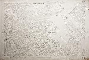
Ordnance Survey Large Scale Map of the Region around Mile End Old Town Workhouse (now Mile End Hospital) in 1873
Editore: The Ordnance Survey, 1873
Da: Morning Mist Books and Maps, Cirencester, Regno Unito
Mappa
EUR 23,38
EUR 45,41 per la spedizione da Regno Unito a U.S.A.Quantità: 1 disponibili
Aggiungi al carrelloNo Binding. Condizione: Fair. Please note: the colour of the map is pale cream, and the printing is uniform, this has proved difficult to accurately reproduce in the accompanying photos. Mapped to a scale of 1:1056 or 88 feet to 1 inch. Surveyed 1870, engraved in 1871. Published 1873. OS blind-stamp to upper margin for 1880. The sheet is in indifferent condition but shows the workhouse in detail and the layout of the surrounding area. All margins dust-marked and discoloured. Several tears to margins, with one large tear in the upper right corner going beyond the margin and penetrating into the map detail by about 5cm. Some pencil notes and a large pencil cross left of Carlton Square. Spotting and marking to reverse. Full sheet measurements 102cm by 69 cm approx. Features include: workhouse with room divisions (now Mile End Hospital); Bancrofts Hospital; part of Regent's Canal with Mile End lock; railways; burial grounds etc. Area covered: Willow Street (SW); George Street (NW); part of Lichfield Road (NE); part of Canal Road (SE). The map will be posted, rolled in a rigid tube. More details available on request. This is an original map, not a modern reproduction. (319fl50).
-
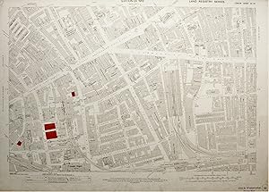
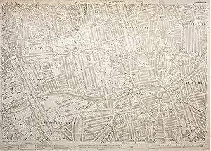
Ordnance Survey Large Scale Map of the Region around part of Whitechapel: Edition of 1913
Editore: The Ordnance Survey, 1913
Da: Morning Mist Books and Maps, Cirencester, Regno Unito
Mappa
EUR 35,08
EUR 45,41 per la spedizione da Regno Unito a U.S.A.Quantità: 1 disponibili
Aggiungi al carrelloNo Binding. Condizione: Good. Please note: the colour of the map is pale cream, and the printing is uniformly sharp, this has proved difficult to accurately reproduce in the accompanying photos. Mapped to a scale of 1:1056 or 88 feet to 1 inch. Revised 1894, published 1913. General marking and discolouring to margins. Map face slightly marked. Reverse with general marking and discolouring. Stamps, in ink, to margin. Some buildings coloured red at a later stage and numbered (Land Registry?). Some creasing from handling. Full sheet measurements 104cm by 74 cm approx. Features include: goods depot at Lambeth Street (now redeveloped); Leman Street Station; goods depot off Haydon Square; Aldgate Station; numerous named warehouses. Area covered: America Square (SW); part of Stoney Lane(NW); part of Nottingham Place (NE); part of Cable Street (SE). The map will be posted, rolled in a rigid tube. More details available on request. This is an original map, not a modern reproduction. (319fl46).
-
Ordnance Survey Large Scale Map of the Region around Peckham Rye Station: Edition of 1916
Editore: The Ordnance Survey
Da: Morning Mist Books and Maps, Cirencester, Regno Unito
Mappa
EUR 35,08
EUR 45,41 per la spedizione da Regno Unito a U.S.A.Quantità: 1 disponibili
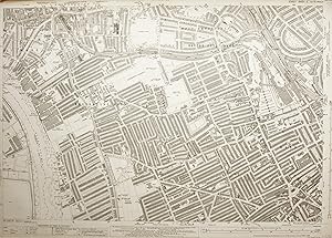
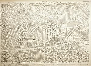
Aggiungi al carrelloNo Binding. Condizione: Very Good. Please note: the colour of the map is pale cream, and the printing is uniformly sharp, this has proved difficult to accurately reproduce in the accompanying photos. Mapped to a scale of 1:2,500 or 208 feet to 1 inch. Surveyed 1866-70. Revised 1913-4. Boundaries revised to 1919. Published 1916. Later printing code for 25/43/P. This means that the map was printed in 1945 but does not mean that the map was fully revised/updated at that time. Price stamps, in ink, to margin. Some light spotting and discolouring to margins. A couple of small nicks and scuffing. Light marking to reverse. Very slight marking to map face. Full sheet measurements 104cm by 74 cm approx. Features include: Peckham Rye and Denmark Hill Stations; tramway and depot; Peckham House lunatic asylum; part of Surrey Canal. Area covered: part of Denmark Hill (SW); part of Brisbane Street (NW); Studholme Street (NE); Nunhead Green (SE). The map will be posted, rolled in a rigid tube. More details available on request. This is an original map, not a modern reproduction. (319fl48).
-
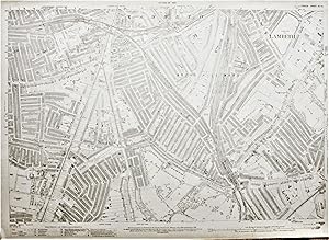
Ordnance Survey Large Scale Map of the Region around Herne Hill: Edition of 1916
Editore: The Ordnance Survey, 1938
Da: Morning Mist Books and Maps, Cirencester, Regno Unito
Mappa
EUR 35,08
EUR 45,41 per la spedizione da Regno Unito a U.S.A.Quantità: 1 disponibili
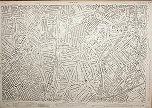
Aggiungi al carrelloNo Binding. Condizione: Very Good. Please note: the colour of the map is pale cream, and the printing is uniformly sharp, this has proved difficult to accurately reproduce in the accompanying photos. Mapped to a scale of 1:2,500 or 208 feet to 1 inch. Surveyed 1867-9. Revised 1913, published 1916, boundaries partly revised in 1919. Reprinted 150/23, 200/28, 150/38. Final printing being 1938, but with no text mentioning actual updates. Upper margin stained with slight staining on the map itself to the upper centre. Other margins dust-marked and slightly discoloured. Stamps, in ink, to margin. Map face bright with only slight toning. Sharp, clear printing. Full sheet measurements 104cm by 74 cm approx. Features include: Herne Hill station, tramlines, parks, schools, Brixton and East Brixton stations. Area covered: part of Dumbarton Road (SW); part of Andalus Road (NW); Ruskin Park (NE); part of Burbage Road(SE). The map will be posted, rolled in a rigid tube. More details available on request. This is an original map, not a modern reproduction. (319fl23).
-
Ordnance Survey Large Scale Map of the Region around Deptford Park: Edition of 1916
Editore: The Ordnance Survey, 1916
Da: Morning Mist Books and Maps, Cirencester, Regno Unito
Mappa
EUR 35,08
EUR 45,41 per la spedizione da Regno Unito a U.S.A.Quantità: 1 disponibili
Aggiungi al carrelloNo Binding. Condizione: Good. Please note: the colour of the map is pale cream, and the printing is uniformly sharp, this has proved difficult to accurately reproduce in the accompanying photos. Mapped to a scale of 1:2,500 or 208 feet to 1 inch. Surveyed 1866-70. Revised 1914, published 1916, boundaries partly revised in 1919. Upper margin stained with slight staining on the map itself to the upper left corner. Other margins dust-marked. Price stamps, in ink, to margin. Map face bright with only slight toning. Sharp, clear printing. Full sheet measurements 104cm by 74 cm approx. Features include: Millwall Football Ground, Surrey Canal, industrial units, railway routes, part of the river with wharves on both sides. Area covered: Wagner Street (SW); Abbeyfield Road (NW); part of West Ferry Road (NE); Albury Street (SE). The map will be posted, rolled in a rigid tube. More details available on request. This is an original map, not a modern reproduction. (319fl19).
-
A Map of the County of Kent Drawn from the Topographical Survey Taken, by Order of the Honourable Board of Ordnance, . Reduced from the Large Map in Four Sheets by a Scale of One Inch to Two Statute Miles
Editore: London: Jas. Wyld, 1841
Da: Bow Windows Bookshop (ABA, ILAB), Lewes, Regno Unito
Mappa
EUR 344,91
EUR 24,97 per la spedizione da Regno Unito a U.S.A.Quantità: 1 disponibili
Aggiungi al carrelloMap dimensions 59.5 x 89 cm, overall 63.5 x 94.5 cm. Finely engraved folding map of the county, dissected into twenty-four sections and mounted on linen, green silk trim to the edges, marbled paper to the folded end sections, folds into original green embossed cloth slipcase with Wyld's printed label to upper board and brief title label to one spine. Some mild wear to the corners of the case, a lovely example overall. Kent was the first of the Ordnance Survey maps to be published, appearing in 1801. This version, reduced in format and scale, was first published by Faden in 1807 and then by his successors, the Wylds, at intervals through to the mid-19th century.
-
'BACON'S NEW ORDNANCE SURVEY ATLAS OF LONDON AND SUBURBS IN EIGHTEEN DOUBLE SHEETS.'. Large atlas of London on 18 sheets on a scale of 9 inches to a mile, with 4 separate extensions on a 4-inch scale. Three supplementary maps (Woolwich, Railway map of London and Suburbs, Environs of London) and one large 1880s printing of the 1596 Ralph Agas map of 'London in the Reign of Queen Elizabeth'
Editore: G. W. Bacon & Co. ca. 1880, 1880
Da: Garwood & Voigt, Sevenoaks, Regno Unito
Mappa
EUR 5.845,98
EUR 45,41 per la spedizione da Regno Unito a U.S.A.Quantità: 1 disponibili
Aggiungi al carrelloCondizione: Fine. Large folio (51x35cm). The double page maps (approx. 54x44each) in original part colour, the Agas map (45x124cm when joined) uncoloured. The covers worn and bumped, the maps in excellent condition. These large scale Ordnance Survey maps by Bacon are very uncommon. Mapsheets #1 - #12 would form a very large (wall) map of central London (168x186cm).
-
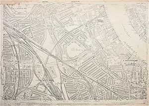
Ordnance Survey Large Scale Map of the Region around Hammersmith Cemetery and Queen's Club: Edition of 1916
Editore: The Ordnance Survey, 1935
Da: Morning Mist Books and Maps, Cirencester, Regno Unito
Mappa
EUR 40,92
EUR 45,41 per la spedizione da Regno Unito a U.S.A.Quantità: 1 disponibili
Aggiungi al carrelloNo Binding. Condizione: Very Good. Please note: the colour of the map is pale cream, and the printing is uniformly sharp, this has proved difficult to accurately reproduce in the accompanying photos. Mapped to a scale of 1:2,500 or 208 feet to 1 inch. Surveyed 1862-5. Revised 1913, boundaries partly revised in 1919, re-levelled 1931-2, printed and published 1935. Left margin stained and crease to the upper corner, along with small tear. Other margins dust-marked. Small tear to upper margin. Small stain to lower margin. Price stamps, in ink, to margin. Map face bright with only slight toning. Sharp, clear printing. Full sheet measurements 104cm by 74 cm approx. Features include: Queen?s Club; Hammersmith, Baron?s Court and West Kensington Stations; Lillie Bridge depot; part of the Thames. Area covered: Thames(SW); Bridge Avenue (NW); part of Longridge Road (NE); Jerdan Place (SE). The map will be posted, rolled in a rigid tube. More details available on request. This is an original map, not a modern reproduction. (319fl42).
-
Ordnance Survey Large Scale Map of the Region around Old Kent Road and Bricklayers Arms Branch Railway: Edition of 1916
Editore: The Ordnance Survey
Da: Morning Mist Books and Maps, Cirencester, Regno Unito
Mappa
EUR 40,92
EUR 45,41 per la spedizione da Regno Unito a U.S.A.Quantità: 1 disponibili
Aggiungi al carrelloNo Binding. Condizione: Very Good. Please note: the colour of the map is pale cream, and the printing is uniformly sharp, this has proved difficult to accurately reproduce in the accompanying photos. Mapped to a scale of 1:2,500 or 208 feet to 1 inch. Surveyed 1866-70. Revised 1914, originally published 1916, boundaries partly revised in 1919. Reprint codes: 25/44 and 50/46. So although the map was reprinted in 1946 the vast majority of the map shows the area from before the Second World War. Margins slightly discoloured and dust-marked. Price stamps, in ink, to margin. Map face bright with only slight toning. Sharp, clear printing. Full sheet measurements 104cm by 74 cm approx. Features include: the network of rails and yards making up this section of the Bricklayers Arms Branch Railway; part of the Surrey Canal with associated wharves; the area around Cobourg Road which has now been totally transformed. Area covered: northern part of New Church Road (SW); Henshaw Street (NW); part of Aspinden Road (NE); Gervase Street (SE). The map will be posted, rolled in a rigid tube. More details available on request. This is an original map, not a modern reproduction. (319fl41).
-
Ordnance Survey Large Scale Map of the Region around North Brixton: Edition of 1916
Editore: The Ordnance Survey, 1916
Da: Morning Mist Books and Maps, Cirencester, Regno Unito
Mappa
EUR 40,92
EUR 45,41 per la spedizione da Regno Unito a U.S.A.Quantità: 1 disponibili
Aggiungi al carrelloNo Binding. Condizione: Very Good. Please note: the colour of the map is pale cream, and the printing is uniformly sharp, this has proved difficult to accurately reproduce in the accompanying photos. Mapped to a scale of 1:2,500 or 208 feet to 1 inch. Surveyed 1866-9. Revised 1913, published 1916, boundaries partly revised in 1919. Margins slightly discoloured and dust-marked. Price stamps, in ink, to margin. Map face bright with only slight toning. Sharp, clear printing. Full sheet measurements 104cm by 74 cm approx. Features include: Camberwell New Road Station, King?s College Hospital, tramlines, railways. Area covered: northern part of Tasman Road (SW); part of Kenchester Street (NW); part of Lomond Grove (NE); north-eastern corner of Ruskin Park (SE). The map will be posted, rolled in a rigid tube. More details available on request. This is an original map, not a modern reproduction. (319fl40).



![Immagine del venditore per A Map of The County of Kent Drawn from the Topographical Survey Taken by Order of the Honourable Board of Ordnance under the Direction of Lt. Colonel Wm. Mudge [.] Reduced from the Large Map [.] by a Scale of One Inch to Two Statute Miles venduto da Morning Mist Books and Maps](https://pictures.abebooks.com/inventory/md/md32106847342.jpg)
