Importo totale (1 articolo articoli):
Destinazione ordine:

dentrecasteaux (25 risultati)
Vai alla pagina principale dei risultati di ricerca
Filtri di ricerca
Tipo di articolo
- Tutti i tipi di prodotto
- Libri (24)
- Riviste e Giornali (Nessun altro risultato corrispondente a questo perfezionamento)
- Fumetti (Nessun altro risultato corrispondente a questo perfezionamento)
- Spartiti (Nessun altro risultato corrispondente a questo perfezionamento)
- Arte, Stampe e Poster (Nessun altro risultato corrispondente a questo perfezionamento)
- Fotografie (Nessun altro risultato corrispondente a questo perfezionamento)
- Mappe (1)
- Manoscritti e Collezionismo cartaceo (Nessun altro risultato corrispondente a questo perfezionamento)
Condizioni Maggiori informazioni
Legatura
Ulteriori caratteristiche
Lingua (2)
Spedizione gratuita
Paese del venditore
Valutazione venditore
-

Le contre-amiral Bruni d'Entrecasteaux (1739-1793).
Editore: Vers 1900., 1900
Da: Loïc Simon, Blaison-Saint Sulpice, FR, Francia
Valutazione del venditore 5 su 5 stelle

EUR 13,00
Spedizione EUR 19,00
Spedito da Francia a U.S.A.Quantità: 1 disponibili
Aggiungi al carrelloBiographie et portrait. Numéro de la revue "Les Contemporains". Illustré. Broché. 16 pages.
-
Extracts from New Zealand Journals Written on Ships Recherche, Esperance and Coquille under the Command of d'Entrecasteaux and Duperrey 1793 and 1824 Early Eyewitness Accounts of Maori Life 3 and 4
Editore: Alexander Turnbull Library & Indosuez NZ Ltd 1986, 1986
Da: Hard to Find Books NZ (Internet) Ltd., Dunedin, OTAGO, Nuova Zelanda
Membro dell'associazione: IOBA
Valutazione del venditore 5 su 5 stelle
EUR 18,41
Spedizione EUR 18,11
Spedito da Nuova Zelanda a U.S.A.Quantità: 1 disponibili
Aggiungi al carrelloLarge oblong quarto, light grey cloth boards with gilt lettering in black decorative panels to spine & front board, 219pp, illus, VG- (some fading & soiling to boards, prominent waterstain to boards, v slight foxing to page edges).
-

Voyage to Australia and the Pacific, 1791-1793: Bruni d'Entrecasteaux
Da: Arete Books, Melbourne, VIC, Australia
Valutazione del venditore 5 su 5 stelle
Copia autografata
EUR 30,81
Spedizione EUR 41,09
Spedito da Australia a U.S.A.Quantità: 1 disponibili
Aggiungi al carrelloSoft cover. Condizione: As New. flat signed "Duyker" on the title page. Signed by Author(s).
-

Voyage to Australia and the Pacific 1791-1793
Lingua: Inglese
Editore: Melbourne; Miegunyah Press; 2001, 2001
ISBN 10: 0522849326 ISBN 13: 9780522849325
Da: Fine Print Books (ABA), Erskineville, Sydney, NSW, Australia
Valutazione del venditore 5 su 5 stelle
EUR 59,73
Spedizione EUR 19,23
Spedito da Australia a U.S.A.Quantità: 1 disponibili
Aggiungi al carrellohardcover in very good condition, dustwrapper lightly foxed; 392 pages, b/w illusts and maps, heavy book which will require excess postage outside Australia.
-

VOYAGE TO AUSTRALIA AND THE PACIFIC. 1791-1793.
Lingua: Inglese
Editore: Miegunyah Press, Carlton, 2001., 2001
ISBN 10: 0522849326 ISBN 13: 9780522849325
Da: Sainsbury's Books Pty. Ltd., Camberwell, VIC, Australia
Membro dell'associazione: ANZAAB ILAB
Valutazione del venditore 4 su 5 stelle

EUR 62,87
Spedizione EUR 20,98
Spedito da Australia a U.S.A.Quantità: 1 disponibili
Aggiungi al carrello8vo, 392pp. A near fine hardback copy in like dust jacket.
-

LE VOYAGE DE D'ENTRECASTEAUX (1791-1793)
Editore: Comité d'Entrecasteaux. Nouméa. ., 1993
Da: Jean-Louis Boglio Maritime Books, CYGNET, TAS, Australia
Membro dell'associazione: ANZAAB ILAB
Valutazione del venditore 5 su 5 stelle
EUR 18,86
Spedizione EUR 21,86
Spedito da Australia a U.S.A.Quantità: 1 disponibili
Aggiungi al carrelloNo pagination. 24 pages with b/w & colour illust. Pict. stiff cover. French text. Fine. 29.8 x 21. In 1792 & 93, the French explorer's voyage of discovery of the New Caledonian coasts (West then North-east) during his search for the vanished La Pérouse.
-

EXTRACTS FROM NEW ZEALAND JOURNALS WRITTEN ON SHIPS UNDER THE COMMAND OF D'ENTRECASTEAUX AND DUPERREY - 1793 AND 1824
Editore: Alexander Turnbull Library Endowment Trust & Indosuez New Zealand Limited. Wellington. ., 1986
ISBN 10: 0908702051 ISBN 13: 9780908702053
Da: Jean-Louis Boglio Maritime Books, CYGNET, TAS, Australia
Membro dell'associazione: ANZAAB ILAB
Valutazione del venditore 5 su 5 stelle
Prima edizione
EUR 37,72
Spedizione EUR 21,86
Spedito da Australia a U.S.A.Quantità: 1 disponibili
Aggiungi al carrello1st edition limited to 1000 copies. Nos. 3 and 4 in the Early Eyewitness Accounts of Maori Life series. Transcription and translation by Isabel Ollivier. Preface by L. A. Cameron. Foreword by Anne Salmond. 220 PP with 9 charts and coastal views, and 30 b/w plates. Cloth cover, gilt title on black label on front cover and spine. French and English text. Fine. Oblong: 26 x 30.5. Extracts from the Journals of the ships Recherche and Espérance in 1793, and Coquille in 1824.
-

Voyage to Australia and the Pacific 1791-1793
Lingua: Inglese
Editore: Melbourne University Press, Melbourne, 2001
ISBN 10: 0522849326 ISBN 13: 9780522849325
Da: Edmonton Book Store, Edmonton, AB, Canada
Membro dell'associazione: ABAC ILAB
Valutazione del venditore 4 su 5 stelle
EUR 63,03
Spedizione EUR 49,83
Spedito da Canada a U.S.A.Quantità: 1 disponibili
Aggiungi al carrelloCondizione: very good. Condizione sovraccoperta: very good. 8vo pp.392. book.
-

The General: The visits of the expedition led by Bruny d'Entrecasteaux to Tasmanian waters in 1792 and 1793
Lingua: Inglese
Editore: Queen Victoria Museum, Launceston, 1993
ISBN 10: 0724641181 ISBN 13: 9780724641185
Da: Edmonton Book Store, Edmonton, AB, Canada
Membro dell'associazione: ABAC ILAB
Valutazione del venditore 4 su 5 stelle
EUR 72,04
Spedizione EUR 49,83
Spedito da Canada a U.S.A.Quantità: 1 disponibili
Aggiungi al carrelloCondizione: very good. Condizione sovraccoperta: very good. 8vo pp.379. book.
-
Voyage to Australia & the Pacific 1791-1793. Edited and Translated by Edward Duyker and Maryse Duyker [Miegunyah Press Second Series No. 36]
Lingua: Inglese
Editore: The Miegunyah Press, Carlton, 2001
ISBN 10: 0522849326 ISBN 13: 9780522849325
Da: Arapiles Mountain Books - Mount of Alex, Castlemaine, VIC, Australia
Membro dell'associazione: ANZAAB ILAB
Valutazione del venditore 5 su 5 stelle
Prima edizione
EUR 110,03
Spedizione EUR 30,60
Spedito da Australia a U.S.A.Quantità: 1 disponibili
Aggiungi al carrelloHard Cover. Condizione: F. Condizione sovraccoperta: F. First Edition. F/F. 8vo. original grey boards gilt in dustwrapper (a trifle rubbed); pp. xliv (last blank), 392, [2 (colophon, last blank), with illustrations + maps. A fine copy. Limited to 1,250 copies.
-
Voyage to Australia & the Pacific 1791-1793
Editore: Melbourne University Press 2001, 2001
Da: Hard to Find Books NZ (Internet) Ltd., Dunedin, OTAGO, Nuova Zelanda
Membro dell'associazione: IOBA
Valutazione del venditore 5 su 5 stelle
EUR 78,92
Spedizione EUR 18,11
Spedito da Nuova Zelanda a U.S.A.Quantità: 1 disponibili
Aggiungi al carrelloSuper octavo, grey heavy card boards with green spine, gilt lettering to spine, xliii + 392pp, illus, VG+ (light bruising to extrems) in d/w, VG+ (light creasing & soiling to edges, light discolouration to spine, 1 cm closed tear to base of front cover).
-
![Immagine del venditore per L'Australie des Explorateurs Francais - The Australia of the French Explorers. venduto da Muir Books [Robert Muir Old & Rare Books]](https://pictures.abebooks.com/inventory/md/md32457103906.jpg)
L'Australie des Explorateurs Francais - The Australia of the French Explorers.
Editore: Somogy Editions d'Art, n.p., 2014
Da: Muir Books [Robert Muir Old & Rare Books], PERTH, WA, Australia
Membro dell'associazione: ANZAAB ILAB
Valutazione del venditore 5 su 5 stelle
Prima edizione
EUR 138,32
Spedizione EUR 24,48
Spedito da Australia a U.S.A.Quantità: 1 disponibili
Aggiungi al carrelloBoards in d.j. Lesueur and Petit (artists) (illustratore). 1st edition. 1st ed., square quarto, text in French and English, pp.192, profusely illus with colour and b&w plates, maps, photographs, original boards in dust-jacket. Near fine condition. Explorations to the Australian coast of French explorers during the 18th and 19th centuries, documented here through contemporary photographs, expedition drawings and historical commentary. Explorers include Saint-Alouarn, La Perouse, Bruny d'Entrecasteaux, Labillardiere, Baudin, Henri Freycinet, Louis Freycinet, Rose Freycinet, Hamelin, Peron and others. Includes artworks by artists Lesueur and Petit.
-
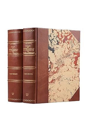
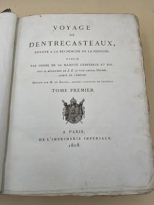
Voyage de Dentrecasteaux, envoyé à la recherche de La Pérouse, publié par ordre de Sa Majesté l'Empereur et Roi, sous le ministère de S. E. le vice-amiral Decrès, comte de l'Empire
Editore: Imprimerie Impériale, 1808
Da: Librairie Voyage et Exploration, Cerny, Francia
Valutazione del venditore 3 su 5 stelle

Prima edizione
EUR 2.500,00
Spedizione EUR 45,00
Spedito da Francia a U.S.A.Quantità: 1 disponibili
Aggiungi al carrelloCouverture rigide. Condizione: Très bon. Edition originale. Paris, Imprimerie impériale, 1808. 2 grands et forts volumes in-4 (32x24), lvi, 704 p., 33 pl. ; viii, 692 p., relié demi basane et coins moderne, dos avec auteur, titre, tomaison, lieu et date, exlibris en page de garde, non rogné, tome 2 non coupé, petite mouillure au tome 2, petites rousseurs aux illustrations du tome 1. Exemplaire sur papier bleuté, complet de son illustration mais sans son atlas de cartes Édition originale du rapport de l'expédition souhaitée par Louis XVI pour retrouver les navires commandés par Jean-François de La Pérouse (1741-1788) disparu dans les mers du sud après l'escale en Australie en 1788. Malgré la Révolution française, deux navires de sauvetage ont été envoyés, rebaptisés symboliquement La Recherche et L'Espérance, commandés par D'Entrecasteaux. Malheureusement, pendant la navigation, D'Entrecasteaux a perdu la vie, et la mission de recherche s'est terminée sans aucune nouvelle sur le sort des navires de La Pérouse mais permis d établir de nouvelles cartes et d améliorer la connaissance des nombreuses iles de l Océanie.
-
Voyage de Dentrecasteaux, envoyé à la recherche de La Pérouse. Publié par ordre de sa Majesté l'Empereur et Roi, sous le ministère de S. E. le vice-amiral Decrès, comte de l'Empire. Rédigé par M. de (Édouard de) Rossel, ancien capitaine de vaisseau.
Editore: Dépôt général des Cartes et Plans de la Marine et des Colonies, Imprimerie Impériale,, 1807
Da: Librairie Voyage et Exploration, Cerny, Francia
Valutazione del venditore 3 su 5 stelle
Prima edizione
EUR 10.000,00
Spedizione EUR 45,00
Spedito da Francia a U.S.A.Quantità: 1 disponibili
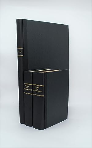
Aggiungi al carrelloCouverture rigide. Condizione: Bon. Edition originale. RARE ENSEMBLE COMPLET en 3 volumes TEXTE ; 2 forts vol. in-4° ; (2)-LVI-704 pp.-32 pl. h.-t. repliées in-fine (I-XXXII)/(2)-VIII-692 pp.-1 pl. h.-t. Repliée sur papier bleuté , relié demi cuir (reliure moderne), dos lisse avec titre et tomaison , tranches mouchetées , mouillure angulaire sur 7 planches, petites rousseurs sur les planches . ATLAS ; 1 volume grand in-folio (560x445) ,page de titre-1 fnch. (Table )-39 cartes et vues h.-t. , dont 29 à double page ,dressées par l'ingénieur hydrographe C. F. Beautemps Beaupré et gravées sur cuivre par E. Collin , relié demi cuir , dos lisse ,cachets répétés , petites rousseurs . Édition originale de la relation du voyage de Bruny d'Entrecasteaux, envoyé par Louis XVI en Océanie à la recherche de La Pérouse. Sa rédaction a été confiée au capitaine de vaisseau Rossel, qui s'est appuyé sur le journal laissé par d'Entrecasteaux, emporté par le scorbut au cours du trajet. Elle est illustrée de 33 planches dépliantes dans les volumes de texte et de 39 cartes et vues dans l'atlas , réalisées pendant l'expédition et qui étaient d'un niveau exceptionnellement élevé, en particuliers les 12 magnifiques cartes de l'Australie occidentale et de la Tasmanie qui enregistraient la côte avec précision pour la première fois , la nouvelle méthode de Beautemps-Beaupré , révolutionna la cartographie . En février 1791, inquiet du sort de l'expédition commandée par La Pérouse, qui aurait dû être rentrée en France depuis plusieurs mois, Louis XVI fit envoyer deux frégates à sa recherche, symboliquement rebaptisées La Recherche et L'Espérance. Cette ambitieuse expédition quitta Brest en septembre, doubla le cap de Bonne-Espérance, visita plusieurs îles du Pacifique sud (la Tasmanie, la Nouvelle-Zélande, la Nouvelle-Calédonie, les îles Tonga, le Vanuatu, etc.) et se termina de façon chaotique à Sourabaya, un des principaux établissements hollandais situés sur l'île de Java. L'équipage y arriva diminué par la fatigue et la maladie , alors que la France avait changé de régime et était en guerre avec l'Angleterre, sans avoir trouvé la moindre trace de La Pérouse. Hormis son issue malheureuse, l'expédition fit des découvertes importantes dans le domaine de la géographie, de l'hydrographie et des sciences naturelles, et rapporta une liste de vocabulaires des peuples qu'elle rencontra (voir les pages 557-590 du premier volume). UN RÉCIT TRÈS RARE D'UN VOYAGE D'UNE IMPORTANCE ÉNORME POUR L'EXPLORATION DE L'AUSTRALIE ET DU PACIFIQUE Antoine Reymond Joseph de Bruni d'Entrecasteaux, dit le « chevalier d'Entrecasteaux » , entre dans la marine à l'age de 15 ans , combattit à Minorque , accompagna Chabert dans ses expéditions scientifique , prend le commandement de la flotte française dans l'océan indien , ouvre une nouvelle route de navigation vers la Chine , il devient gouverneur des Mascareignes jusqu'à sa nomination à la direction de l'expédition à la recherche de La Pérouse en 1791. Charles-François Beautemps-Beaupré, (Neuville-au-Pont 1766, Paris 1854), est un ingénieur hydrographe et cartographe français, membre de l'Académie des sciences et du Bureau des longitudes . Il est considéré comme le père de l'hydrographie moderne . Chadenat, n°5056. , Sabin, n°22671 FIRST EDITION. D'Entrecasteaux joined the French navy in 1754 and fought in 1756 at Minorca. He assumed command of the French fleet of the East Indies and in 1787, was appointed governor of Mauritius and the Isle of Bourbon. While in command in search for La Perouse in 1791-92, he determined the position of Amsterdam Island, explored the coastlines of New Caledonia, Tasmania, and New Holland, and located several groups of islands. Many of the charts made by the expedition (particularly those of South Australia produced by Beautemp Beaupre) were of unusually high standards, and the 12 magnificent maps of Western Australia and Tasmania recorded the coast accurately for the first time. They are regarded the most significant ever made. A VERY RARE ACCOUNT OF A VO.
-
Voyage de Dentrecasteaux envoyé à la recherche de La Pérouse. Publié par ordre de sa Majesté l'Empereur et Roi, sous le Ministère de S.E. le Vice Amiral Decrès, Comte de l'Empire, rédigé par M. de Rossel,ancien Capitaine de vaisseau. Tome 1 seul
Editore: Imprimerie Impériale, 1808
Da: LIBRAIRIE GIL-ARTGIL SARL, RODEZ, Francia
Valutazione del venditore 4 su 5 stelle
EUR 2.000,00
Spedizione EUR 37,00
Spedito da Francia a U.S.A.Quantità: 1 disponibili
Aggiungi al carrelloA Paris, de l'Imprimerie Impériale, 1808. Tome I seul, Un volume très fort In-folio, relié cartonnage d'attente de l'époque, LVI + 704 pages et 32 planches dépliantes. Le corps de l'ouvrage est en très bon état, les pages, à grandes marges ne sont ni tachées ni affectéees de rousseurs, imprimées sur beau papier. Les planches dépliantes sont également en bon état, présentant juste quelques petites pointes de rousseurs dans les marges sans gravité. La reliure (cartonnage d'attente) est en mauvais état. Rappelons que d'Entrecateaux avait été envoyé, en 1781) par Louis XVI à la recherche de La Pérouse.
-
Voyage de Dentrecasteaux, envoye a la recherche de La Perouse. Publie par ordre de sa Majeste l'Empereur et Roi. Redige par M. de Roseel, ancien capitaine de Vaisseau. - Atlas du Voyage de Bruny-Dentrecasteaux. Fait
Editore: Paris: Au Depot general des cartes et plans de la marine et des colonies, 1807., 1807
Da: Arader Galleries - AraderNYC, New York, NY, U.S.A.
Valutazione del venditore 5 su 5 stelle
Prima edizione
Soft cover. 1st Edition. 3 volumes: 2 volumes text, 4to (11 x 8 4/8 inches), and atlas volume, folio (23 4/8 x 17 2/8 inches). Half-titles in text volumes; atlas with title and contents leaf. 33 engraved folding plates in the text volumes and 39 engraved maps in the atlas, mostly double-page (atlas leaves with pale dampstain at lower right corner). Text bound in 20th-century red niger-backed marbled boards; atlas in 20th-century green buckram, uncut. Provenance: Bookplates of Frank Sherwin Streeter (1918-2006), his sale, Christie's, Collection of Important Navigation, Pacific Voyages, Cartography and Science, 17th April 2007, lot 181 First Edition. In 1786 D'Entrecasteaux was made commander of the Indian Station of the French navy. While there he made his first significant exploratory voyage, sailing 'La Résolution' to China, pioneering a new route via Sunda Strait and the Moluccas, which could be used in the monsoon. "When the term of his office expired Bruny was appointed governor of Ile de France and Ile Bourbon in the Indian Ocean. Services there, together with his reputation as a seaman and discoverer in the monsoon belt, brought him to the notice of Louis XVI, and when the National Assembly decided to send an expedition to search for the missing La Pérouse Bruny was chosen to lead it. "With two ships,'La Recherche' and 'L'Espérance' under Huon de Kermadec, he left Brest on 28 September 1791 with orders to sail via the Cape of Good Hope, along the south coast of Australia from Cape Leeuwin to the east, and then into the Pacific. The object was twofold: to search for the missing navigator and to make scientific discoveries and surveys on the way, checking in particular the accuracy of the early Dutch and d'Apres charts of the South Indian and South Pacific Oceans. A number of learned men sailed with the expedition, including the hydrographic engineer Beautemps-Beaupré, the botanist La Billardière, the artist Piron, the astronomer l'abbé Bertrand, and the learned sailor de Rossel who later wrote the history of the voyage. "At the Cape of Good Hope Bruny learned from a letter that clothes and objects of French origin had been seen in the Admiralty Islands, so he decided to make straight for the Pacific. In southern latitudes he sighted and surveyed Amsterdam Island; he then sailed for Van Diemen's Land, anchoring in Storm Bay on 23 April 1792. Here, while refreshing ships and crews, he made detailed surveys and charts of the southern coast, discovered that Adventure Bay was on an island (Bruny Island) and sailed through the channel (D'Entrecasteaux Channel) between it and the mainland. The expedition then made for New Caledonia, which was charted in the same thorough way, and between June and September he searched the seas to the north of New Guinea. He refitted at Amboina, and on 14 October sailed for the south-west coast of New Holland to carry out his instructions in those waters. The two ships sighted land near Cape Leeuwin on 5 December 1792 near St Allouarn Island, discovered by the French in 1772. The expedition then sailed eastward, exploring the coast of Nuyts Land to 129° 18' E, near D'Entrecasteaux Reef. Running short of water, on 4 January 1793 Bruny sailed for Van Diemen's Land, thus missing the coasts later discovered by George Bass and Matthew Flinders. He remained there from 21 January to 28 February, surveying and completing his charts and notes about the inhabitants. He sailed for New Zealand to investigate the coast, then north to scour the central Pacific for La Pérouse to the east of his previous course. On this leg of the voyage he surveyed Santa Cruz, which led him to within miles of the wrecked ships found later by Dumont d'Urville, and made many discoveries in the seas around the Solomon Islands and Bismarck Archipelago. Needing a refit Bruny made for the Dutch Islands, but died off the north-east of New Guinea on 20 July 1793" (Lesley R. Marchant for Australian Dictionary of National Biography). The expedition gathe.
-

Looking for La Perouse. D'Entrecasteaux in Australia and the South Pacific 1792-1793.
Data di pubblicazione: 1996
Da: Berkelouw Rare Books, Berrima, NSW, Australia
Membro dell'associazione: ANZAAB ILAB
Valutazione del venditore 4 su 5 stelle
EUR 28,29
Spedizione EUR 33,22
Spedito da Australia a U.S.A.Quantità: 1 disponibili
Aggiungi al carrelloMelbourne U.P., (1996). Roy. 8vo. Orig. illust. limp boards. (xiv, 318pp.). With 2 double-page and 8 full-page b/w plates, 2 diagrams, and 11 maps. 1st paperback edition. Fine.
-
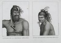
Sauvage de la Nouvelle Zeelande (&) Jeune Sauvage de la Nouvelle Zeelande
Editore: Paris, 1800
Da: Antipodean Books, Maps & Prints, ABAA, Garrison, NY, U.S.A.
Membro dell'associazione: ABAA ANZAAB ESA ILAB
Valutazione del venditore 4 su 5 stelle
Black and white copper engraved portraits of two Maoris, somewhat romanticized. Both have hair decorated with feathers, one wearing a necklace, the other long earrings. Platemark size 44 x 30 cm. Very good condition with very wide margins, slt. dusty on 2 margins.
-
Voyage de D'entrecasteaux, envoyé à la recherche de La Pérouse
Da: Douglas Stewart Fine Books, Armadale, VIC, Australia
Membro dell'associazione: ANZAAB ILAB
Valutazione del venditore 4 su 5 stelle
EUR 11.316,91
Spedizione EUR 32,35
Spedito da Australia a U.S.A.Quantità: 1 disponibili
Aggiungi al carrello./? rédigé par M. de Rossel. Paris : De L'Imprimerie impériale, 1808. Two volumes, thick quarto, both text volumes finely bound in uniform full morocco, ruled in gilt, expertly rebacked, spines in compartments with ornamental gilt tooling and lettering, all edges gilt, first volume with half-title, title leaf, pp. lvi, 704 pp with 32 folding charts and diagrams, second volume with half-title, title leaf, pp. viii, 692, with a plate, some light foxing, overall very clean; with the large elephant folio Atlas du voyage de Bruny-Dentrecasteaux by C.F. Beautemps-Beaupré (Paris : Dépôt général des cartes et plans de la Marine et des Colonies, 1807), in modern papered boards, 39 engraved charts (mostly double-page), including a fine Carte génerale de la Nouvelle Hollande et des archipels du Grand Océan, the leaves with faint, marginal water staining, a short sealed edge tear to one chart, the final two charts with light soiling, more pronounced on the last chart, which is presented with a duplicate copy, clean, loosely enclosed, overall sound and clean; a fine set. The official account of Bruny D'Entrecasteaux's voyage to the Pacific in 1791-1794 in search of the lost la Perouse expedition. It contains significant descriptions and maps of Tasmania and south-west Western Australia. The atlas contains some of the most detailed and scientifically important charts of the coastline of New Holland to date.
-
Carte Generale de la Nouvelle Hollande et Des Archipels du Grand Ocean, qui Sont au Nord et a l'Est de Cette Terre dressee, en 1807; pour servir au voyage du contre-amiral Bruny-Dentrecasteaux, fait, par ordre du gouvernement en 1791, 1792 et 1793; par C.F. Beautemps-Beaupre, hydrographe sous-chefs du Depot general de la marine.
Editore: Depot general des cartes et plans de la marine et des colonies],
Da: Daniel Crouch Rare Books Ltd, London, Regno Unito
Membro dell'associazione: ABA ILAB PBFA
Valutazione del venditore 4 su 5 stelle
Mappa
EUR 4.844,70
Spedizione EUR 23,52
Spedito da Regno Unito a U.S.A.Quantità: 1 disponibili
Aggiungi al carrello"Sieur d'Entrecasteaux shall draw precise maps of every coastline and isle he encounters" (Fleurieu) First issue. Double-page engraved chart. Plate no. 1 from, the 'Atlas du voyage de Bruny-Dentrecasteaux, contre-amiral de France, commandant les fregates 'la Recherche' et 'l'Esperance', fait par ordre du gouvernement en 1791, 1792 et 1793 : publie par ordre de sa majeste l'empereur et roi, sous le ministere de son excellence le vice-amiral Decres. par C.F. Beautemps-Beaupre' (1807). A beautiful map of Australia, the East Indies, New Guinea and the islands of the western Pacific showing tracks of D'Entrecasteaux's ships, Recherche and Esperance in 1792-1793. Coastline of southeastern Australia and northern and western Tasmania is missing. From 29 September 1791 to 27 October 27 1793, Charles-François Beautemps-Beaupré (1766-1854) sailed aboard the frigate 'La Recherche' under the command of Antoine Bruny d'Entrecasteaux. The expedition's primary objective was to find trace of the missing Lapérouse expedition. By following the expedition's route to New Holland. "That will be the final destination of Sieur d'Entrecasteaux's expedition in search of Lapérouse's frigates. However, if these ships have indeed been swallowed by the sea, if the ocean has left no debris on any beaches, if after exhausting every possible avenue Sieur d'Entrecasteaux has no choice but to abandon this goal, as critical as it is, he shall at least have the satisfaction and glory of having made an immeasurable contribution to the perfecting of the field of cartography and the expansion of man's knowledge. Sieur d'Entrecasteaux shall draw precise maps of every coastline and isle he encounters. If these places have already been explored, he shall verify the accuracy of his predecessors' maps and descriptions" (Fleurieu, Mémoire du Roi pour servir d'instruction au sieur d'Entrecasteaux, September 16, 1791). The ships eventually came within reach of Vanikoro (the Salomon Islands), where shipwrecked survivors from La Boussole and L'Astrolabe were still living. D'Entrecasteaux died of scurvy off the coast of Java on July 20, 1793. After spending two years perfecting his art during every day of the voyage, Beautemps-Beaupré became the premier specialist of modern hydrography. In his work he skilfully combined the art of drawing with the precision of science. It was the first time that an expedition employed a full-time hydrographer. By and large, the task of surveying coastlines and sea bottoms had previously been entrusted to naval officers, for whom it was but one of many tasks. D'Entrecasteaux quickly realized the unique chance his expedition had of having such a talented specialist aboard. The more the search for Lapérouse seemed hopeless, the more Beautemps-Beaupré had time to fulfill his scientific and artistic mission. In 25 months, Beautemps-Beaupré drew 32 maps, at a monthly rate vastly greater than any other expedition of his time. The mapmakers Denis Decrès (1761-1820) was an officer in the French Navy who took part in numerous attacks against the English in the Antilles during the War of Independance, the Indies and Ireland. In 1793 he became Ship-of-the-Line Captain, then Chef de Division in March 1797 and Counter Admiral in April 1798, and was chosen by Napoleon Bonaparte to command Brueys's frigates in his Egyptian expedition. He took part in the Battle of the Nile, from whence he sailed to Malta with Villeneuve. After conducting a siege against the English navy led by Horatio Nelson, he was taken prisoner. He was freed after a prisoner exchange in August 1800, and on 2 October 1801 the First Consul promoted him to Minister of the Navy, replacing the engineer Pierre Alexandre Forfait. He was made Vice Admiral on May 30, 1804, and Duke in April 1813, and remained Minister of the Navy until 1814. He returned to the rank of Minister of the Navy during Napoleon's Hundred Days (from March 20 to June 22, 1815). Despite being granted a fleet that was too wea.
-
VOYAGE DE DENTRECASTEAUX, ENVOYE A LA RECHERCHE DE LA PEROUSE
Data di pubblicazione: 1808
Da: Librairie Philosophique J. Vrin, Paris, Francia
Valutazione del venditore 4 su 5 stelle
Prima edizione
EUR 1.500,00
Spedizione EUR 21,96
Spedito da Francia a U.S.A.Quantità: 1 disponibili
Aggiungi al carrelloCouverture rigide. Condizione: Moyen. Edition originale. DENTRECASTEAUX (A.). Voyage de Dentrecasteaux, envoyé à la recherche de La Pérouse.Publié par ordre de sa majesté l'Empereur et Roi, sous le ministère de S. E. le vice-amiral Decrès, comte de l'Empire, rédigé par M. de Rossel, ancien capitaine de vaisseau.[I. Journal de bord, II. Observations astronomiques].P., 1808, 2 forts vol. in-4°, rel. pl. veau [à restaurer], pièce de titre au t. II, plats épidermés et frottés, mques sur les plats et les mors, coins émoussés, dentelles dorées sur les plats et les coupes, tranches marbrées, charnières fragiles, lég. mouill. sans atteinte au texte au début du t. I, qq. annot. au crayon, 32pl. gravées. \bÉdition originale sans l'Atlas}. 6200 gr.
-
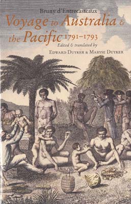
Voyage to Australia & the Pacific 1791-1793. Edited and translated by E. and M. Duyker.
Data di pubblicazione: 2001
Da: Berkelouw Rare Books, Berrima, NSW, Australia
Membro dell'associazione: ANZAAB ILAB
Valutazione del venditore 4 su 5 stelle
EUR 59,73
Spedizione EUR 33,22
Spedito da Australia a U.S.A.Quantità: 1 disponibili
Aggiungi al carrelloMelbourne University Press at The Miegunyah Press, (2001). Roy. 8vo. Orig. cloth. Spine gilt. In illust. dustjacket. (xliv, 394pp.). With several full-page b/w plates and maps. Limited edition, this being number 36 in the second numbered series of the Miegunyah Volumes. Good condition.
-
EUR 49,99
Spedizione EUR 46,00
Spedito da Francia a U.S.A.Quantità: 1 disponibili
Aggiungi al carrelloUnknown Binding. Condizione: Used: Good. Bon exemplaire solide et propre, un pli sur la 4e de couverture.
-
APPENDICE : Exposé des méthodes employées pour lever et construire les cartes et les plans qui composent l'Atlas du VOYAGE DU CONTRE-AMIRAL BRUNY-DENTRECASTEAUX ENVOYÉ A LA RECHERCHE DE LA PÉROUSE.
Da: Librairie de l'Univers, Lausanne, Svizzera
Valutazione del venditore 5 su 5 stelle
EUR 2.006,89
Spedizione EUR 35,00
Spedito da Svizzera a U.S.A.Quantità: 1 disponibili
Aggiungi al carrelloParis, Imprimerie Nationale, 1808, 24x30.5cm. Reliure moderne en simili-cuir bordeaux. Titre et auteur en lettres dorées. Exemplaire contenant uniquement les 111 pages d'appendice ainsi que les 32 planches gravées. Très bon exemplaire, à grandes marges, formant un tout en soi (sur la création de plans et cartes). Très bon exemplaire, envoi de photographies sur demande.
-
Voyage To Australia And The Pacific (Paperback)
Lingua: Inglese
Editore: Melbourne University Press, Carlton, 2006
ISBN 10: 0522852327 ISBN 13: 9780522852325
Da: AussieBookSeller, Truganina, VIC, Australia
Valutazione del venditore 5 su 5 stelle
Prima edizione Print on Demand
EUR 59,52
Spedizione EUR 32,35
Spedito da Australia a U.S.A.Quantità: 1 disponibili
Aggiungi al carrelloPaperback. Condizione: new. Paperback. In 1791 Admiral Bruny d'Entrecasteaux sailed with two ships from Revolutionary France to search for his compatriot, the explorer La Perouse, who was missing in the Pacific. Over a period of nearly two years he had held his ideologically divided expedition together. Without his exceptional maritime skills his men (and one cross-dressing woman!) might all have dieda "or played out the destructive fury of the Revolution on the quarterdeck before reaching Java. More than two centuries later, d'Entrecasteaux's account of his voyage remains a profound affirmation of his achievements. His humane, sensitive and even joyful encounters with the peoples of Australia and the Pacific make this a remarkably appealing book. Although d'Entrecasteaux failed to discover the fate of La Perouse, and perished in the attempt, his voyage was more than a mere rescue mission. Between 1791 and 1793 the expedition discovered the Derwent estuary and the D'Entrecasteaux Channel between Bruny Island and mainland Tasmania, and Esperance Bay and the Archipelago of the Recherche in Western Australia. D'Entrecasteaux's voyage also recorded some of the earliest observations of the Aboriginal people of Tasmania and south-western Australia, and detailed accounts of the islands and peoples of the Pacific, including New Zealand, Tonga, New Caledonia, the Solomon Islands and New Guinea. D'Entrecasteaux died suddenly off the coast of New Guinea, reportedly afflicted by symptoms of scurvy in July 1793. In 1791, Admiral Bruny d'Entrecasteaux sailed from France to search for his compatriot, the explorer La Perouse. Although d'Entrecasteaux failed to discover the fate of La Perouse, his voyage had many achievements. It also yielded significant natural history collections and ethnographic observations in both Australia and the Pacific. This item is printed on demand. Shipping may be from our Sydney, NSW warehouse or from our UK or US warehouse, depending on stock availability.