
Importo totale (1 articolo articoli):
Destinazione ordine:

philipp cluver (278 risultati)
Vai alla pagina principale dei risultati di ricerca
Filtri di ricerca
Tipo di articolo
- Tutti i tipi di prodotto
- Libri (224)
- Riviste e Giornali (Nessun altro risultato corrispondente a questo perfezionamento)
- Fumetti (Nessun altro risultato corrispondente a questo perfezionamento)
- Spartiti (Nessun altro risultato corrispondente a questo perfezionamento)
- Arte, Stampe e Poster (4)
- Fotografie (Nessun altro risultato corrispondente a questo perfezionamento)
- Mappe (50)
- Manoscritti e Collezionismo cartaceo (Nessun altro risultato corrispondente a questo perfezionamento)
Condizioni Maggiori informazioni
Legatura
Ulteriori caratteristiche
- Prima ed. (5)
- Copia autograf. (Nessun altro risultato corrispondente a questo perfezionamento)
- Sovracoperta (Nessun altro risultato corrispondente a questo perfezionamento)
- Con foto (245)
- Non Print on Demand (160)
Lingua (5)
Spedizione gratuita
Paese del venditore
Valutazione venditore
-

Africa Minor - Cyrenaica - Mauritania. Karte aus: Introductio in Universam Geographiam
Editore: o.J. um 1660, 1660
Da: Versandantiquariat H�sl, Neuried, Germania
Valutazione del venditore 5 su 5 stelle

Mappa
EUR 20,00
Spedizione EUR 9,50
Spedito da Germania a U.S.A.Quantit�: 1 disponibili
Aggiungi al carrelloCondizione: Befriedigend. Karte aus Cl�vers Werk 'Introductio in Universam Geographiam' ohne Jahr, um 1660. Dreigeteilte Darstellung mit der Tunesischen K�ste, der Cyrenaica und der Hauptkarte Mauretanien. Die Karte ist mittig gefaltet, am linken Rand mit Knickspuren und einem starken Fl�ssigkeitsfleck am oberen Eck rechts. Sprache / Language: la 1 Seiten. ca. 17,1 x 20,6 cm.
-

Philippi Cluverii Introductio in Universam Geographiam Tam Veterem Quam Novam Tabulis Geographicis XLVI Ac Notis Olim Ornata Johanne Bunone Classic Reprint
Da: PBShop.store US, Wood Dale, IL, U.S.A.
Valutazione del venditore 5 su 5 stelle
PAP. Condizione: New. New Book. Shipped from UK. Established seller since 2000.
-
Philippi Cluverii Introductio in Universam Geographiam Tam Veterem Quam Novam Tabulis Geographicis XLVI Ac Notis Olim Ornata Johanne Bunone Classic Reprint
Da: PBShop.store UK, Fairford, GLOS, Regno Unito
Valutazione del venditore 5 su 5 stelle
EUR 35,13
Spedizione EUR 7,89
Spedito da Regno Unito a U.S.A.Quantit�: 15 disponibili
Aggiungi al carrelloPAP. Condizione: New. New Book. Shipped from UK. Established seller since 2000.
-

Philippi Cluverii Introductio In Universam Geographiam (1697) (Latin Edition)
Da: California Books, Miami, FL, U.S.A.
Valutazione del venditore 4 su 5 stelle

EUR 53,12
Spedizione gratuita
Spedito in U.S.A.Quantit�: Pi� di 20 disponibili
Aggiungi al carrelloCondizione: New.
-
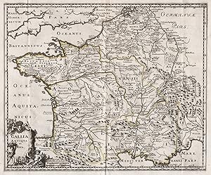
"Gallia Antiqua et Nova" - Gallia / Gallien / Gaule / France / Frankreich / Gallier
Lingua: Latino
Editore: Amsterdam, 1697
Da: Antiquariat Steffen V�lkel GmbH, Seubersdorf, Germania
Membro dell'associazione: ILAB VDA
Valutazione del venditore 5 su 5 stelle
Mappa
EUR 24,99
Spedizione EUR 30,00
Spedito da Germania a U.S.A.Quantit�: 1 disponibili
Aggiungi al carrelloBlatt-Ma�e: ca. 30,5 x 37 cm. -- Original Kupferstich-Karte von 1697. -- gut erhalten. -- Original engraved map from 1697. -- in good condition. || Carte grav�e de 1697. -- en bon etat. || Philipp Cl�ver war ein deutscher Geograph und Historiker, der starken Einfluss auf die Wiederbelebung der geographischen Wissenschaft in Europa hatte und als Begr�nder der historischen Geographie gilt. || Philipp Cl�ver was a German geographer and historian who had a strong influence on the revival of geographical science in Europe and is considered the founder of historical geography. || Philipp Cl�ver �tait un g�ographe et historien allemand qui a eu une forte influence sur la renaissance de la science g�ographique en Europe et est consid�r� comme le fondateur de la g�ographie historique. // Wir, das Antiquariat Steffen V�lkel, kaufen und verkaufen alte B�cher, Handschriften, Zeichnungen, Autographen, Grafiken und Fotografien. Wir sind stets am Ankauf von kompletten Bibliotheken, Sammlungen und Nachl�ssen interessiert. la Gewicht in Gramm: 10.
-
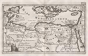
"Aegyptus et Cyrene" - Egypt / �gypten / Egypte / Libya / Libyen
Lingua: Latino
Editore: Amsterdam, 1697
Da: Antiquariat Steffen V�lkel GmbH, Seubersdorf, Germania
Membro dell'associazione: ILAB VDA
Valutazione del venditore 5 su 5 stelle
Mappa
EUR 24,99
Spedizione EUR 30,00
Spedito da Germania a U.S.A.Quantit�: 1 disponibili
Aggiungi al carrelloBlatt-Ma�e: ca. 22,5 x 31,5 cm. Platte: ca. 14 x 21,5 cm. -- Original Kupferstich-Karte von 1697. -- gut erhalten. -- Original engraved map from 1697. -- in good condition. || Carte grav�e de 1697. -- en bon �tat. || Philipp Cl�ver war ein deutscher Geograph und Historiker, der starken Einfluss auf die Wiederbelebung der geographischen Wissenschaft in Europa hatte und als Begr�nder der historischen Geographie gilt. || Philipp Cl�ver was a German geographer and historian who had a strong influence on the revival of geographical science in Europe and is considered the founder of historical geography. || Philipp Cl�ver �tait un g�ographe et historien allemand qui a eu une forte influence sur la renaissance de la science g�ographique en Europe et est consid�r� comme le fondateur de la g�ographie historique. // Wir, das Antiquariat Steffen V�lkel, kaufen und verkaufen alte B�cher, Handschriften, Zeichnungen, Autographen, Grafiken und Fotografien. Wir sind stets am Ankauf von kompletten Bibliotheken, Sammlungen und Nachl�ssen interessiert. la Gewicht in Gramm: 10.
-

"Hodiernae Belgicae sive Germaniae Inferioris Tabula" - Holland / Nederland / Netherlands / Niederlande
Lingua: Latino
Editore: Amsterdam, 1697
Da: Antiquariat Steffen V�lkel GmbH, Seubersdorf, Germania
Membro dell'associazione: ILAB VDA
Valutazione del venditore 5 su 5 stelle
Mappa
EUR 29,99
Spedizione EUR 30,00
Spedito da Germania a U.S.A.Quantit�: 1 disponibili
Aggiungi al carrelloBlatt-Ma�e: ca. 22,5 x 31,5 cm. -- Original Kupferstich-Karte von 1697. -- gut erhalten. -- Original engraved map from 1697. -- in good condition. || Carte grav�e de 1697. -- en bon �tat. || Philipp Cl�ver war ein deutscher Geograph und Historiker, der starken Einfluss auf die Wiederbelebung der geographischen Wissenschaft in Europa hatte und als Begr�nder der historischen Geographie gilt. || Philipp Cl�ver was a German geographer and historian who had a strong influence on the revival of geographical science in Europe and is considered the founder of historical geography. || Philipp Cl�ver �tait un g�ographe et historien allemand qui a eu une forte influence sur la renaissance de la science g�ographique en Europe et est consid�r� comme le fondateur de la g�ographie historique. // Wir, das Antiquariat Steffen V�lkel, kaufen und verkaufen alte B�cher, Handschriften, Zeichnungen, Autographen, Grafiken und Fotografien. Wir sind stets am Ankauf von kompletten Bibliotheken, Sammlungen und Nachl�ssen interessiert. la Gewicht in Gramm: 10.
-

"Syriae sive Soriae" - Syria / Syrien / Syrie
Lingua: Latino
Editore: Amsterdam, 1697
Da: Antiquariat Steffen V�lkel GmbH, Seubersdorf, Germania
Membro dell'associazione: ILAB VDA
Valutazione del venditore 5 su 5 stelle
Mappa
EUR 29,99
Spedizione EUR 30,00
Spedito da Germania a U.S.A.Quantit�: 1 disponibili
Aggiungi al carrelloBlatt-Ma�e: ca. 22,5 x 31,5 cm. -- Original altkolorierte Kupferstich-Karte von 1697. -- im unteren Au�enrand mit hinterlegter Wurmspur, sonst gut erhalten. -- Original old colored engraved map from 1697. -- with a deposited wormhole on the lower outer margin, otherwise in good condition. || Carte grav�e de 1697. -- en bon etat. || Philipp Cl�ver war ein deutscher Geograph und Historiker, der starken Einfluss auf die Wiederbelebung der geographischen Wissenschaft in Europa hatte und als Begr�nder der historischen Geographie gilt. || Philipp Cl�ver was a German geographer and historian who had a strong influence on the revival of geographical science in Europe and is considered the founder of historical geography. || Philipp Cl�ver �tait un g�ographe et historien allemand qui a eu une forte influence sur la renaissance de la science g�ographique en Europe et est consid�r� comme le fondateur de la g�ographie historique. // Wir, das Antiquariat Steffen V�lkel, kaufen und verkaufen alte B�cher, Handschriften, Zeichnungen, Autographen, Grafiken und Fotografien. Wir sind stets am Ankauf von kompletten Bibliotheken, Sammlungen und Nachl�ssen interessiert. la Gewicht in Gramm: 10.
-

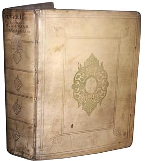
Introductionis In Universam Geographiam Tam Veterem Quam Novam Libri VI, Edito Ultima
Lingua: Inglese
Editore: Amsterdam, 1636
Da: A Turn of the Page Books, Fishers, IN, U.S.A.
Valutazione del venditore 5 su 5 stelle
Vellum. Condizione: Very Good. Lugduni: Apud Ant. & P Pillehotte, sub signo SS. Trinitatis. Bound in vellum with six raised bands 506 pp. plus an index for all six volumes Engraved title page. Measures 2 1/4" by 4 1/2". Two folding tables one of which has a small closed tear that has been expertly repaired with acid free tape. This volume was first published in 1624 by Philipp Cluver (158-1622). Cluver is credited with being the father of modern geography and his six books on geography (of which this is the 6th), were published posthumously. This is the edition of 1636. There is some light spotting and browning of the pages but overall this is a very nice copy of this important work.
-

"Mauritania et Africa Propria nunc Barbaria" - Morocco / Algeria / Maroc / Algerie / Marokko / Algerien
Lingua: Latino
Editore: Amsterdam, 1697
Da: Antiquariat Steffen V�lkel GmbH, Seubersdorf, Germania
Membro dell'associazione: ILAB VDA
Valutazione del venditore 5 su 5 stelle
Mappa
EUR 39,99
Spedizione EUR 30,00
Spedito da Germania a U.S.A.Quantit�: 1 disponibili
Aggiungi al carrelloBlatt-Ma�e: ca. 22,5 x 31,5 cm. Platte: ca. 14 x 21,5 cm. -- Original Kupferstich-Karte von 1697. -- gut erhalten. -- Original engraved map from 1697. -- in good condition. || Carte grav�e de 1697. -- en bon �tat. || Philipp Cl�ver war ein deutscher Geograph und Historiker, der starken Einfluss auf die Wiederbelebung der geographischen Wissenschaft in Europa hatte und als Begr�nder der historischen Geographie gilt. || Philipp Cl�ver was a German geographer and historian who had a strong influence on the revival of geographical science in Europe and is considered the founder of historical geography. || Philipp Cl�ver �tait un g�ographe et historien allemand qui a eu une forte influence sur la renaissance de la science g�ographique en Europe et est consid�r� comme le fondateur de la g�ographie historique. // Wir, das Antiquariat Steffen V�lkel, kaufen und verkaufen alte B�cher, Handschriften, Zeichnungen, Autographen, Grafiken und Fotografien. Wir sind stets am Ankauf von kompletten Bibliotheken, Sammlungen und Nachl�ssen interessiert. la Gewicht in Gramm: 10.
-

"Veteris et Nova Pannoniae et Illyrici Descriptio" - Croatia / Slovenia / Bosnia Herzegovina / Serbia / Montenegro / Kroatien / Slowenien / Serbien / Bosnien
Lingua: Latino
Editore: Amsterdam, 1697
Da: Antiquariat Steffen V�lkel GmbH, Seubersdorf, Germania
Membro dell'associazione: ILAB VDA
Valutazione del venditore 5 su 5 stelle
Mappa
EUR 39,99
Spedizione EUR 30,00
Spedito da Germania a U.S.A.Quantit�: 1 disponibili
Aggiungi al carrelloBlatt-Ma�e: ca. 22,5 x 31,5 cm. -- Original Kupferstich-Karte von 1697. -- im unteren Au�enrand mit d�nner Wurmspur, sonst gut erhalten. -- Original engraved map from 1697. -- with a small worm hole on the lower outer margin, otherwise in good condition. || Carte grav�e de 1697. -- Petits trous de vers dans la marge inf�rieure, sinon bon �tat. || Philipp Cl�ver war ein deutscher Geograph und Historiker, der starken Einfluss auf die Wiederbelebung der geographischen Wissenschaft in Europa hatte und als Begr�nder der historischen Geographie gilt. || Philipp Cl�ver was a German geographer and historian who had a strong influence on the revival of geographical science in Europe and is considered the founder of historical geography. || Philipp Cl�ver �tait un g�ographe et historien allemand qui a eu une forte influence sur la renaissance de la science g�ographique en Europe et est consid�r� comme le fondateur de la g�ographie historique. // Wir, das Antiquariat Steffen V�lkel, kaufen und verkaufen alte B�cher, Handschriften, Zeichnungen, Autographen, Grafiken und Fotografien. Wir sind stets am Ankauf von kompletten Bibliotheken, Sammlungen und Nachl�ssen interessiert. la Gewicht in Gramm: 10.
-

"Africa Minor. Mauritania. Aegyptus." - Egypt Northern Africa Afrika �gypten Karte map
Lingua: Tedesco
Editore: N�rnberg, 1680
Da: Antiquariat Steffen V�lkel GmbH, Seubersdorf, Germania
Membro dell'associazione: ILAB VDA
Valutazione del venditore 5 su 5 stelle
Mappa
EUR 24,99
Spedizione EUR 30,00
Spedito da Germania a U.S.A.Quantit�: 1 disponibili
Aggiungi al carrelloSeltene Miniatur Kupferstich-Karte von Philip Cl�ver (1580-1622) von ca. 1680. -- Blatt-Ma�e: ca. 14 x 14 cm. -- gut erhalten. || Rare miniature copper engraved map by Philip Cl�ver (1580-1622) from c. 1680. -- in good condition. || Dies ist ein Original! - Kein Nachdruck! - Keine Kopie! -- This is an original! No copy! - No reprint! // Wir, das Antiquariat Steffen V�lkel, kaufen und verkaufen alte B�cher, Handschriften, Zeichnungen, Autographen, Grafiken und Fotografien. Wir sind stets am Ankauf von kompletten Bibliotheken, Sammlungen und Nachl�ssen interessiert. Sprache: Deutsch Gewicht in Gramm: 10.
-

AMERICA (CALIFORNIA AS AN ISLAND) 1661
Lingua: Inglese
Editore: Germany, 1661
Da: Hornseys, Ripon, Regno Unito
Membro dell'associazione: PBFA
Valutazione del venditore 5 su 5 stelle
EUR 300,59
Spedizione EUR 29,18
Spedito da Regno Unito a U.S.A.Quantit�: 1 disponibili
Aggiungi al carrelloNo Binding. Condizione: Very Good. California is shown as a large island, the north-west coast of America is not identified and none of the Great Lakes are visible. New Zealand is shown as a single coastline.�Published in Leiden. Date:1661. Edition identified by 'pag. 666' in the top right hand corner. Sheet Size: 37.7cm x 25cm. Original fold lines. Very minor age-spots. Age-toning to the paper. Reverse is blank with age toning and minor marks. In very good condition overall. Location: Map Drawer C: FS: Folder M2000 002546.
-
Philippi Cluverii Introductio in universam geographiam tam veterem quam novam. Tabulis geographicis XLVI ac notis olim ornata a Johanne Bunone, jam vero locupletata additamentis & annotationibus Joh. Frid. Hekelii & Joh. Reiskii. Cum privilegio ordinum Ho
Lingua: Francese
Editore: Jean Wolters, Amsterdam, 1697
Da: Des livres autour (Julien Mannoni), Paris, PARIS, Francia
Valutazione del venditore 4 su 5 stelle
Prima edizione
EUR 2.200,00
Spedizione EUR 45,00
Spedito da Francia a U.S.A.Quantit�: 1 disponibili
Aggiungi al carrelloPlein V�lin. Condizione: Bon. First Thus. Amsterdam [Amstelaedami], Jean Wolters [Joannem Wolters], 1697. 24 x 18 cm (R), in-4, 1 f. bl. - titre frontispice enti�rement grav� - 11 ff. n. ch. (dont titre, d�dicace, adresse au lecteur, epistolae, table et privil�ge) - 565 pp. - 31 ff. n. ch. d'index - 2 ff. bl. - 2 planches, 3 tableaux et 41 (sur 43) cartes grav�es hors texte, dont 40 sont d�pliantes ou � double page, reliure hollandaise de l'�poque en plein v�lin dor�, plats estamp�s � froid de motifs des Pays Bas espagnols dans un double encadrement de filets avec fleurons d'angle, dos estamp� de filets et fleurons, titre manuscrit � l'�poque, traces de lacets. (sig. *3, **4, ***4, A-Z4, Aa-Zz4, Aaa-Zzz4, Aaaa-Kkkk4) Belle �dition de la fin du XVIIeme du c�l�bre atlas de Cl�ver, avec les commentaires de Buno, Reiske et Heckel, int�ressante notamment parce qu'elle est au format in-4 et non in-8 ou in-12, comme la plupart des autres. Un bel ex-dono, dat� de 1725 et couvrant tout le premier feuillet blanc, nous indique qu'il s'agit d'un livre de prix. Cachets annul�s d'une biblioth�que de capucins au titre. Sans la mappemonde et la carte l'Am�rique. Exemplaire tr�s l�g�rement d�r�gl�, ce qui est courant pour un volume de cette taille, une carte d�tach�e, pour le reste un fort bel exemplaire exempt de rousseurs et dans une belle reliure estamp�e de l'�poque. dv.
-

EUR 36,84
Spedizione EUR 48,99
Spedito da Germania a U.S.A.Quantit�: Pi� di 20 disponibili
Aggiungi al carrelloCondizione: New. KlappentextrnrnThis scarce antiquarian book is a facsimile reprint of the original. Due to its age, it may contain imperfections such as marks, notations, marginalia and flawed pages. Because we believe this work is culturally important, we have.
-
Philippi Cluveri Introductionis in universam geographiam, tam veterem quam novam libri VI.
Lingua: Latino
Editore: Amstelaedami, J. Pauli,, 1729
Da: Sequitur Books, Boonsboro, MD, U.S.A.
Membro dell'associazione: IOBA
Valutazione del venditore 5 su 5 stelle
Hardcover. Condizione: Fair. Reference copy. Later boards. 26 cm. Front board detached. Engraved frontis. 21 preliminary leaves, 688, [60] pages. LACKING ALL MAPS. Only 3 plates present, folding table. Front board detached. Toning. Title in red and black.
-
Scythia et Tartaria Asiatica. Engraved map
Editore: Joannem Wolters, Amsterdam, 1697
Da: Zephyr Books LLC, Reno, NV, U.S.A.
Membro dell'associazione: ABAA ILAB IOBA
Valutazione del venditore 5 su 5 stelle
Condizione: Very Good. Image size: 21x25.5 cm. Decorative title cartouche. Uncolored. weight: 0.1 lb. Very good. 23x33x0.1 cm. One sheet.
-
Syriae Sive Sorie Desriptio. (map)
Editore: Philipp Cluver. Circa 1690, 1690
Da: Zephyr Books LLC, Reno, NV, U.S.A.
Membro dell'associazione: ABAA ILAB IOBA
Valutazione del venditore 5 su 5 stelle
Image size: 20x24.6 cm. A sharp image with a wide right margin. Elephant cartouche in the lower right corner. weight: 0.1 lb. Minor loss to the wide right margin, otherwise very good. Copperplate engraving, uncolored. 23x33 cm. One sheet.
-
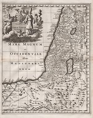
"Totius Terrae Sanctae Delineatio" - Holy Land / Israel / Palestine / Pal�stina / Heiliges Land
Lingua: Latino
Editore: Amsterdam, 1697
Da: Antiquariat Steffen V�lkel GmbH, Seubersdorf, Germania
Membro dell'associazione: ILAB VDA
Valutazione del venditore 5 su 5 stelle
Mappa
EUR 69,99
Spedizione EUR 30,00
Spedito da Germania a U.S.A.Quantit�: 1 disponibili
Aggiungi al carrelloBlatt-Ma�e: ca. 22,5 x 31,5 cm. -- Original Kupferstich-Karte von 1697. -- mit zwei winzigen hinterlegten Wurml�chlein, sonst gut erhalten. -- Original engraved map from 1697. -- with two deposited small wormholes, otherwise in good condition. || Carte grav�e de 1697. -- avec deux petits trous de vers d�pos�s, sinon en bon �tat. || Philipp Cl�ver war ein deutscher Geograph und Historiker, der starken Einfluss auf die Wiederbelebung der geographischen Wissenschaft in Europa hatte und als Begr�nder der historischen Geographie gilt. || Philipp Cl�ver was a German geographer and historian who had a strong influence on the revival of geographical science in Europe and is considered the founder of historical geography. || Philipp Cl�ver �tait un g�ographe et historien allemand qui a eu une forte influence sur la renaissance de la science g�ographique en Europe et est consid�r� comme le fondateur de la g�ographie historique. // Wir, das Antiquariat Steffen V�lkel, kaufen und verkaufen alte B�cher, Handschriften, Zeichnungen, Autographen, Grafiken und Fotografien. Wir sind stets am Ankauf von kompletten Bibliotheken, Sammlungen und Nachl�ssen interessiert. la Gewicht in Gramm: 10.
-
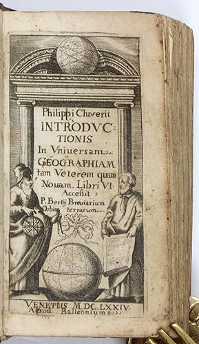
Introductionis in universam geographiam tam veterem quam novam libri VI. Accessit P. Bertii breviarium orbis terrarum.
Editore: Venice, Balleoni, 1674., 1674
Da: Antiquariat INLIBRIS Gilhofer Nfg. GmbH, Vienna, A, Austria
Membro dell'associazione: ILAB PADA VDA VDAO
Valutazione del venditore 5 su 5 stelle
EUR 120,00
Spedizione EUR 30,00
Spedito da Austria a U.S.A.Quantit�: 1 disponibili
Aggiungi al carrello12mo (56 x 105 mm). 465, (11) pp. Engraved title-page. With a letterpress folding table; a folding plate is missing. Contemporary leather binding. Uncommon pocket-sized edition of Cl�ver's popular geographic history, edited by Joseph Vorstius and first published in Leiden in 1624. Long considered a standard work, it was later issued with maps. The text describes all the countries of the world, including a section on America and the islands of the "New World" (book 6, chapters 11 ff.). Book 5, chapter 24 (pp. 341 ff.) discusses Arabia, chapter 15 (pp. 315 f.) deals with the Kingdom of Ormuz. - Some worming to spine. Interior a little wrinkled throughout; light edge flaws to index at the end; an engraved plate after p. 30 has been torn out. Stamp of the L'achki collection on lower pastedown. A working copy. - OCLC 634555324.
-

Introductio in Universam Geographiam. Iam Veterem Quam Novam. Tabulis Geographicis XLVI ac Notis Olim Ornata, Etc
Editore: Sam. Smith and Benj. Walford, London, 1697
Da: Barter Books Ltd, Alnwick, NORTH, Regno Unito
Membro dell'associazione: IOBA
Valutazione del venditore 5 su 5 stelle
EUR 202,00
Spedizione EUR 9,34
Spedito da Regno Unito a U.S.A.Quantit�: 1 disponibili
Aggiungi al carrelloBrown hardback leather cover. Condizione: Good. Reprint. G : in Good condition. Cover rubbed and edgeworn. Browning and occasional foxing within. 240mm x 180mm (9" x 7"). [20pp], 565pp + index. Frontis engraving. Four tables. No maps. Latin text throughout. Heavy item - shipping supplement may apply for overseas.
-
Philippi Cluverii Introductionis in universam geographiam tam veterem, quam novam Libri sex. Illustrati, & aucti. Et P. Bertii Breviarium
Editore: ex Typographia Seminarii, Patavii, 1695
Da: Libreria Ex Libris ALAI-ILAB/LILA member, Roma, RM, Italia
Membro dell'associazione: ALAI ILAB
Valutazione del venditore 5 su 5 stelle
EUR 190,00
Spedizione EUR 30,00
Spedito da Italia a U.S.A.Quantit�: 1 disponibili
Aggiungi al carrelloLegatura 900 in piena tela rossa con fili e titolo impressi in oro al ds. Esemplare in ottimo stato di conservazione. Provenienza: Collezione Spina, Avezzano (timbretto ex libris su una carta bianca iniziale). 12mo (cm. 15,2), 8 pp., 2 cc.nn., 12 pp., 2 cc.nn. da p. 13 a p. 348, 5 cc.nn., 50 pp., 3 cc.nn. Con 4 tavv. ripiegate (1 tavola calcografica e 3 tabelle).
-

Introductionis In Universam Geographiam, Tam Veterem Quam Novam, Libri VI (1624)
Lingua: Latino
Editore: Kessinger Publishing, LLC Aug 2009, 2009
ISBN 10: 1104870339 ISBN 13: 9781104870331
EUR 46,55
Spedizione EUR 62,08
Spedito da Germania a U.S.A.Quantit�: 1 disponibili
Aggiungi al carrelloTaschenbuch. Condizione: Neu. Neuware - This scarce antiquarian book is a facsimile reprint of the original. Due to its age, it may contain imperfections such as marks, notations, marginalia and flawed pages. Because we believe this work is culturally important, we have made it available as part of our commitment for protecting, preserving, and promoting the world's literature in affordable, high quality, modern editions that are true to the original work.
-

"Africa Antiqua et Nova" - Africa / Afrika / Afrique / continent / Kontinent
Lingua: Latino
Editore: Amsterdam, 1697
Da: Antiquariat Steffen V�lkel GmbH, Seubersdorf, Germania
Membro dell'associazione: ILAB VDA
Valutazione del venditore 5 su 5 stelle
Mappa
EUR 79,99
Spedizione EUR 30,00
Spedito da Germania a U.S.A.Quantit�: 1 disponibili
Aggiungi al carrelloBlatt-Ma�e: ca. 22,5 x 31,5 cm. -- Original Kupferstich-Karte von 1697. -- im unteren Randbereich mit kleinen Wurmspuren, sonst gut erhalten. -- Original engraved map from 1697. -- with some small worm holes on the lower part, otherwise in good condition. || Carte grav�e de 1697. -- Petits trous de vers dans la marge inf�rieure, sinon bon �tat. || Philipp Cl�ver war ein deutscher Geograph und Historiker, der starken Einfluss auf die Wiederbelebung der geographischen Wissenschaft in Europa hatte und als Begr�nder der historischen Geographie gilt. || Philipp Cl�ver was a German geographer and historian who had a strong influence on the revival of geographical science in Europe and is considered the founder of historical geography. || Philipp Cl�ver �tait un g�ographe et historien allemand qui a eu une forte influence sur la renaissance de la science g�ographique en Europe et est consid�r� comme le fondateur de la g�ographie historique. // Wir, das Antiquariat Steffen V�lkel, kaufen und verkaufen alte B�cher, Handschriften, Zeichnungen, Autographen, Grafiken und Fotografien. Wir sind stets am Ankauf von kompletten Bibliotheken, Sammlungen und Nachl�ssen interessiert. la Gewicht in Gramm: 10.
-
DER ATLAS DES PRINZEN EUGEN. - Originalgetreue Faksimile-Reproduktionen aus dem 'ATLAS BLAEU - Van der Hem'(Amsterdam 1662-1678) der �sterreichischen Nationalbibliothek, Band 1: SCHWEIZER ST�DTE- UND LANDSCHAFTSBILDER IN ILLUMINIERTEN KUPFERSTICHEN DES 17. JAHRHUNDERTS. - 35 Ansichten und 8 Kartenbl�tter; mit einem wissenschaftlichen Kommentar von Robert Wagner. [Helvetia, quae est Europae Liber XV.]
Editore: Graz, Akademische Druck- und Verlagsanstalt / ADEVA, 1979., 1979
Da: C O - L I B R I , Bremen - Berlin ; Deutschland / Germany ., Berlin, Germania
Valutazione del venditore 5 su 5 stelle
EUR 235,00
Spedizione EUR 45,00
Spedito da Germania a U.S.A.Quantit�: 1 disponibili
Aggiungi al carrello67 (1) Seiten Text, 43 einseitig bedruckte tls. doppelblattgro�e Farbtafeln mit zwischenliegenden Seidenschutzbl�ttern; alles auf kr�ftigem hochwertig strukturiertem Papier. - Schwerer, reich vergoldeter wei�er Original-Ledereinband - wohl - auf Holzdeckeln und �ber 8 erhabene B�nde mit goldgepr�gtem R�ckentitel; imperial-Folio (ca. 59,5 x 40 x 4 cm; ca. 6,2 kg.). *** [Verl�ngerter FR�HSOMMER-VERKAUF / Ongoing EARLY SUMMER-SALE: um �ber 20% REDUZIERTER PREIS bis Donnerstag, 09.07.2026 / PRICE-REDUCTION of over 20% until Thursday, July 09; vorheriger Preis / previously EUR 300,-] --- 1. AUFLAGE, �BERGROSSFORMATIGE BIBLIOPHIL GEBUNDENE AUSGABE; Nr. CCXXXII (#232) von 1.000 Exemplaren der Gesamtauflage (noch mit beiliegendem signierten Qualit�tspr�fzettel). - Vorderdeckel am Rand etwas stockfleckig-, Hinterdeckel nur am Rand der unteren Innenkante; Vorderdeckel auch mit kleiner Bereibung und kleinem oberfl�chlichen Lederabrieb (ca. 5x5 mm); innen tadellos und mit allen Seidenschutzbl�ttern. --- DER TEXTTEIL ENTH�LT DIE KAPITEL 'Der Atlas des Prinzen Eugen von Savoyen, oder >Atlas Blaeu - Van der Hem<.'; 'Der Initiator: Laurens Van der Hem.'; 'Spiritus Rector: Joan Blaeu.'; 'Der Illuminator: Dirck Jansz. van Santen.'; 'Der Bibliophile: Prinz Eugen von Savoyen.'; 'Die St�dte- und Landschaftsbilder: Matth�us Merian und seine Grosse Topographie.'; 'Die Schweiz im Atlas des Prinzen Eugen von Savoyen.'; '�bersicht aller B�nde des Atlas . . .'; 'Literatur.'; 'Die Tafeln: Verzeichnis der Tafeln.'; 'Die illuminierten Kupferstiche aus Band 13 (Schweiz) im Atlas . . . / Illuminierte Schweizer Kupferstiche aus anderen B�nden des Atlas . . .'; DIE MONTIERTEN FARBTAFELN AUF HALBMATTEM KUNSTDRUCKPAPIER ZEIGEN die 'Schweiz.'(Johannes Janssonius); das 'Rheintal oberhalb Chur, Graub�nden.'(Caspar Merian)*; den 'Rheinfall bei Schaffhausen.'(Matth�us Merian)**; 'Rhein bei Kadelburg, Aargau.'(**); 'Gr�ningen, Z�rich.'(Hans Heinrich Thomann/**); 'Regensberg, Z�rich.'(Johann Jacob Ziegler/**); 'Z�richgau und Basel'(Gerard Mercator/Willem Jansz. Blaeu)***; 'Z�rich.'(Hans Caspar N�scheler/**); 'Breitenlandenberg, Z�rich.'(*); 'Einsiedeln, Schwyz.'(**); 'Leuk, Wallis.'(*); 'Sempach, Luzern.'(**); 'Baden, Aargau.'(**); 'Wiflisburgergau.'(***); 'Grindelwaldgletscher, Bern.'(Josef Plepp/**)****; 'Pa� Pierre Pertuis.'(****); 'Lenzburg, Aargau.'(****); 'Neuenburg/Neuch�tel.'(**); 'Aargau.'(***); 'Vierwaldst�tter See.'(Johann Leopold Cysat/*); 'Luzern.'(Martin Martini/**); 'Altdorf, Uri.'(**); 'Thun.'(**); 'Schwyz.'(*); 'Bad Pf�fers, St. Gallen.'(**); 'Unterwalden.'(**); 'Basel.'(**); 'Rheinbr�cke und M�nster in Basel.'(**); 'M�nchenstein, Basel Land.'(**); 'Basel und Umgebung.'(Joan Blaeu); 'Graub�nden.'(Fortunat Sprecher. . . und Philipp Cl�ver/W.J. Blaeu); 'Chur, Graub�nden.'(**); 'Wallis.'(Pierre du Val d'Abb�ville); 'Saint-Maurice/[St. Moritz], Wallis.'(*); 'Brig und Naters, Wallis.'(*); 'Lugano, Tessin.'(**); 'Bellinzona, Tessin.'(**); 'Engelberg, Unterwalden ob dem Wald.'(*); 'Landschaft um Bad Pf�fers, St. Gallen.'(*); 'Visp, Wallis.'(*); 'Genfer See.'(Jacques Goulart/W. J. Blaeu); 'Genf/Gen�ve.'(Jean Poinssart); 'Tarasp, Graub�nden.'(*).
-
Philippi Cluverii Introductionis in universam geographiam tam veterem quam novam libri VI: tabulis aeneis illustrati
Editore: Apud Guilielmum Broedelet, Trajecti ad Rhenum [Utrecht], 1701
Da: McBlain Books, ABAA, Hamden, CT, U.S.A.
Membro dell'associazione: ABAA ILAB SNEAB
Valutazione del venditore 5 su 5 stelle
Hardcover. Condizione: Good. Illustrated title-page, 40 (of 41) folding plates (38 of them maps in our copy), [12], 355, [83]p. Old (contemporary?) full leather. 14 cm. Splitting along front joint . Corner chipped at base of backstrip. No cover titling. Lacks both free endpapers and any other leaves preceding illustrated title-page and after the final page of the Index. The maps are generally sound and clean although a few have some soiling and creasing in margins and the map (Sueviae Antiquae Descriptio) facing page 92 has a horizontal tear across almost the entire map. The OCLC entry for the 1701 edition lists it as having 41 folding plates; the missing plate is the world map titled Globi Mundi Terrarum which should face page 5. A small format edition of this posthumously-published work by a talented German geographer. Numerous editions, mostly larger format, of this work were published in the century after Cluver's death.
-

EUR 61,97
Spedizione EUR 48,99
Spedito da Germania a U.S.A.Quantit�: Pi� di 20 disponibili
Aggiungi al carrelloCondizione: New. KlappentextrnrnThis scarce antiquarian book is a facsimile reprint of the original. Due to its age, it may contain imperfections such as marks, notations, marginalia and flawed pages. Because we believe this work is culturally important, we have.
-
Philippi Cluverii INTRODUCTIO in Universam Geographiam tam Veterem, quam Novam, Multis locis emendata, memorabilibus locorum illustrata et XXXIIX Tabulis Geographicis aucta studio & opera JOHANNIS BUNONIS, Illustris Gymnasii, quod Luneburgi est Histor. Prof. & S,R. Cum gratia & privilegio Sac.Cas.Majest. [Later Edition Full Vellum Binding Lacking Maps]
Editore: Guelpherbyti: Impensis CONRADI BUNONIS, TYPIS JOHANNIS BISMARCI., 1661
Da: Louis88Books (Members of the PBFA), Andover, Regno Unito
Membro dell'associazione: PBFA
Valutazione del venditore 5 su 5 stelle
EUR 360,71
Spedizione EUR 33,85
Spedito da Regno Unito a U.S.A.Quantit�: 1 disponibili
Aggiungi al carrelloHardcover. Condizione: Good. Guelpherbyti: Impensis CONRADI BUNONIS, TYPIS JOHANNIS BISMARCI, 1661, Later Edition. Full vellum binding, ink manuscript titles to the spine, limp vellum, worn and marked, ink marginalia and colour underlining throughout. With 3 (I, II and III) of the illustrations and 2 folding tables (see photos) only. Pagination: [xxx], 632, [68]pp. Provenance: ex library with 2 stamps to the title page. Approximately 7 � inches (19.5cm) tall. Condition Report Externally Spine good condition rubbed and worn, ink titles marked. Joints good condition sound, rubbed and worn. Corners good condition rubbed and bumped. Boards good condition full limp vellum, marked and worn. Page edges good condition all edges tanned and darkened. Binding good condition sound. See above and photos. Internally Hinges good condition sound. Paste downs good condition tanned paper, ink and other manuscript notes. End papers good condition lacking to the front, tanned paper, ink and other manuscript notes at the rear. Title good condition tanned and marked, 2 stamps. Pages good condition tanned with some foxing and damp staining. See photos.
-
Introductio in Universam Geographiam
Editore: Joannem Wolters, Amsterdam, 1697
Da: Rooke Books PBFA, Bath, Regno Unito
Membro dell'associazione: PBFA
Valutazione del venditore 5 su 5 stelle
EUR 474,94
Spedizione EUR 23,34
Spedito da Regno Unito a U.S.A.Quantit�: 1 disponibili
Aggiungi al carrelloLeather. Condizione: Good. Not Stated (illustratore). An important early modern geographical textbook by Philipp Cluver, a monumental work, this copy illustrated with a frontispiece. In the original Latin.ESTC citation number R223927.An important early modern study on Geography.This work, first published in 1624, was the first comprehensive modern geography, and subsequently became a standard geographical textbook.Illustrated with a frontispiece only, bound without the other plates and folding maps.By Philipp Cluver, an antiquarian, historian, and geographer, who is well known for his contributions to early modern study. In a full panelled calf binding. Externally, generally smart, with some light rubbing and marks to the boards and spine. Minor bumping to the spine and extremities, with a little loss to the head of the spine. Lacking most of the spine label. Small repair to the head and tail of the boards to the joints. Small cracks to the joints. Institutional label to the front paste down. Internally, firmly bound. Pages are lightly age-toned with the odd spot. Bound without the plates and maps. Prior owner's ink inscription to the head of the title page. Good. book.
-
[World Atlas] PHILIPPI CLUVERII INTRODUCTIO IN UNIVERSAM GEOGRAPHIAM Tam veterem quam novam Tabulis Geographicis XLVI. ac Notis olim ornata � JOHANNE BUNONE, Jam ver� locupletata Additamentis & Annotationibus JOH. FRID. HEKELII & JOH. REISKII.
Editore: Philipp Cl�ver / Joannes Wolters, 1697
Da: Barry Lawrence Ruderman, La Jolla, CA, U.S.A.
Membro dell'associazione: ABAA ILAB
Valutazione del venditore 5 su 5 stelle
Hardcover. Condizione: vg. A complete 1697 Wolters edition of Cl ver s foundational geographical treatise, illustrated with 43 folding maps.This 1697 edition of Philipp Cl ver's landmark historical and geographic treatise, Introductio in Universam. Quarto. Full vellum with gilt morocco label to spine. (Recased, rubbed). All edges sprinkled red. Inked stamp to title page (partially effaced). Complete with 46 (of 46) engraved plates, including 43 folding maps. Occasional toning. Collation: (engr. title +) *3, 2*-3*4, A-4K4 (4K4 blank) (+46 plates). [2, engraved title], [22], 368, 367-565, [1, blank], [61], [3, blank]. Nice example of this important historical atlas, which was first published in 1624 by Philipp Cl ver, a geographer from Gdansk who spent much of his life in Leiden. Cl ver was known for his love of travel and geography, and this atlas reflects his deep interest in these areas. This edition, published by Jan Wolters, is based on that originally issued by Johannis Bunonis (Wolfenbuttel, 1661) and includes additions by Hekelii and Reiskii.This atlas contains a range of detailed maps covering different parts of the world, including Europe, Africa, Asia, Asia Minor, the Holy Land, and the Americas. One of the key features is a double hemisphere map of the world, showing how people of that time viewed the world's geography.Cluver's work was widely respected and used for a long time, as shown by the multiple times it was reprinted after its first publication. The atlas is not just a collection of maps; it represents the knowledge and understanding of historical geography in the 17th century.The American-related maps are:Typus Orbis Terrarum. Double hemisphere world mapAmerica. Shows both North and South America. California as an island, with a flat northern coast. Straight of Anian.In sum, the Cl ver atlas contains a beautiful suite of maps, all nicely engraved, in a handsome compact quarto format. Book.


![Immagine del venditore per Philippi Cluverii INTRODUCTIO in Universam Geographiam tam Veterem, quam Novam, Multis locis emendata, memorabilibus locorum illustrata et XXXIIX Tabulis Geographicis aucta studio & opera JOHANNIS BUNONIS, Illustris Gymnasii, quod Luneburgi est Histor. Prof. & S,R. Cum gratia & privilegio Sac.Cas.Majest. [Later Edition Full Vellum Binding Lacking Maps] venduto da Louis88Books (Members of the PBFA)](https://pictures.abebooks.com/inventory/md/md32199386710.jpg)
![Immagine del venditore per [World Atlas] PHILIPPI CLUVERII INTRODUCTIO IN UNIVERSAM GEOGRAPHIAM Tam veterem quam novam Tabulis Geographicis XLVI. ac Notis olim ornata � JOHANNE BUNONE, Jam ver� locupletata Additamentis & Annotationibus JOH. FRID. HEKELII & JOH. REISKII. venduto da Barry Lawrence Ruderman](https://pictures.abebooks.com/inventory/md/md32452740119.jpg)